Loiret
| Loiret | |||
|---|---|---|---|
| Department | |||
|
Prefecture building of the Loiret department, in Orléans | |||
| |||
 Location of Loiret in France | |||
| Coordinates: 47°55′N 02°10′E / 47.917°N 2.167°ECoordinates: 47°55′N 02°10′E / 47.917°N 2.167°E | |||
| Country | France | ||
| Region | Centre | ||
| Prefecture | Orléans | ||
| Subprefectures |
Montargis Pithiviers | ||
| Government | |||
| • President of the General Council | Eric Doligé (UMP) | ||
| Area1 | |||
| • Total | 6,775 km2 (2,616 sq mi) | ||
| Population (2007) | |||
| • Total | 647,733 | ||
| • Rank | 35th | ||
| • Density | 96/km2 (250/sq mi) | ||
| Time zone | CET (UTC+1) | ||
| • Summer (DST) | CEST (UTC+2) | ||
| Department number | 45 | ||
| Arrondissements | 3 | ||
| Cantons | 41 | ||
| Communes | 334 | ||
| ^1 French Land Register data, which exclude estuaries, and lakes, ponds, and glaciers larger than 1 km2 | |||
Loiret (French pronunciation: [lwaʁɛ]) is a department in north-central France.
The department is named after the river Loiret, a tributary of the Loire. The Loiret is located wholly within the department.
History
Loiret is one of the original 83 departments that was created during the French Revolution on March 4, 1790. It was created from the former province of Orléanais.
Geography
Loiret is part of the current region of Centre and is surrounded by the departments of Essonne, Seine-et-Marne, Yonne, Nièvre, Cher, Loir-et-Cher, and Eure-et-Loir.
Tourism
Orléans is a popular tourist destination, with its cathedral of Ste. Croix.
-
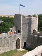
Yèvre-le-Châtel
See also
- Cantons of the Loiret department
- Communes of the Loiret department
- Arrondissements of the Loiret department
External links
- (French) Prefecture website
- (French) General Council website
.jpg)


