Loikaw
| Loikaw လွိုင်ကော်မြို့ Lwègaw[1] | |
|---|---|
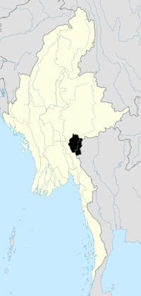
 Loikaw Location in Burma | |
| Coordinates: 19°40′27″N 97°12′34″E / 19.67417°N 97.20944°E | |
| Country |
|
| Division | Kayah State |
| District | Loikaw |
| Township | Loikaw |
| Elevation | 2,900 ft (884 m) |
| Population (2013) | 140 670 |
| Time zone | MST (UTC+6.30) |
Loikaw (Burmese: လွိုင်ကော်မြို့; MLCTS: lwing kaw mrui., pronounced: [lwàikɔ̀ mjo̰]) is the capital of Kayah State in Burma (Myanmar). It is located in the Karen Hills area, near the State's northern tip, just above an embayment on the Pilu River.[2] The inhabitants are mostly Kayah (Karenni). Myanmar's largest hydropower plant built (by the Japanese as war reparation) is located about 20 km east of Loikaw at Lawpita Falls.

Loikaw, the Headquarters of the Political Officer in Charge of the Karen-ni States in 1922
Loikaw is in the only flat part of Karen-ni. In 1892 it numbered four huts. The headquarters of the American Baptist Mission to Hill Karens is located here. The bridges look flimsy, but are so substantial that elephants walk over them.
Population history
- 1983: 33,665
- 2013: 140,670
Climate
| Climate data for Loikaw | |||||||||||||
|---|---|---|---|---|---|---|---|---|---|---|---|---|---|
| Month | Jan | Feb | Mar | Apr | May | Jun | Jul | Aug | Sep | Oct | Nov | Dec | Year |
| Average high °C (°F) | 26 (79) |
29 (84) |
32 (90) |
34 (93) |
31 (88) |
28 (82) |
27 (81) |
27 (81) |
28 (82) |
28 (82) |
27 (81) |
26 (79) |
28.6 (83.5) |
| Average low °C (°F) | 11 (52) |
11 (52) |
15 (59) |
19 (66) |
20 (68) |
20 (68) |
20 (68) |
20 (68) |
20 (68) |
19 (66) |
16 (61) |
12 (54) |
16.9 (62.5) |
| Average rainfall mm (inches) | 8 (0.31) |
3 (0.12) |
7 (0.28) |
50 (1.97) |
178 (7.01) |
222 (8.74) |
251 (9.88) |
289 (11.38) |
236 (9.29) |
151 (5.94) |
51 (2.01) |
14 (0.55) |
1,460 (57.48) |
| Avg. rainy days | 2 | 1 | 2 | 5 | 17 | 23 | 25 | 26 | 21 | 14 | 6 | 3 | 145 |
| Mean monthly sunshine hours | 279 | 280 | 310 | 270 | 217 | 150 | 124 | 124 | 150 | 186 | 210 | 248 | 2,548 |
| Source: World Climate Guide | |||||||||||||
Transport
Loikaw is linked by the newly constructed Aungban-Pinlong-Loikaw rail line.
Education
The town is home to Loikaw University, Technological University, Loikaw, Computer University, Loikaw.
See also
- Transport in Myanmar
- Loikaw Airport
- Kayah State Cultural Museum
Notes
- ↑ "Lwègaw (Variant)" Loikaw at GEOnet Names Server, United States National Geospatial-Intelligence Agency
- ↑ Bitsch, Jørgen (1966) Why Buddha Smiles Taplinger Publishing, New York, pages 55-56, OCLC 421824
Coordinates: 19°40′27″N 97°12′33″E / 19.67417°N 97.20917°E
| |||||||||||||||||||||
References
- "City Population: Myanmar". Archived from the original on 6 October 2014.