Lockyer Valley Region
| Lockyer Valley Region Queensland | |||||||||||||
|---|---|---|---|---|---|---|---|---|---|---|---|---|---|
|
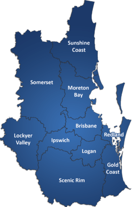
Location within Queensland | |||||||||||||
| Population | 36,591 (2010)[1] | ||||||||||||
| • Density | 16.1024/km2 (41.7049/sq mi) | ||||||||||||
| Established | 2008 | ||||||||||||
| Area | 2,272.4 km2 (877.4 sq mi) | ||||||||||||
| Mayor | Steve Jones | ||||||||||||
| Council seat | Gatton | ||||||||||||
| Region | West Moreton | ||||||||||||
| State electorate(s) | Lockyer | ||||||||||||
| Federal Division(s) | Wright | ||||||||||||
|
| |||||||||||||
| Website | Lockyer Valley Region | ||||||||||||
| |||||||||||||

The Lockyer Valley Region is a local government area in the West Moreton region of South East Queensland, Australia, between the cities of Ipswich and Toowoomba. It was created in 2008 from a merger of the Shire of Gatton and the Shire of Laidley.
It has an estimated operating budget of A$35m.
History

Prior to European settlement, the Lockyer Valley area was home to the Kitabul Aboriginal people.
Tarampa Divisional Board was created on 15 January 1880 under the Divisional Boards Act 1879, and held its first meeting on 20 February 1880. On 25 April 1888, the Laidley area broke away and separately incorporated, and on 25 January 1890, the Forest Hill area moved from Tarampa to Laidley.[2] On 1 July 1902, the town of Laidley was created as a separate municipality with its own Borough Council.
With the passage of the Local Authorities Act 1902, the borough and divisions became a town and shires respectively on 31 March 1903. The town council was dissolved on 8 February 1917, and Laidley absorbed part of the Shire of Rosewood.
On 3 September 1938, Tarampa was renamed the Shire of Gatton.[3] On 19 March 1949 it grew to incorporate part of the former Shires of Drayton and Highfields, while losing some of its original area to the City of Toowoomba and Shire of Crows Nest.[4]
In July 2007, the Local Government Reform Commission released its report and recommended that Gatton and Laidley amalgamate, uniting the major farming, cropping and horticultural production area of South East Queensland under one local authority. While both councils opposed the amalgamation, they identified each other as preferred partners if it had to go ahead.[5] On 15 March 2008, the two Shires formally ceased to exist, and elections were held on the same day to elect six councillors and a mayor to the Regional Council.
Wards
The council remains undivided and its elected body consists of six councillors and a mayor, elected for a four-year term.
Towns and localities


|
|
Population
The populations given relate to the component entities prior to 2008. The next census, due in 2011, will be the first for the new Region.
| Year | Population (Region total) |
Population (Gatton) |
Population (Laidley) |
|---|---|---|---|
| 1933 | 11,153 | 6,053 | 5,100 |
| 1947 | 11,158 | 6,403 | 4,755 |
| 1954 | 11,754 | 7,137 | 4,617 |
| 1961 | 12,387 | 7,594 | 4,793 |
| 1966 | 12,661 | 7,814 | 4,847 |
| 1971 | 12,592 | 8,099 | 4,493 |
| 1976 | 13,324 | 8,689 | 4,635 |
| 1981 | 15,055 | 9,675 | 5,380 |
| 1986 | 18,546 | 11,734 | 6,812 |
| 1991 | 22,273 | 13,810 | 8,463 |
| 1996 | 26,846 | 14,730 | 12,116 |
| 2001 | 27,561 | 14,925 | 12,636 |
| 2006 | 29,883 | 15,572 | 14,311 |
References
- ↑ Australian Bureau of Statistics (31 March 2011). "Regional Population Growth, Australia, 2009–10". Retrieved 11 June 2011.
- ↑ Queensland Government Gazette, 25 April 1888, p.1403.
- ↑ "Order in Council". Queensland Government Gazette. 3 September 1938. p. 151:794.
- ↑ Queensland Government Gazette. 17 March 1949. p. 172:981–985. Missing or empty
|title=(help) - ↑ Queensland Local Government Reform Commission (July 2007). Report of the Local Government Reform Commission (PDF) 2. pp. 182–186. ISBN 1-921057-11-4. Retrieved 3 June 2010.
External links
![]() Media related to Lockyer Valley Region at Wikimedia Commons
Media related to Lockyer Valley Region at Wikimedia Commons
| ||||||||||
| ||||||
| ||||||||||||||||||||||||||||||||||||||
Coordinates: 27°33′31.8″S 152°16′41.4″E / 27.558833°S 152.278167°E