Llupia
| Llupia | ||
|---|---|---|
|
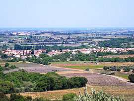
A general view of Llupia | ||
| ||
 Llupia | ||
|
Location within Languedoc-Roussillon region  Llupia | ||
| Coordinates: 42°37′18″N 2°46′11″E / 42.6217°N 2.7697°ECoordinates: 42°37′18″N 2°46′11″E / 42.6217°N 2.7697°E | ||
| Country | France | |
| Region | Languedoc-Roussillon | |
| Department | Pyrénées-Orientales | |
| Arrondissement | Perpignan | |
| Canton | Thuir | |
| Intercommunality | Aspres | |
| Government | ||
| • Mayor (2014–2020) | Roger Rigall | |
| Area1 | 6.88 km2 (2.66 sq mi) | |
| Population (1999)2 | 1,734 | |
| • Density | 250/km2 (650/sq mi) | |
| INSEE/Postal code | 66101 / 66300 | |
| Elevation |
88–140 m (289–459 ft) (avg. 104 m or 341 ft) | |
|
1 French Land Register data, which excludes lakes, ponds, glaciers > 1 km² (0.386 sq mi or 247 acres) and river estuaries. 2 Population without double counting: residents of multiple communes (e.g., students and military personnel) only counted once. | ||

Llupia (Catalan: Llupià) is a commune in the Pyrénées-Orientales department in southern France.
Geography
Llupia is located in the canton of Thuir and in the arrondissement of Perpignan.

Map of Llupia and its surrounding communes
Toponymy
The historical name in catalan is Llupià.
Government and politics

Town hall in Llupia
Mayors
| Mayor | Term start | Term end |
|---|---|---|
| Roger Rigall | 2001 |
See also
References
| Wikimedia Commons has media related to Llupia. |