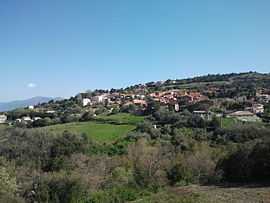
Llauro
| Llauro | ||
|---|---|---|
|
Llauro | ||
| ||
 Llauro | ||
|
Location within Languedoc-Roussillon region  Llauro | ||
| Coordinates: 42°33′02″N 2°44′40″E / 42.5506°N 2.7444°ECoordinates: 42°33′02″N 2°44′40″E / 42.5506°N 2.7444°E | ||
| Country | France | |
| Region | Languedoc-Roussillon | |
| Department | Pyrénées-Orientales | |
| Arrondissement | Perpignan | |
| Canton | Thuir | |
| Intercommunality | Aspres | |
| Government | ||
| • Mayor (2008–2014) | Roger Tourné | |
| Area1 | 8.34 km2 (3.22 sq mi) | |
| Population (1999)2 | 270 | |
| • Density | 32/km2 (84/sq mi) | |
| INSEE/Postal code | 66099 / 66300 | |
| Elevation |
174–511 m (571–1,677 ft) (avg. 138 m or 453 ft) | |
|
1 French Land Register data, which excludes lakes, ponds, glaciers > 1 km² (0.386 sq mi or 247 acres) and river estuaries. 2 Population without double counting: residents of multiple communes (e.g., students and military personnel) only counted once. | ||
.svg.png)
Llauro (Catalan: Llauró) is a commune in the Pyrénées-Orientales department in southern France.
Geography
Llauro is located in the canton of Thuir and in the arrondissement of Perpignan.
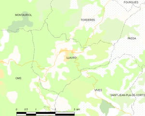
Map of Llauro and its surrounding communes
Sites of interest
- Saint Martin church
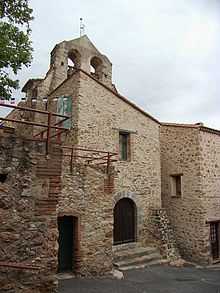
Saint Martin church
See also
References
| Wikimedia Commons has media related to Llauro. |