Llanllwni
| Llanllwni | |
 Mynydd Llanllwni |
|
 Llanllwni |
|
| Population | 638 (2011)[1] |
|---|---|
| OS grid reference | SN489395 |
| Community | Llanllwni |
| Principal area | Carmarthenshire |
| Ceremonial county | Dyfed |
| Country | Wales |
| Sovereign state | United Kingdom |
| Post town | PENCADER |
| Postcode district | SA39 |
| Dialling code | 01559 |
| Police | Dyfed-Powys |
| Fire | Mid and West Wales |
| Ambulance | Welsh |
| EU Parliament | Wales |
| UK Parliament | Carmarthen East and Dinefwr |
| Welsh Assembly | Carmarthen East and Dinefwr |
| Website | http://www.llanllwni.co.uk/ |
|
|
Coordinates: 52°02′02″N 4°12′11″W / 52.034°N 4.203°W
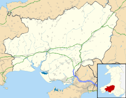
Llanllwni is a village and community located in Carmarthenshire, Wales. The village lies along the A485 highway, stretching for about 2.5 mi (4.0 km), to the south-west of Llanybydder. To the south of the village lies Llanllwni Mountain. The 16th-century parish church, formerly dedicated to St. Llwni, is now dedicated to St. Luke and is a grade II* listed building.[2]
Besides Llanllwni village, the community extends to the southern bank of the River Teifi and includes the summit of Mynydd Llanybydder, 1,338 ft (408 m) high. The 2001 census recorded a population of 676, with 72.19% of the community able to speak some Welsh. The population taken at the 2011 Census had decreased to 638.
To the north of the village are Norwood Gardens, which are open to the public for much of the year. To the south west of the village is the listed building and listed garden of Maesycrugiau Manor. Now being used for accommodation.
References
- ↑ "Community population 2011". Retrieved 15 April 2015.
- ↑ "Church of St Luke or St Llonio, Llanllwni". British Listed Buildings. Retrieved 20 December 2013.