Ljubišnja
| Ljubišnja | |
|---|---|
|
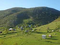
View of Ljubišnja from the village of Bobovo | |
| Highest point | |
| Peak | Dernečišta |
| Elevation | 2,238 m (7,343 ft) |
| Dimensions | |
| Area | 380 km2 (150 sq mi) |
| Geography | |
|
<div style="padding:2px 2px 5px 2px;> 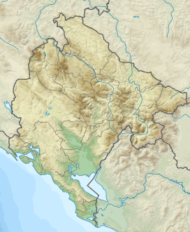 Montenegro | |
| Country | Montenegro |
| Borders on | Draga river Canyon > Tara river Canyon>Ćehotina river |
Ljubišnja (Serbian: Љубишња) dinaric mountain range of Montenegro, conventionally referred to as the highland of Montenegro, represents a major natural feature of the country alongside Tara Canyon, Draga Canyon and Montenegro.[1]
Geography
It is situated in the extreme north-west of Montenegro, close to the Republika Srpska. The mountain rises between the rivers Ćehotina and Tara and borders on the masiff of Durmitor. Maximum altitude is 2,238 metres (7,343 ft) at the Dernečišta peak, while the lowest elevation is 600 m (2,000 ft) at valley Sandića Ubo in the Tara Canyon on the west, and 505 m (1,657 ft) to the east in the valley of Ćehotina river.
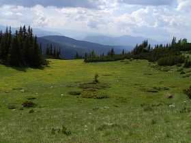
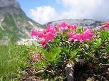
The Ljubišnja mountain area is characterised by temperate mountainous coniferous forests,alpine meadows and pastures,cultivated fields,and numerous ponds and springs.Widespread alpenrose the distinctive emblem of the village scattered on the plateau of Ljubišnja.
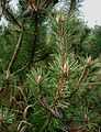
Picea forests dominate to alpine levels and temperate schrubs such as mountain pine, and alpenrose are widespread. The area occupies 380 km2 (150 sq mi).
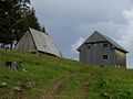
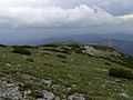
Gallery
See also
- Pljevlja
- Gradac, Pljevlja
- Ćehotina
- Tara (Drina)
- Đurđevića Tara Bridge
- Čelebići (Foča)
- Foča
References
Literature
- Васовић, Милорад (2009). Историја Пљеваља. ISBN 978-9940-512-03-3.
Sources
- Васовић, Милорад (2009). Историја Пљеваља. ISBN 978-9940-512-03-3.