Lizonne
| Lizonne | |
|---|---|
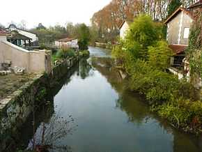 The Lizonne between Combiers (left) and La Rochebeaucourt-et-Argentine (right) | |
| Origin |
Sceau-Saint-Angel 45°29′00″N 00°40′07″E / 45.48333°N 0.66861°E |
| Mouth |
Dronne 45°17′22″N 00°15′09″E / 45.28944°N 0.25250°ECoordinates: 45°17′22″N 00°15′09″E / 45.28944°N 0.25250°E |
| Basin countries | France |
| Length | 60.5 km (37.6 mi) |
| Source elevation | 200 m (660 ft) |
| Mouth elevation | 48 m (157 ft) |
| Avg. discharge | 5.28 m3/s (186 cu ft/s) at mouth |
| Basin area | 640 km2 (250 sq mi) |
The Lizonne (French: la Lizonne), also called Nizonne, is a 60.5 km (37.6 mi) long river in the Dordogne and Charente départements, southwestern France. Its source is near Morelière, a hamlet in Sceau-Saint-Angel. It flows generally southwest. It is a right tributary of the Dronne into which it flows between Saint-Séverin and Allemans.
Part of its course forms part of the border between the Dordogne and Charente départements.
Départements and communes along its course
This list is ordered from source to mouth:
- Dordogne: Sceau-Saint-Angel, Saint-Front-sur-Nizonne, Champeaux-et-la-Chapelle-Pommier, Rudeau-Ladosse, Saint-Sulpice-de-Mareuil, Puyrenier, Beaussac, Les Graulges, Sainte-Croix-de-Mareuil, Combiers, La Rochebeaucourt-et-Argentine,
- Charente: Édon,
- Dordogne: Champagne-et-Fontaine,
- Charente: Blanzaguet-Saint-Cybard, Gurat,
- Dordogne: Vendoire,
- Charente: Vaux-Lavalette, Salles-Lavalette,
- Dordogne: Nanteuil-Auriac-de-Bourzac,
- Charente: Palluaud,
- Dordogne: Bouteilles-Saint-Sébastien, Saint-Paul-Lizonne,
- Charente: Saint-Séverin,
- Dordogne: Allemans,
Notes
- This article is based on the equivalent article from the French Wikipedia, consulted on April 7th 2009.
References
| Wikimedia Commons has media related to Lizonne. |