Littleport, Cambridgeshire
| Littleport | |
 St George's Church |
|
 Littleport |
|
| Area | 28.46 sq mi (73.7 km2) [1] |
|---|---|
| Population | 8,738 [2] |
| – density | 307/sq mi (119/km2) |
| OS grid reference | TL568868 |
| – London | 67.4 mi (108.5 km) S |
| District | East Cambridgeshire |
| Shire county | Cambridgeshire |
| Region | East |
| Country | England |
| Sovereign state | United Kingdom |
| Post town | ELY |
| Postcode district | CB6 |
| Dialling code | 01353 |
| Police | Cambridgeshire |
| Fire | Cambridgeshire |
| Ambulance | East of England |
| EU Parliament | East of England |
| UK Parliament | North East Cambridgeshire |
|
|
Coordinates: 52°27′29″N 0°18′18″E / 52.458°N 0.305°E
Littleport is the largest village in East Cambridgeshire,[3] England, approximately 6 miles (10 km) north of Ely and 6 miles (10 km) south-east of Welney. It lies on the Bedford Level South section of the River Great Ouse, close to Burnt Fen and Mare Fen. There are two primary schools in the village; Millfield Primary and Littleport Community school.
The Littleport riots of 1816 were a factor in Parliament passing the Vagrancy Act of 1824.
History
With an Old English name of Litelport, the village was worth 17,000 Eels to the Abbot's of Ely in 1086.[4]
The legendary founder of Littleport was King Canute. A fisherman gave the king shelter one night, after drunken monks had denied hospitality. Following his punishment of the monastics, the king made his host the mayor of a newly founded village.[5]
Littleport was the site of the Littleport Riots of 1816. War-weary veterans from the Battle of Waterloo had returned home, only to find that they could not get any work, and that the grain prices had gone up. They took to the streets and smashed shops and other buildings until troops came to put an end to the riots.[6] St George's church registers were destroyed[7] during the riots. The remaining registers start from 1754 (marriages), 1756 (burials), and 1783 (baptisms). Some original historical documents relating to the riots are held by Cambridgeshire Archives and Local Studies at the County Record Office Cambridge.[8]
In 2003, a Harley-Davidson statue was unveiled in Littleport to commemorate the centenary of the famous motorcycle company. William Harley, the father of the company's co-founder William Sylvester Harley, had been born in Victoria Street, Littleport, in 1835, before emigrating to the USA in 1859.[9]
Governance
Littleport is a civil parish with an elected council. Parish council services include bus shelters, cemeteries, shared equity housing, local planning consultation, play areas, village halls, and war memorials. Parish council meetings are held in the village hall situated in each civil parish.[10]
The civil parish councils were governed by Ely Rural District council from 1894 until 1974.[11] East Cambridgeshire District Council (ECDC) was formed in 1974 with administration buildings in Ely. The district council collects taxes, provides services such as building regulations and local planning, leisure and tourism, handles issues strategic to the district, and many other services. ECDC is in turn governed by Cambridgeshire County Council which has administration buildings in Cambridge. The county council provides county-wide services such as major road infrastructure, fire and rescue, libraries and heritage, and strategic planning.[10]
The parish is represented in the House of Commons of the Parliament of the United Kingdom as part of North East Cambridgeshire. It elects one Member of Parliament (MP) by the first past the post system of election. It is also part of the East of England constituency of the European Parliament which elects seven MEPs using the d'Hondt method of party-list proportional representation.
Economy
Thomas Peacock, who founded the gentlemen's tailoring chain Hope Brothers, was born in Littleport in 1829. The first Hope Brothers shirt-making factory was opened in the village in 1882. For a period in the 1940s and 1950s, Hope Brothers were also manufacturers of the England football kit. The factory was eventually taken over by Burberry.[12]
From 1979-1983, Jim Burns guitars were based in Padnal Road in Littleport. They produced guitars such as the Steer, popularized by guitarist Billy Bragg.[13]
Little Ouse
Littleport covers the hamlet of Little Ouse which comes under the Littleport East ward. Little Ouse is now entirely residential: the former pub (the Waterman's Arms) and church of St John the Evangelist have both been converted to private dwellings.[14]
Climate
With an average annual rainfall of 24 inches (600 mm), Cambridgeshire is one of the driest counties in the British Isles. Protected from the cool onshore coastal breezes east of the region, Cambridgeshire is warm in summer and cold and frosty in winter.[15]
Regional UK climate forecasts and historical summaries are available from the UK Met Office.[16][17] The nearest Met Office weather station is Cambridge NIAB.
There are many additional local weather stations reporting periodic figures to the internet. For example, via Weather Underground, Inc.[18]
| Climate data for Cambridge (1971-2000 averages) | |||||||||||||
|---|---|---|---|---|---|---|---|---|---|---|---|---|---|
| Month | Jan | Feb | Mar | Apr | May | Jun | Jul | Aug | Sep | Oct | Nov | Dec | Year |
| Average high °F (°C) | 44.6 (7.0) |
45.3 (7.4) |
50.4 (10.2) |
54.7 (12.6) |
61.7 (16.5) |
66.9 (19.4) |
72 (22.2) |
72.1 (22.3) |
66 (18.9) |
58.3 (14.6) |
49.8 (9.9) |
46 (7.8) |
57.4 (14.1) |
| Average low °F (°C) | 34.3 (1.3) |
34 (1.1) |
37.2 (2.9) |
39.2 (4.0) |
44.1 (6.7) |
49.6 (9.8) |
53.6 (12.0) |
53.4 (11.9) |
50.2 (10.1) |
44.8 (7.1) |
38.7 (3.7) |
36.1 (2.3) |
43 (6.1) |
| Average rainfall inches (mm) | 1.772 (45.0) |
1.287 (32.7) |
1.634 (41.5) |
1.697 (43.1) |
1.752 (44.5) |
2.118 (53.8) |
1.504 (38.2) |
1.921 (48.8) |
2.008 (51.0) |
2.118 (53.8) |
2.012 (51.1) |
1.969 (50.0) |
21.791 (553.5) |
| Source: Met Office | |||||||||||||
Demography
Littleport is 28.46 square miles (73.7 km2) in size making it the largest village in East Cambridgeshire by area. The city of Ely itself has the highest East Cambridgeshire population with Soham second and Littleport third.[1]
| Historical population of Littleport[19] | |||||||||||
| Year | 1801 | 1811 | 1821 | 1831 | 1841 | 1851 | 1861 | 1871 | 1881 | 1891 | 1901 |
|---|---|---|---|---|---|---|---|---|---|---|---|
| Population | 1602 | 1847 | 2364 | 2644 | 3365 | 3832 | 3733 | 3903 | 3571 | 4201 | 4221 |
| Year | 1911 | 1921 | 1931 | 1941 | 1951 | 1961 | 1971 | 1981 | 1991 | 2001 | 2011 |
| Population | 4527 | 4526 | 4779 | [20] | 5182 | 5291 | 5293 | 5673 | 6282 | 7521 | 8738 |
Notable people
- Fred Hockley, World War II fighter pilot.
- William Harley who emigrated to the USA where his son William Sylvester Harley went in partnership and established the Harley Davidson Motorcycle Company.[21]
- James Nightall, was posthumously awarded the George Cross for gallantry shown in the Soham rail disaster in 1944.
See also
Gallery
-
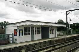
Littleport railway station
-

Harley-Davidson monument
Notes and references
- ↑ 1.0 1.1 1.2 Research Group (2010). "Historic Census Population Figures" (XLS). Cambridgeshire County Council. Retrieved 19 June 2010.
- ↑ 2.0 2.1 "Key Figures for 2011 Census: Key Statistics. Area: Littleport (Parish)". ONS. 2013. Retrieved 2 February 2013.
- ↑ Confirmed by the assistant clerk to the Littleport parish council who reiterated that towns have a town council; villages have a parish council
- ↑ Domesday Book (1999–2010). "Cambridgeshire, Littleport". The Domesday Book Online. © domesdaybook.co.uk. Retrieved 19 June 2010.
- ↑ Beare, Beryl England: Myths and Legends Bath 1999 p.47 ISBN 0752529781
- ↑ Strawson. "The Littleport Riots". Family website. Strawson family. Archived from the original on 2012-10-11. Retrieved 19 June 2010.
- ↑ T D Atkinson, Ethel M Hampson, E T Long, C A F Meekings, Edward Miller, H B Wells, G M G Woodgate (1953), Pugh, R B, ed., The Victoria History of the Counties of England: Cambridge and the isle of Ely 4, Oxford University Press, pp. 95–102
- ↑ "County Records Office, Cambridge". Cambridgeshire County Council. 2010. Retrieved 19 June 2010.
- ↑ "Littleport Harley Davidson statue".
- ↑ 10.0 10.1 ECDC (February 2010). Leaflet:Councillors, committees & meeting dates. The Grange, Nutholt Lane, Ely, CB7 4EE.
- ↑ A Vision of Britain (2004). "A vision of Britain between 1801 and 2001". University of Portsmouth and others. Retrieved 19 June 2010.
- ↑ "Littleport Plaque For Hope Brothers Factory".
- ↑ Gjörde, Per (2001). Pearls and Crazy Diamonds. Göteborg, Sweden: Addit Information AB. pp. 50–54.
- ↑ "Church of St John the Evangelist Little Ouse Littleport, Ely, Cambs". East Cambridgeshire District Council.
- ↑ Greig, Dr. A.; Martin, J. (1998). "Cambridgeshire and Peterborough's State of the Environment Report: Chapter 11 Physical Background" (PDF). Cambridgeshire County Council. Retrieved 9 June 2010.
- ↑ Met Office. "Forecast:East of England". UK Climate Forecasts. Crown Copyright. Retrieved 5 June 2010.
- ↑ Met Office. "Historical Data:Regional:Cambridge NIAB". UK Climate Summaries. Crown Copyright. Retrieved 5 June 2010.
- ↑ Weather Underground (2010). "Ely, United Kingdom". Weather Underground, Inc. Retrieved 5 June 2010.
- ↑ Area in 1801 26.20 square miles (67.9 km2)
- ↑ No census 1941 due to WWII
- ↑ William Harley Retrieved 20 March 2015
External links
| Wikimedia Commons has media related to Littleport, Cambridgeshire. |
- 2001 Census
- GenUK's entry for Littleport
- Littleport unveiling of Hope Brothers factory plaque
- Littleport Life Community Magazine
| ||||||||||||||||||||

| ||||||||||||||||||||||||||