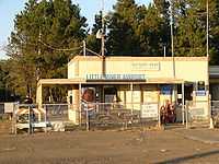
Little River Airport
| Little River Airport | |||||||||||
|---|---|---|---|---|---|---|---|---|---|---|---|
| IATA: none – ICAO: KLLR – FAA LID: LLR | |||||||||||
| Summary | |||||||||||
| Airport type | Public | ||||||||||
| Owner | Mendocino County | ||||||||||
| Serves | Little River, California | ||||||||||
| Elevation AMSL | 572 ft / 174 m | ||||||||||
| Coordinates | 39°15′43″N 123°45′13″W / 39.26194°N 123.75361°W | ||||||||||
| Runways | |||||||||||
| |||||||||||
| Statistics (2004) | |||||||||||
| |||||||||||
Little River Airport (ICAO: KLLR, FAA LID: LLR, formerly O48) is a small county-owned public-use airport located three nautical miles (6 km) southeast of the central business district of Little River, in Mendocino County, California, United States.[1]
Although most U.S. airports use the same three-letter location identifier for the FAA and IATA, this airport is assigned LLR by the FAA but has no designation from the IATA.[2]
History
In 1945, this airport served as an outlying field to NALF Santa Rosa. The Naval Auxiliary Air Station at Santa Rosa, California, was part of a network of training airfields supporting Naval Air Station Alameda.[3]
Facilities and aircraft
Little River Airport covers an area of 548 acres (222 ha) and contains one asphalt paved runway designated 11/29 which measures 5,249 by 150 feet (1,600 x 46 m). For the 12-month period ending February 4, 2004, the airport had 6,300 aircraft operations, an average of 17 per day: 98% general aviation and 2% air taxi.[1]
New for 2006: Super AWOS weather for pilots on CTAF 122.70 by clicking your mic 3 times.
References
- ↑ 1.0 1.1 1.2 FAA Airport Master Record for LLR (Form 5010 PDF), effective 2007-12-20
- ↑ Great Circle Mapper: KLLR - Little River, California (Little River Airport)
- ↑ "Santa Rosa Naval Auxiliary Air Station / Santa Rosa Air Center, Santa Rosa, CA". Freeman, Paul. Retrieved 2011-12-13.