Little Nerang Dam
| Little Nerang Dam | |
|---|---|
 in Queensland | |
| Country | Australia |
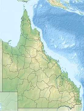
| Location | South East Queensland |
| Coordinates | 28°8′37″S 153°17′6″E / 28.14361°S 153.28500°ECoordinates: 28°8′37″S 153°17′6″E / 28.14361°S 153.28500°E |
| Purpose | Potable water supply[1] |
| Status | Operational |
| Opening date | 1962 |
| Operator(s) | SEQ Water |
| Dam and spillways | |
| Type of dam | Gravity dam |
| Impounds | Little Nerang Creek |
| Height | 44 m (144 ft)[1] |
| Length | 201 m (659 ft)[1] |
| Dam volume | 68×103 m3 (2.4×10⁶ cu ft)[1] |
| Spillway type | Uncontrolled |
| Spillway capacity | 570 m3/s (20,000 cu ft/s)[1] |
| Reservoir | |
| Creates | Lake Macdonald |
| Total capacity | 8,390 ML (1.85×10⁹ imp gal; 2.22×10⁹ US gal)[1][2] |
| Catchment area | 35 km2 (14 sq mi)[1][3] |
| Surface area | 50 ha (120 acres)[3][2] |
|
Website www | |
The Little Nerang Dam is a concrete gravity dam with an un-gated spillway across the Little Nerang Creek that is located in the South East region of Queensland, Australia. The main purpose of the dam is for potable water supply of the Gold Coast region.[1][2] The impounded reservoir is also called Little Nerang Dam.
Location and features
The dam is located 6 kilometres (3.7 mi) from Cooroy and 15 kilometres (9.3 mi) west of Noosa. The small settlement of Lake MacDonald is located adjacent to the dam. The primary inflow of the reservoir is Six Mile Creek,[2] and the dam is located directly upstream from the Hinze Dam. Prior to the completion of the Hinze Dam, the Little Nerang Creek Gravity Scheme supplied the water requirements of the Gold Coast area. Water flows by gravity pipeline to the Mudgeeraba Water Treatment Plant. The plant, completed in 1969, has the capacity to treat 110 megalitres (24,000,000 imp gal; 29,000,000 US gal) a day. The water then flows by gravity to the city's storage reservoirs.
Completed in 1962,[1] the rock and earthfill dam structure is 44 metres (144 ft) high and 201 metres (659 ft) long. The 68-thousand-cubic-metre (2.4×10⁶ cu ft) dam wall holds back the 8,390-megalitre (1.85×10⁹ imp gal; 2.22×10⁹ US gal) reservoir when at full capacity. From a catchment area of 35 square kilometres (14 sq mi) that includes the Springbrook Plateau, the dam creates an unnamed reservoir with a surface area of 50 hectares (120 acres). The uncontrolled un-gated spillway has a discharge capacity of 570 cubic metres per second (20,000 cu ft/s).[1] Initially managed by Gold Coast Water, management of the dam was transferred to Seqwater in July 2008.
Recreational
Recreation is not permitted at Little Nerang Dam.
See also
- List of dams in Queensland
- Gold Coast Water
References
- ↑ 1.0 1.1 1.2 1.3 1.4 1.5 1.6 1.7 1.8 1.9 "Register of Large Dams in Australia" (Excel (requires download)). Dams information. Australian National Committee on Large Dams. 2010. Retrieved 4 July 2014.
- ↑ 2.0 2.1 2.2 2.3 Harrison, Rod; James, Ernie; Sully, Chris; Classon, Bill; Eckermann, Joy (2008). Queensland Dams. Bayswater, Victoria: Australian Fishing Network. ISBN 978-1-86513-134-4.
- ↑ 3.0 3.1 "Little Nerang Dam". Water supply: Dams and weirs. Seqwater. 2014. Retrieved 4 July 2014.
External links
- "Little Nerang Dam". Picture Australia. National Library of Australia.
- "Spillway photo". Flickr.
| ||||||||||||||||||||||||||||||||||