List of waterfalls of Australia


This is a list of waterfalls in Australia.
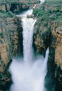
Wallaman Falls in Queensland are Australia's tallest permanent waterfall with a plunge of nearly 300 metres (980 ft). Wollomombi Falls in New South Wales are second with a 220-metre (720 ft) combined drop and Ellenborough Falls, also in New South Wales, is third plunging 160 metres (520 ft) as a single drop.[1]
Australian Capital Territory
The following waterfalls are located in the Australian Capital Territory:
- This list is incomplete; you can help by expanding it.
| Image | Waterfall | Location | Drop | Type | Coordinates |
|---|---|---|---|---|---|
 | Gibraltar Falls | Namadgi National Park | 67–120 m (220–394 ft)[2] | Cascade | 35°29′12″S 148°56′06″E / 35.48667°S 148.93500°E |
| Ginini Falls | Namadgi National Park | 190–220 m (623–722 ft)[3] | 35°29′43″S 148°48′16″E / 35.49528°S 148.80444°E | ||
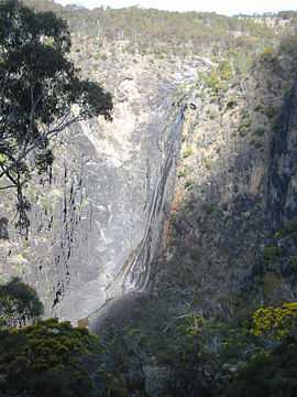
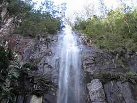
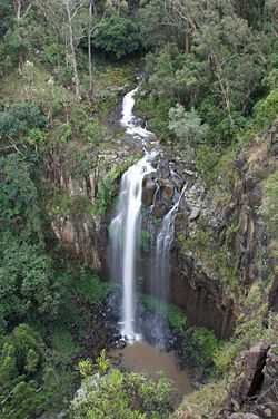
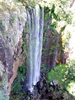
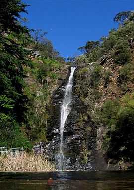
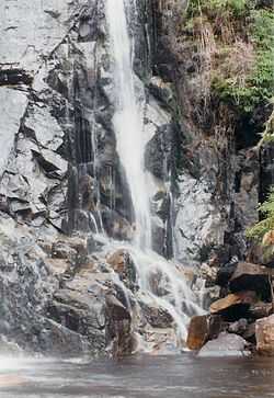
New South Wales
The following waterfalls are located in New South Wales:
- This list is incomplete; you can help by expanding it.

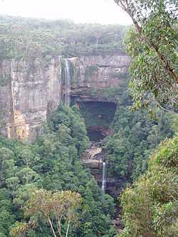


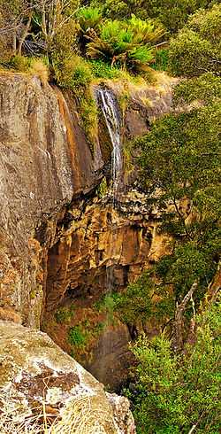
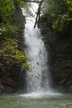
.JPG)


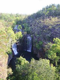
Northern Territory
The following waterfalls are location in the Northern Territory:
- This list is incomplete; you can help by expanding it.
| Image | Waterfall | Location | Drop | Type | Coordinates |
|---|---|---|---|---|---|
| 17 Mile Falls | Nitmiluk National Park | 30–33 metres (98–108 ft)[11] | 14°03′S 132°24′E / 14.050°S 132.400°E | ||
| Bine - Jeruk Falls | Litchfield National Park | 32–49 metres (105–161 ft)[12] | 13°08′53″S 130°40′46″E / 13.14806°S 130.67944°E | ||
| Crystal Falls | Nitmiluk National Park | 35–42 metres (115–138 ft)[13] | |||
| Cuthbertson Falls | Kakadu National Park | 14–15 metres (46–49 ft)[14] | 12°33′41″S 133°52′41″E / 12.56139°S 133.87806°E | ||
 | Edith Falls / Leliyn | Nitmiluk National Park | 8.7–12 metres (29–39 ft)[15] | Cascade | 14°10′S 132°10′E / 14.167°S 132.167°E |
 | Florence Falls | Litchfield National Park | 9.8–15 metres (32–49 ft)[16] | Segmented | 13°05′56″S 130°46′50″E / 13.09889°S 130.78056°E |
| Havelock Falls | Kakadu National Park | 4.4–6 metres (14–20 ft)[17] | 12°40′29″S 133°51′19″E / 12.67472°S 133.85528°E | ||
| Henscke Falls | near Peppimenarti | 21–40 metres (69–131 ft)[18] | 14°11′30″S 130°11′54″E / 14.19167°S 130.19833°E | ||
| Inukalen Cataract | near Timber Creek | 3.3–5 metres (11–16 ft)[19] | 15°19′15″S 130°44′17″E / 15.32083°S 130.73806°E | ||
 | Jim Jim Falls / Barrkmalam | Kakadu National Park | 140–200 metres (460–660 ft)[20] | Plunge | 13°16′20″S 132°50′22″E / 13.27222°S 132.83944°E |
| Kathleen Falls[21] | Flora River Nature Park | 14°45′29″S 131°35′36″E / 14.75806°S 131.59333°E | |||
| Lily Ponds Falls | Nitmiluk National Park | 3.6–6.6 metres (12–22 ft)[22] | 14°19′22″S 132°28′05″E / 14.32278°S 132.46806°E | ||
| Mandjawuril | near Oenpelli | 55–70 metres (180–230 ft)[23] | 12°21′46″S 133°05′34″E / 12.36278°S 133.09278°E | ||
| Myra Falls | near Oenpelli | 8.3–11 metres (27–36 ft)[24] | 12°27′00″S 133°19′59″E / 12.45000°S 133.33306°E | ||
| Robin Falls | near Adelaide River | 20–25 metres (66–82 ft)[25] | 13°21′21″S 131°07′44″E / 13.35583°S 131.12889°E | ||
| Rosies Falls | near Kununurra | 32–43 metres (105–141 ft)[26] | 15°28′07″S 129°20′48″E / 15.46861°S 129.34667°E | ||
| Surprise Creek Falls[27] | Litchfield National Park | 13°24′24″S 130°47′20″E / 13.40667°S 130.78889°E | |||
| Tjaetaba Falls | Litchfield National Park | 35–48 metres (115–157 ft)[28] | 13°11′44″S 130°42′12″E / 13.19556°S 130.70333°E | ||
| Tjaynera Falls | Litchfield National Park | 31–46 metres (102–151 ft)[29][30] | 13°14′40″S 130°45′29″E / 13.24444°S 130.75806°E | ||
 | Tolmer Falls | Litchfield National Park | 32–42 metres (105–138 ft)[31] | Plunge | 13°12′20″S 130°42′52″E / 13.20556°S 130.71444°E |
| Trudies Falls | near Kununurra | 61–94 metres (200–308 ft)[32] | 15°27′09″S 129°20′26″E / 15.45250°S 129.34056°E | ||
 | Twin Falls / Gungkurdul | Kakadu National Park | 44–51 metres (144–167 ft)[33] | Cascade | 13°19′20″S 132°46′41″E / 13.32222°S 132.77806°E |
| Walwalgiyn Falls | Litchfield National Park | 17–22 metres (56–72 ft)[34] | 13°11′13″S 130°41′45″E / 13.18694°S 130.69583°E | ||
| | Wangi Falls | Litchfield National Park | 41–52 metres (135–171 ft)[35] | Segmented | 13°09′49″S 130°41′07″E / 13.16361°S 130.68528°E |
| Waterfall Creek Falls / Gunlom | Kakadu National Park | 60–85 metres (197–279 ft)[36] | Cascade | 13°25′37″S 132°25′00″E / 13.42694°S 132.41667°E | |
| Yawuriyarra Falls | 2.3–2.6 metres (7 ft 7 in–8 ft 6 in)[37] | 15°43′39″S 135°15′28″E / 15.72750°S 135.25778°E |
Queensland
The following waterfalls are located in Queensland:
- This list is incomplete; you can help by expanding it.


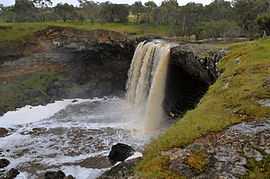
South Australia
The following waterfalls are located in South Australia:
- This list is incomplete; you can help by expanding it.
| Image | Waterfall | Location | Drop | Type | Coordinates |
|---|---|---|---|---|---|
| Ferntree Falls | Flinders Ranges National Park, Rawnsley Park | ||||
| Fifth Falls[60] | |||||
| First Falls (Adelaide Hills) | Morialta Conservation Park | 30 metres (98 ft)[61] | Plunge | 35°54′23″S 138°42′29″E / 35.90639°S 138.70806°E | |
 | First Falls (City of Burnside)[62] | Waterfall Gully, Cleland Conservation Park | Cascade | 34°58′14″S 138°40′53″E / 34.97056°S 138.68139°E | |
| Fourth Falls[60] | |||||
| Glenora Falls[60] | |||||
| Hay Flat Waterfall[60] | |||||
| Hindmarsh Falls[60] | |||||
| Ingalalla Waterfalls | Fleurieu Peninsula | 81–92 metres (266–302 ft)[63] | Cascade | 35°31′52″S 138°20′34″E / 35.53111°S 138.34278°E | |
| Kanalla Falls | Flinders Ranges National Park | 64–79 metres (210–259 ft)[64] | 31°29′52″S 138°30′43″E / 31.49778°S 138.51194°E | ||
| Kapinka Falls[60] | |||||
| Lower Waterfall[60] | |||||
| Malloga Falls[65] | Flinders Ranges National Park, near Wilpena | ||||
| Mannum Waterfall[60] | |||||
| Morialta Falls[60] | Morialta Conservation Park | ||||
| Petalinka Waterfall[60] | |||||
 | Second Falls (Adelaide Hills)[66] | Morialta Conservation Park | 15 metres (49 ft) | ||
| Second Falls (City of Burnside)[60] | |||||
| Seventh Falls[60] | |||||
| Six Falls[60] | |||||
| Strepara Waterfall[60] | |||||
| The Waterfall[60] | |||||
| The Waterfalls[60] | |||||
| Third Falls[66] | Morialta Conservation Park | 13 metres (43 ft) | |||
| Upper Waterfall[60] | |||||
| Wadella Falls[60] | near Tumby Bay | ||||
| Waukarie Falls[60] | Mount Brown Conservation Park | ||||
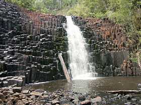
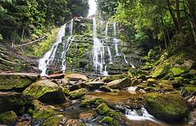
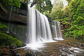
Tasmania
The following waterfalls are located in Tasmania:
- This list is incomplete; you can help by expanding it.


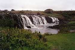
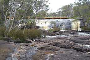
Victoria
The following waterfalls are located in Victoria:
- This list is incomplete; you can help by expanding it.
| Image | Waterfall | Location | Drop | Type | Coordinates |
|---|---|---|---|---|---|
| Agnes Falls[75] | Toora | 59 metres (194 ft)[76] | |||
| Beauchamp Falls | Otway Forest Park, near Beech Forest | 16–26 metres (52–85 ft)[77] | 38°39′03″S 143°36′27″E / 38.650897°S 143.607488°E | ||
| Carisbrook Falls | Great Otway National Park, near Wongarra | 64–120 metres (210–394 ft)[78] | 38°41′32″S 143°48′33″E / 38.69226°S 143.809286°E | ||
| Cora Lynn Cascades[79] | Great Otway National Park, Angahook section | 89–140 metres (292–459 ft)[80] | 38°30′30″S 143°55′37″E / 38.508415°S 143.927078°E | ||
| Cumberland Falls | 85–110 metres (279–361 ft)[81] | ||||
| Currawong Falls | |||||
| Dandongadale Falls | Alpine National Park, western section | 255 metres (837 ft)[82][83] | Plunge | ||
| Erskine Falls[84] | Great Otway National Park, Angahook section | 49–57 metres (161–187 ft)[85] | 38°29′36″S 143°54′06″E / 38.493369°S 143.901672°E | ||
| Henderson Falls | Great Otway National Park, Angahook section | 8 metres (26 ft) | 38°32′17″S 143°57′39″E / 38.537961°S 143.960724°E | ||
 | Hopkins Falls | north of Allansford, near Warrnambool | 11–13 metres (36–43 ft)[86] | 38°20′01″S 143°37′08″E / 38.3337°S 143.6189°E | |
| | Hopetoun Falls | Great Otway National Park, near Beech Forest | 46–49 metres (151–161 ft)[87] | 38°39′26″S 143°34′47″E / 38.657097°S 143.579636°E | |
| Kalimna Falls[88] | Great Otway National Park, Angahook section | ||||
| Ladies Baths Falls | Mt Buffalo | ||||
| Lal Lal Falls | near Ballarat | 130–190 metres (430–620 ft)[89] | |||
| Little Aire Falls | Great Otway National Park | ||||
| Little River Falls[75] | Snowy River National Park | ||||
| Loddon Falls | near Daylesford | 20–28 metres (66–92 ft)[90] | |||
| Masons Falls | Kinglake National Park (Sugarloaf Block), near Kinglake | 45 metres (148 ft)[91] | |||
| Marriners Falls | Great Otway National Park | 10 metres (33 ft) | 38°42′21″S 143°38′27″E / 38.705874°S 143.640747°E | ||
 | Nigretta Falls | near Coleraine | 15–16 metres (49–52 ft)[92] | 37°39′22″S 141°55′28″E / 37.656016°S 141.924477°E | |
| Olinda Falls | Falls Rd Olinda - Dandenong Ranges | ||||
| Phantom Falls | Great Otway National Park, Angahook section | 15 metres (49 ft) | 38°32′59″S 143°57′35″E / 38.549827°S 143.959801°E | ||
| Piemans Falls | Alpine National Park, western section | 234 metres (768 ft)[93] | |||
| Sabine Falls | Great Otway National Park, near Wongarra | 130 metres (430 ft)[94] | 38°39′45″S 143°45′12″E / 38.662459°S 143.753357°E | ||
| Sheoak Falls | Great Otway National Park, Angahook section | ||||
 | Silverband Falls | Grampians National Park | 37°9′9.56″S 142°31′39.7″E / 37.1526556°S 142.527694°E | ||
 | Steavenson Falls | near Marysville | 55–110 metres (180–361 ft)[95] | 37°31′58″S 145°46′25″E / 37.5327°S 145.7737°E | |
| Stevenson Falls | Otway Forest Park, near Barramunga | 38°33′09″S 143°39′26″E / 38.552461°S 143.657227°E | |||
| Straw Falls[96] | Great Otway National Park, Angahook section | 28–53 metres (92–174 ft)[97] | |||
| Toorongo Falls[75] | Noojee | 37°50′57″S 146°2′46″E / 37.84917°S 146.04611°E | |||
 | Trentham Falls | Trentham | 44–48 metres (144–157 ft)[98] | 37°22′12″S 144°19′26″E / 37.370°S 144.324°E | |
 | Triplet Falls | Great Otway National Park, Marreeyn section | 38°39′33″S 143°29′38″E / 38.659242°S 143.493805°E | ||
 | Wannon Falls | near Coleraine | 18–22 metres (59–72 ft)[99] | 37°40′35″S 141°50′27″E / 37.676263°S 141.840835°E | |
| Wilhelmina Falls | Murrindindi Scenic Reserve, Murrindindi Shire | 92–170 metres (302–558 ft)[100] | |||
| Won Wondha Falls | Great Otway National Park, Angahook section | ||||
Western Australia
The following waterfalls are located in Western Australia:
- This list is incomplete; you can help by expanding it.
| Image | Waterfall | Location | Drop | Type | Coordinates |
|---|---|---|---|---|---|
| Baden Powell Water Spout | Murray River near Dwellingup | ||||
| Big Mertens Falls | Mitchell Plateau in the Kimberley | ||||
| Beedalup Falls | Beedalup National Park near Pemberton | ||||
| Black Rock Falls | near Kununurra | ||||
| The Cascades | Gloucester National Park | Cascade | |||
| Eagle Rock Falls | near Newman | ||||
 | Fernhook Falls | ||||
| Fortescue Falls | Karijini National Park | ||||
| Gladstone Falls | |||||
| Hovea Falls | John Forrest National Park | ||||
| Joffre Falls | Karijini National Park | ||||
| Kalamina Falls | Karijini National Park | ||||
| King George Falls | King George River | ||||
| Kings Cascade | Prince Regent River near Wyndham | ||||
| Lane-Poole Falls | Northcliffe | 34°41′47″S 116°15′01″E / 34.696391°S 116.250286°E | |||
 | Lesmurdie Falls | Mundy Regional Park | 31°59′39″S 116°02′03″E / 31.994246°S 116.03425°E | ||
| Marrinup Falls | near Marrinup | ||||
| Mitchell Falls | The Kimberley | 14°49′00″S 125°41′00″E / 14.81667°S 125.68330°E | |||
| National Park Falls | John Forrest National Park | ||||
 | Noble Falls | near Gidgegannup | |||
| Quinninup Falls | near Yallingup | ||||
 | Serpentine Falls | Serpentine National Park | |||
| Spa Pool | Karijini National Park |
See also
References
- ↑ "Tallest Waterfalls". Australian Government. Retrieved 11 August 2009.
- ↑ "Map of Gibraltar Falls, ACT". Bonzle Digital Atlas of Australia. Retrieved 17 May 2014.
- ↑ "Map of Ginni Falls, ACT". Bonzle Digital Atlas of Australia. Retrieved 17 May 2014.
- ↑ 4.0 4.1 4.2 4.3 4.4 4.5 4.6 4.7 4.8 4.9 4.10 4.11 4.12 "Name search". New South Wales Government (Geographical Names Board). Retrieved 2008-08-19.
- ↑ "Belmore Falls - Robertson". Visit NSW. Retrieved 11 February 2014.
- ↑ "Gibraltar Range National Park". Department of Environment and Climate Change. Retrieved 2008-08-19.
- ↑ "Morton National Park - Fitzroy Falls". Department of Environment and Climate Change. Retrieved 2009-06-02.
- ↑ "Wild Walks". Retrieved 2009-08-31.
- ↑ "Minyon Falls". New South Wales Government. Retrieved 2009-11-18.
- ↑ "Protestors Falls". New South Wales Government. Retrieved 2009-11-18.
- ↑ "Map of 17 Mile Falls, NT". Bonzle Digital Atlas of Australia. Retrieved 17 May 2014.
- ↑ "Map of Bine - Jeruk Falls, NT". Bonzle Digital Atlas of Australia. Retrieved 17 May 2014.
- ↑ "Map of Crystal Falls, NT". Bonzle Digital Atlas of Australia. Retrieved 17 May 2014.
- ↑ "Map of Cuthbertson Falls, NT". Bonzle Digital Atlas of Australia. Retrieved 17 May 2014.
- ↑ "Map of Edith Falls, NT". Bonzle Digital Atlas of Australia. Retrieved 17 May 2014.
- ↑ "Map of Florence Falls, NT". Bonzle Digital Atlas of Australia. Retrieved 17 May 2014.
- ↑ "Map of Havelock Falls, NT". Bonzle Digital Atlas of Australia. Retrieved 17 May 2014.
- ↑ "Map of Henscke Falls, NT". Bonzle Digital Atlas of Australia. Retrieved 17 May 2014.
- ↑ "Map of Inukalen Cataract, NT". Bonzle Digital Atlas of Australia. Retrieved 17 May 2014.
- ↑ "Map of Jim Jim Falls (Barrkmalam), NT". Bonzle Digital Atlas of Australia. Retrieved 17 May 2014.
- ↑ "Map of Kathleen Falls, NT". Bonzle Digital Atlas of Australia. Retrieved 17 May 2014.
- ↑ "Map of Lily Ponds Falls, NT". Bonzle Digital Atlas of Australia. Retrieved 17 May 2014.
- ↑ "Map of Mandjawuril, NT". Bonzle Digital Atlas of Australia. Retrieved 17 May 2014.
- ↑ "Map of Myra Falls, NT". Bonzle Digital Atlas of Australia. Retrieved 17 May 2014.
- ↑ "Map of Robin Falls, NT". Bonzle Digital Atlas of Australia. Retrieved 17 May 2014.
- ↑ "Map of Rosies Falls, NT". Bonzle Digital Atlas of Australia. Retrieved 17 May 2014.
- ↑ "Litchfield National Park - Surprise Creek Falls". Litchfield National Park. Retrieved 9 August 2009.
- ↑ "Map of Tjaetaba Falls, NT". Bonzle Digital Atlas of Australia. Retrieved 17 May 2014.
- ↑ "Map of Tjaynera Falls, NT". Bonzle Digital Atlas of Australia. Retrieved 17 May 2014.
- ↑ "Map of Tjaynera (Sandy Creek) Falls, NT". Bonzle Digital Atlas of Australia. Retrieved 17 May 2014.
- ↑ "Map of Tolmer Falls, NT". Bonzle Digital Atlas of Australia. Retrieved 17 May 2014.
- ↑ "Map of Trudies Falls, NT". Bonzle Digital Atlas of Australia. Retrieved 17 May 2014.
- ↑ "Map of Gungkurdul (Twin Falls), NT". Bonzle Digital Atlas of Australia. Retrieved 17 May 2014.
- ↑ "Map of Walwalgiyn Falls, NT". Bonzle Digital Atlas of Australia. Retrieved 17 May 2014.
- ↑ "Map of Wangi Falls, NT". Bonzle Digital Atlas of Australia. Retrieved 17 May 2014.
- ↑ "Map of Wangi Falls, NT". Bonzle Digital Atlas of Australia. Retrieved 17 May 2014.
- ↑ "Map of Yawuriyarra Falls, NT". Bonzle Digital Atlas of Australia. Retrieved 17 May 2014.
- ↑ "Barron Falls". World Waterfall Database. 2014. Retrieved 18 May 2014.
- ↑ "Map of Binda Falls, QLD". Bonzle Digital Atlas of Australia. Retrieved 2009-08-14.
- ↑ "Blencoe Falls". World of Waterfalls. Johnny T. Cheng. 19 May 2008. Retrieved 18 May 2014.
- ↑ "Tour the Bloomfield Falls with an expert". 150 Must dos in Queensland. RACQ. Retrieved 18 May 2014.
- ↑ "Browns Falls". World of Waterfalls. Johnny T. Cheng. 9 May 2008. Retrieved 18 May 2014.
- ↑ "Map of Buderim Falls, QLD". Bonzle Digital Atlas of Australia. Retrieved 2009-08-30.
- ↑ Lackner, Thomas (1989). Discovering Binna Burra on Foot. Envirobook. p. 37. ISBN 0-85881-088-3.
- ↑ "Davies Creek Falls". World Waterfall Database. 21 May 2011. Retrieved 20 May 2014.
- ↑ "Map of Herbert River Falls, QLD". Bonzle Digital Atlas of Australia. Retrieved 23 May 2014.
- ↑ "Map of Jones Falls in Queensland". Bonzle Digital Atlas of Australia. Retrieved 14 August 2009.
- ↑ "Map of Josephine Falls, QLD". Bonzle Digital Atlas of Australia. Retrieved 23 May 2014.
- ↑ "Map of Kondalilla Falls, QLD". Bonzle Digital Atlas of Australia. Retrieved 2009-08-14.
- ↑ "Millaa Millaa Falls". World of Waterfalls. 18 May 2008. Retrieved 24 May 2014.
- ↑ "Map of Milmilgee River Falls, QLD". Bonzle Digital Atlas of Australia. Retrieved 29 May 2014.
- ↑ "Murray Falls". World of Waterfalls. Johnny T. Cheng. 16 May 2008.
- ↑ "Purling Brook Falls". World of Waterfalls. Johnny T. Cheng. 16 May 2008. Retrieved 30 May 2014.
- ↑ "Queen Mary Falls". World of Waterfalls. Johnny T. Cheng. 9 May 2008. Retrieved 18 May 2014.
- ↑ "Daggs Falls". World of Waterfalls. Johnny T. Cheng. 9 May 2008. Retrieved 18 May 2014.
- ↑ "Tully Falls". World Waterfall Database. 21 May 2011. Retrieved 30 May 2014.
- ↑ "Education: Significant Waterfalls". Geoscience Australia. Australian Government. 23 November 2010. Retrieved 30 May 2014.
- ↑ "Map of Wongalee Falls, QLD". Bonzle Digital Atlas of Australia. Retrieved 31 May 2014.
- ↑ Lackner, Thomas (1989). Discovering Binna Burra on Foot. Envirobook. p. 37. ISBN 0-85881-088-3.
- ↑ 60.0 60.1 60.2 60.3 60.4 60.5 60.6 60.7 60.8 60.9 60.10 60.11 60.12 60.13 60.14 60.15 60.16 60.17 60.18 "PlaceNames Online, South Australian State Gazetteer". Department for Transport, Energy and Infrastructure. Retrieved 30 July 2008.
- ↑ "Morialta Conservation Park". South Australia Tourism. Government of South Australia. Retrieved 31 May 2014.
- ↑ "Cleland Conservation Park Map" (PDF). National Parks and Wildlife South Australia. Retrieved 2009-11-24.
- ↑ "Map of Ingalalla Waterfalls, SA". Bonzle Digital Atlas of Australia. Retrieved 31 May 2014.
- ↑ "Map of Kanalla Falls, SA". Bonzle Digital Atlas of Australia. Retrieved 31 May 2014.
- ↑ "Flinders Ranges National Park". National Parks and Wildlife South Australia. Retrieved 2009-11-24.
- ↑ 66.0 66.1 "National Parks and Wildlife South Australia - Morialta Conservation Park". Department for Environment and Heritage. Retrieved 2008-08-14.
- ↑ "Preston Falls (Delaney's Falls)". World of Waterfalls. Johnny T. Cheng. 27 November 2006. Retrieved 31 May 2014.
- ↑ "Dip Falls". Bonzle Digital Atlas of Australia. Retrieved 31 May 2014.
- ↑ "Map of Guide Falls, TAS". Bonzle Digital Atlas of Australia. Retrieved 31 May 2014.
- ↑ "Map of Liffey Falls, TAS". Bonzle Digital Atlas of Australia. Retrieved 31 May 2014.
- ↑ "Montezuma Falls". World Waterfall Database. 21 May 2011. Retrieved 31 May 2014.
- ↑ "Montezuma Falls Area, Roseberry, TAS, Australia". Australian Heritage Database: Register of the National Estate. Retrieved 31 May 2014.
- ↑ "Nelson Falls". World of Waterfalls. Johnny T. Cheng. 29 November 2006. Retrieved 31 May 2014.
- ↑ "Map of Russell Falls, TAS". Bonzle Digital Atlas of Australia. Retrieved 31 May 2014.
- ↑ 75.0 75.1 75.2 "Waterfalls in Gippsland". Visit Victoria. Retrieved 9 August 2009.
- ↑ "Agnes Falls". Parks Victoria. Retrieved 3 June 2010.
- ↑ "Map of Beauchamp Falls, VIC". Bonzle Digital Atlas of Australia. Retrieved 20 June 2014.
- ↑ "Map of Carisbrook Falls, VIC". Bonzle Digital Atlas of Australia. Retrieved 20 June 2014.
- ↑ "Cora Lynn Cascades". Parks Victoria. Retrieved 3 June 2010.
- ↑ "Map of Cora Lynn Falls, VIC". Bonzle Digital Atlas of Australia. Retrieved 20 June 2014.
- ↑ "Map of Cumberland Falls, VIC". Bonzle Digital Atlas of Australia. Retrieved 20 June 2014.
- ↑ "Significant Waterfalls". Geoscience Australia. Retrieved 31 May 2010.
- ↑ "Dandongadale Falls". World Waterfall Database. Retrieved 31 May 2010.
- ↑ "Erskine Falls". Parks Victoria. Retrieved 3 June 2010.
- ↑ "Map of Erskine Falls, VIC". Bonzle Digital Atlas of Australia. Retrieved 20 June 2014.
- ↑ "Map of Hopkins Falls, VIC". Bonzle Digital Atlas of Australia. Retrieved 20 June 2014.
- ↑ "Map of Hopetoun Falls, VIC". Bonzle Digital Atlas of Australia. Retrieved 20 June 2014.
- ↑ "Kalimna Falls". Parks Victoria. Retrieved 3 June 2010.
- ↑ "Map of La La Falls, VIC". Bonzle Digital Atlas of Australia. Retrieved 20 June 2014.
- ↑ "Map of Loddon Falls, VIC". Bonzle Digital Atlas of Australia. Retrieved 20 June 2014.
- ↑ Thomas, Tyrone T. (2000). 120 Walks in Victoria. Melbourne: Hill of Content. p. 87. ISBN 0-85572-308-4.
- ↑ "Map of Nigretta Falls, VIC". Bonzle Digital Atlas of Australia. Retrieved 20 June 2014.
- ↑ "Piemans Falls". World Waterfall Database. Retrieved 31 May 2010.
- ↑ "Sabine Falls". World Waterfall Database. Retrieved 31 May 2010.
- ↑ "Map of Steavenson Falls, VIC". Bonzle Digital Atlas of Australia. Retrieved 20 June 2014.
- ↑ "Straw Falls". Parks Victoria. Retrieved 3 June 2010.
- ↑ "Map of Straw Falls, VIC". Bonzle Digital Atlas of Australia. Retrieved 20 June 2014.
- ↑ "Map of Trentham Falls, VIC". Bonzle Digital Atlas of Australia. Retrieved 20 June 2014.
- ↑ "Map of Wannon Falls, VIC". Bonzle Digital Atlas of Australia. Retrieved 20 June 2014.
- ↑ "Map of Wilhelmina Falls, VIC". Bonzle Digital Atlas of Australia. Retrieved 20 June 2014.
External links
| ||||||||||||||||||||||||||||||||||||||||||||||||||||
| ||||||||||||||