List of protected areas of the Philippines

This is a list of protected areas of the Philippines administered by the Department of Environment and Natural Resources' Biodiversity Management Bureau under the National Integrated Protected Areas System (NIPAS) Act of 1992. As of 2012, there are 240 protected areas in the Philippines covering a total area of 35,700 square kilometers – 11.9% of the Philippines' total land area.[1]
History
The first important legislation that formed the basis of the current system of national parks and protected areas in the Philippines is the Philippine Commission Act No. 648 enacted in 1903 by the US Congress. This act authorized the Civil Governor to "reserve for civil public purposes, and from sale or settlement, any part of the public domain not appropriated by law for special public purposes." [2]
A total of eight national reserves had been established in July 26, 1904 pursuant to this law. These are: Lamao Forest Reserve in Bataan, Mariquina Reserve in Rizal, Angat River Reserve in Bulacan, Caliraya Falls Reserve in Laguna, La Carlota Reserve in Negros Occidental, San Ramon Reserve in Zamboanga, Magalang Reserve in Pampanga, and Hacienda San Antonio in Isabela.[3] In the same year, the Forest Act of 1904 (Act No. 1148) was adopted that expanded the scope of protected areas in the Philippines.[4] Among the first of such mountain forest reserves to be declared was Mount Maquiling declared in November 21, 1910.[5]
On February 1, 1932, the National Parks Act (Act No. 3195) was enacted that formally established the national parks system in the country.[6] Mount Arayat became the first national park in the Philippines established in June 27, 1933 following this act.
A series of acts and legislations were passed in the next decades that aimed to further strengthen these policies, including the Revised Forestry Code of 1975 (Presidential Decree No. 705) and Forest Administrative Order No. 7. Following the 1987 Constitution, the National Integrated Protected Areas System Act was enacted which further enhanced the administration and classification of protected areas, and broadened the mandate of the Department of Environment and Natural Resources in enforcing its provisions.
Classification
Protected areas in the Philippines are managed according to the following classifications described in Section 4 of the National Integrated Protected Areas System Act of 1992 (NIPAS Act).
National Parks
National parks refer to forest reservations essentially of natural wilderness character which have been withdrawn from settlement, occupancy or any form of exploitation except in conformity with approved management plan and set aside as such exclusively to conserve the area or preserve the scenery, the natural and historic objects, wild animals and plants therein and to provide enjoyment of these features in such areas.
Natural Parks
Natural parks are relatively large areas not materially altered by human activity where extractive resource uses are not allowed and maintained to protect outstanding natural and scenic areas of national or international significance for scientific, educational and recreational use.


| Name | Location | Area | Established |
|---|---|---|---|
| Apo Reef | Mindoro Occidental | 15,792 ha 39,023 acres |
1996 |
| Balinsasayao Twin Lakes | Negros Oriental | 8,016.05 ha 19,808 acres |
2000 |
| Bicol | Camarines Norte-Camarines Sur | 5,201 ha 12,850 acres |
2000 |
| Bongsanglay | Masbate | 244.72 ha 605 acres |
2000 |
| Bulusan Volcano | Sorsogon | 3,672 ha 9,074 acres |
2000 |
| Kalbario-Patapat | Ilocos Norte | 3,800 ha 9,390 acres |
2007 |
| Lake Danao | Leyte | 2,193 ha 5,419 acres |
1998 |
| Mahagnao Volcano | Leyte | 635 ha 1,569 acres |
1998 |
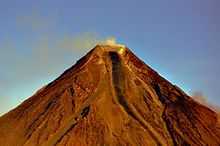
| Mayon Volcano | Albay | 5,775.70 ha 14,272 acres |
2000 |
| Mount Apo | Davao del Sur-Cotabato | 3,632.74 ha 8,977 acres |
2007 |
| Mount Balatukan Range | Misamis Oriental | 8,423 ha 20,814 acres |
2007 |
| Mount Guiting-Guiting | Romblon | 15,265.48 ha 37,722 acres |
1996 |
| Mount Inayawan Range | Lanao del Norte | 3,632.74 ha 8,977 acres |
2007 |
| Mount Isarog | Camarines Sur | 10,112.35 ha 24,988 acres |
2002 |
| Mount Kalatungan Range | Bukidnon | 21,247.73 ha 52,504 acres |
2000 |
| Mount Kanlaon | Negros Occidental-Negros Oriental | 24,388 ha 60,264 acres |
1997 |
| Mount Kitanglad Range | Bukidnon | 31,235.19 ha 77,184 acres |
1996 |
| Mount Malindang | Misamis Occidental | 34,694 ha 85,731 acres |
2002 |
| Northern Negros | Negros Occidental | 80,454.50 ha 198,807 acres |
2002 |
| Northern Sierra Madre | Isabela | 359,486 ha 888,309 acres |
1997 |
| Northwest Panay Peninsula | Aklan-Antique | 12,009.29 ha 29,676 acres |
2002 |
| Pasonanca | Zamboanga del Sur | 12,107 ha 29,917 acres |
1999 |
| Samar Island | Eastern Visayas | 333,300 ha 823,602 acres |
2003 |
| Sibalom | Antique | 5,511.47 ha 13,619 acres |
2000 |
| Tubbataha Reef | Palawan | 97,030 ha 239,766 acres |
2010 |
Natural Monuments
A natural monument is a relatively small area focused on protection of small features to protect or preserve nationally significant natural features on account of their special interest or unique characteristics.

| Name | Location | Area | Established |
|---|---|---|---|
| Bessang Pass | Ilocos Sur | 693.32 ha 1,713 acres |
2000 |
| Chocolate Hills | Bohol | 14,145 ha 34,953 acres |
1997 |
| Salinas | Nueva Vizcaya | 6,675.56 ha 16,496 acres |
2000 |
| Timpoong and Hibok-Hibok | Camiguin | 2,227.62 ha 5,505 acres |
2004 |
Protected Landscape
Protected landscapes/seascapes are areas of national significance which are characterized by the harmonious interaction of man and land while providing opportunities for public enjoyment through recreation and tourism within the normal lifestyle and economic activity of these areas.


| Name | Location | Area | Established |
|---|---|---|---|
| Aliwagwag | Davao Oriental-Compostela Valley | 10,491.33 ha 25,925 acres |
2011 |
| Amro River | Aurora | 6,471.08 ha 15,990 acres |
2000 |
| Baganga | Davao Oriental | 114.88 ha 284 acres |
2000 |
| Bigbiga | Ilocos Sur | 135.71 ha 335 acres |
2000 |
| Buenavista | Quezon | 284.27 ha 702 acres |
2000 |
| Calbayog-Pan-as-Hayiban | Samar | 7,832 ha 19,353 acres |
1998 |
| Casecnan | Cagayan Valley-Aurora | 88,846.80 ha 219,545 acres |
2000 |
| Central Cebu | Cebu | 29,062 ha 71,814 acres |
2003 |
| Dinadiawan River | Aurora | 3,371.33 ha 8,331 acres |
2000 |
| Hinulugang Taktak | Rizal | 3.20 ha 8 acres |
2000 |
| José Rizal Memorial | Zamboanga del Norte | 439 ha 1,085 acres |
2000 |
| Libunao | Ilocos Sur | 46.70 ha 115 acres |
2000 |
| Lidlidda | Ilocos Sur | 1,157.44 ha 2,860 acres |
2000 |
| Magapit | Cagayan | 3,403.62 ha 8,411 acres |
2000 |
| Mainit Hot Springs | Compostela Valley | 1,374 ha 3,395 acres |
2000 |
| Manleluag Spring | Pangasinan | 1,935.17 ha 4,782 acres |
2004 |
| Mati | Davao Oriental | 914.26 ha 2,259 acres |
2005 |
| Maulawin Spring | Quezon | 149.01 ha 368 acres |
2000 |
| Mimbilisan | Misamis Oriental | 66 ha 163 acres |
1999 |
| Mounts Banahaw-San Cristobal | Quezon-Laguna | 10,900.59 ha 26,936 acres |
2009 |
| Mount Mantalingajan | Palawan | 120,457 ha 297,656 acres |
2009 |
| Mount Matutum | South Cotabato | 15,600 ha 38,548 acres |
1995 |
| Mounts Palay-Palay–Mataas-na-Gulod | Cavite-Batangas | 3,973.13 ha 9,818 acres |
2007 |
| Mount Timolan | Zamboanga del Sur | 1,994.80 ha 4,929 acres |
2000 |
| Pamitinan | Rizal | 600 ha 1,483 acres |
1996 |
| Quezon | Quezon | 938 ha 2,318 acres |
2003 |
| Quirino | Quirino | 164,364.46 ha 406,153 acres |
2005 |
| Rajah Sikatuna | Bohol | 10,452.60 ha 25,829 acres |
2000 |
| Roosevelt | Bataan | 786.04 ha 1,942 acres |
2000 |
| Santa Lucia | Ilocos Sur | 174.16 ha 430 acres |
2000 |
| Simbahan-Talagas | Aurora | 2,266.49 ha 5,601 acres |
2000 |
| Taal Volcano | Batangas | 62,292.14 ha 153,927 acres |
1996 |
| Talaytay | Aurora | 3,526.29 ha 8,714 acres |
2000 |
| Upper Marikina River Basin | Rizal | 26,125.64 ha 64,558 acres |
2011 |
Protected Landscape and Seascape


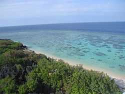
.jpg)
| Name | Location | Area | Established |
|---|---|---|---|
| Agoo-Damortis | La Union | 10,513.30 ha 25,979 acres |
2000 |
| Alburquerque-Loay-Loboc | Bohol | 1,164.16 ha 2,877 acres |
1999 |
| Aliguay Island | Zamboanga del Norte | 1,191.89 ha 2,945 acres |
1999 |
| Apo Island | Negros Oriental | 691.45 ha 1,709 acres |
1994 |
| Baliangao | Misamis Occidental | 295 ha 729 acres |
2000 |
| Batanes | Batanes | 213,578 ha 527,763 acres |
1994 |
| Biri Larosa | Northern Samar | 33,492 ha 82,761 acres |
2000 |
| Cuatro Islas | Leyte | 12,500 ha 30,888 acres |
2000 |
| Dumanquilas | Zamboanga del Sur | 25,948 ha 64,119 acres |
1999 |
| Great and Little Santa Cruz Islands | Zamboanga del Sur | 1,877 ha 4,638 acres |
2000 |
| Guiuan | Eastern Samar | 60,448 ha 149,370 acres |
1994 |
| Initao-Libertad | Misamis Oriental | 800.45 ha 1,978 acres |
2002 |
| Mabini | Compostela Valley | 6,106 ha 15,088 acres |
2000 |
| Malabungot | Camarines Sur | 120.62 ha 298 acres |
2000 |
| Malampaya | Palawan | 200,115 ha 494,495 acres |
2000 |
| Murcielagos Island | Zamboanga del Norte | 151 ha 373 acres |
2000 |
| Peñablanca | Cagayan | 118,781.58 ha 293,516 acres |
2003 |
| Pujada Bay | Davao Oriental | 21,200 ha 52,386 acres |
1994 |
| Selinog Island | Zamboanga del Norte | 1,294.35 ha 3,198 acres |
2000 |
| Siargao Island | Surigao del Norte | 278,914.13 ha 689,212 acres |
1996 |
| Talibon Islands | Bohol | 6,456.87 ha 15,955 acres |
1999 |
Protected Seascape

| Name | Location | Area | Established |
|---|---|---|---|
| Panglao Island | Bohol | 385.67 ha 953 acres |
2003 |
| Sarangani Bay | Sarangani | 215,950 ha 533,624 acres |
1996 |
| Tañon Strait | Cebu-Negros Oriental | 450 ha 1,112 acres |
1998 |
Game Refuge and Bird Sanctuaries
Strict nature reserve is an area possessing some outstanding ecosystem, features and/or species of flora and fauna of national scientific importance maintained to protect nature and maintain processes in an undisturbed state in order to have ecologically representative examples of the natural environment available for scientific study, environmental monitoring, education, and for the maintenance of genetic resources in a dynamic and evolutionary state.

| Name | Location | Area | Established |
|---|---|---|---|
| Calauit Safari Park | Palawan | 3,400 ha 8,402 acres |
1976 |
| Calavite and FB Harrison | Mindoro Occidental | 121,983.81 ha 301,429 acres |
1920 |
| Lake Buluan | Cotabato | 6,300 ha 15,568 acres |
2006 |
| Lake Malimanga | Zambales | 12.35 ha 31 acres |
1980 |
| Olango Island | Cebu | 920 ha 2,273 acres |
1992 |
| Palawan | Palawan | 761,416 ha 1,881,500 acres |
1967 |
Resource Reserves
Resource reserve is an extensive and relatively isolated and uninhabited area normally with difficult access designated as such to protect natural resources of the area for future use and prevent or contain development activities that could affect the resource pending the establishment of objectives which are based upon appropriate knowledge and planning.
| Name | Location | Area | Established |
|---|---|---|---|
| Siocon | Zamboanga del Norte | 793.74 ha 1,961 acres |
1999 |
| Upper Agno River Basin | Cordillera-Nueva Vizcaya | 77,561 ha 191,657 acres |
2000 |
Managed Resource Protected Areas

| Name | Location | Area | Established |
|---|---|---|---|
| El Nido Managed Resource Protected Area | Palawan | 89,134.76 ha 220,257 acres |
1998 |
Marine Reserves
| Name | Location | Area | Established |
|---|---|---|---|
| Masinloc and Oyon Bay | Zambales | 7,568 ha 18,701 acres |
1993 |
| Palaui Island | Cagayan | 7,415.48 ha 18,324 acres |
1994 |
| Sagay | Negros Occidental | 32,000 ha 79,074 acres |
2001 |
| Taklong Island | Guimaras | 1,143.45 ha 2,826 acres |
1990 |
Watershed Forest Reserves


| Name | Location | Area | Established |
|---|---|---|---|
| Aklan River | Aklan | 23,185 ha 57,291 acres |
1990 |
| Alabat | Quezon | 688 ha 1,700 acres |
1987 |
| Alijawan-Cansuhay-Anibongan River | Bohol | 3,630 ha 8,970 acres |
1992 |
| Allah | South Cotabato | 92,450 ha 228,449 acres |
1985 |
| Angat River | Bulacan | 6,600 ha 16,309 acres |
1968 |
| Aurora | Aurora | 430 ha 1,063 acres |
1936 |
| Bawa | Cagayan | 8,955 ha 22,128 acres |
1987 |
| Binahaan River | Quezon | 465 ha 1,149 acres |
1991 |
| Calabgan | Aurora | 4,803 ha 11,868 acres |
1992 |
| Calatrava-San Andres-San Agustin | Romblon | 2,670 ha 6,598 acres |
1982 |
| Calauag | Quezon | 328 ha 811 acres |
1939 |
| Capalonga | Camarines Norte | 752 ha 1,858 acres |
1966 |
| Catanduanes | Catanduanes | 26,010 ha 64,272 acres |
1987 |
| Dahican | Camarines Norte | 44 ha 109 acres |
1933 |
| Dalanas River | Antique | 8,558 ha 21,147 acres |
1990 |
| Dibalo-Pingit-Zabali-Malayat | Aurora | 4,528 ha 11,189 acres |
1992 |
| Dipaculao | Aurora | 1,786 ha 4,413 acres |
1987 |
| Doña Remedios-General Tinio | Bulacan-Nueva Ecija | 20,760 ha 51,299 acres |
1988 |
| Dupax | Nueva Vizcaya | 424.80 ha 1,050 acres |
1934 |
| Ilocos Norte Metro | Ilocos Norte | 2,815 ha 6,956 acres |
1934 |
| Ilog-Hilabangan | Negros Occidental | 10,211 ha 25,232 acres |
1990 |
| Infanta | Quezon | 384 ha 949 acres |
1967 |
| Jalaur River | Iloilo | 9,228 ha 22,803 acres |
1990 |
| Kabankalan | Negros Occidental | 432 ha 1,067 acres |
1991 |
| Lake Lanao | Lanao del Sur | 180,460 ha 445,926 acres |
1992 |
| Libungan | Cotabato | 52,820 ha 130,521 acres |
1990 |
| Loboc River | Bohol | 19,410 ha 47,963 acres |
1953 |
| Lopez | Quezon | 418 ha 1,033 acres |
1940 |
| Lower Agno | Benguet | 39,304 ha 97,122 acres |
1983 |
| Maasin | Iloilo | 6,150 ha 15,197 acres |
1923 |
| Mahugunao | Misamis Oriental | 136 ha 336 acres |
1932 |
| Malagos | Davao del Sur | 235 ha 581 acres |
1933 |
| Marcos Highway | Benguet | 6,105 ha 15,086 acres |
1978 |
| Mariveles (Palanas) | Bataan | 325 ha 803 acres |
1919 |
| Mulanay | Quezon | 26 ha 64 acres |
1938 |
| Naguilian | La Union | 90 ha 222 acres |
1936 |
| Olongapo (Palanas) | Zambales | 6,335 ha 15,654 acres |
1987 |
| Palawan | Palawan | 4,776 ha 11,802 acres |
1982 |
| Palompon | Leyte | 2,392 ha 5,911 acres |
1988 |
| Panay River | Capiz | 4,350 ha 10,749 acres |
1990 |
| Pantabangan-Carranglan | Nueva Ecija | 84,500 ha 208,804 acres |
1969 |
| Polillo | Quezon | 130 ha 321 acres |
1966 |
| Santa | Ilocos Sur | 25 ha 62 acres |
1935 |
| South Upi | Maguindanao | 1,894.20 ha 4,681 acres |
1987 |
| Talavera | Nueva Ecija-Nueva Vizcaya | 37,156 ha 91,814 acres |
1938 |
| Tanap | Ilocos Norte | 41 ha 101 acres |
1971 |
| Tibiang-Damagandong | Quezon | 280 ha 692 acres |
1938 |
| Torrijos | Marinduque | 105 ha 259 acres |
1932 |
| Tumauini | Isabela | 17,670 ha 43,664 acres |
1994 |
| Wangag | Cagayan | 6,992 ha 17,278 acres |
1987 |
Natural Biotic Areas
Natural biotic area is an area set aside to allow the way of life of societies living in harmony with the environment to adapt to modem technology at their pace.
| Name | Location | Area | Established |
|---|---|---|---|
| Abasig-Matogdon-Mananap | Camarines Norte | 5,420.12 ha 13,393 acres |
2000 |
| Basilan | Basilan | 4,497 ha 11,112 acres |
2000 |
| Buug | Zamboanga del Sur | 1,095 ha 2,706 acres |
1998 |
| Lagonoy | Camarines Sur | 444.60 ha 1,099 acres |
2000 |
Wildlife Sanctuaries
Wildlife sanctuary comprises an area which assures the natural conditions necessary to protect nationally significant species, groups of species, biotic communities or physical features of the environment where these may require specific human manipulation for the perpetuation.

| Name | Location | Area | Established |
|---|---|---|---|
| Agusan Marsh | Agusan del Sur | 14,835.99 ha 36,661 acres |
1996 |
| Chico Island | Masbate | 7.77 ha 19 acres |
2000 |
| Marinduque | Marinduque | 8,827.96 ha 21,814 acres |
2004 |
| Mount Calavite | Mindoro Occidental | 18,016.19 ha 44,519 acres |
2000 |
| Mount Hamiguitan Range | Davao Oriental | 6,834 ha 16,887 acres |
2004 |
| Naro Island | Masbate | 109.98 ha 272 acres |
2000 |
| Rasa Island | Palawan | 1,983 ha 4,900 acres |
2006 |
| Turtle Islands | Tawi-Tawi | 242,967 ha 600,385 acres |
1999 |
Wilderness Areas
| Name | Location | Area | Established |
|---|---|---|---|
| Alibijaban Island | Quezon | 430 ha 1,063 acres |
1981 |
| Awasan Bay Islands | Surigao del Norte | 1981 | |
| Bantayan Island | Cebu | 1981 | |
| Basot-Quinalang-Malabungot Islands | Camarines Sur | 185.38 ha 458 acres |
1981 |
| Caniago Strait Islands | Bohol | 210 ha 519 acres |
1981 |
| Cebu Strait Islands | Bohol | 34 ha 84 acres |
1981 |
| Dampalit Island | Masbate | 1981 | |
| Guinauyan-Naro-Chico-Pobre Islands | Masbate | 23.25 ha 57 acres |
1981 |
| Isabela Monte Alto Timber Resource Corp. |
Isabela | 1,985 ha 4,905 acres |
1987 |
| Majaba-Napayuan Islands | Masbate | 18 ha 44 acres |
1981 |
| Panag Bay Islands | Surigao del Norte | 1981 | |
| Rasa Island | Surigao del Norte | 1981 | |
See also
- List of World Heritage Sites in the Philippines
- List of national parks of the Philippines
- Environment of the Philippines
References
- ↑ "Establishing and Managing Protected Areas". DENR-Protected Areas and Wildlife Bureau. Retrieved 11 June 2012.
- ↑ "Act No. 648". PhilippineLaw.info. Retrieved 18 June 2012.
- ↑ "Executive orders and proclamations issued by the governor-general. (1904)". University of Michigan Library. Retrieved 18 June 2012.
- ↑ "Act No. 1148". Chan Robles. Retrieved 18 June 2012.
- ↑ "Mount Makiling marks centennial". BusinessMirror. Retrieved 21 June 2012.
- ↑ "Act No. 3915 - National Parks Act of 1932". Chan Robles. Retrieved 18 June 2012.
External links
- National Integrated Protected Areas System Act of 1992
- Protected areas (240) in the Philippines from Protected Areas and Wildlife Bureau
Mount Kalatungan Range Natural Park Official Site
| |||||||||||||||||||||||||||||||||||||||||||||

| ||||||||||||||
| Wikimedia Commons has media related to National parks of the Philippines. |