List of proposed states and territories of India

This is a list of proposed states and territories of India, in addition to the existing twenty nine states and seven union territories.[1] The admission or creation of new states and territories is a power reserved solely for the Parliament of India, which can do so by admitting new states, separating territory from an existing state or by merging two or more states or parts thereof.[2]
History
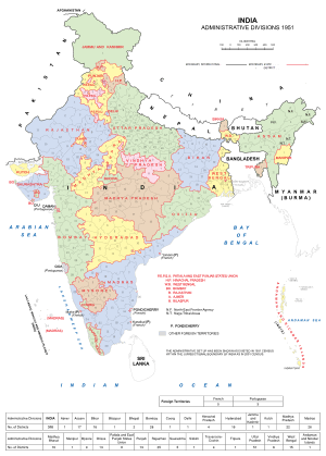
Before independence, most of India was divided into British-administered provinces and nominally autonomous princely states, which were governed with British advice. After the partition of India, some of these administrative divisions became part of the Dominion of Pakistan, whilst the remaining states and provinces formed the Dominion of India. The colonial system of administration continued until 1956 when the States Reorganization Act abolished the provinces and princely states in favour of new states which were based on language and ethnicity.
Several new states and union territories have been created out of existing states since 1956. The Bombay Reorganization Act split Bombay State into the linguistic states of Gujarat and Maharashtra on 1 May 1960.[3] Nagaland was created on 1 December 1963.[4] The Punjab Reorganization Act of 1966 created a new Hindi-speaking state of Haryana from the southern districts of Punjab state,[5] transferred the northern districts of Punjab to Himachal Pradesh, and designated a union territory around Chandigarh, the shared capital of Punjab and Haryana.[6]
Statehood was conferred upon Himachal Pradesh on 25 January 1971,[7] and Manipur, Meghalaya and Tripura.[8] The Kingdom of Sikkim joined the Indian Union as a state on 26 April 1975.[9] In 1987, Arunachal Pradesh and Mizoram became states on 20 February, followed by Goa on 30 May, while Goa's northern exclaves of Daman and Diu became a separate union territory.[10]
Three new states were created in November 2000: Chhattisgarh (1 November) was created out of eastern Madhya Pradesh;[11] Uttaranchal (9 November), which was renamed Uttarakhand in 2007,[12] was created out of the mountainous districts of northwest Uttar Pradesh;[13] and Jharkhand (15 November) was created out of the southern districts of Bihar.[14] On 2 June 2014, Telangana was separated from Andhra Pradesh as a new state.[15]
Delhi

Delhi /ˈdɛli/, also known as the National Capital Territory of Delhi, is a metropolitan region that includes the national capital city, New Delhi, and together with the neighbouring cities of Baghpat, Gurgaon, Sonipat, Faridabad, Ghaziabad, Noida, Greater Noida forms the National Capital Region, with a population of about 22 million residents.[16][17] The political administration of Delhi more closely resembles that of a state than a union territory, with its own legislature, high court and an executive council of ministers headed by a Chief Minister. New Delhi is jointly administered by the Union government and the local government of Delhi. The previous National Democratic Alliance government introduced a bill in Parliament in 2003, to grant full statehood to Delhi, but the legislation was not passed.[18]
West Bengal
Gorkhaland

Gorkhaland (Nepali: गोर्खाल्याण्ड) is a proposed state covering areas inhabited by the ethnic Gorkha (Nepali) people, namely Darjeeling hills and Dooars in the northern part of West Bengal.[19] The movement for Gorkhaland has gained momentum in the line of ethno-linguistic-cultural sentiment of the people who desire to identify themselves as Gorkha.[20]
The demand for a separate administrative region has existed since 1907, when the Hillmen's Association of Darjeeling submitted a memorandum to the Morley-Minto reforms committee.[21] After Indian independence, the Akhil Bharatiya Gorkha League (ABGL) was the first political party from the region to demand greater identity for the Gorkha ethnic group and economic freedom for the community. In 1980, the Pranta Parishad of Darjeeling wrote to the then Prime Minister of India, Indira Gandhi, with the need to form a state for the Gorkhas.
The movement for a separate state of Gorkhaland gained serious momentum during the 1980s, when a violent agitation was carried out by Gorkha National Liberation Front (GNLF) led by Subhash Ghising. The agitation ultimately led to the establishment of a semiautonomous body in 1988 called the Darjeeling Gorkha Hill Council (DGHC) to govern certain areas of Darjeeling district. However, in 2008, a new party called the Gorkha Janmukti Morcha (GJM) raised the demand for a separate state of Gorkhaland once again.[22] In 2011, GJM signed an agreement with the state and central governments for the formation of Gorkhaland Territorial Administration, a semiautonomous body that replaced the DGHC in the Darjeeling hills.[23]
Kamtapur
Kamtapur in northern parts of West Bengal.[24] The proposed state consists of the districts of Koch Behar, Jalpaiguri, and southern plains of Darjeeling including Siliguri city.
Assam
Karbi Anglong
Karbi Anglong is one of the two hill districts of Assam. Karbi Anglong was previously known as Mikir Hills. It was part of the Excluded Areas and Partially Excluded Areas (the present North East India) during British India. The British India government had never included this area under their government jurisdiction. Thereby no government development work or activity were done, nor any tax levied from the hills, including Karbi Anglong (then Mikir Hills). The first memorandum for a Karbi homeland was presented to Governor Reid on 28 October 1940 by Semsonsing Ingti and Khorsing Terang at Mohongdijua,[25] Mikir Hills (now Karbi Anglong). Then the Karbi leaders were part of the All Party Hill Leaders' Conference (APHLC) formed on 6 July 1960 represented by Raidang Ingti, Basa Ingti Kathar, John Kathar, Davidlong Inghi, Barelong Terang, Moniram Langneh. Later Harlongbi Ingti Kathar, Pitor Tisso, Bapuram Singnar, Longsodar Katharson (Ingti Kathar); and then, Gandhiram Timung, Protap Chandro Tokbi, Song Beh, Nihang Teron, Harikanto Ronghang, Sonaram Terang, Harsing Taro, Thong Timung, Sara Ingti Kathar, Moniram Rongpi, Rongpi Lamding, and many more.[26] The movement again gained momentum when the Karbi Anglong District Council passed a resolution demanding a Separate State in 1981. Then again from 1986 through the leadership of Autonomous State Demand Committee (ASDC) demanded Autonomous statehood of Karbi Anglong & Dima Hasao under Article 244(A). In 2002, the Karbi Anglong Autonomous Council again passed another resolution to press for statehood. Besides there were several Memoranda submitted at different times by several organizations. The demand for Separate State of Karbi Anglong took a violent turn on 31 July 2013 where student demonstrators burst out in anger burning almost every government building. Following which, the elected political leaders of Karbi Anglong jointly submitted a memorandum to the Prime Minister of India demanding a separate State. The Prime Minister had given them his assurance to discuss the matter.
Bodoland

The agitation for the creation of a separate Bodoland state resulted in an agreement between the Indian Government, the Assam state government and the Bodo Liberation Tigers Force. Per that agreement of 10 February 2003, the Bodoland Territorial Council, an entity subordinate to the government of Assam, was created to govern four districts covering 3082 Bodo-majority villages in Assam.[27][28] Elections to the council were held on 13 May 2003, and Hagrama Mahillary was sworn in as chief of the 46-member council on 4 June 2003.[29]
Gujarat
Kutch or Cutch State, Saurashtra and Bhilistan
Kutch Region or Cutch State and Saurashtra Region are aspirant states both as separate or combined Saurashtra was formed by union of different princely states and Kutch was a separate princely state which became border state after independence of India. Saurashtra and Kutch were Part-B and Part-C states of India respectively. Both were separate states till 1956 and later merged with Bombay state following the States Reorganization Act.[30] They became part of Gujarat state after bifurcation of Bombay state on May 1, 1960 following Mahagujarat Movement. Some people demand return of statehood to Saurashtra and Kutch citing slow development of the regions.[31]
Apart from these two separate state-hood demands there is as well a third equally vocal demand for separate Bhilistan state.[32]
Revival movements for formerly separate Sourashtra State and Kutch State
Sourashtra State and Kutch State separately existed from 1947 to 1956. Gujarat has demands for separate states of Kutch State, Sourashtra State and Bhilistan from many decades. ,, ,
Saurashtra State
Movement for separate Saurashtra State was initiated in 1972 by advocate Ratilal Tanna, who was close aide of former Prime Minister Morarji Desai. As per Saurashtra Sankalan Samiti, more than 300 organisations across the Saurashtra region support the demand of the separate State. Samiti also claims that compared to other parts of Gujarat, Saurashtra is underdeveloped. Big industrial projects are coming near Ahmedabad and Vadodara, while Saurashtra is being ignored. It is claimed that, People of Saurashtra are facing shortage of drinking water and even youths are forced to migrate in search of jobs. No development is made along the coastline and if Saurashtra had its own state government the region would have done much better. Parag Tejura is current president of Saurashtra Sankalan Samiti. , , Sourashtra has separate identity from rest of Gujarat. Region has its own Sourashtra language dialect. Sourashtra people have their own diaspora all over world including that in Tamil Nadu for centuries. Some agitators claim, people from Saurashtra are often taunted with titles such as "kathiawadi" and "via Viramgam".
Combined Saurashtra-Kutch State
There is also demand for combined Kutch Sourashtra State or Sourashtra-Kutch State. Mansukhbhai Joshi, has called a meeting under the banner ‘Kutch Saurashtra Vikas Sangharsh Samiti’ to find ways to rekindle the issue. The former chief ministe claims people of Saurashtra do not physically associate themselves with Gujarat. He says leaders from the territory have always faced anger in Gandhinagar. Yuva Kranti Sena is another organisation fighting for a separate land altogether. Saurashtra-Kutch State ,
Kutch State
While Kutch Rajya Sankalp Samitee (KRSS) is spearheading demand for separate Kutch State under leadership of Pragmalji III. At the time of integration of the princely state with India in 1947, the accession was done on the condition that Kutch would retain the status of a separate state. It enjoyed this status till 1960, when a separate state of Gujarat was carved out of Maharashtra and Kutch was merged with it. The main reason behind a separate state is cultural and geographical distance from Gandhinagar. The latter, according to KRSS, is also a hindrance to the development of the region. Kutch is still governed by an administration in Gandhinagar, which sits 400 km away. In 1960, Kutch was promised an autonomous development board under Article 371(2) of the Constitution, which never came into existence due to lack of political will. Narmada water does not reach the farms of this region, which is basically a desert land.
Uttar Pradesh
Experts have advocated for creation of at least four states out of the largest state of India, Uttar Pradesh.[33]
Braj/Harit Pradesh/Paschimanchal

Harit Pradesh (Hindi: हरित प्रदेश, Urdu: ہرِت پردیش) is a proposed state, which would comprise 22 districts of Western Uttar Pradesh, currently forming six divisions – Agra, Aligarh, Bareilly, Meerut, Moradabad, and Saharanpur. The most prominent advocate for the creation of the new state is Ajit Singh, the leader of the Rashtriya Lok Dal party. Mayawati also supported the formation of Harit Pradesh in December 2009.
There is another demand within the same region - Braj Pradesh, consisting of Agra division and Aligarh division from Uttar Pradesh and districts of Bharatpur and Gwalior from Rajasthan and Madhya Pradesh. The proposed capital would be in Agra.[34][35] So far, Braj has remained as a historical and cultural region, rather than a political entity. Language of Braj is Braj Bhasha.
Awadh/Central Uttar Pradesh
The population of proposed Awadh state consisting of Awadhi speaking districts of central Uttar Pradesh would be approximately 50 million people, with an area of approximately 75,000 km2 and Lucknow as the capital.
Purvanchal
Purvanchal (Hindi: पूर्वांचल, Urdu: پُورواںچل) is a geographic region of north-central India, which comprises the eastern end of Uttar Pradesh state. It is bounded by Nepal to the north, Bihar state to the east, Bagelkhand region of Madhya Pradesh state to the south, the Awadh region of Uttar Pradesh to the west. Purvanchal comprises three divisions – Awadhi region in the west, Bhojpuri region in the east and the Baghelkhand region in the south.
The most commonly spoken language in Purvanchal is Bhojpuri.
Purvanchal area is represented by 23 Members of Parliament to the lower house of Indian Parliament, and 117 legislators in the 403 member Uttar Pradesh state assembly or Vidhan Sabha.[36] Districts-Azamgarh, Ballia, Chandauli, Deoria, Ghazipur, Gorakhpur, Jaunpur, Kushinagar, Maharajganj, Mau, Mirzapur, Sant Kabir Nagar, Sant Ravidas Nagar, Siddharth Nagar, Varanasi.
As a fallout of Telangana creation movement, Mayawati proposed 13 Dec 2009 to carve Purvanchal.[37] out of Uttar Pradesh. Current movement for Purvanchal is spearheaded by politician Amar Singh.
Bundelkhand

Bundelkhand comprises parts of Uttar Pradesh and Madhya Pradesh. While the Bahujan Samaj Party government under Mayawati proposed in 2011 the creation of Bundelkhand from seven districts of Uttar Pradesh, organizations such as Bundelkhand Mukti Morcha (BMM) want it to include six districts from Madhya Pradesh as well.[38] Uma Bharati of Bharatiya Janata Party promised a separate state of Bundelkhand within three years if her party was voted to power, during campaigning for the Loksabha Election, 2014 at Jhansi.[39] Similar promise was made by Congress leader Pradeep Jain Aditya during Loksabha Election, 2014.[40]
Since the early 1960s there has been a movement for establishing a Bundelkhand state or promoting development of the region. Bundelkhand is geographically the central part of India covering part of Madhya Pradesh and part of Uttar Pradesh. In spite of being rich in minerals, the people of Bundelkhand are very poor and the region is underdeveloped and underrepresented in state and central politics.[41][42] Agrarian crisis and farmer's suicides is also cited as reason for separate statehood.[43]
Uttar Pradesh In November 2011 Uttar Pradesh Council of Ministers proposed to split the state into four parts, with one part being Bundelkhand.
The proposed state includes the following districts:
- From Uttar Pradesh (three districts from Jhansi Division and four districts from Chitrakoot Division)
- Jhansi (currently part of Jhansi Division)
- Jalaun (currently part of Jhansi Division)
- Lalitpur (currently part of Jhansi Division)
- Chitrakoot (currently part of Chitrakoot Division)
- Banda (currently part of Chitrakoot Division)
- Hamirpur (currently part of Chitrakoot Division)
- Mahoba (currently part of Chitrakoot Division)
Madhya Pradesh
- From Madhya Pradesh (one district from Gwalior Division and six districts from Sagar Division)
- Datia (currently part of Gwalior Division)
- Chhatarpur (currently part of Sagar Division)
- Damoh (currently part of Sagar Division)
- Panna (currently part of Sagar Division)
- Sagar (currently part of Sagar Division)
- Tikamgarh (currently part of Sagar Division)
- Vidisha District (Bhopal division)
In addition to the above districts, sometimes the following districts of Madhya Pradesh are considered as being part of Bundelkhand:
Bihar
Mithila or Mithilanchal

Mithila (Devnagri: मिथिला, mithilā Tirhuta: মিথিলা) is proposed to cover the Maithili speaking regions of Bihar and Jharkhand. There are 24 Maithili-speaking districts in Bihar: Araria, Begusarai, Bhagalpur, (Banka), Darbhanga, East Champaran Katihar, Khagaria, Kishanganj, Madhepura, Madhubani, Muzaffarpur, Purnea, Saharasa, Samastipur, Sheohar, Sitamarhi, Supaul, Vaishali, and West Champaran, Munger, Jamui. There are six Maithili-speaking districts in Jharkhand: Deoghar, Dumka, godda, Jamtara, Pakaur, and Sahebganj. There is no consensus on a proposed capital, Muzaffarpur, Barauni and Darbhnaga have been suggested by different persons and groups.
Bhojpur
There have been demands for a Bhojpur state, made up of Bhojpuri speaking districts of western Bihar, eastern Uttar Pradesh and northern Chattisgarh and Jharkhand.[44][45][46]
Karnataka
Hyderabad-Karnataka or Kalyana Karnataka
is a Kannada speaking region of Hyderabad State ruled by the Nizams of Hyderabad until 1948 and after merging with India union, the region was the part of Hyderabad State until 1956. The Hyderabad-Karanataka region comprises Bidar, Yadgir, Raichur, Koppal Bellary and Gulbarga is in the present state of Karnataka, The Hyderabad-Karanataka region is the second largest arid region in India. [47][48][49][50]
Kalyana Karnataka
Kalyana Karnataka (Kannada: ಕಲ್ಯಾಣ ಕರ್ನಾಟಕ ) was the term coined by noted Kannada activist Dr. Chidananda Murthy.[51] Kalyana Karnataka to refer to Hyderabad-Karnataka as an administrative block with Gulbarga as the administrative headquarters. It consists of 6 districts namely Bidar, Gulbarga, Yadgir, Raichur, Bellary and Koppal.[52] Kalyana Karnataka is also called as Gulbarga division. The provisions of Article 371(J) of the Constitution, aimed at bringing about all-round development in six districts of the Hyderabad-Karnataka region.
As recent as October 2014 there are demands from organizations fighting for cause of this region such as Karnataka Rajya Raitha Sangha - KRSS[53] and Hyderabad-Karnataka Abhivradhi Horata Samithi.[54] The Hyderabad-Karnataka Abhivradhi Horata Samithi was formed to launch an agitation, with former minister Vaijanath Patil as one of its leaders. Every year, the Samithi observes Liberation Day to mark their ‘independence from Nizam’ on September 17 and a symbolic bandh on Rajyothsava Day (November 1 - Formation day of Karnataka State). Although Hyderabad-Karnataka Abhivradhi Horata Samithi is hoping the special status under article 371(J) as announced by the then UPA government in 2014 will ease concerns and facilitate in the growth over the next five years or so from 2014, otherwise Samiti will be said to be forced to re-launch agitation for the separate statehood again.[55]
Tulu Nadu

Tulu Nadu is a region on the border between the states of Karnataka and Kerala in southern India. The demand for a separate state is based on a distinct culture and language (Tulu, which does not have official status), and neglect of the region by the two state governments.[56][57] To counter these demands and accusations, the Karnataka and Kerala state governments have created the Tulu Sahitya Academy to preserve and promote Tuluva culture.[58] The proposed state would comprise three existing districts; Dakshina Kannada and Udupi in Karnataka, and Kasaragod in Kerala.[59][60]
Jammu and Kashmir
Kashmir
The proposed Kashmir state comprises the Kashmir valley region in Jammu & Kashmir
Jammu/ Dogradesh
The Jammu region of the present day Indian state of 'Jammu and Kashmir' is predominantly inhabited by the Dogras. The demand for the creation of a separate state of 'Jammu' is almost 60 years old and has its origin in the 'Praja Parishad' agitation of 1952-53. Historically, the people of Jammu or the Dogras were never connected with the region of Kashmir given the geographical proximity of the two regions and were united as a state only after the sale of the area comprising the regions of Jammu, Kashmir and Ladakh to Raja Gulab Singh Jamwal by the British.
The demand for the creation of a separate 'Jammu' State has gained ground with the marginalization of the people of the region in Elected Government and in selection in the state government services. In addition, there are no cultural or linguistic similarities between the people of the 'Jammu' and the 'Kashmir' region of the state (Barring the people residing in the Districts of Doda and Poonch in the Jammu region). Also, while the people of Kashmir are predominantly Muslim, the Jammu region is largely Hindu with the community comprising almost 70% of the population.
The proposed Dogradesh state comprises the Jammu region in Jammu & Kashmir.
Ladakh
Ladakh, comprising a sizeable chunk of eastern Jammu and Kashmir, has asked for Union Territory status as part of a desire to protect its Buddhist culture from the influence of the mainly Muslim Kashmir Valley.
Madhya Pradesh
Vindhya Pradesh, Baghelkhand and Bundelkhand

Vindhya Pradesh (Hindi: विंध्य प्रदेश) is a former state of India. It occupied an area of 23,603 sq. miles.[61] It was created in 1948, shortly after Indian independence, from the territories of the princely states in the eastern portion of the former Central India Agency. It was named for the Vindhya Range, which runs through the center of the province. The capital of the state was Rewa. It lay between Uttar Pradesh to the north and Madhya Pradesh to the south, and the enclave of Datia, which lay a short distance to the west, was surrounded by the state of Madhya Bharat.
Vindhya Pradesh was merged into Madhya Pradesh in 1956, following the States Reorganization Act.[30]
Vindhya Pradesh state was formed on 12 March 1948 and the newly formed state was inaugurated on 4 April 1948. Following its formation 35 princely states were merged to form Vindhya Pradesh state:
- Rewa
- Panna
- Datia
- Orchha
- Ajaigarh
- Baoni
- Baraundha
- Bijawar
- Chhatarpur
- Charkhari
- Maihar
- Nagod
- Samthar
- Alipura
- Banka-Pahari
- Beri
- Bhaisunda (Chaube Jagir)
- Bihat
- Bijna
- Dhurwai
- Garrauli
- Gaurihar
- Jaso
- Jigni
- Khaniadhana
- Kamta Rajaula (Chaube Jagir)
- Kothi
- Lugasi
- Naigawan Rebai
- Pahra (Chaube Jagir)
- Paldeo (Chaube Jagir)
- Sarila
- Sohawal
- Taraon (Chaube Jagir)
- Tori-Fatehpur (Hasht-Bhaiya Jagir)
On 25 January 1950, 10 erstwhile princely states, namely, Bihat, Banka Paharee, Baoni, Beri, Bijna, Charkhari, Jigni, Samthar, Sarila and Tori-Fatehpur were transferred to Uttar Pradesh and Madhya Bharat. Vindhya Pradesh, together with the states of Madhya Bharat and Bhopal State, was merged into Madhya Pradesh on November 1, 1956.
After formation, the state was divided into two divisions, which were further divided into 8 districts.
Bundelkhand Division with its headquarters at Nowgaon comprised the following 4 districts:[61]
Baghelkhand Division with its headquarters at Rewa comprised the following 4 districts:[61]
- Rewa district
- Satna district
- Sidhi district
- Singrauli district
In 2000, Sriniwas Tiwari, ex-speaker of the Madhya Pradesh assembly, called for nine districts to be separated from Madhya Pradesh to create a new state of Vindhya Pradesh, although this was rejected by the Chief Minister of Madhya Pradesh.[62]
Separate Bundelkhand and Baghelkhand states instead of single Vindhya Pradesh is as well advocated to accommodate districts claimed by Bundelkhand and Baghelkhand from neighboring Uttar Pradesh state.,[41][63]
Mahakoshal and Gondwana
Mahakoshal is a region which lies in the upper or eastern reaches of the Narmada River valley in the Indian state of Madhya Pradesh. Cities and districts of the region include Jabalpur, Katni, Narsinghpur, Mandla, Dindori, Satna, Seoni and Chhindwara. The largest city and a possible capital is Jabalpur. Organizations such as Mahakaushal Mukti Morcha, Bharatiya Janashakti (Prahlad Patel faction) have demanded separate statehood.[64][65]
It is alleged that though the Mahakoshal region is rich in minerals, forests, water and land resources, related industries were set up in nearby states.[65] Also, the region has a distinct cultural identity owing to Jabalpur city, known as the Sanskardhani ( Cultural Capital) of the State, one of the oldest towns of Central India. Culturally and socially, the Mahakoshal region differs greatly from the neighbouring Vindhya Pradesh. One of the key reasons for this is said to be that large parts of Mahakoshal were under direct British rule from the nineteenth century onwards, turning it into a relatively progressive, modern and liberal area and infusing democratic values into its body politic. Casteism and feudalism are said to be not as deeply rooted in this region as they are Vindhya Pradesh.[66]
A parallel demand for a state of Gondwana from the same Mahakoshal region of Madhya Pradesh has arisen owing to the fact that vast areas of Mahakoshal were ruled by Gond kings and even today, Mandla, Chinndwara, Dindori, Seoni and Balaghat have a predominantly Gond tribal population. Tribals constitute 64 per cent of the total population of Dindori district. For Mandla, the corresponding figure is 57 per cent. The Gondwana Gantantra party ( GGP) was established in 1991, with the objective to struggle for the creation of a separate Gondwana State comprising regions that were ruled by Gonds. The Gondwana Gantantra party ( GGP) has since divided into numerous factions such as Rashtriya Gondwana party and Gondwana Mukti Dal.[66]
Malwa
There are sporadic demands for a separate Malwa state with the probable capital at Indore. The region includes the Madhya Pradesh districts of Agar, Dewas, Dhar, Indore, Jhabua, Mandsaur, Neemuch, Rajgarh, Ratlam, Shajapur, Ujjain, and parts of Guna and Sehore, and the Rajasthan districts of Jhalawar and parts of Banswara and Pratapgarh.
The main language of Malwa is Malvi, although Hindi is widely spoken in the cities. This Indo-European language is subclassified as Indo-Aryan. The language is sometimes referred to as Malavi or Ujjaini. Malvi is part of the Rajasthani branch of languages; Nimadi is spoken in the Nimar region of Madhya Pradesh and in Rajasthan. The dialects of Malvi are, in alphabetical order, Bachadi, Bhoyari, Dholewari, Hoshangabadi, Jamral, Katiyai, Malvi Proper, Patvi, Rangari, Rangri and Sondwari. A survey in 2001 found only four dialects: Ujjaini (in the districts of Ujjain, Indore, Dewas and Sehore), Rajawari (Ratlam, Mandsaur and Neemuch), Umadwari (Rajgarh) and Sondhwari (Jhalawar, in Rajasthan). About 55% of the population of Malwa can converse in and about 40% of the population is literate in Hindi, the official language of the Madhya Pradesh state.[67]
North East
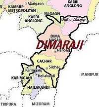
Dimaraji
The Dimasa people of Northeast India have been demanding a separate state called Dimaraji or "Dimaland" for several decades. It would comprise the Dimasa inhabited areas of Assam and Nagaland, namely Dima Hasao district and Cachar district, parts of Nagaon district and Karbi Anglong district in Assam together with part of Dimapur district in Nagaland.[68]
Kukiland
The Kuki Hills was an independent hill country during the pre-British colonial period. It was merged by the colonial power into Manipur. The Kuki people under the leadership of Kuki State Demand Committee[69] demand statehood for the Kuki areas in Manipur, i.e. Sadar Hills, Chandel, Churachandpur districts and some parts of Ukhrul, Tamenglong districts to be formed as Kukiland.[70]
Odisha
Kosal
The Kosal region is the entire Western Odisha area located in Odisha state, between 19° 37’- 23° N latitude and 82° 28’- 85° 22’ E longitudes comprising the districts of Sundargarh, Jharsuguda, Debagarh, Sambalpur, Bargarh, Sonepur, Boudh, Bolangir, Nuapada, Kalahandi, Nabarangpur, Aathmallik sub-division of Angul district and Kashipur block of Rayagada district. It is surrounded by Jharkhand state on the north, on the east by the dist of Keonjhar, Angul and Kandhamal; on the south by Rayagada, Koraput and on the west by Chhattisgarh state. This geographical area comes under the Western Odisha Development Council.
Maharashtra
Vidarbha
Vidarbha (Marathi: विदर्भ) is a region that comprises the Amravati and Nagpur divisions of eastern Maharashtra. The State Reorganization Act of 1956 placed Vidarbha in Bombay State. Shortly after this, the States Reorganisation Commission recommended the creation of "Vidarbha state" with Nagpur as the capital, but instead it was included in Maharashtra state, which was formed on 1 May 1960.
Support for a separate state of Vidarbha had been expressed by Loknayak Bapuji Aney and Brijlal Biyani Vidarbha. The demand for the creation of a separate state are based on allegations of neglect by the Maharashtra state government. Jambuwantrao Dhote led a popular struggle for Vidarbha statehood in the 1970s. Two politicians, N.K.P. Salve and Vasant Sathe, have led 21st century attempts to bring about a state of Vidarbha.
Konkan
Konkan (Konkan: कोकण) Konkan or the Konkan Coast is a rugged section of the western coastline of India. It consists of the coastal districts of Maharashtra, Goa and Karnataka. The ancient sapta-Konkan is a slightly larger region described in the Sahyadrikhanda which refers to it as "Parashuramakshetra".
Tamil Nadu
Kongu Nadu
There have been demands for the creation of separate state of Kongu Nadu (also called Kongadesam, the ancient Chera Kingdom), comprising the regions of western Tamil Nadu, parts of southern Karanataka and northern Kerala with capital at Coimbatore, based on demography, culture, linguistics and other factors. There have been claims that the Kongu Nadu region has often been ignored by successive governments in spite of being the largest contributor to the state's economy. A number of political outfits including Kongadesa Rashtra Samithi, Kongunadu Munnetra Kazhagam, Kongu Vellala Goundergal Peravai and Tamil Nadu Kongu Ilaignar Peravai are active in the region claiming to fight for the rights of the region.[71][72][73][74][75]
Chola Nadu
There have been demands for the creation of separate state of Chola Nadu (also called Choladesam, the ancient Chola Kingdom), encompasses the lower reaches of the Kaveri River and its delta, the boundaries of the region roughly correlates with those of the British India districts of Tanjore and Trichinopoly with capital at Tiruchirapalli, based on demography, culture, linguistics, developmental and other factors. The demand for this state has been because of the claims that these regions have often been ignored by successive governments and have remained backward in comparison to Tondai Nadu, where government primarily focus.
Pandya Nadu
There have been demands for the creation of separate state of Pandya Nadu, comprising the southernmost regions of Tamil Nadu with capital at Madurai, based on demography, culture, linguistics, developmental and other factors. The demand for this state has been because of the claims that these regions have often been ignored by successive governments and have remained backward in comparison to Tondai Nadu, where government primarily focus.
Others
In a historical interview with All India Radio, Sindhi political leader G.M. Syed advocated the independence of Sindh from Pakistan to form Sindhudesh, or confederation of Sindh with India.[76]
In a speech, Prime Minister of India Narendra Modi told the Sindhi diaspora in India that Sindh returning to India is an accomplishable dream.[77]
According to Gul Agha, India is a country that is well suited to the secular Sufi mindset of the Sindhi people, although the region may become a magnet for migration from growth-stunted regions of Northern India in the event that this occurs.[78]
- Chakmaland, Mizoram: People from Chakma Autonomous District Council (CADC) of Mizoram are demanding for a new Union Territory Chakmaland.The area of Chakmaland include all the Chakma inhabited area of Mamit and Lunglei District.
- Garoland, Meghalaya: People from Garo regions of Meghalaya are demanding for a new state Garoland.
- Gondwana, which would include portions of Andhra Pradesh, Chhattisgarh, Madhya Pradesh, and Maharashtra.
- Karaikal district (Tamil: காரைக்கால் மாவட்டம்) is one of the four districts of the Puducherry Union Territory, lying 150 km (93 mi) south of the Pondicherry district. There is a movement to transform Karaikal district into a separate union territory because of a perceived lack of development compared to the rest of Puducherry.[79]
- Frontier Nagaland, covers four eastern districts of Nagaland. The aspiring state accuses the other ethnic groups in the rest of nagaland of social and economic discrimination.
- Konkan, comprising the Konkani-speaking areas of Raigad, Ratnagiri, Thane, Mumbai, Navi Mumbai and Sindhudurg districts in Maharashtra.[80][81]
See also
- States and territories of India
- Autonomous regions of India
- Separatist movements of India
References
- ↑ "First Schedule of the Constitution of India" (PDF). Government of India. Retrieved 23 May 2013.
- ↑ "Articles 2 and 3 of the Constitution of India" (PDF). Government of India. Retrieved 23 May 2013.
- ↑ J.C. Aggarwal and S.P. Agrawal, editors, Uttarakhand: Past, Present, and Future (New Delhi: Concept Publishing, 1995), p89-90
- ↑ Nagaland History & Geography-Source india.gov.in
- ↑ The Punjab Reorganization Act 1966
- ↑ "State map of India". Travel India guide. Retrieved 2013-06-17.
- ↑ Statehood Himachal Pradesh
- ↑ Snapshot of North Eastern States
- ↑ Sikkim joins Indian Union
- ↑ Goa Chronology
- ↑ "Chhattisgarh state - History". Cg.gov.in. 1979-12-19. Retrieved 2013-06-17.
- ↑ Chopra, Jasi Kiran (2 January 2007). "Uttaranchal is Uttarakhand, BJP cries foul". TNN. The Time of India. Retrieved 22 January 2013.
- ↑ "About Us: Uttarakhand Government Portal, India". Uk.gov.in. 2000-11-09. Retrieved 2013-06-17.
- ↑ "Official Website of Government of Jharkhand". Jharkhand.gov.in. Retrieved 2013-06-17.
- ↑ "Notification" (PDF). The Gazette of India. Government of India. 4 March 2014. Retrieved 6 February 2015.
- ↑ "Urban agglomerations/cities having population 1 million and above" (PDF). Provisional population totals, census of India 2011. Registrar General & Census Commissioner, India. 2011. Retrieved 23 May 2013.
- ↑ "World Urbanization Prospects: The 2009 Revision Population Database". United Nations. 2012. Retrieved 23 May 2013.
- ↑ "Bill on statehood for Delhi cleared". The Hindu. 12 August 2003. Retrieved 23 May 2013.
- ↑ Sailen Debnath, The Dooars in Historical Transition, ISBN 9788186860441
- ↑ "Why Gorkhaland". Gorkha Janmukti Morcha. Retrieved 6 October 2012.
- ↑ "The Parliament is the supreme and ultimate authority of India". Darjeeling Times. 23 November 2010. Retrieved 20 March 2012.
- ↑ "Demand for Gorkhaland raised again". The Hindu. 16 November 2007. Retrieved 20 March 2012.
- ↑ "‘Gorkhaland Territorial Administration’ it is". The Statesman (Kolkata, India). 8 July 2011.
- ↑ "Factions merge for Kamtapur fight". Calcutta: The Telegraph. 14 October 2010. Retrieved 17 May 2013.
- ↑ Dharamsing Teron, "Opium Curse - A Forgotten Chapter", unpublished.
- ↑ J. I. Kathar (IAS Retd), "1971 Aningkan Kilik Kehai Un:e....", Thekar (5 February 2013); available from http://thekararnivang.com/2013/02/05/1971-aningkan-kilik-kehai-un-e-karbi-asongja-atum-karbi-atum-aphan-autonomous-state-kapelong-aphurkimo-2/
- ↑ "The Hindu : Assam: accord and discord". Hinduonnet.com. Retrieved 2012-03-04.
- ↑ "Memorandum of Settlement on Bodoland Territorial Council (BTC)". Satp.org. 10 February 2003. Retrieved 2012-03-04.
- ↑ "Mahillary sworn in Bodoland council chief". The Hindu (Chennai, India). 4 June 2005.
- ↑ 30.0 30.1 "States Reorganisation Act, 1956". India Code Updated Acts. Ministry of Law and Justice, Government of India. 31 August 1956. pp. section 9. Retrieved 16 May 2013.
- ↑ http://daily.bhaskar.com/article/GUJ-AHD-clamour-for-separate-srashtra-bhilistan-to-get-louder-4336147-NOR.html
- ↑ http://www.dailypioneer.com/nation/now-gujarat-revives-statehood-demand.html
- ↑ http://www.sunday-guardian.com/news/dividing-uttar-pradesh-will-be-good-for-growth-say-experts. Missing or empty
|title=(help) - ↑ "Demand for separate 'Braj Pradesh' gains momentum". The Hindu. 26 December 2009. Retrieved 19 April 2013.
- ↑ 'Braj Pradesh' State Demand Intensifies – Indiaserver.com
- ↑ "Congressmen demand separate Purvanchal, Bundelkhand States". The Hindu (Chennai, India). 7 March 2005.
- ↑ "Maya challenges Pranab over statehood". timesnow.tv. 13 December 2009. Retrieved 2012-03-04.
- ↑ http://www.highbeam.com/doc/1P3-1921363201.html
- ↑ http://indianexpress.com/article/india/politics/uma-bharti-promises-separate-bundelkhand-to-voters-in-jhansi/
- ↑ http://www.news18.com/videos/uttar-pradesh/ls-polls-pradeep-jain-aditya-uma-bharti-promise-separate-bundelkhand-state-401373.html
- ↑ 41.0 41.1 http://daily.bhaskar.com/news/MP-BHO-demand-for-seperate-bundelkhand-reignited-ahead-of-assembly-polls-4226793-NOR.html
- ↑ http://www.thehindu.com/news/national/other-states/nod-for-telangana-fuels-the-demand-for-bundelkhand/article63277.ece
- ↑ http://www.epw.in/states/farmers-suicides-and-statehood-demand-bundelkhand.html
- ↑ http://www.dnaindia.com/india/report-bhojpuri-speaking-people-demand-separate-state-1062441
- ↑ http://newsviews.satya-weblog.com/2013/08/seperate-mithila-state-demand-from.html
- ↑ http://archive.indianexpress.com/news/demand-for-creation-of-ten-new-states/482355/
- ↑ "Home". Hyderabad Karnataka area development board. 2009. Retrieved 28 April 2013.
- ↑ Dev, Vanu (19 December 2012). "Karnataka wins 4-decade-old battle; gets special status for Hyderabad-Karnataka region". India Today. Retrieved 28 April 2013.
- ↑ "Hyderabad-Karnataka special status will be Congress poll plank". Times of India. 23 April 2013. Retrieved 28 April 2013.
- ↑ "Bill giving special status for Hyderabad-Karnataka region raises Telangana hopes". Times of India. 20 December 2012. Retrieved 28 April 2013.
- ↑ http://www.hindu.com/2008/10/26/stories/2008102652370300.htm
- ↑ http://www.deccanherald.com/content/276445/hyderabad-karnataka-region-gets-spl.html
- ↑ http://www.thehindu.com/news/national/karnataka/krrs-demands-for-separate-state-for-north-karnataka/article6544924.ece
- ↑ http://epaper.timesofindia.com/Default/Scripting/ArticleWin.asp?From=Archive&Source=Page&Skin=TOI&BaseHref=TOIBG%2F2009%2F12%2F11&PageLabel=20&EntityId=Ar02000&AppName=1&ViewMode=HTML
- ↑ http://timesofindia.indiatimes.com/city/bangalore/North-Karnatakas-separate-statehood-demand-still-a-far-cry-/articleshow/21556538.cms
- ↑ "Tulu Nadu movement gaining momentum". The Hindu (Mangalore, India). 13 August 2006. Retrieved 16 May 2013.
- ↑ "Samithi seeks separate Tulu state". Deccan Herald (Mangalore, India). 21 October 2006. Retrieved 16 May 2013.
- ↑ "Tulu academy urged to publish Machendranath’s selected dramas". The Hindu (Mangalore, India). 13 April 2003. Retrieved 16 May 2013.
- ↑ "Tulu organisations to meet soon". The Hindu (Mangalore, India). 6 March 2008. Retrieved 16 May 2013.
- ↑ "News headlines". Dajiworld. 21 October 2006. Retrieved 19 May 2013.
- ↑ 61.0 61.1 61.2 Bhattacharyya, P. K. (1977). Historical Geography of Madhya Pradesh from Early Records. Delhi: Motilal Banarsidass. pp. 54–5. ISBN 0 8426 909 13.
- ↑ "No more division of State: Digvijay". The Hindu. 10 September 2000. Retrieved 16 May 2013.
- ↑ http://chakresh.com/indianpolitics/bundelkhand-or-vindhya-pradesh-proposed-state/
- ↑ http://www.bhaskar.com/news/MP-JBL-mahakaushal-state-will-be-a-fight-to-the-finish-4769174-NOR.html
- ↑ 65.0 65.1 http://news.oneindia.in/2008/10/24/prahlad-patel-demands-separate-state-in-mahakaushal-1224837437.html
- ↑ 66.0 66.1 http://freepressjournal.in/mahakaushal-no-cakewalk-for-either-contender/
- ↑ Ethnologue
- ↑ "Demand for separate state of Dimaraji in North East - Oneindia News". News.oneindia.in. 2011-01-28. Retrieved 2013-06-17.
- ↑ http://www.tehelka.com/ksdc-announces-quit-kuki-land-protest-in-manipur-from-24-january/
- ↑ http://samaw.com/kukiland-state-map/6023
- ↑ "India may have 50 states if new demands met". The Hindu. 4 August 2013.
- ↑ Region's 'neglect' by governments prompted party formation : Best' Ramasamy - Chennaionline News
- ↑ "Beginning with message of conservation". The Hindu (Chennai, India). 10 April 2009.
- ↑ "KMP to work for progressive Western Tamil Nadu". The Hindu (Chennai, India). 29 April 2009.
- ↑ url=https://www.facebook.com/Konga.Desamm?fref=ts
- ↑ An Interview Of Sain G M Syed - JSQM
- ↑ Sindhis want Sindh in India?Modi gives example of Jews - DeshGujarat, March 2012
- ↑ Should Pakistan be broken up? Gul Agha
- ↑ "Union Territory status sought for Karaikal". Times of India. 9 June 2007. Retrieved 15 May 2013.
- ↑ http://news.webindia123.com/news/articles/India/20101217/1650700.html
- ↑ http://news.oneindia.in/2006/09/29/agri-kunbi-sena-demand-separate-konkan-state-1159553012.html OneIndia News. 29 September 2006
External links
| Wikimedia Commons has media related to Proposed states and union territories in India. |
- "India Redrawn". Outlook India. 6 February 2012.
| |||||||||||||||||