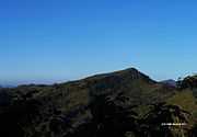
List of mountains of Bangladesh
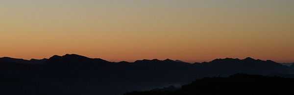
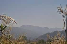
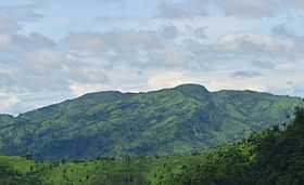
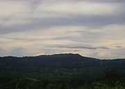
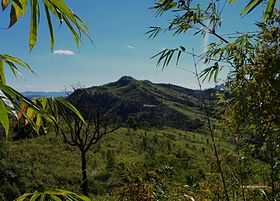
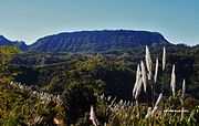
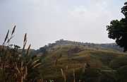
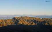
Bangladesh is a low-lying country.Only exceptions are the Chittagong Hills in the southeast, the Low Hills of Sylhet in the northeast and highlands in the north and northwest. The Chittagong Hills constitute the only significant hill system in the country. The Chittagong Hills rise steeply to narrow ridge lines,with altitudes from 600 to 1000 meters above sea level. At 1,063 m(3,488 ft) altitude, the highest elevation in Bangladesh is Saka Haphong at Mowdok range, in the southeastern part of the hills. Highly elevated peaks of this area can also be called as mountains cause hill above 2000 ft(600m) with a distinct peak referred as mountain.Fertile valleys lie between the hill lines, which generally run north-south. West of the Chittagong Hills is a broad plain, cut by rivers draining into the Bay of Bengal, that rises to a final chain of low coastal hills, mostly below 200 meters, that attain a maximum elevation of 350 meters. West of these hills is a narrow, wet coastal plain located between the cities of Chittagong in the north and Cox's Bazar in the south.
Saka Haphong
Unofficially the highest peak of Bangladesh is Saka Haphong at Mowdok range.[1][2] on the border with Myanmar. In February 2006 a GPS reading of 1,064 metres was recorded on this summit by English adventurer Ginge Fullen. The location he recorded, 21°47′11″N 92°36′36″E / 21.78639°N 92.61000°E, accurately matches the location given by Russian topographic mapping and SRTM data, although these sources show its height to be slightly lower, at 1,052 metres. However, SRTM data has been demonstrated to have about 5-9m vertical accuracy, while most tracking grade handheld GPS receivers also have several meters of vertical inaccuracy. Only accurate DGPS or RTK-GPS survey, or airborne LIDAR/photogrammetric survey can yield more accurate result. Recently two trekking clubs counted the height of "Saka Haphong" as 3,488 and 3,461 feet respectively. Any of these two figure would make it the highest mountain in Bangladesh exceeding the height of Keokaradong, which is 3,172 feet high.[3] This peak is also known as Mowdok Taung (as per USGS Topo and Russian Topo map), Saka Haphong (by local Tripura tribes). Mowdok Taung was the official name that appeared in all British India topographic maps of 1938, 1939 and 1948 which is also reflected in US Army Corps of Engineers Map of 1954. Because no name change notification by the governments of India till 1947, government of Pakistan till 1971 or the Government of Bangladesh afterward was found anywhere, 'Mowdok Taung' still presumably remains as the official and the most authentic name for this peak. Since 2007 till now route to Saka Haphong is the most desired trekking route for adventure lovers in Bangladesh.
Zow Tlang
Zow Tlang is guarding the eastern horizon of Bangladesh and Myanmar border. In Bawm language the term Zow means Mizo (Mizo is derived from Mizoram, India. Probable reason is that Bangladesh was a part of greater India before 1947) and Tlang means Mountain. According to American and Russian topographic maps Zow Tlang is mentioned as Mowdok Mual. As per Bangla Trek, it is the second highest peak of the country; though it is not officially recognized by the government till date.[4] Many accomplished local adventurers describe this as one of the most wildest peak of Bangladesh.
The peak was first summitted in 2005 by two Bangladeshi adventurers, Subrata Das Nitish and Bijoy Shankar Kar. The same team summitted the mountain again in 2007. The altitude couldn't be measured in these two expeditions as the team wasn't carrying any GPS device. On January 12, 2012, the peak was summitted for the third time by the Bangla Trek team members Tashdid Rezwan Mugdho, Tarikul Alom Sujon, Salehin Arshady & SM Mainul. Measured altitude and Geo location of the peak by their Garmin eTrex 20 was 1021.69 meter and 21°40’23.78″N & 92°36’16.01″E.[5] Two of the team members, Mugdho and Sujon died in a tragic bus accident on their way back to Bandarban after the expedition. The other two members, Salehin and Mainul suffered serious injuries and it took them a long time to recover.
On October 13, 2013, a team led by Shahzaman Chowdhury Hira became the third team to summit the peak at 1400 hrs. This team was having 6 members - Sharfaraj Hussain Jony, Sidratul Afia Mohona, Mahbubur Rahman, Abdullah Anas Oni and Baqui Billah Milon.[6] Member of this team Mohona was the first woman ever to summit this very peak. Several other teams have made their way to the summit in last few years.
Dumlong
In 2011 Md.Wadud Mohosin Rubel with his three travel fellows, Asif Aminur Rashid, Nagib Meshkat & Abdul Haque have claimed the mountain "Dumlong" to be the second highest mountain; on the basis of Garmin GPS they have measured the height of the mountain which is 3314 feet. The location he recorded, 22°02′02.1″N 92°35′36.3″E, accurately matches the location given by Google Earth.[3][7] Few months after this expedition,Travelers of Bangladesh team led by Zaqiul Deep measured this peak which was 3,312 feet. Few months later Fahim hasan of BD Explorer Reached the summit of Dumlong as 3rd team. Surely there is no doubt about the height of Dumlong peak but whether it is the 2nd or 3rd Highest peak of the country, is not confirmed yet. It is the highest peak of Rangamati hill district and also the one of only three 1000 meters peaks in Bangladesh. In 2014, several teams have summitted Zow Tlang and based on their readings it can be said that Dumlong is the third highest peak of the country.
Keokradong
Although it is widely reported to be the highest point in Bangladesh at 1230 metres,[8] recent SRTM data, GPS readings and Russian topographic mapping show that its true height is less than 1,000 meters.
On the top of Keokradong there is a small shelter and a signboard put up by the Bangladeshi military proclaiming the altitude to be 3172 feet. Garmin GPS recorded 974 meters (3196 feet) at this location, a different team measured 986m with 3m accuracy by GPS,[9] a measurement consistent with Russian topographic mapping and SRTM data. It is at 21°57′00″N 92°30′53″E / 21.95000°N 92.51472°E. USGS and Russian mapping dispute the claim that this is the location correctly named Keokradong; they show Keokradong at an 883m summit further north.
Tazing Dong
Another peak that is sometimes claimed to be the peak of Bangladesh is Tazing Dong (sometimes spelled as Tahjingdong, and also known as Bijoy). It has been claimed to be 1,280 meters.[10] Neither Russian topographic mapping[11] nor SRTM data show anything in the area exceeding 1,000 meters.
There are three peaks in that area known as Thajindong (Lungphe Tuang in US army 1:250K topo map and Russian 1:200k topo map). A local trekker team measured the highest two peaks and found the middle one (N 21° 49' 16.20" - E 92° 32' 11.61") is 871m (3m accuracy) and higher than the other peak which was at N 21° 48' 58.17" - E 92° 31' 49.87" with 829m (accuracy 3m) measured height.[12] A different measurement done by another team using Garmin GPS shows the height of the other peak as 829.66m with 3m accuracy [13]
Thingdawlte Tlang
Thingdawlte Tlang is a significant peak of Bangladesh.This peak is the Highest point of 'lawmbok Row' range and possible 7th highest of the country.In December 2012 a local explorer Fahim Hasan of "BD Explorer" summitted the peak of Thingdawlte Tlang and measured the height for the first time.Which is 3149 feet(959.8 m). GPS accuracy was 3m(+/-). The name of the peak was collected by BD Explorer and confirmed by the local tribal people of Thingdawlte village. Few days later Zaqiul Deep of "Travelers Of Bangladesh" measured this peak as 3,133 feet(955m). The most easiest route to summit this peak is to start from Ruma of Bandarban district.Nearest settlement is known as Thingdawlte (Bawm) village. This peak is named after this village.
- Location: Ruma, Bandarban
- Range: Lawmbok row
- Elevation: 3,149 feet /960 meters (GPS accuracy 3m +/-) [Possible 7th highest peak of Bangladesh & highest point of lowmbok Row range]
- Geo position: N 21°54.611', E 092°35.380′ (21.910182, 92.589654)
- Measured By: BD Explorer [14][15]
Mukhra Thuthai Haphong
Mukhra Thuthai Haphong is a significant border peak of Bangladesh, situated at the southern part of Belaichori of Rangamati Hill District. In April 2013, Fahim Hasan of BD Explorer summitted and measured this peak for the first time. Elevation measured at 953.6 metres (3,129 ft).The name of the peak was collected by BD Explorer and confirmed by the local tribal people of Dhupanichora village. The name Mukhra Thuthai Haphong came from the Tripura language. Nearest settlement is known as Dhupanichora para. The easiest route to summit this peak is to start from Ruma of Bandarban district.
- Location: Belaichori,Rangamati
- Range:Reng Tlang
- Elevation: 3,129 feet (GPS accuracy: 2 m +/-)
- Position: N 21°58'51.87", E 92°36'12.88"
- Measured By: BD Explorer [16][17][18][19]
Kapital/Capital
Kapital/Capital is a distinctive,beautiful and very eye catching peak on the Politai range near Thaikeng para. This flat mountain top once used as a hide out place by separatist group from Mizoram. They declared this mountain top as their temporary capital of free and independent Mizoram.Later they moved from this place.Still the locals called this mountain top as kapital.
- Location: Ruma,Bandarban.
- Range: Politai range
- Elevation: 3,094 feet
- Geo position: N 21°54'2.58", E 92°31'26.68"
Kreikung Taung
- Alternative name: Ngaramh Tlang (ন্যারা্ম্ ত্ল্যাং,বম);Kreikung Taung name originated from local Marma language.
- Bengali meaning: মাছ পাহাড়
- Location: Ruma,Bandarban.
- Range: Lawmbok row
- Elevation: 3,083 feet (GPS accuracy 2m +/-) [2nd highest peak of Lowmbok row range]
- Geo location: N 21°55.563', E 092°34.827′
- Measured By- BD Explorer[17][20][21]
Laisra Haphong
- Location:Belaichori,Rangamati.
- Range: Reng Tlang.
- Elevation: 3,041 feet (GPS accuracy: 3 m +/-)
- Position: N 21°58'14.00", E 92°36'23.94"
- Measured By: BD Explorer [17][20][22]
Sippi Arsuang
Sippi Arsuang measured by a local group located at N 22°11′03.43″ E 92°29′01.57″ with height 896m (15m accuracy). In US Army 1:250k topo map this peak is shown as Ramju Taung with a height of 3016feet and in Russian 1:200k topo map it is shown as 917m.[23]
Taung Prai
Taung Prai,a very beautiful dome shape mountain at Reng Tlang border range is the most south-eastern border peak of Rangamati district.It is also the last major peak at Reng Tlang range inside our border.View seen from the top is mind-blowing.Taung prai[24] is a Marma word.Means "Ulta pahar"(উল্টা পাহাড়).In 2013,6 November Fahim Hasan along with Saki Khan from Dhaka,members of local adventure group BD Explorer[25] summited the peak of Taung Prai and measured this peak as 2,959 feet by Garmin gps device for the first time.
- Location:Belaichori,Rangamati.
- Range:Reng Tlang.
- Elevation:2,959 feet(GPS accuracy 3m+/-)[26]
- Nearest village:Kes Pai(Khumi)
- Geo position: 21° 54.176'N 92° 37.611'E
- Measured by: BD Explorer.[17]
Tinmukh/Tinmatha pillar peak
Tinmukh/Tinmatha pillar is a significant border pillar which marks the meet point of the three countries border-Bangladesh,Myanmar and India,located above a peak in between "Mukhra Thuthai Haphong" and "Laisra Haphong".
- Location: Belaichori,Rangamati.
- Range: Reng Tlang.
- Elevation: 2,912 ft (GPS accuracy 2m +/-)
- Geo position: N21 58.474 E92 36.440 [17][27][28]
List of peaks above 3000 ft
| scope"col" | |
scope"col" | |
scope"col" data-sort-type="number" | |
scope"col" | |
scope"col" | |
|---|---|---|---|---|
| 1 | Saka Haphong/Mowdok Taung | 3,465 ft | Thanchi,Bandarban |
|
| 2 | Zow Tlang / Mowdok Mual | 3,353 ft | Thanchi,Bandarban |
|
| 3 | Dumlong | 3,314 ft | Belaichori,Rangamati |
|
| 4 | Jogi Haphong | 3,251 ft | Thanchi,Bandarban |
|
| 5 | Keokradong | 3,235 ft | Ruma,Bandarban |
|
| 6 | Maithai Jama Haphong | 3,174 ft | Belaichori,Rangamati |
|
| 7 | Thingdawl Te Tlang | 3,149 ft | Ruma,Bandarban |
|
| 8 | Mukhra Thuthai haphong | 3,129 ft | Belaichori,Rangamati |
|
| 9 | Kapital/Capital | 3,094 ft | Ruma,Bandarban |
|
| 10 | Kreikung Taung/Ngaramh Tlang | 3,083 ft | Ruma,Bandarban |
|
| 11 | Taung Mey | 3,060 ft | Ruma,Bandarban |
|
| 12 | Laisra Haphong | 3,041 ft | Belaichori,Rangamati |
|
| 13 | Rang Tlang | Unmeasured | Belaichori,Rangamati | |
| 14 | Nasai Hum | 3,005 ft | Thanchi,Bandarban |
|
References
- ↑ Bao-Rong Lu,Generai information of the areas visited and the collecting routes, A Report On BRRI-IRRI Cooperative Collection of Wild Oryza Species In Bangladesh, page 5, International Rice Research Institute, October 1529, 1998
- ↑ http://highpointguides.com/catalog/index.php?manufacturers_id=10&osCsid=8c8694c8a089ad05118870df688a00ff Country-wise highest points], HighPoint.com]
- ↑ 3.0 3.1 'Second highest hill' spotted by 4 Youths The Daily Star, February 28, 2011
- ↑ "List of peaks in Bangladesh". http://www.banglatrek.org/''. Retrieved 28 January 2015.
- ↑ "Zow Tlang/Mowdok Mual". http://www.banglatrek.org/''. Retrieved 28 January 2015.
- ↑ "Zow Tlang (Mowdok Mual) as seen from the nearest mountain village Dowlian Para". http://www.panoramio.com/''.
- ↑ Second highest hill' spotted by 4 youths
- ↑ CIA: the World Factbook
- ↑ Keokradong, Banglatrek, Banglatrek.org.
- ↑ Masud Hasan Chowdhury, Physiography, Banglapedia
- ↑ Relevant section of Russian map
- ↑ Thanchi to Tajingdong,through Paddo Jhiri, Banglatrek, Banglatrek.org.
- ↑ Thajindhong, Banglatrek, Banglatrek.org.
- ↑ 14.0 14.1 http://www.panoramio.com/photo/84143352
- ↑ http://www.panoramio.com/photo/84143352?tag=Peaks
- ↑ http://www.technocard.org/bdexplorer.org/
- ↑ 17.0 17.1 17.2 17.3 17.4 https://www.facebook.com/groups/BDExplorer/
- ↑ http://www.panoramio.com/photo/88659646
- ↑ http://www.panoramio.com/photo/88659641?tag=Peaks
- ↑ 20.0 20.1 http://bdexplorer.org/
- ↑ http://www.panoramio.com/photo/84272045?tag=Peaks
- ↑ http://www.panoramio.com/photo/88659045?tag=Peaks
- ↑ Sippi Arsuang / Ramju Taung, Banglatrek, Banglatrek.org.
- ↑ http://www.panoramio.com/photo/99203791
- ↑ http://www.wikiloc.com/wikiloc/view.do?id=5657006
- ↑ https://www.facebook.com/photo.php?fbid=10201034285164648&set=a.10201027876284430.1073741829.1393175230&type=3&src=https%3A%2F%2Ffbcdn-sphotos-g-a.akamaihd.net%2Fhphotos-ak-prn1%2F858923_10201034285164648_184551710_o.jpg&smallsrc=https%3A%2F%2Ffbcdn-sphotos-g-a.akamaihd.net%2Fhphotos-ak-ash3%2F563710_10201034285164648_184551710_n.jpg&size=1494%2C2048
- ↑ http://www.bdexplorer.org/
- ↑ http://www.panoramio.com/photo/79228985
- ↑ https://www.facebook.com/bijoyshankar.kar/media_set?set=a.207725012702941.52485.100003963324049&type=3
- ↑ http://www.wikiloc.com/wikiloc/view.do?id=3791461
- ↑ http://www.panoramio.com/photo/88659045
- ↑ http://www.panoramio.com/photo/89174427
External links
.