List of mountains in Australia
- This list is incomplete; you can help by expanding it.
This is a list of mountains in Australia.
State/territory high points

Looking east back down the chimney on Mount Ossa towards Pelion East, in Tasmania.
| Flag | State/country
Territory name |
Highest point | Altitude | Notes |
|---|---|---|---|---|
| Ashmore and Cartier Islands | ||||
| Australian Antarctic Territory | Mount McClintock | 3,490 metres (11,450 ft) | [2] | |
| Australian Capital Territory | Bimberi Peak | 1,912 metres (6,273 ft) | ||
| Christmas Island | Murray Hill | 361 metres (1,184 ft) | [3] | |
| Cocos (Keeling) Islands | ||||
| Coral Sea Islands | Heralds-Beacon Islet, Mellish Reef | 1.5 metres (4 ft 11 in) | [4] | |
| Heard Island and McDonald Islands | Mawson Peak | 2,745 metres (9,006 ft) | the summit of the Big Ben massif | |
| Jervis Bay Territory | Cape St George, Booderee National Park | |||
| New South Wales | Mount Kosciuszko | 2,228 metres (7,310 ft) | ||
| Norfolk Island | Mount Bates | 319 metres (1,047 ft) | ||
| Northern Territory | Mount Zeil | 1,531 metres (5,023 ft) | ||
| Queensland | Mount Bartle Frere | 1,622 metres (5,322 ft) | ||
| South Australia | Mount Woodroffe | 1,435 metres (4,708 ft) | ||
| Tasmania | Mount Ossa | 1,614 metres (5,295 ft) | ||
| Victoria | Mount Bogong | 1,986 metres (6,516 ft) | ||
| Western Australia | Mount Meharry | 1,253 metres (4,111 ft) |
Australian Capital Territory
Main article: List of mountains in the Australian Capital Territory
The following is a list of mountains and prominent hills in the Australian Capital Territory in order, from the highest peak to the lowest peak, for those mountains and hills with an elevation above 750 metres (2,460 ft) AHD :
| Order | Highest peak | Range/nature reserve | Altitude AHD | Image | Notes |
|---|---|---|---|---|---|
| 1 | Bimberi Peak | Brindabella Ranges, Great Dividing Range |
1,913 metres (6,276 ft) |  |
[5] |
| 2 | Mount Gingera | 1,857 metres (6,093 ft) | The most prominent snow covered peak to be seen from Canberra in winter.[6] | ||
| 3 | Mount Kelly | 1,814 metres (5,951 ft) | |||
| 4 | Mount Scabby | 1,790 metres (5,870 ft) | |||
| 5 | Mount Namadgi | 1,782 metres (5,846 ft) | |||
| 6 | Ginger Ale | 1,766 metres (5,794 ft) | |||
| 7 | Mount Ginini | 1,762 metres (5,781 ft) |  |
[7] | |
| 8 | Mount Burbidge | 1,730 metres (5,680 ft) | |||
| 9 | Mount Gudgenby | 1,719 metres (5,640 ft) | |||
| 10 | Sentry Box Mountain | 1,718 metres (5,636 ft) | |||
| 11 | Little Bimberi | 1,654 metres (5,427 ft) | |||
| 12 | Mount Franklin | 1,646 metres (5,400 ft) | [8] | ||
| 13 | Mavis Ridge | 1,618 metres (5,308 ft) | |||
| 14 | Mount McKeahnie | 1,588 metres (5,210 ft) | |||
| 15 | Mount Tidbinbilla | 1,583 metres (5,194 ft) | |||
| 16 | The Pimple | 1,501 metres (4,925 ft) | |||
| 17 | Mount Majura | Canberra Nature Park | 890 metres (2,920 ft) | ||
| 18 | Mount Taylor | 856 metres (2,808 ft) | 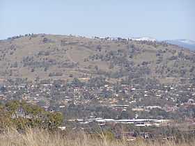 |
||
| 19 | Tuggeranong Hill | 855 metres (2,805 ft) |  |
||
| 20 | Mount Ainslie | 842 metres (2,762 ft) | 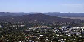 |
||
| 21 | Black Mountain | 812 metres (2,664 ft) |  |
||
| 22 | Mount Wanniassa | 809 metres (2,654 ft) |  |
||
| 23 | Mount Stromlo | 770 metres (2,530 ft) | 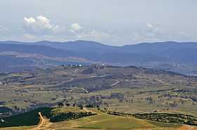 |
||
New South Wales
Barrington Tops Mount Allyn in the background, viewed from Mount Cabrebald.
Blue Mountains Mount Banks on the Explorer's Range in the Blue Mountains.
Budawang Range Pigeon House Mountain within the Budawang Range.
Gibraltar Range
Great Dividing Range
Central Tablelands Mount Canobolas as viewed from the Pinnacles, near Orange.
Mid North Coast region
Monaro region Mount Kembla viewed from Mount Nebo.
Illawarra escarpment
Lord Howe Island
|
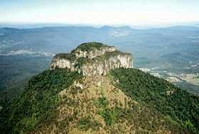
McPherson Range
Nandewar Range Grattai Mountain in the Nandewar Range.
New England Tableland The view from Point Lookout.
Nightcap Range
Snowy Mountains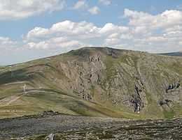 Carruthers Peak on the Main Range.  The view from Mount Tate, looking towards Guthega.
Sugarloaf Range
Tweed Range
Warrumbungles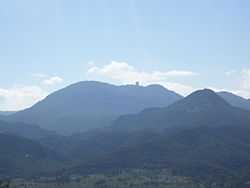 Siding Spring Observatory on Siding Spring Mountain
Other mountains
|


Queensland
South East Queensland Mount Coolum
|
Central and North Queensland
|


South Australia
Flinders Ranges
Gammon Ranges and Arkaroola
|
Gawler Ranges and Eyre Peninsula
Mount Lofty Ranges
Musgrave Ranges
|
Tasmania
- Mount Hamilton (Macquarie Island) (433m)
- Mount Achilles
- The Acropolis
- Adamsons Peak
- Mount Anne
- Mount Arthur
- Artillery Knob
- Barn Bluff
- Mount Barrow (1,413m)
- Ben Lomond
- Mount Bischoff
- Castle Crag
- Cradle Mountain
- Mount Darwin
- Mount Dundas
- Mount Field
- Federation Peak
- Frenchmans Cap
- Mount Geikie
- Mount Geryon
- Mount Gould
- Hartz Mountains
- Mount Huxley
- Ironstone Mountain
- Mount Jukes
- King Davids Peak
- Legges Tor
- Mount Lyell
- Mount Massif
- Mount Mawson
- Mother Cummings Peak
- Mount Munro
- Mount Ossa (1,617m)[14][27] (Highest mountain in Tasmania)
- Mount Owen
- Mount Murchison
- Mount Pelion East
- Mount Pelion West
- Quamby Bluff
- Mount Read
- Mount Sedgwick
- Mount Sorell
- Stacks Bluff
- Mount Strahan
- Mount Thetis
- Mount Tyndall
- Mount Victoria
- Mount Wellington
- Mount Pleasant
- West Coast Range
- Mount Darwin
- Mount Huxley
- Mount Jukes
- Mount Lyell
- Mount Owen
- Mount Sedgwick
- Mount Strahan
Victoria
 Mount William, looking east towards Ararat. 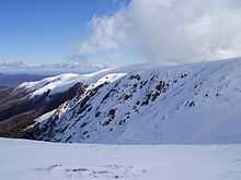 From the summit of Mount Bogong, in winter.  Ascending to the summit of Mount Feathertop, in winter.  Mount Buller ridge in summer.  Mount Tambo, in summer. Grampians
Victorian Alps
|
 Mount Alexander, in summer.  Hanging Rock, in summer.  Corhanwarrabul, in winter.  Mount Napier, in summer. 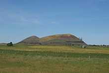 Mount Elephant, in spring. Other Victorian mountains
|
Western Australia
- Mount Augustus
- Darling Range
- Mount Dale
- Mount Cooke
- Hamersley Range
- Mount Meharry (highest peak in WA at 1249 metres)
- Mount Bruce
- Mount Nameless
- King Leopold Range
- Stirling Range
- Bluff Knoll
- Pyungoorup
- Toolbrunup
- Mount Magog
- Mount Trio
- Mount Hassell
- Talyuberlup Peak
- Peak Charles National Park
- Peak Charles
- Peak Eleanora
Northern Territory
- Central Mount Stuart
- Chambers Pillar
- Mount Connor
- Mount Hermannsburg
- MacDonnell Ranges
- Mount Liebig
- Mount Giles
- Mount Gillen
- Mount Sonder
- Mount Zeil (1,531m)
- Uluru/Ayers Rock
- Kata Tjuta/Mount Olga
References
- ↑ References and details on data provided in the table can be found within the individual state and territory articles.
- ↑
- ↑ "Christmas Island". World Factbook. CIA. 2010. Retrieved 2010-12-26.
- ↑ "HERALD'S BEACON ISLET | Marine World Database". Anchorageworld.com. Retrieved 2012-08-05.
- ↑ "Bimberi Peak, Australia". Peakbagger.com. Retrieved 10 October 2013.
- ↑ "Mount Gingera, Australia". Peakbagger.com.
- ↑ "Mount Ginini, Australia". Peakbagger.com.
- ↑ "Mount Franklin, Australia". Peakbagger.com.
- ↑ "Mount Boyce". Geographical Names Register (GNR) of NSW. Geographical Names Board of New South Wales. Retrieved 7 October 2013.
- ↑ "Didhol (Pigeon House Mountain)". South Coast of NSW. Morningside web publishers. Retrieved 9 October 2013.
- ↑ Werrikimbe & WilliWilli National Parks
- ↑ "Map of Brown Mountain, NSW". Bonzle Digital Atlas of Australia. Retrieved 14 May 2013.
- ↑ "List of mountains in Australia". Peakbagger.com.
- ↑ 14.0 14.1 14.2 14.3 "Geoscience Basics - Geoscience Australia". Ga.gov.au. 2010-11-18. Retrieved 2012-08-05.
- ↑ 15.0 15.1 15.2 15.3 15.4 15.5 15.6 Climbing Australia's Highest Peaks. "Climbing Australia's Highest Mountains". Aussie10.com. Retrieved 2012-08-05.
- ↑ "Ulandra Nature Reserve, Bethungra, NSW, Australia (entry AHD708)". Australian Heritage Database. Department of Sustainability, Environment, Water, Population and Communities. Retrieved 2009-05-24.
- ↑ Dunn, John; Ingram, Peter (February 1994). "Ulandra Nature Reserve Plan of Management" (PDF). NSW National Parks & Wildlife Service. p. 15. Retrieved 2009-05-24.
- ↑ "Mount Coolum | Sunshine Coast Property | Real Estate News for Sunshine Coast, Australia". Sunshine Coast Daily. 2008-03-22. Retrieved 2012-08-05.
- ↑ "List of mountains in Australia". Peakbagger.com.
- ↑
- ↑
- ↑ "List of mountains in Australia". Peakbagger.com.
- ↑ "List of mountains in Australia". Peakbagger.com.
- ↑ "Radar Images". Mirror.bom.gov.au. Retrieved 2012-08-05.
- ↑ "List of mountains in Australia". Peakbagger.com.
- ↑ "Climbing the Highest Mountain in each Australian State and Territory". State8.net. Retrieved 2012-08-05.
- ↑
- ↑ "Mount Bogong, Australia". Peakbagger.com.
- ↑ "Feathertop, Australia". Peakbagger.com.
- ↑ "Mount Hotham, Australia". Peakbagger.com.
- ↑ "Mount McKay, Australia". Peakbagger.com.
- ↑ "Mount Buggery". Mapcarta. Retrieved 11 July 2014.
- ↑ "Map of Mount Buggery, VIC". Bonzle Digital Atlas of Australia. Retrieved 11 July 2014.
- ↑ "Map of Mount Selwyn, VIC". Bonzle Digital Atlas of Australia. Retrieved 21 January 2014.
- ↑ "Mount Donna Buang, Australia". Peakbagger.com.
- ↑ "Map of Mount Buggery, VIC". Bonzle Digital Atlas of Australia. Retrieved 11 July 2014.
| ||||||||||||||||||||||||||||||||||||||||||||||||||||