List of mountain peaks of the United States

This article comprises three sortable tables of the major mountain peaks of the United States of America.
Topographic elevation is the vertical distance above the reference geoid, a precise mathematical model of the Earth's sea level as an equipotential gravitational surface. Topographic prominence is the elevation difference between the summit and the highest or key col to a higher summit. Topographic isolation is the minimum great circle distance to a point of higher elevation.
This article defines a significant summit as a summit with at least 100 meters (328.1 feet) of topographic prominence, and a major summit as a summit with at least 500 meters (1640.4 feet) of topographic prominence. An ultra-prominent summit is a summit with at least 1500 meters (4921.3 feet) of topographic prominence. There are 129 ultra-prominent summits in the United States.
All elevations in the 48 states of the contiguous United States include an elevation adjustment from the National Geodetic Vertical Datum of 1929 (NGVD 29) to the North American Vertical Datum of 1988 (NAVD 88). For further information, please see this United States National Geodetic Survey note.
Highest major summits
The following sortable table lists the 50 highest mountain peaks of the United States with at least 500 meters (1640.4 feet) of topographic prominence. Of these 50 highest major peaks, 28 are located in Colorado, 14 in Alaska, 7 in California, and 1 in Washington. The 11 tallest peaks in the United States all reside in Alaska. California's Mount Whitney, which comes in at 12th on the list, is the highest in the contiguous United States at 14,505 feet (4,421 m). Colorado's Mount Elbert at 14,440 feet (4,400 m) is the second tallest peak in contiguous United States, followed by Mount Massive in Colorado at 14,428 feet (4,398 m), Mount Harvard in Colorado at 14,421 feet (4,396 m), and Mount Rainier in Washington at 14,411 feet (4,392 m).
Most prominent summits
Of the 50 most prominent peaks of the United States, 27 are located in Alaska, 5 in Washington, 5 in California, 3 in Hawaii, 3 in Wyoming, 2 in Oregon, 2 in Nevada, and 1 each in Arizona, Utah and Colorado.
The following sortable table lists the 50 most topographically prominent mountain peaks of the United States.
| Rank | Mountain Peak | State | Mountain Range | Elevation | Prominence | Isolation | Location |
|---|---|---|---|---|---|---|---|
| 1 | Mount McKinley[1][2] (Denali) |
Alaska Range | 20,236 ft 6168 m | 20,174 ft 6149 m | 4,629 mi 7,450 km |
63.0690°N 151.0063°W | |
| 2 | Mauna Kea[153][154] | Island of Hawaiʻi | 13,796 ft 4205 m | 13,796 ft 4205 m | 2,453 mi 3,947 km |
19.8207°N 155.4680°W | |
| 3 | Mount Rainier[40][41][42] | Cascade Range | 14,417 ft 4394 m | 13,210 ft 4026 m | 731 mi 1,177 km |
46.8529°N 121.7604°W | |
| 4 | Mount Fairweather[13][14][15] (Fairweather Mountain) |
Saint Elias Mountains | 15,299 ft 4663 m | 12,995 ft 3961 m | 125 mi 201 km |
58.9064°N 137.5267°W | |
| 5 | Mount Blackburn[9][10][11] | Wrangell Mountains | 16,390 ft 4996 m | 11,640 ft 3548 m | 61 mi 98 km |
61.7305°N 143.4031°W | |
| 6 | Mount Hayes[155][156] | Alaska Range | 13,832 ft 4216 m | 11,507 ft 3507 m | 127 mi 205 km |
63.6203°N 146.7178°W | |
| 7 | Mount Saint Elias[3][4][5] | Saint Elias Mountains | 18,009 ft 5489 m | 11,250 ft 3429 m | 26 mi 41 km |
60.2931°N 140.9264°W | |
| 8 | Mount Marcus Baker[157][158] | Chugach Mountains | 13,176 ft 4016 m | 10,751 ft 3277 m | 127 mi 204 km |
61.4374°N 147.7525°W | |
| 9 | Mount Whitney[23][24][25][26] | Sierra Nevada | 14,505 ft 4421 m | 10,080 ft 3072 m | 1,646 mi 2,649 km |
36.5786°N 118.2920°W | |
| 10 | Haleakalā[159][160] | Island of Maui | 10,023 ft 3055 m | 10,023 ft 3055 m | 75 mi 121 km |
20.7097°N 156.2533°W | |
| 11 | Mount Shasta[98][99][100][101] | Cascade Range | 14,179 ft 4322 m | 9,832 ft 2997 m | 335 mi 539 km |
41.4092°N 122.1949°W | |
| 12 | Shishaldin Volcano[161][162] | Unimak Island | 9,414 ft 2869 m | 9,414 ft 2869 m | 545 mi 877 km |
54.7554°N 163.9709°W | |
| 13 | Redoubt Volcano[163][164] | Chigmit Mountains | 10,197 ft 3108 m | 9,147 ft 2788 m | 59 mi 94 km |
60.4854°N 152.7442°W | |
| 14 | Mount Elbert[28][29][30][31] | Sawatch Range | 14,440 ft 4401 m | 9,093 ft 2772 m | 671 mi 1,079 km |
39.1178°N 106.4454°W | |
| 15 | Mount Baker[165][166][167] | Cascade Range | 10,786 ft 3287 m | 8,845 ft 2696 m | 132 mi 212 km |
48.7768°N 121.8145°W | |
| 16 | Mount Torbert[168][169] | Alaska Range | 11,413 ft 3479 m | 8,688 ft 2648 m | 98 mi 157 km |
61.4086°N 152.4125°W | |
| 17 | San Jacinto Peak[170][171][172][173] | San Jacinto Mountains | 10,834 ft 3302 m | 8,339 ft 2542 m | 20 mi 33 km |
33.8147°N 116.6794°W | |
| 18 | San Gorgonio Mountain[174][175][176] | San Bernardino Mountains | 11,503 ft 3506 m | 8,294 ft 2528 m | 162 mi 262 km |
34.0992°N 116.8249°W | |
| 19 | Charleston Peak[177][178][179][180] (Mount Charleston) |
Spring Mountains | 11,916 ft 3632 m | 8,258 ft 2517 m | 135 mi 218 km |
36.2716°N 115.6956°W | |
| 20 | Pavlof Volcano[181][182] | Alaska Peninsula | 8,250 ft 2515 m | 8,225 ft 2507 m | 94 mi 152 km |
55.4173°N 161.8932°W | |
| 21 | Mount Veniaminof[183] | Alaska Peninsula | 8,225 ft 2507 m | 8,200 ft 2499 m | 210 mi 337 km |
56.2194°N 159.2975°W | |
| 22 | Mount Adams[184][185][186] | Cascade Range | 12,281 ft 3743 m | 8,136 ft 2480 m | 46 mi 74 km |
46.2024°N 121.4909°W | |
| 23 | Mount Hubbard[16][17] | Saint Elias Mountains | 15,016 ft 4577 m | 8,061 ft 2457 m | 21 mi 34 km |
60.3192°N 139.0714°W | |
| 24 | Mount Chamberlin[187][188] | Brooks Range | 9,020 ft 2749 m | 7,945 ft 2422 m | 395 mi 636 km |
69.2775°N 144.9107°W | |
| 25 | Iliamna Volcano[189] | Chigmit Mountains | 10,016 ft 3053 m | 7,866 ft 2398 m | 34 mi 54 km |
60.0321°N 153.0915°W | |
| 26 | Mount Olympus[190][191][192][193] | Olympic Mountains | 7,980 ft 2432 m | 7,838 ft 2389 m | 108 mi 174 km |
47.8013°N 123.7108°W | |
| 27 | Mount Cook[194][195] | Saint Elias Mountains | 13,760 ft 4194 m | 7,710 ft 2350 m | 15 mi 23 km |
60.1819°N 139.9808°W | |
| 28 | Mount Hood[196][197][198][199] | Cascade Range | 11,249 ft 3429 m | 7,706 ft 2349 m | 57 mi 92 km |
45.3735°N 121.6959°W | |
| 29 | Mount Sanford[12] | Wrangell Mountains | 16,237 ft 4949 m | 7,687 ft 2343 m | 40 mi 65 km |
62.2132°N 144.1292°W | |
| 30 | Mount Tom White[200] | Chugach Mountains | 11,191 ft 3411 m | 7,641 ft 2329 m | 73 mi 118 km |
60.6518°N 143.6972°W | |
| 31 | Wheeler Peak[201][202][203][204] | Snake Range | 13,065 ft 3982 m | 7,568 ft 2307 m | 232 mi 373 km |
38.9858°N 114.3139°W | |
| 32 | Glacier Peak[205][206][207] | Cascade Range | 10,545 ft 3214 m | 7,518 ft 2291 m | 56 mi 90 km |
48.1125°N 121.1138°W | |
| 33 | Mount Kimball[208][209] | Alaska Range | 10,350 ft 3155 m | 7,425 ft 2263 m | 56 mi 90 km |
63.2390°N 144.6419°W | |
| 34 | Mount Griggs[210] | Alaska Peninsula | 7,650 ft 2332 m | 7,300 ft 2225 m | 136 mi 219 km |
58.3534°N 155.0958°W | |
| 35 | Mount Foraker[6] | Alaska Range | 17,400 ft 5304 m | 7,250 ft 2210 m | 14 mi 23 km |
62.9604°N 151.3998°W | |
| 36 | White Mountain Peak[84][85][86][87] | White Mountains | 14,252 ft 4344 m | 7,196 ft 2193 m | 67 mi 109 km |
37.6341°N 118.2557°W | |
| 37 | Mount Crillon[211] | Saint Elias Mountains | 12,726 ft 3879 m | 7,176 ft 2187 m | 20 mi 31 km |
58.6625°N 137.1712°W | |
| 38 | Mauna Loa[212][213] | Island of Hawaiʻi | 13,679 ft 4169 m | 7,099 ft 2164 m | 25 mi 41 km |
19.4756°N 155.6054°W | |
| 39 | Cloud Peak[214][215][216][217] | Bighorn Mountains | 13,167 ft 4013 m | 7,077 ft 2157 m | 145 mi 233 km |
44.3821°N 107.1739°W | |
| 40 | Gannett Peak[218][219][220][221] | Wind River Range | 13,809 ft 4209 m | 7,076 ft 2157 m | 290 mi 467 km |
43.1842°N 109.6542°W | |
| 41 | Mount Vsevidof[222][223] | Umnak Island | 7,051 ft 2149 m | 7,051 ft 2149 m | 223 mi 359 km |
53.1256°N 168.6938°W | |
| 42 | Mount Hesperus[224][225] | Alaska Range | 9,828 ft 2996 m | 6,978 ft 2127 m | 58 mi 93 km |
61.8036°N 154.1469°W | |
| 43 | Mount Bona[7][8] | Saint Elias Mountains | 16,550 ft 5044 m | 6,900 ft 2103 m | 50 mi 80 km |
61.3856°N 141.7495°W | |
| 44 | Mount Drum[226] | Wrangell Mountains | 12,010 ft 3661 m | 6,760 ft 2060 m | 18 mi 29 km |
62.1159°N 144.6394°W | |
| 45 | Mount Chiginagak[227] | Aleutian Range | 6,925 ft 2111 m | 6,675 ft 2035 m | 98 mi 157 km |
57.1334°N 156.9912°W | |
| 46 | Grand Teton[228][229][230][231] | Teton Range | 13,775 ft 4199 m | 6,545 ft 1995 m | 69 mi 112 km |
43.7412°N 110.8024°W | |
| 47 | Sacajawea Peak[232][233][234] | Wallowa Mountains | 9,843 ft 3000 m | 6,377 ft 1944 m | 126 mi 202 km |
45.2450°N 117.2929°W | |
| 48 | Mount Neacola[235][236] | Aleutian Range | 9,426 ft 2873 m | 6,376 ft 1943 m | 31 mi 50 km |
60.7981°N 153.3959°W | |
| 49 | Kings Peak (Utah)[237][238][239] | Uinta Mountains | 13,534 ft 4125 m | 6,358 ft 1938 m | 167 mi 268 km |
40.7763°N 110.3729°W | |
| 50 | Mount Graham[240][241][242][243] | Pinaleño Mountains | 10,724 ft 3269 m | 6,340 ft 1932 m | 82 mi 133 km |
32.7017°N 109.8714°W |
Most isolated major summits
The following sortable table lists the 50 most topographically isolated mountain peaks of the United States with at least 500 meters (1640.4 feet) of topographic prominence.
| Rank | Mountain Peak | State | Mountain Range | Elevation | Prominence | Isolation | Location |
|---|---|---|---|---|---|---|---|
| 1 | Mount McKinley[1][2] (Denali) |
Alaska Range | 20,236 ft 6168 m | 20,174 ft 6149 m | 4,629 mi 7,450 km |
63.0690°N 151.0063°W | |
| 2 | Mauna Kea[153][154] | Island of Hawaiʻi | 13,796 ft 4205 m | 13,796 ft 4205 m | 2,453 mi 3,947 km |
19.8207°N 155.4680°W | |
| 3 | Mount Whitney[23][24][25][26] | Sierra Nevada | 14,505 ft 4421 m | 10,080 ft 3072 m | 1,646 mi 2,649 km |
36.5786°N 118.2920°W | |
| 4 | Mount Mitchell[244][245][246] | Blue Ridge Mountains | 6,684 ft 2037 m | 6,092 ft 1857 m | 1,189 mi 1,913 km |
35.7650°N 82.2652°W | |
| 5 | Mount Washington[247][248][249][250] | White Mountains | 6,288 ft 1917 m | 6,158 ft 1877 m | 820 mi 1,319 km |
44.2705°N 71.3032°W | |
| 6 | Mount Rainier[40][41][42] | Cascade Range | 14,417 ft 4394 m | 13,210 ft 4026 m | 731 mi 1,177 km |
46.8529°N 121.7604°W | |
| 7 | Mount Elbert[28][29][30][31] | Sawatch Range | 14,440 ft 4401 m | 9,093 ft 2772 m | 671 mi 1,079 km |
39.1178°N 106.4454°W | |
| 8 | Shishaldin Volcano[161][162] | Unimak Island | 9,414 ft 2869 m | 9,414 ft 2869 m | 545 mi 877 km |
54.7554°N 163.9709°W | |
| 9 | Tanaga Volcano[251][252] | Tanaga Island | 5,925 ft 1806 m | 5,925 ft 1806 m | 407 mi 656 km |
51.8839°N 178.1414°W | |
| 10 | Mount Chamberlin[187][188] | Brooks Range | 9,020 ft 2749 m | 7,945 ft 2422 m | 395 mi 636 km |
69.2775°N 144.9107°W | |
| 11 | Magazine Mountain[253][254][255] | Ouachita Mountains | 2,753 ft 839 m | 2,143 ft 653 m | 381 mi 613 km |
35.1671°N 93.6447°W | |
| 12 | Mount Shasta[98][99][100][101] | Cascade Range | 14,179 ft 4322 m | 9,832 ft 2997 m | 335 mi 539 km |
41.4092°N 122.1949°W | |
| 13 | Gannett Peak[218][219][220][221] | Wind River Range | 13,809 ft 4209 m | 7,076 ft 2157 m | 290 mi 467 km |
43.1842°N 109.6542°W | |
| 14 | Mount Osborn[256][257][258] | Seward Peninsula | 4,714 ft 1437 m | 4,327 ft 1319 m | 282 mi 454 km |
64.9922°N 165.3294°W | |
| 15 | Mount Igikpak[259][260] | Brooks Range | 8,276 ft 2523 m | 6,126 ft 1867 m | 282 mi 453 km |
67.4129°N 154.9656°W | |
| 16 | Humphreys Peak[261][262][263] | San Francisco Peaks | 12,637 ft 3852 m | 6,039 ft 1841 m | 246 mi 396 km |
35.3464°N 111.6780°W | |
| 17 | Wheeler Peak[201][202][203][204] | Snake Range | 13,065 ft 3982 m | 7,568 ft 2307 m | 232 mi 373 km |
38.9858°N 114.3139°W | |
| 18 | Mount Vsevidof[222][223] | Umnak Island | 7,051 ft 2149 m | 7,051 ft 2149 m | 223 mi 359 km |
53.1256°N 168.6938°W | |
| 19 | Mount Veniaminof[183] | Alaska Peninsula | 8,225 ft 2507 m | 8,200 ft 2499 m | 210 mi 337 km |
56.2194°N 159.2975°W | |
| 20 | Kawaikini[264][265] | Island of Kauaʻi | 5,243 ft 1598 m | 5,243 ft 1598 m | 203 mi 327 km |
22.0586°N 159.4973°W | |
| 21 | Dillingham High Point[266][267] | Kuskokwim Mountains | 5,250 ft 1600 m | 4,475 ft 1364 m | 193 mi 311 km |
60.1159°N 159.3241°W | |
| 22 | Hall Island High Point[268][269] | Hall Island | 1,665 ft 507 m | 1,665 ft 507 m | 193 mi 311 km |
60.6647°N 173.0887°W | |
| 23 | Tooth Benchmark[270][271][272] | Saint Lawrence Island | 2,207 ft 673 m | 2,207 ft 673 m | 178 mi 287 km |
63.5920°N 170.3804°W | |
| 24 | Spruce Knob[273][274][275][276] | Allegheny Mountains | 4,863 ft 1482 m | 2,791 ft 851 m | 175 mi 282 km |
38.6999°N 79.5328°W | |
| 25 | Kings Peak (Utah)[237][238][239] | Uinta Mountains | 13,534 ft 4125 m | 6,358 ft 1938 m | 167 mi 268 km |
40.7763°N 110.3729°W | |
| 26 | Sierra Blanca Peak[277][278][279][280] | Sacramento Mountains | 12,003 ft 3659 m | 5,553 ft 1693 m | 166 mi 267 km |
33.3743°N 105.8087°W | |
| 27 | San Gorgonio Mountain[174][175][176] | San Bernardino Mountains | 11,503 ft 3506 m | 8,294 ft 2528 m | 162 mi 262 km |
34.0992°N 116.8249°W | |
| 28 | Katahdin[281][282][283][284] | Longfellow Mountains | 5,270 ft 1606 m | 4,293 ft 1309 m | 158 mi 255 km |
45.9044°N 68.9213°W | |
| 29 | Peak 4030[285][286] | Nulato Hills | 4,030 ft 1228 m | >1,640 ft >500 m | 158 mi 255 km |
64.4535°N 159.4152°W | |
| 30 | Mount Baldy[287][288][289][290] | White Mountains | 11,409 ft 3477 m | 4,728 ft 1441 m | 154 mi 248 km |
33.9059°N 109.5626°W | |
| 31 | Borah Peak[291][292][293] | Lost River Range | 12,668 ft 3861 m | 6,002 ft 1829 m | 151 mi 243 km |
44.1374°N 113.7811°W | |
| 32 | Mount Roberts[294][295][296] | Nunivak Island | 1,675 ft 511 m | 1,675 ft 511 m | 148 mi 238 km |
60.0280°N 166.2627°W | |
| 33 | Cloud Peak[214][215][216][217] | Bighorn Mountains | 13,167 ft 4013 m | 7,077 ft 2157 m | 145 mi 233 km |
44.3821°N 107.1739°W | |
| 34 | Harney Peak[297][298][299][300] | Black Hills | 7,244 ft 2208 m | 2,932 ft 894 m | 140 mi 226 km |
43.8658°N 103.5324°W | |
| 35 | Slide Mountain[301][302][303][304] | Catskill Mountains | 4,180 ft 1274 m | 3,295 ft 1004 m | 136 mi 220 km |
41.9992°N 74.3859°W | |
| 36 | Mount Griggs[210] | Alaska Peninsula | 7,650 ft 2332 m | 7,300 ft 2225 m | 136 mi 219 km |
58.3534°N 155.0958°W | |
| 37 | Charleston Peak[177][178][179][180] (Mount Charleston) |
Spring Mountains | 11,916 ft 3632 m | 8,258 ft 2517 m | 135 mi 218 km |
36.2716°N 115.6956°W | |
| 38 | Junipero Serra Peak[305][306][307] | Santa Lucia Range | 5,865 ft 1788 m | 4,447 ft 1355 m | 132 mi 212 km |
36.1457°N 121.4191°W | |
| 39 | Mount Baker[165][166][167] | Cascade Range | 10,786 ft 3287 m | 8,845 ft 2696 m | 132 mi 212 km |
48.7768°N 121.8145°W | |
| 40 | Mount Marcy[308][309][310][311] | Adirondack Mountains | 5,343 ft 1629 m | 4,919 ft 1499 m | 130 mi 209 km |
44.1127°N 73.9237°W | |
| 41 | Mount Hayes[155][156] | Alaska Range | 13,832 ft 4216 m | 11,507 ft 3507 m | 127 mi 205 km |
63.6203°N 146.7178°W | |
| 42 | Mount Marcus Baker[157][158] | Chugach Mountains | 13,176 ft 4016 m | 10,751 ft 3277 m | 127 mi 204 km |
61.4374°N 147.7525°W | |
| 43 | Sacajawea Peak[232][233][234] | Wallowa Mountains | 9,843 ft 3000 m | 6,377 ft 1944 m | 126 mi 202 km |
45.2450°N 117.2929°W | |
| 44 | Steens Mountain[312][313] | Steens Mountain | 9,738 ft 2968 m | 4,383 ft 1336 m | 125 mi 201 km |
42.6364°N 118.5767°W | |
| 45 | Mount Fairweather[13][14][15] (Fairweather Mountain) |
Saint Elias Mountains | 15,299 ft 4663 m | 12,995 ft 3961 m | 125 mi 201 km |
58.9064°N 137.5267°W | |
| 46 | Delano Peak[314][315][316][317] | Tushar Mountains | 12,174 ft 3711 m | 4,709 ft 1435 m | 112 mi 180 km |
38.3692°N 112.3714°W | |
| 47 | Black Mountain[318][319] | Brooks Range | 5,020 ft 1530 m | >1,640 ft >500 m | 112 mi 180 km |
68.5598°N 160.3281°W | |
| 48 | Mount Tozi[320][321] | Ray Mountains | 5,519 ft 1682 m | 4,169 ft 1271 m | 111 mi 178 km |
65.6865°N 150.9498°W | |
| 49 | Mount Olympus[190][191][192][193] | Olympic Mountains | 7,980 ft 2432 m | 7,838 ft 2389 m | 108 mi 174 km |
47.8013°N 123.7108°W | |
| 50 | Blanca Peak[47][48][49] | Sangre de Cristo Mountains | 14,357 ft 4376 m | 5,326 ft 1623 m | 103 mi 166 km |
37.5775°N 105.4856°W |
Gallery
-
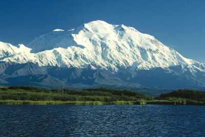
Mount McKinley, or Denali, in Alaska is the highest mountain peak of the United States and North America.
-

Mount Saint Elias on the border of Alaska and the Yukon is the second highest mountain peak of both the United States and Canada.
-

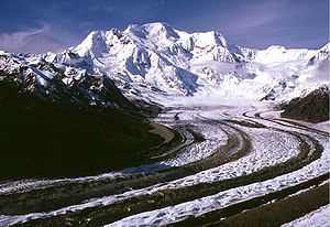
Mount Foraker is the second highest mountain peak of the Alaska Range.
-
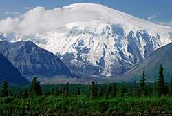
Mount Blackburn in Alaska is the highest peak of the Wrangell Mountains.
-
Mount Sanford in Alaska is the second highest peak of the Wrangell Mountains.
-

Mount Fairweather on the border of Alaska and British Columbia is the fourth most topographically prominent mountain peak of the U.S.
-
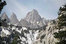
Mount Whitney in California is the highest mountain peak of the contiguous United States.
-
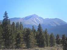
Mount Elbert in Colorado is the highest peak of the Rocky Mountains.
-

Mount Rainier in Washington is the third most topographically prominent mountain peak of the U.S.
-
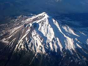
Mount Shasta in California is the second highest summit of the Cascade Range.
-
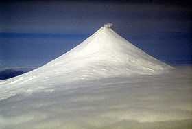
Mount Shishaldin on Unimak Island in Alaska is the highest point in the Aleutian Islands.
-

Mount Mitchell in North Carolina is the highest mountain peak of the Eastern United States.
-
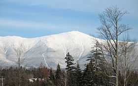
Mount Washington is the highest mountain peak in the Northeastern United States.
-
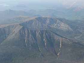
Mount Katahdin is the peak having the greatest spire measure in Eastern United States.


See also
- Outline of the United States
- Index of United States-related articles
- Lists of mountains
- Mountain peaks of North America
- Mountain peaks of Greenland
- Mountain peaks of Canada
- Mountain peaks of the Rocky Mountains
- Mountain peaks of the United States
- The 200 highest major summits of the United States
- The 104 major 4000 meter summits of the United States
- The 200 most prominent summits of the United States
- The 129 ultra-prominent summits of the United States
- The 200 most isolated major summits of the United States
- Mountain peaks of Alaska
- Mountain peaks of California
- Mountain peaks of Colorado
- Mountain peaks of Hawaii
- The 200 highest major summits of the United States
- Mountain peaks of México
- Mountain peaks of Central America
- Mountain peaks of the Caribbean
- Physical geography
- Topography
- Topographic elevation
- Topographic isolation
- Topographic prominence
- Topographic summit
- Topography
- United States of America
- Geography of the United States
- Category:Mountains of the United States
- Geography of the United States
References
- ↑ 1.0 1.1 1.2 The summit of Mount McKinley is the highest point of the Alaska Range, the State of Alaska, the United States of America, and all of greater North America. Mount McKinley is the third most prominent summit on earth.
- ↑ 2.0 2.1 2.2 "Mount McKinley". Summits of the World. peakbagger.com. Retrieved April 1, 2012.
- ↑ 3.0 3.1 Mount Saint Elias is the second highest major summit of both Canada and the United States.
- ↑ 4.0 4.1 "Mount Saint Elias". Geographical Names of Canada. Natural Resources Canada. Retrieved April 1, 2012.
- ↑ 5.0 5.1 "Mount Saint Elias". Summits of the World. peakbagger.com. Retrieved April 1, 2012.
- ↑ 6.0 6.1 "Mount Foraker". Summits of the World. peakbagger.com. Retrieved April 1, 2012.
- ↑ 7.0 7.1 The summit of Mount Bona is the highest point of the northwest Saint Elias Mountains.
- ↑ 8.0 8.1 "Mount Bona". Summits of the World. peakbagger.com. Retrieved April 1, 2012.
- ↑ 9.0 9.1 The summit of Mount Blackburn is the highest point of the Wrangell Mountains.
- ↑ 10.0 10.1 "Mount Blackburn". NGS Station Datasheet. United States National Geodetic Survey. Retrieved April 1, 2012.
- ↑ 11.0 11.1 "Mount Blackburn". Summits of the World. peakbagger.com. Retrieved April 1, 2012.
- ↑ 12.0 12.1 "Mount Sanford". Summits of the World. peakbagger.com. Retrieved April 1, 2012.
- ↑ 13.0 13.1 13.2 The summit of Mount Fairweather is the highest point of the Fairweather Range and the Province of British Columbia.
- ↑ 14.0 14.1 14.2 "Mount Fairweather". Geographical Names of Canada. Natural Resources Canada. Retrieved April 1, 2012.
- ↑ 15.0 15.1 15.2 "Mount Fairweather". Summits of the World. peakbagger.com. Retrieved April 1, 2012.
- ↑ 16.0 16.1 "Mount Hubbard". Geographical Names of Canada. Natural Resources Canada. Retrieved April 1, 2012.
- ↑ 17.0 17.1 "Mount Hubbard". Summits of the World. peakbagger.com. Retrieved April 1, 2012.
- ↑ "Mount Bear". Summits of the World. peakbagger.com. Retrieved April 1, 2012.
- ↑ "Mount Hunter". Summits of the World. peakbagger.com. Retrieved April 1, 2012.
- ↑ "Mount Alverstone". NGS Station Datasheet. United States National Geodetic Survey. Retrieved April 1, 2012.
- ↑ "Mount Alverstone". Geographical Names of Canada. Natural Resources Canada. Retrieved April 1, 2012.
- ↑ "Mount Alverstone". Summits of the World. peakbagger.com. Retrieved April 1, 2012.
- ↑ 23.0 23.1 23.2 The summit of Mount Whitney is the highest point of the Sierra Nevada, the State of California, and the contiguous United States.
- ↑ 24.0 24.1 24.2 "Mount Whitney". NGS Station Datasheet. United States National Geodetic Survey. Retrieved April 1, 2012.
- ↑ 25.0 25.1 25.2 "Mount Whitney". Summits of the World. peakbagger.com. Retrieved April 1, 2012.
- ↑ 26.0 26.1 26.2 The elevation of Mount Whitney includes an adjustment of +1.869 m (+6.13 ft) from NGVD 29 to NAVD 88.
- ↑ "University Peak". Summits of the World. peakbagger.com. Retrieved April 1, 2012.
- ↑ 28.0 28.1 28.2 The summit of Mount Elbert is the highest point of the Rocky Mountains and the State of Colorado.
- ↑ 29.0 29.1 29.2 "Mount Elbert". NGS Station Datasheet. United States National Geodetic Survey. Retrieved April 1, 2012.
- ↑ 30.0 30.1 30.2 "Mount Elbert". Summits of the World. peakbagger.com. Retrieved April 1, 2012.
- ↑ 31.0 31.1 31.2 The elevation of Mount Elbert includes an adjustment of +1.995 m (+6.55 ft) from NGVD 29 to NAVD 88.
- ↑ Mount Massive is the second highest summit of the Rocky Mountains.
- ↑ "Mount Massive". NGS Station Datasheet. United States National Geodetic Survey. Retrieved April 1, 2012.
- ↑ "Mount Massive". Summits of the World. peakbagger.com. Retrieved April 1, 2012.
- ↑ The elevation of Mount Massive includes an adjustment of +2.087 m (+6.85 ft) from NGVD 29 to NAVD 88.
- ↑ The summit of Mount Harvard is the highest point of the Collegiate Peaks.
- ↑ "Mount Harvard". NGS Station Datasheet. United States National Geodetic Survey. Retrieved April 1, 2012.
- ↑ "Mount Harvard". Summits of the World. peakbagger.com. Retrieved April 1, 2012.
- ↑ The elevation of Mount Harvard includes an adjustment of +2.084 m (+6.84 ft) from NGVD 29 to NAVD 88.
- ↑ 40.0 40.1 40.2 The summit of Mount Rainier is the highest point of the Cascade Range and the State of Washington. Mount Rainier is the most prominent summit in the contiguous United States and the fourth most prominent in greater North America.
- ↑ 41.0 41.1 41.2 "Mount Rainier". Summits of the World. peakbagger.com. Retrieved April 1, 2012.
- ↑ 42.0 42.1 42.2 The elevation of Mount Rainier includes an adjustment of +1.914 m (+6.28 ft) from NGVD 29 to NAVD 88.
- ↑ "Mount Williamson". Summits of the World. peakbagger.com. Retrieved April 1, 2012.
- ↑ The elevation of Mount Williamson includes an adjustment of +1.807 m (+5.93 ft) from NGVD 29 to NAVD 88.
- ↑ "La Plata Peak". Summits of the World. peakbagger.com. Retrieved April 1, 2012.
- ↑ The elevation of La Plata Peak includes an adjustment of +1.983 m (+6.51 ft) from NGVD 29 to NAVD 88.
- ↑ 47.0 47.1 The summit of Blanca Peak is the highest point of the Sierra Blanca Massif and the Sangre de Cristo Mountains.
- ↑ 48.0 48.1 "Blanca Peak". Summits of the World. peakbagger.com. Retrieved April 1, 2012.
- ↑ 49.0 49.1 The elevation of Blanca Peak includes an adjustment of +1.755 m (+5.76 ft) from NGVD 29 to NAVD 88.
- ↑ The summit of Uncompahgre Peak is the highest point of the San Juan Mountains.
- ↑ "Uncompahgre Peak". NGS Station Datasheet. United States National Geodetic Survey. Retrieved April 1, 2012.
- ↑ "Uncompahgre Peak". Summits of the World. peakbagger.com. Retrieved April 1, 2012.
- ↑ The elevation of Uncompahgre Peak includes an adjustment of +1.967 m (+6.45 ft) from NGVD 29 to NAVD 88.
- ↑ The summit of Crestone Peak is the highest point of the northern Sangre de Cristo Range.
- ↑ "Crestone Peak". Summits of the World. peakbagger.com. Retrieved April 1, 2012.
- ↑ The elevation of Crestone Peak includes an adjustment of +1.760 m (+5.77 ft) from NGVD 29 to NAVD 88.
- ↑ The summit of Mount Lincoln is the highest point of the Mosquito Range.
- ↑ "Mount Lincoln". NGS Station Datasheet. United States National Geodetic Survey. Retrieved April 1, 2012.
- ↑ "Mount Lincoln". Summits of the World. peakbagger.com. Retrieved April 1, 2012.
- ↑ The elevation of Mount Lincoln includes an adjustment of +2.098 m (+6.88 ft) from NGVD 29 to NAVD 88.
- ↑ The summit of Castle Peak is the highest point of the Elk Mountains.
- ↑ "Castle Peak". NGS Station Datasheet. United States National Geodetic Survey. Retrieved April 1, 2012.
- ↑ "Castle Peak". Summits of the World. peakbagger.com. Retrieved April 1, 2012.
- ↑ The elevation of Castle Peak includes an adjustment of +2.165 m (+7.10 ft) from NGVD 29 to NAVD 88.
- ↑ The summit of Grays Peak is the highest point of the Front Range and the Continental Divide of North America.
- ↑ "Grays Peak". NGS Station Datasheet. United States National Geodetic Survey. Retrieved April 1, 2012.
- ↑ "Grays Peak". Summits of the World. peakbagger.com. Retrieved April 1, 2012.
- ↑ The elevation of Grays Peak includes an adjustment of +1.881 m (+6.17 ft) from NGVD 29 to NAVD 88.
- ↑ The summit of Mount Antero is the highest point of the southern Sawatch Range.
- ↑ "Mount Antero". NGS Station Datasheet. United States National Geodetic Survey. Retrieved April 1, 2012.
- ↑ "Mount Antero". Summits of the World. peakbagger.com. Retrieved April 1, 2012.
- ↑ The elevation of Mount Antero includes an adjustment of +2.071 m (+6.79 ft) from NGVD 29 to NAVD 88.
- ↑ "Mount Evans". NGS Station Datasheet. United States National Geodetic Survey. Retrieved April 1, 2012.
- ↑ "Mount Evans". Summits of the World. peakbagger.com. Retrieved April 1, 2012.
- ↑ The elevation of Mount Evans includes an adjustment of +1.827 m (+5.99 ft) from NGVD 29 to NAVD 88.
- ↑ The summit elevation of Mount Evans includes a vertical offset of +1.8 m (+5.9 ft) from the benchmark.
- ↑ The summit of Longs Peak is the highest point of the northern Front Range.
- ↑ "Longs Peak". NGS Station Datasheet. United States National Geodetic Survey. Retrieved April 1, 2012.
- ↑ "Longs Peak". Summits of the World. peakbagger.com. Retrieved April 1, 2012.
- ↑ The elevation of Longs Peak includes an adjustment of +1.652 m (+5.42 ft) from NGVD 29 to NAVD 88.
- ↑ The summit of Mount Wilson is the highest point of the San Miguel Mountains.
- ↑ "Mount Wilson". Summits of the World. peakbagger.com. Retrieved April 1, 2012.
- ↑ The elevation of Mount Wilson includes an adjustment of +1.899 m (+6.23 ft) from NGVD 29 to NAVD 88.
- ↑ 84.0 84.1 The summit of White Mountain Peak is the highest point of the White Mountains.
- ↑ 85.0 85.1 "White Mountain Peak". NGS Station Datasheet. United States National Geodetic Survey. Retrieved April 1, 2012.
- ↑ 86.0 86.1 "White Mountain Peak". Summits of the World. peakbagger.com. Retrieved April 1, 2012.
- ↑ 87.0 87.1 The elevation of White Mountain Peak includes an adjustment of +1.910 m (+6.27 ft) from NGVD 29 to NAVD 88.
- ↑ The summit of North Palisade is the highest point of the Palisades and the central Sierra Nevada.
- ↑ "North Palisade". NGS Station Datasheet. United States National Geodetic Survey. Retrieved April 1, 2012.
- ↑ "North Palisade". Summits of the World. peakbagger.com. Retrieved April 1, 2012.
- ↑ The elevation of North Palisade includes an adjustment of +1.867 m (+6.13 ft) from NGVD 29 to NAVD 88.
- ↑ "Mount Princeton". NGS Station Datasheet. United States National Geodetic Survey. Retrieved April 1, 2012.
- ↑ "Mount Princeton". Summits of the World. peakbagger.com. Retrieved April 1, 2012.
- ↑ The elevation of Mount Princeton includes an adjustment of +2.075 m (+6.81 ft) from NGVD 29 to NAVD 88.
- ↑ "Mount Yale". NGS Station Datasheet. United States National Geodetic Survey. Retrieved April 1, 2012.
- ↑ "Mount Yale". Summits of the World. peakbagger.com. Retrieved April 1, 2012.
- ↑ The elevation of Mount Yale includes an adjustment of +2.036 m (+6.68 ft) from NGVD 29 to NAVD 88.
- ↑ 98.0 98.1 98.2 The summit of Mount Shasta is the highest point of the southern Cascade Range.
- ↑ 99.0 99.1 99.2 "Mount Shasta". NGS Station Datasheet. United States National Geodetic Survey. Retrieved April 1, 2012.
- ↑ 100.0 100.1 100.2 "Mount Shasta". Summits of the World. peakbagger.com. Retrieved April 1, 2012.
- ↑ 101.0 101.1 101.2 The elevation of Mount Shasta includes an adjustment of +1.791 m (+5.88 ft) from NGVD 29 to NAVD 88.
- ↑ "Maroon Peak". NGS Station Datasheet. United States National Geodetic Survey. Retrieved April 1, 2012.
- ↑ "Maroon Peak". Summits of the World. peakbagger.com. Retrieved April 1, 2012.
- ↑ The elevation of Maroon Peak includes an adjustment of +2.048 m (+6.72 ft) from NGVD 29 to NAVD 88.
- ↑ "Mount Wrangell". Summits of the World. peakbagger.com. Retrieved April 1, 2012.
- ↑ The summit of Mount Sneffels is the highest point of the Sneffels Range.
- ↑ "Mount Sneffels". NGS Station Datasheet. United States National Geodetic Survey. Retrieved April 1, 2012.
- ↑ "Mount Sneffels". Summits of the World. peakbagger.com. Retrieved April 1, 2012.
- ↑ The elevation of Mount Sneffels includes an adjustment of +1.879 m (+6.16 ft) from NGVD 29 to NAVD 88.
- ↑ "Capitol Peak". NGS Station Datasheet. United States National Geodetic Survey. Retrieved April 1, 2012.
- ↑ "Capitol Peak". Summits of the World. peakbagger.com. Retrieved April 1, 2012.
- ↑ The elevation of Capitol Peak includes an adjustment of +1.991 m (+6.53 ft) from NGVD 29 to NAVD 88.
- ↑ Pikes Peak is the easternmost 14,000-foot (4267.2 m) summit of Northern America. Pikes Peak was the inspiration for the lyrics of America the Beautiful.
- ↑ "Pikes Peak". NGS Station Datasheet. United States National Geodetic Survey. Retrieved April 1, 2012.
- ↑ "Pikes Peak". Summits of the World. peakbagger.com. Retrieved April 1, 2012.
- ↑ The elevation of Pikes Peak includes an adjustment of +1.678 m (+5.51 ft) from NGVD 29 to NAVD 88.
- ↑ The summit of Mount Eolus is the highest point of the Needle Mountains.
- ↑ "Mount Eolus". Summits of the World. peakbagger.com. Retrieved April 1, 2012.
- ↑ "Mount Eolus". Bivouac Mountaineering Directory. bivouac.com. Retrieved April 1, 2012.
- ↑ The elevation of Mount Eolus includes an adjustment of +1.756 m (+5.76 ft) from NGVD 29 to NAVD 88.
- ↑ "Mount Augusta". Geographical Names of Canada. Natural Resources Canada. Retrieved April 1, 2012.
- ↑ "Mount Augusta". Summits of the World. peakbagger.com. Retrieved April 1, 2012.
- ↑ "Handies Peak". NGS Station Datasheet. United States National Geodetic Survey. Retrieved April 1, 2012.
- ↑ "Handies Peak". Summits of the World. peakbagger.com. Retrieved April 1, 2012.
- ↑ The elevation of Handies Peak includes an adjustment of +1.994 m (+6.54 ft) from NGVD 29 to NAVD 88.
- ↑ The summit of Culebra Peak is the highest point of the Culebra Range.
- ↑ "Culebra Peak". Summits of the World. peakbagger.com. Retrieved April 1, 2012.
- ↑ The elevation of Culebra Peak includes an adjustment of +1.740 m (+5.71 ft) from NGVD 29 to NAVD 88.
- ↑ The summit of San Luis Peak is the highest point of the La Garita Mountains.
- ↑ "San Luis Peak". NGS Station Datasheet. United States National Geodetic Survey. Retrieved April 1, 2012.
- ↑ "San Luis Peak". Summits of the World. peakbagger.com. Retrieved April 1, 2012.
- ↑ The elevation of San Luis Peak includes an adjustment of +2.098 m (+6.88 ft) from NGVD 29 to NAVD 88.
- ↑ The summit of Mount of the Holy Cross is the highest point of the northern Sawatch Range.
- ↑ "Mount of the Holy Cross". NGS Station Datasheet. United States National Geodetic Survey. Retrieved April 1, 2012.
- ↑ "Mount of the Holy Cross". Summits of the World. peakbagger.com. Retrieved April 1, 2012.
- ↑ The elevation of Mount of the Holy Cross includes an adjustment of +1.926 m (+6.32 ft) from NGVD 29 to NAVD 88.
- ↑ The summit elevation of Mount of the Holy Cross includes a vertical offset of +0.6 m (+2.0 ft) from the benchmark.
- ↑ "Grizzly Peak". NGS Station Datasheet. United States National Geodetic Survey. Retrieved April 1, 2012.
- ↑ "Grizzly Peak". Summits of the World. peakbagger.com. Retrieved April 1, 2012.
- ↑ The elevation of Grizzly Peak includes an adjustment of +2.035 m (+6.68 ft) from NGVD 29 to NAVD 88.
- ↑ "Mount Humphreys". NGS Station Datasheet. United States National Geodetic Survey. Retrieved April 1, 2012.
- ↑ "Mount Humphreys". Summits of the World. peakbagger.com. Retrieved April 1, 2012.
- ↑ The elevation of Mount Humphreys includes an adjustment of +1.842 m (+6.04 ft) from NGVD 29 to NAVD 88.
- ↑ "Mount Keith". NGS Station Datasheet. United States National Geodetic Survey. Retrieved April 1, 2012.
- ↑ "Mount Keith". Summits of the World. peakbagger.com. Retrieved April 1, 2012.
- ↑ The elevation of Mount Keith includes an adjustment of +1.795 m (+5.89 ft) from NGVD 29 to NAVD 88.
- ↑ The summit of Mount Ouray is the highest point of the far southern Sawatch Range.
- ↑ "Mount Ouray". NGS Station Datasheet. United States National Geodetic Survey. Retrieved April 1, 2012.
- ↑ "Mount Ouray". Summits of the World. peakbagger.com. Retrieved April 1, 2012.
- ↑ The elevation of Mount Ouray includes an adjustment of +1.871 m (+6.14 ft) from NGVD 29 to NAVD 88.
- ↑ "Vermilion Peak". Summits of the World. peakbagger.com. Retrieved April 1, 2012.
- ↑ The elevation of Vermilion Peak includes an adjustment of +1.827 m (+5.99 ft) from NGVD 29 to NAVD 88.
- ↑ 153.0 153.1 The summit of Mauna Kea is the highest point of the Island of Hawaiʻi, the State of Hawaiʻi, and the entire Pacific Ocean. Mauna Kea is also the tallest mountain on Earth as measured from base to summit. The shield volcano sits on the ocean floor at a depth of 5,998 meters (19,678 ft) for a total height of 10,203 meters (33,474 ft).
- ↑ 154.0 154.1 "Mauna Kea". Summits of the World. peakbagger.com. Retrieved April 1, 2012.
- ↑ 155.0 155.1 The summit of Mount Hayes is the highest point of the Hayes Range.
- ↑ 156.0 156.1 "Mount Hayes". Summits of the World. peakbagger.com. Retrieved April 1, 2012.
- ↑ 157.0 157.1 The summit of Mount Marcus Baker is the highest point of the Chugach Mountains.
- ↑ 158.0 158.1 "Mount Marcus Baker". Summits of the World. peakbagger.com. Retrieved April 1, 2012.
- ↑ The summit of Haleakalā is the highest point of the Island of Maui and the westermost 3000 meter (9842.5-foot) summit of the United States.
- ↑ "Haleakalā". Summits of the World. peakbagger.com. Retrieved April 1, 2012.
- ↑ 161.0 161.1 The summit of Shishaldin Volcano is the highest point of Unimak Island and the Aleutian Islands.
- ↑ 162.0 162.1 "Shishaldin Volcano". Summits of the World. peakbagger.com. Retrieved April 1, 2012.
- ↑ The summit of Redoubt Volcano is the highest point of the Chigmit Mountains.
- ↑ "Redoubt Volcano". Summits of the World. peakbagger.com. Retrieved April 1, 2012.
- ↑ 165.0 165.1 The summit of Mount Baker is the highest point of the northern Cascade Range.
- ↑ 166.0 166.1 "Mount Baker". Summits of the World. peakbagger.com. Retrieved April 1, 2012.
- ↑ 167.0 167.1 The elevation of Mount Baker includes an adjustment of +1.430 m (+4.69 ft) from NGVD 29 to NAVD 88.
- ↑ The summit of Mount Torbert is the highest point of the Tordrillo Mountains.
- ↑ "Mount Torbert". Summits of the World. peakbagger.com. Retrieved April 1, 2012.
- ↑ The summit of San Jacinto Peak is the highest point of the San Jacinto Mountains.
- ↑ "San Jacinto Peak". NGS Station Datasheet. United States National Geodetic Survey. Retrieved April 1, 2012.
- ↑ "San Jacinto Peak". Summits of the World. peakbagger.com. Retrieved April 1, 2012.
- ↑ The elevation of San Jacinto Peak includes an adjustment of +1.107 m (+3.63 ft) from NGVD 29 to NAVD 88.
- ↑ 174.0 174.1 The summit of San Gorgonio Mountain is the highest point of the San Bernardino Mountains.
- ↑ 175.0 175.1 "San Gorgonio Mountain". Summits of the World. peakbagger.com. Retrieved April 1, 2012.
- ↑ 176.0 176.1 The elevation of San Gorgonio Mountain includes an adjustment of +1.303 m (+4.27 ft) from NGVD 29 to NAVD 88.
- ↑ 177.0 177.1 The summit of Charleston Peak is the highest point of the Spring Mountains.
- ↑ 178.0 178.1 "Charleston Peak". NGS Station Datasheet. United States National Geodetic Survey. Retrieved April 1, 2012.
- ↑ 179.0 179.1 "Charleston Peak". Summits of the World. peakbagger.com. Retrieved April 1, 2012.
- ↑ 180.0 180.1 The elevation of Charleston Peak includes an adjustment of +1.250 m (+4.10 ft) from NGVD 29 to NAVD 88.
- ↑ The summit of Pavlof Volcano is the highest point of the Alaska Peninsula.
- ↑ "Pavlof Volcano". Summits of the World. peakbagger.com. Retrieved April 1, 2012.
- ↑ 183.0 183.1 "Mount Veniaminof". Summits of the World. peakbagger.com. Retrieved April 1, 2012.
- ↑ "Mount Adams". NGS Station Datasheet. United States National Geodetic Survey. Retrieved April 1, 2012.
- ↑ "Mount Adams". Summits of the World. peakbagger.com. Retrieved April 1, 2012.
- ↑ The elevation of Mount Adams includes an adjustment of +1.655 m (+5.43 ft) from NGVD 29 to NAVD 88.
- ↑ 187.0 187.1 The summit of Mount Chamberlin is the highest point of the Brooks Range.
- ↑ 188.0 188.1 "Mount Chamberlin". Summits of the World. peakbagger.com. Retrieved April 1, 2012.
- ↑ "Iliamna Volcano". Summits of the World. peakbagger.com. Retrieved April 1, 2012.
- ↑ 190.0 190.1 The summit of Mount Olympus is the highest point of the Olympic Mountains.
- ↑ 191.0 191.1 "Mount Olympus". NGS Station Datasheet. United States National Geodetic Survey. Retrieved April 1, 2012.
- ↑ 192.0 192.1 "Mount Olympus". Summits of the World. peakbagger.com. Retrieved April 1, 2012.
- ↑ 193.0 193.1 The elevation of Mount Olympus includes an adjustment of +1.338 m (+4.39 ft) from NGVD 29 to NAVD 88.
- ↑ "Mount Cook". Geographical Names of Canada. Natural Resources Canada. Retrieved April 1, 2012.
- ↑ "Mount Cook". Summits of the World. peakbagger.com. Retrieved April 1, 2012.
- ↑ The summit of Mount Hood is the highest point of the State of Oregon.
- ↑ "Mount Hood". NGS Station Datasheet. United States National Geodetic Survey. Retrieved April 1, 2012.
- ↑ "Mount Hood". Summits of the World. peakbagger.com. Retrieved April 1, 2012.
- ↑ The elevation of Mount Hood includes an adjustment of +1.341 m (+4.40 ft) from NGVD 29 to NAVD 88.
- ↑ "Mount Tom White". Summits of the World. peakbagger.com. Retrieved April 1, 2012.
- ↑ 201.0 201.1 The summit of Wheeler Peak is the highest point of the Snake Range.
- ↑ 202.0 202.1 "Wheeler Peak". NGS Station Datasheet. United States National Geodetic Survey. Retrieved April 1, 2012.
- ↑ 203.0 203.1 "Wheeler Peak". Summits of the World. peakbagger.com. Retrieved April 1, 2012.
- ↑ 204.0 204.1 The elevation of Wheeler Peak includes an adjustment of +1.649 m (+5.41 ft) from NGVD 29 to NAVD 88.
- ↑ "Glacier Peak". NGS Station Datasheet. United States National Geodetic Survey. Retrieved April 1, 2012.
- ↑ "Glacier Peak". Summits of the World. peakbagger.com. Retrieved April 1, 2012.
- ↑ The elevation of Glacier Peak includes an adjustment of +1.492 m (+4.90 ft) from NGVD 29 to NAVD 88.
- ↑ The summit of Mount Kimball is the highest point of the Delta Range.
- ↑ "Mount Kimball". Summits of the World. peakbagger.com. Retrieved April 1, 2012.
- ↑ 210.0 210.1 "Mount Griggs". Summits of the World. peakbagger.com. Retrieved April 1, 2012.
- ↑ "Mount Crillon". Summits of the World. peakbagger.com. Retrieved April 1, 2012.
- ↑ The shield volcano Mauna Loa is the most voluminous mountain on Earth with an estimated volume of 74,000 km³ (17,800 cubic miles), or enough material to fill the Grand Canyon more than 18 times. Mauna Loa is the southernmost and westernmost 4000 meter (13,123.4-foot) summit of the United States.
- ↑ "Mauna Loa". Summits of the World. peakbagger.com. Retrieved April 1, 2012.
- ↑ 214.0 214.1 The summit of Cloud Peak is the highest point of the Bighorn Mountains.
- ↑ 215.0 215.1 "Cloud Peak". NGS Station Datasheet. United States National Geodetic Survey. Retrieved April 1, 2012.
- ↑ 216.0 216.1 "Cloud Peak". Summits of the World. peakbagger.com. Retrieved April 1, 2012.
- ↑ 217.0 217.1 The elevation of Cloud Peak includes an adjustment of +1.293 m (+4.24 ft) from NGVD 29 to NAVD 88.
- ↑ 218.0 218.1 The summit of Gannett Peak is the highest point of the Wind River Range, the State of Wyoming, and the central Rocky Mountains.
- ↑ 219.0 219.1 "Gannett Peak". NGS Station Datasheet. United States National Geodetic Survey. Retrieved April 1, 2012.
- ↑ 220.0 220.1 "Gannett Peak". Summits of the World. peakbagger.com. Retrieved April 1, 2012.
- ↑ 221.0 221.1 The elevation of Gannett Peak includes an adjustment of +1.737 m (+5.70 ft) from NGVD 29 to NAVD 88.
- ↑ 222.0 222.1 The summit of Mount Vsevidof is the highest point of Umnak Island and the westernmost 2000 meter (6561.7-foot) summit of greater North America.
- ↑ 223.0 223.1 "Mount Vsevidof". Summits of the World. peakbagger.com. Retrieved April 1, 2012.
- ↑ The summit of Mount Hesperus is the highest point of the West Alaska Range.
- ↑ "Mount Hesperus". Summits of the World. peakbagger.com. Retrieved April 1, 2012.
- ↑ "Mount Drum". Summits of the World. peakbagger.com. Retrieved April 1, 2012.
- ↑ "Mount Chiginagak". Summits of the World. peakbagger.com. Retrieved April 1, 2012.
- ↑ The summit of Grand Teton is the highest point of the Teton Range.
- ↑ "Grand Teton". NGS Station Datasheet. United States National Geodetic Survey. Retrieved April 1, 2012.
- ↑ "Grand Teton". Summits of the World. peakbagger.com. Retrieved April 1, 2012.
- ↑ The elevation of Grand Teton includes an adjustment of +1.571 m (+5.15 ft) from NGVD 29 to NAVD 88.
- ↑ 232.0 232.1 The summit of Sacajawea Peak is the highest point of the Wallowa Mountains and the Columbia Plateau.
- ↑ 233.0 233.1 "Sacajawea Peak". Summits of the World. peakbagger.com. Retrieved April 1, 2012.
- ↑ 234.0 234.1 The elevation of Sacajawea Peak includes an adjustment of +1.560 m (+5.12 ft) from NGVD 29 to NAVD 88.
- ↑ The summit of Mount Neacola is the highest point of the Neacola Mountains.
- ↑ "Mount Neacola". Summits of the World. peakbagger.com. Retrieved April 1, 2012.
- ↑ 237.0 237.1 The summit of Kings Peak (Utah) is the highest point of the Uinta Mountains, the State of Utah, and the western Rocky Mountains.
- ↑ 238.0 238.1 "Kings Peak (Utah)". Summits of the World. peakbagger.com. Retrieved April 1, 2012.
- ↑ 239.0 239.1 The elevation of Kings Peak (Utah) includes an adjustment of +1.807 m (+5.93 ft) from NGVD 29 to NAVD 88.
- ↑ The summit of Mount Graham is the highest point of the Pinaleño Mountains.
- ↑ "Mount Graham". NGS Station Datasheet. United States National Geodetic Survey. Retrieved April 1, 2012.
- ↑ "Mount Graham". Summits of the World. peakbagger.com. Retrieved April 1, 2012.
- ↑ The elevation of Mount Graham includes an adjustment of +1.036 m (+3.40 ft) from NGVD 29 to NAVD 88.
- ↑ The summit of Mount Mitchell is the highest point of the Appalachian Mountains, the State of North Carolina, and the eastern United States.
- ↑ "Mount Mitchell". Summits of the World. peakbagger.com. Retrieved April 1, 2012.
- ↑ The elevation of Mount Mitchell includes an adjustment of +0.025 m (+0.08 ft) from NGVD 29 to NAVD 88.
- ↑ The summit of Mount Washington is the highest point of the White Mountains, the State of New Hampshire, and the northeastern United States.
- ↑ "Mount Washington". NGS Station Datasheet. United States National Geodetic Survey. Retrieved April 1, 2012.
- ↑ "Mount Washington". Summits of the World. peakbagger.com. Retrieved April 1, 2012.
- ↑ The elevation of Mount Washington includes an adjustment of +0.020 m (+0.07 ft) from NGVD 29 to NAVD 88.
- ↑ The summit of Tanaga Volcano is the highest point of Tanaga Island and the Andreanof Islands.
- ↑ "Tanaga Volcano". Summits of the World. peakbagger.com. Retrieved April 1, 2012.
- ↑ The summit of Magazine Mountain is the highest point of the Ouachita Mountains and the State of Arkansas.
- ↑ "Magazine Mountain". Summits of the World. peakbagger.com. Retrieved April 1, 2012.
- ↑ The elevation of Magazine Mountain includes an adjustment of +0.075 m (+0.25 ft) from NGVD 29 to NAVD 88.
- ↑ The summit of Mount Osborn is the highest point of the Seward Peninsula.
- ↑ "Mount Osborn". NGS Station Datasheet. United States National Geodetic Survey. Retrieved April 1, 2012.
- ↑ "Mount Osborn". Summits of the World. peakbagger.com. Retrieved April 1, 2012.
- ↑ The summit of Mount Igikpak is the highest point of the Schwatka Mountains.
- ↑ "Mount Igikpak". Summits of the World. peakbagger.com. Retrieved April 1, 2012.
- ↑ The summit of Humphreys Peak is the highest point of the San Francisco Peaks and the State of Arizona.
- ↑ "Humphreys Peak". Summits of the World. peakbagger.com. Retrieved April 1, 2012.
- ↑ The elevation of Humphreys Peak includes an adjustment of +1.345 m (+4.41 ft) from NGVD 29 to NAVD 88.
- ↑ The summit of Kawaikini is the highest point of the Island of Kauaʻi.
- ↑ "Kawaikini". Summits of the World. peakbagger.com. Retrieved April 1, 2012.
- ↑ The summit of Dillingham High Point is the highest point of the Kuskokwim Mountains.
- ↑ "Dillingham High Point". Summits of the World. peakbagger.com. Retrieved April 1, 2012.
- ↑ The summit of Hall Island High Point is the highest point of Hall Island.
- ↑ "Hall Island High Point". Summits of the World. peakbagger.com. Retrieved April 1, 2012.
- ↑ The summit of Tooth Benchmark is the highest point of Saint Lawrence Island and all the Bering Sea Islands.
- ↑ "Tooth Benchmark". NGS Station Datasheet. United States National Geodetic Survey. Retrieved April 1, 2012.
- ↑ "Tooth Benchmark". Summits of the World. peakbagger.com. Retrieved April 1, 2012.
- ↑ The summit of Spruce Knob is the highest point of the Allegheny Mountains.
- ↑ "Spruce Knob". NGS Station Datasheet. United States National Geodetic Survey. Retrieved April 1, 2012.
- ↑ "Spruce Knob". Summits of the World. peakbagger.com. Retrieved April 1, 2012.
- ↑ The elevation of Spruce Knob includes an adjustment of -0.074 m (−0.24 ft) from NGVD 29 to NAVD 88.
- ↑ The summit of Sierra Blanca Peak is the highest point of the Sacramento Mountains and southern New Mexico.
- ↑ "Sierra Blanca Peak". NGS Station Datasheet. United States National Geodetic Survey. Retrieved April 1, 2012.
- ↑ "Sierra Blanca Peak". Summits of the World. peakbagger.com. Retrieved April 1, 2012.
- ↑ The elevation of Sierra Blanca Peak includes an adjustment of +1.098 m (+3.60 ft) from NGVD 29 to NAVD 88.
- ↑ The summit of Katahdin is the highest point of the Longfellow Mountains and the State of Maine.
- ↑ "Katahdin". NGS Station Datasheet. United States National Geodetic Survey. Retrieved April 1, 2012.
- ↑ "Katahdin". Summits of the World. peakbagger.com. Retrieved April 1, 2012.
- ↑ The elevation of Katahdin includes an adjustment of -0.125 m (−0.41 ft) from NGVD 29 to NAVD 88.
- ↑ The summit of Peak 4030 is the highest point of the Nulato Hills.
- ↑ "Peak 4030". Summits of the World. peakbagger.com. Retrieved April 1, 2012.
- ↑ The summit of Mount Baldy is the highest point of the White Mountains.
- ↑ "Mount Baldy". NGS Station Datasheet. United States National Geodetic Survey. Retrieved April 1, 2012.
- ↑ "Mount Baldy". Summits of the World. peakbagger.com. Retrieved April 1, 2012.
- ↑ The elevation of Mount Baldy includes an adjustment of +1.375 m (+4.51 ft) from NGVD 29 to NAVD 88.
- ↑ The summit of Borah Peak is the highest point of the Lost River Range and the State of Idaho.
- ↑ "Borah Peak". Summits of the World. peakbagger.com. Retrieved April 1, 2012.
- ↑ The elevation of Borah Peak includes an adjustment of +1.682 m (+5.52 ft) from NGVD 29 to NAVD 88.
- ↑ The summit of Mount Roberts is the highest point of Nunivak Island.
- ↑ "Mount Roberts". NGS Station Datasheet. United States National Geodetic Survey. Retrieved April 1, 2012.
- ↑ "Mount Roberts". Summits of the World. peakbagger.com. Retrieved April 1, 2012.
- ↑ The summit of Harney Peak is the highest point of the Black Hills and the State of South Dakota.
- ↑ "Harney Peak". NGS Station Datasheet. United States National Geodetic Survey. Retrieved April 1, 2012.
- ↑ "Harney Peak". Summits of the World. peakbagger.com. Retrieved April 1, 2012.
- ↑ The elevation of Harney Peak includes an adjustment of +0.676 m (+2.22 ft) from NGVD 29 to NAVD 88.
- ↑ The summit of Slide Mountain is the highest point of the Catskill Mountains.
- ↑ "Slide Mountain". NGS Station Datasheet. United States National Geodetic Survey. Retrieved April 1, 2012.
- ↑ "Slide Mountain". Summits of the World. peakbagger.com. Retrieved April 1, 2012.
- ↑ The elevation of Slide Mountain includes an adjustment of -0.158 m (−0.52 ft) from NGVD 29 to NAVD 88.
- ↑ The summit of Junipero Serra Peak is the highest point of the Santa Lucia Range.
- ↑ "Junipero Serra Peak". Summits of the World. peakbagger.com. Retrieved April 1, 2012.
- ↑ The elevation of Junipero Serra Peak includes an adjustment of +0.971 m (+3.19 ft) from NGVD 29 to NAVD 88.
- ↑ The summit of Mount Marcy is the highest point of the Adirondack Mountains and the State of New York.
- ↑ "Mount Marcy". NGS Station Datasheet. United States National Geodetic Survey. Retrieved April 1, 2012.
- ↑ "Mount Marcy". Summits of the World. peakbagger.com. Retrieved April 1, 2012.
- ↑ The elevation of Mount Marcy includes an adjustment of -0.029 m (−0.10 ft) from NGVD 29 to NAVD 88.
- ↑ "Steens Mountain". Summits of the World. peakbagger.com. Retrieved April 1, 2012.
- ↑ The elevation of Steens Mountain includes an adjustment of +1.496 m (+4.91 ft) from NGVD 29 to NAVD 88.
- ↑ The summit of Delano Peak is the highest point of the Tushar Mountains.
- ↑ "Delano Peak". NGS Station Datasheet. United States National Geodetic Survey. Retrieved April 1, 2012.
- ↑ "Delano Peak". Summits of the World. peakbagger.com. Retrieved April 1, 2012.
- ↑ The elevation of Delano Peak includes an adjustment of +1.664 m (+5.46 ft) from NGVD 29 to NAVD 88.
- ↑ The summit of Black Mountain is the highest point of the De Long Mountains.
- ↑ "Black Mountain". Summits of the World. peakbagger.com. Retrieved April 1, 2012.
- ↑ The summit of Mount Tozi is the highest point of the Ray Mountains.
- ↑ "Mount Tozi". Summits of the World. peakbagger.com. Retrieved April 1, 2012.
External links
- National Geodetic Survey (NGS)
- United States Geological Survey (USGS)
- peakbagger.com
- peaklist.org
- summitpost.org
- World Mountain Encyclopedia @ peakware.com
| ||||||||||
| ||||||||||||||||||||||||||||||||||||||||||||||||||||||||||||||||||||||||||||||