List of local nature reserves in Greater London

London is one of the largest urban areas in Europe, with an area of 1,572 km2 (607 sq mi).[1] Its boundaries were set in 1965 when Greater London, which covers the 32 London boroughs and the City of London, was created. Almost two-thirds of it is green space and wetlands.[2] Its population according to the 2011 census was 8.17 million.[3]
Local nature reserve (LNR) is a statutory designation by local authorities which gives protection to wildlife habitats and natural features. It allows local authorities to apply local bye-laws to manage and protect sites.[4] The local authority must have a legal interest in the site, by owning or leasing it or having a nature reserve agreement with the owner.[5] Natural England gives details of 143 local nature reserves[lower-alpha 1] declared by local authorities in Greater London, which are listed below.[8]
The largest site, at 97.31 hectares (240.5 acres), is Brent Reservoir, most of which is a Site of Special Scientific Interest for its breeding wetland birds, especially great crested grebes, and for its marsh plant life.[9] The smallest is Burnt Ash Pond at 0.13 hectares (0.32 acres), an old farm pond in the middle of a residential area.[10] The longest is Parkland Walk, a linear site of 7.2 kilometres (4.5 mi) along the route of an old railway line.[11] Perivale Wood is one of the oldest nature reserves in Britain. It has been managed by the Selborne Society since 1902, and was designated an LNR in 1974.[12] The newest LNRs are Coldfall Wood, Alexandra Palace and Park and Masons Field, all declared in 2013.[13][14][15] Several sites, including Camley Street Natural Park in Kings Cross and Frays Valley, are managed by the London Wildlife Trust.[16]
Sites
Access
- YES = free public access to all or most of the site
- PP = free public access to part of the site
- PL = public access at limited times
- NO = no public access
| Site | Photograph | Borough | Area[lower-alpha 2] | Location[lower-alpha 3] | Map[lower-alpha 4] | Details[lower-alpha 5] | Access | Description |
|---|---|---|---|---|---|---|---|---|
| Abney Park Cemetery | 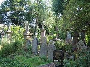 | Hackney | 12.54 hectares (31.0 acres) | 51°33′50″N 0°04′37″W / 51.564°N 0.077°W TQ 334 868 | Map | Details | YES | This is one of London's Magnificent Seven cemeteries. It was closed to burials in 1978 and is now managed as a nature reserve.[17] |
| Ackroyd Drive Greenlink |  | Tower Hamlets | 0.87 hectares (2.1 acres) | 51°31′08″N 0°01′23″W / 51.519°N 0.023°W TQ 368 818 | Map | Details | YES | The Greenlink is a green corridor between Tower Hamlets Cemetery and Mile End Park.[18] |
| Adelaide |  | Camden | 0.90 hectares (2.2 acres)[19][lower-alpha 6] | 51°32′35″N 0°09′40″W / 51.543°N 0.161°W TQ 276 843 | Map[lower-alpha 6] | Details | PL | This nature reserve slopes down to a railway line. It is mainly neutral grassland, with areas of scrub and woodland.[21] |
| Ainslie Wood | 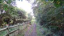 | Waltham Forest | 2.06 hectares (5.1 acres) | 51°36′40″N 0°00′40″W / 51.611°N 0.011°W TQ 378 921 | Map | Details | YES | This is ancient woodland which has mature oaks and wild service trees. It is known locally as Bluebell Wood on account of its spring display.[22] |
| Alexandra Palace and Park |  | Haringey | 62.66 hectares (154.8 acres) | 51°35′38″N 0°07′48″W / 51.594°N 0.130°W TQ 296 900 | Map | Details | YES | The park has a wide range of habitats for an urban area, and is particularly noted for its varied bird species.[14] |
| Anton Crescent Wetland |  | Sutton | 1.04 hectares (2.6 acres) | 51°22′19″N 0°12′11″W / 51.372°N 0.203°W TQ 252 652 | Map | Details | NO | The wetland is used as a flood storage area by the Environment Agency. It has open water, reed beds and willow trees.[23] |
| Barnes Common |  | Richmond | 41.68 hectares (103.0 acres) | 51°28′12″N 0°14′17″W / 51.470°N 0.238°W TQ 225 760 | Map | Details | YES | The common is mainly wooded, with areas of grassland. Plane, lime and horse chestnut trees were planted in the late nineteenth century[24] |
| Barnsbury Wood |  | Islington | 0.32 hectares (0.79 acres) | 51°32′31″N 0°06′54″W / 51.542°N 0.115°W TQ 308 842 | Map | Details | PL | The wood was the garden of a vicarage. It is mainly sycamore, ash and lime.[25] |
| Battersea Park Nature Areas |  | Wandsworth | 2.90 hectares (7.2 acres) | 51°28′48″N 0°09′04″W / 51.480°N 0.151°W TQ 285 773 51°28′52″N 0°08′56″W / 51.481°N 0.149°W TQ 286 774 | Map | Details | YES | The nature areas have mixed woodland and scrub, four glades and a pond. There are twenty species of butterflies.[26] |
| Beam Valley |  | Barking and Dagenham | 39.29 hectares (97.1 acres) | 51°32′17″N 0°10′23″E / 51.538°N 0.173°E TQ 508 844 | Map | Details | YES | A park on the bank the River Beam. Historic features include tanks traps and pillboxes.[27] |
| Beam Valley (Environment Agency) | .JPG) | Barking and Dagenham | 11.86 hectares (29.3 acres) | 51°32′17″N 0°10′23″E / 51.538°N 0.173°E TQ 508 844 | Map | Details | YES | Part of Beam Valley is owned by the Environment Agency, and it has been designated a separate LNR.[28] |
| Beckenham Place Park |  | Lewisham | 95.14 hectares (235.1 acres) | 51°25′05″N 0°00′43″W / 51.418°N 0.012°W TQ 383 707 | Map | Details | YES | The park has extensive ancient woodland, diverse acid grassland, a natural stretch of river and an old pond.[29] |
| Bedfont Lakes Country Park |  | Hounslow | 31.59 hectares (78.1 acres) | 51°26′35″N 0°26′56″W / 51.443°N 0.449°W TQ 079 727 | Map | Details | YES | The park has lakes created from a former landfill site, together with areas of grass and woodland.[30] |
| Bedfords Park |  | Havering | 106.35 hectares (262.8 acres)[31][lower-alpha 6] | 51°36′29″N 0°11′31″E / 51.608°N 0.192°E TQ 519 922 | Map[lower-alpha 6] | Details | YES | This site has wildflower meadows, diverse woodland, several ponds and a lake, as well as a herd of red deer.[32] |
| Belmont Pastures |  | Sutton | 1.26 hectares (3.1 acres) | 51°20′46″N 0°11′56″W / 51.346°N 0.199°W TQ 255 623 | Map | Details | YES | The pastures are grassland and scrub, and they have a wide variety of crickets, butterflies and grasshoppers.[33] |
| Belsize Wood |  | Camden | 0.27 hectares (0.67 acres) | 51°33′11″N 0°09′50″W / 51.553°N 0.164°W TQ 274 854 | Map | Details | PP | This is a sloping wooded site with mature oak trees. It has a wide variety of insect species.[34][35] |
| Bennett's Hole |  | Merton | 1.22 hectares (3.0 acres) | 51°23′28″N 0°10′12″W / 51.391°N 0.170°W TQ 274 674 | Map | Details | YES | Diverse habitats including woodland, marsh and scrub. The north has a variety of tree species, and the south has mainly crack willows and oaks.[36] |
| Bentley Priory |  | Harrow | 59.25 hectares (146.4 acres) | 51°37′16″N 0°19′55″W / 51.621°N 0.332°W TQ 156 927 | Map | Details | YES | This is a Site of Special Scientific Interest, principally for its meadows. It also has extensive woods and two ponds.[37] |
| Big Wood and Little Wood |  | Barnet | 8.29 hectares (20.5 acres) | 51°34′59″N 0°11′24″W / 51.583°N 0.190°W TQ 255 887 51°35′10″N 0°11′35″W / 51.586°N 0.193°W TQ 253 890 | Map | Details | YES | These two small woods are the remnants of the forest which once covered north London. It has birds rarely seen in London, such as the green woodpecker.[38] |
| Blondin Park, Northfields | 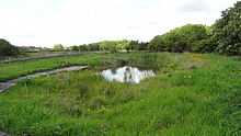 | Ealing | 2.34 hectares (5.8 acres) | 51°29′42″N 0°19′12″W / 51.495°N 0.320°W TQ 167 787 | Map | Details | YES | The nature area of this park has a pond, an orchard and a wildflower meadow.[39] |
| Bonesgate Open Space | 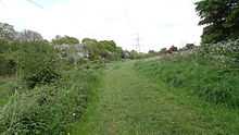 | Kingston | 5.07 hectares (12.5 acres) | 51°21′40″N 0°17′28″W / 51.361°N 0.291°W TQ 191 638 | Map | Details | YES | This is a path along the bank of the Bonesgate Stream. It is parkland with areas of hazel, and has a wide variety of breeding birds.[40] |
| Bramley Bank |  | Croydon | 10.30 hectares (25.5 acres) | 51°21′14″N 0°03′29″W / 51.354°N 0.058°W TQ 353 634 | Map | Details | YES | Bramley Bank is managed by the London Wildlife Trust. It has oak and ash woodland with a large pond, and areas of acidic grassland.[41] |
| Brent Reservoir/Welsh Harp |  | Barnet/Brent | 97.31 hectares (240.5 acres) | 51°34′16″N 0°14′42″W / 51.571°N 0.245°W TQ 217 873 | Map | Details | YES | Most of the site is a Site of Special Scientific Interest, especially for its large number of breeding birds, including the great crested grebe.[42] |
| Brookmill Road |  | Lewisham | 0.44 hectares (1.1 acres) | 51°28′05″N 0°01′12″W / 51.468°N 0.020°W TQ 376 762 | Map | Details | NO | A steeply sloping disused railway embankment. It is woodland, with the main trees being hornbeam and hazel.[43] |
| Burnt Ash Pond | 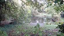 | Lewisham | 0.13 hectares (0.32 acres) | 51°26′28″N 0°01′12″E / 51.441°N 0.020°E TQ 405 733 | Map | Details | NO | A small pond in the middle of houses, which has an extensive variety of aquatic animals, including many breeding toads, and plants, including great and hoary willowherb.[10] |
| Camley Street Natural Park | 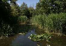 | Camden | 0.84 hectares (2.1 acres) | 51°32′06″N 0°07′44″W / 51.535°N 0.129°W TQ 299 834 | Map | Details | YES | This nature reserve in Kings Cross is run by the London Wildlife Trust. It has ponds and areas of meadows and woodland.[44] |
| Cannon Hill Common | 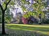 | Merton | 14.16 hectares (35.0 acres) | 51°24′00″N 0°13′19″W / 51.400°N 0.222°W TQ 238 683 | Map | Details | YES | The common has meadows with plants such as meadow barley and meadow foxtail, and woodland dominated by ancient oak trees.[45] |
| Castle Hill | 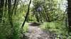 | Kingston | 3.48 hectares (8.6 acres) | 51°21′29″N 0°17′28″W / 51.358°N 0.291°W TQ 191 635 | Map | Details | YES | The site of a medieval hunting lodge, this is a Scheduled Monument. It is woodland mainly of oak and hazel, with diverse ground flora.[40] |
| Chase - Barking, TheThe Chase - Barking | 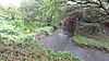 | Barking and Dagenham | 44.15 hectares (109.1 acres) | 51°33′00″N 0°11′02″E / 51.550°N 0.184°E TQ 515 857 | Map | Details | YES | The Chase is a footpath along the River Rom. It has diverse habitats and wildlife includes water voles.[46] |
| Chase - Havering, TheThe Chase - Havering |  | Havering | 1.39 hectares (3.4 acres) | 51°33′29″N 0°11′02″E / 51.558°N 0.184°E TQ 515 866 | Map | Details | YES | This is a continuation of The Chase in Barking. It has black poplar trees.[47] |
| Cherry Wood |  | Merton | 1.76 hectares (4.3 acres) | 51°23′49″N 0°12′54″W / 51.397°N 0.215°W TQ 243 680 | Map | Details | YES | The main trees are pedunculate oak, ash and horse chestnut. There are over twenty-five species of birds.[48] |
| Chiswick Eyot |  | Hounslow | 0.83 hectares (2.1 acres) | 51°29′13″N 0°14′46″W / 51.487°N 0.246°W TQ 219 779 | Map | Details | NO | This is a small wooded island in the Thames. The main trees are willows, and the island is surrounded by reed beds.[49] |
| Coldfall Wood | .jpg) | Haringey | 13.43 hectares (33.2 acres) | 51°35′49″N 0°09′43″W / 51.597°N 0.162°W TQ 274 903 | Map | Details | YES | This is ancient woodland, mainly of hornbeam, oak, birch and sycamore. There are a number of ground plants which are rare in London, such as pale sedge, trailing St John's wort and lady-fern.[50] |
| Coombe Hill Wood |  | Kingston | 2.19 hectares (5.4 acres) | 51°25′08″N 0°15′04″W / 51.419°N 0.251°W TQ 217 703 | Map | Details | YES | This wood is mainly oak, with an understorey of hazel coppice.[51] |
| Coppett's Wood and Glebelands |  | Barnet | 20.00 hectares (49.4 acres) | 51°36′32″N 0°09′32″W / 51.609°N 0.159°W TQ 276 916 51°36′14″N 0°10′12″W / 51.604°N 0.170°W TQ 268 910 | Map | Details | YES | Coppett's Wood is mainly oak and hornbeam, and has a number of rare insects.[52] Glebelands is a remnant of Finchley Common, and has woodland and ponds.[53] |
| Covert Way |  | Enfield | 6.77 hectares (16.7 acres) | 51°39′36″N 0°10′23″W / 51.660°N 0.173°W TQ 265 973 | Map | Details | YES | Covert Way is deciduous woodland. Animals include muntjac deer, green and greater spotted woodpeckers, and white-letter and purple hair-streak butterflies.[54] |
| Crane Park Island |  | Richmond | 2.67 hectares (6.6 acres) | 51°26′31″N 0°22′44″W / 51.442°N 0.379°W TQ 128 727 | Map | Details | YES | This is an island in the River Crane, which is managed by the London Wildlife Trust. It has wet woodland, grassland and reed beds.[55] |
| Cranebank, Hatton |  | Hounslow | 6.69 hectares (16.5 acres) | 51°28′34″N 0°24′58″W / 51.476°N 0.416°W TQ 101 764 | Map | Details | YES | Cranebank is flood meadows by the River Crane, which are under water in winter. There are twenty-six species of butterflies and twelve of damselflies and dragonflies.[56] |
| Cranham Brickfields |  | Havering | 8.69 hectares (21.5 acres) | 51°33′50″N 0°16′41″E / 51.564°N 0.278°E TQ 580 875 | Map | Details | YES | Cranham Brickfields has pasture, a pond, scrub and woodland. Invertebrates include the great crested newt and slow worm, and plants dyer's greenweed.[57] |
| Cranham Marsh |  | Havering | 12.97 hectares (32.0 acres) | 51°32′49″N 0°15′47″E / 51.547°N 0.263°E TQ 570 855 | Map | Details | YES | Cranham Marsh is managed by the Essex Wildlife Trust. Its habitats include marshes, ponds and ancient woodland, and a tributary of the River Markyke runs through the site.[58] |
| Cranmer Green |  | Merton | 3.22 hectares (8.0 acres) | 51°23′53″N 0°09′47″W / 51.398°N 0.163°W TQ 279 681 | Map | Details | YES | The green has a pond, woodland and grassland.[36] The pond is probably late eighteenth century in origin.[59] |
| Crossness | 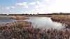 | Bexley | 25.50 hectares (63.0 acres) | 51°30′04″N 0°08′53″E / 51.501°N 0.148°E TQ 492 802 | Map | Details | PP | This is a network of open water and ditches, with areas of rough grassland. There are over one hundred and thirty species of birds.[60] |
| Cuddington Meadows |  | Sutton | 1.39 hectares (3.4 acres) | 51°20′02″N 0°12′50″W / 51.334°N 0.214°W TQ 245 610 | Map | Details | YES | Cuddington Meadows is chalk grassland, and its most important feature is the variety of flowering plants. Sixteen butterfly species have been recorded.[61] |
| Dacres Wood |  | Lewisham | 0.70 hectares (1.7 acres) | 51°25′55″N 0°03′07″W / 51.432°N 0.052°W TQ 355 721 | Map | Details | PL | The wood has some massive turkey oaks, and ornamental shrubs which are probably inherited from a time when it was a Victorian garden. There are also marshes and a pond.[62] |
| Dagenham Village Churchyard | 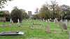 | Barking and Dagenham | 0.87 hectares (2.1 acres) | 51°32′20″N 0°09′43″E / 51.539°N 0.162°E TQ 500 845 | Map | Details | YES | The old gravestones and walls in the churchyard provide a habitat for lichens and mosses, and woodpeckers feed in an avenue of lime trees.[63] |
| Danson Park Bog Garden, Welling | 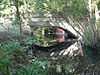 | Bexley | 1.07 hectares (2.6 acres) | 51°27′14″N 0°06′50″E / 51.454°N 0.114°E TQ 470 749 | Map | Details | YES | Danson Park has a large lake, and a marshy area at its western end has been converted into a nature reserve.[64] |
| Denham Country Park | 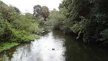 | Hillingdon/ Buckinghamshire | 19.82 hectares (49.0 acres) | 51°34′26″N 0°29′06″W / 51.574°N 0.485°W TQ 051 872 | Map | Details | YES | Three rivers go through the park, the Colne, the Misbourne and the Frays. Birds include herons and kingfishers.[65] |
| Derwent Floodwash |  | Merton | 1.83 hectares (4.5 acres) | 51°23′31″N 0°13′34″W / 51.392°N 0.226°W TQ 235 674 | Map | Details | YES | This is designed to store water during flooding of Pyl Brook, to prevent flooding downstream. It is wet grassland with a number of uncommon plant species.[66] |
| Devonshire Avenue Nature Area |  | Sutton | 0.42 hectares (1.0 acre) | 51°21′14″N 0°11′20″W / 51.354°N 0.189°W TQ 262 632 | Map | Details | YES | This is mainly chalk grassland. It has the locally rare small blue butterfly, and the butterfly's food plant, kidney vetch.[67] |
| Downham Woodland Walk | 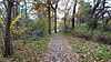 | Lewisham | 2.82 hectares (7.0 acres) | 51°25′48″N 0°00′07″E / 51.430°N 0.002°E TQ 393 720 | Map | Details | YES | The walk is ancient woodland. Trees include pedunculate oaks, hornbeams and field maples, and there are invertebrates such as stag and fungus beetles.[68] |
| Duke's Hollow |  | Hounslow | 0.27 hectares (0.67 acres) | 51°28′23″N 0°15′22″W / 51.473°N 0.256°W TQ 212 763 | Map | Details | YES | Duke's Hollow slopes steeply down towards the Thames. It is woodland mainly of willow.[69] |
| Dulwich Upper Wood |  | Southwark | 1.74 hectares (4.3 acres) | 51°25′26″N 0°04′41″W / 51.424°N 0.078°W TQ 337 712 | Map | Details | YES | This is a remnant of the Great North Wood. It is mainly oak, and animals include stag beetles and bats.[70] |
| Eastbrookend Country Park |  | Barking and Dagenham | 67.39 hectares (166.5 acres) | 51°33′07″N 0°10′37″E / 51.552°N 0.177°E TQ 510 860 | Map | Details | YES | The park is former derelict land planted with 50,000 small trees, and with grass and flower seeds suitable for poor soil.[71] |
| Edith Gardens |  | Kingston | 0.44 hectares (1.1 acres) | 51°23′20″N 0°17′02″W / 51.389°N 0.284°W TQ 195 669 | Map | Details | NO | The site is abandoned allotments next to Tolworth Brook. Most of it is low diversity grassland, and there is also a thicket of young elms areas of brambles and some large mature trees.[72] |
| Elmbridge Open Space[lower-alpha 7] |  | Kingston | 9.35 hectares (23.1 acres) | 51°23′31″N 0°16′26″W / 51.392°N 0.274°W TQ 202 673 | Map | Details | YES | This is a green walk along the bank of the Hogsmill River. There are willow trees by the river bank and plants such as meadowsweet and comfrey.[74] |
| Fishpond Wood and Beverley Meads |  | Merton | 5.92 hectares (14.6 acres) | 51°25′19″N 0°14′53″W / 51.422°N 0.248°W TQ 219 707 | Map | Details | YES | This site is managed by the London Wildlife Trust. Fishpond Wood has wetlands and oak and hazel woodlands, while Beverley Meads is a mosaic of woods and pastures.[75] |
| Foots Cray Meadows |  | Bexley | 30.32 hectares (74.9 acres) | 51°25′30″N 0°07′26″E / 51.425°N 0.124°E TQ 478 717 | Map | Details | YES | The River Cray runs through the meadows. They have a diverse landscape, including ancient woodlands and wildflower meadows.[76] |
| Fox Wood | 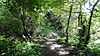 | Ealing | 2.25 hectares (5.6 acres) | 51°31′34″N 0°17′56″W / 51.526°N 0.299°W TQ 181 822 | Map | Details | YES | Fox Wood was a reservoir which was drained in World War II to stop it being used as a navigational aid by German bombers. It is now sloping woodland.[77] |
| Foxley Wood | 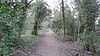 | Croydon | 11.36 hectares (28.1 acres) | 51°19′41″N 0°06′50″W / 51.328°N 0.114°W TQ 315 605 | Map | Details | YES | Foxley Wood has chalk grassland and woods. There are badgers and roe deer, and over forty species of birds have been observed.[78] |
| Frays Valley | 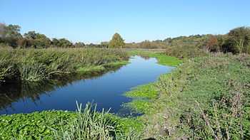 | Hillingdon | 71.87 hectares (177.6 acres) | 51°34′05″N 0°28′44″W / 51.568°N 0.479°W TQ 055 865 | Map | Details | YES | The Frays River goes through the valley, which is managed by the London Wildlife Trust. Part of it is a Site of Special Scientific Interest.[79] |
| Fryent Country Park | 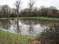 | Brent | 106.97 hectares (264.3 acres) | 51°34′26″N 0°16′37″W / 51.574°N 0.277°W TQ 195 875 | Map | Details | YES | The park has a varied landscape, including lakes, woodland and meadows. Over 800 species have been recorded, including 80 birds and 21 butterflies.[80] |
| Gillespie Park | 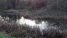 | Islington | 3.03 hectares (7.5 acres) | 51°33′32″N 0°06′25″W / 51.559°N 0.107°W TQ 313 862 | Map | Details | YES | Gillespie Park has an ecology centre, and it is mainly grassland. Bird species include reed bunting and song thrush, and there are also ponds with many invertebrates.[81] |
| Grove Farm | 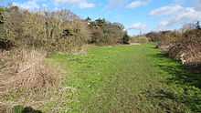 | Ealing | 8.07 hectares (19.9 acres) | 51°33′14″N 0°20′28″W / 51.554°N 0.341°W TQ 151 852 | Map | Details | YES | Grove Farm has ancient woodland with wild service trees and a variety of wild flowers.[82] |
| Gunnersbury Triangle | 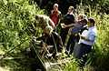 | Ealing/Hounslow | 2.57 hectares (6.4 acres) | 51°29′38″N 0°16′16″W / 51.494°N 0.271°W TQ 201 786 | Map | Details | YES | This is managed by the London Wildlife Trust. It has a varied habitat, including woodland and marshes. It has amphibians such as toads, newts and frogs.[83] |
| Hainault Lodge | 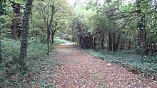 | Redbridge | 5.60 hectares (13.8 acres) | 51°36′25″N 0°07′48″E / 51.607°N 0.130°E TQ 476 919 | Map | Details | NO | Hainault Lodge is ancient woodland and pasture. Butterflies include orange tips and speckled woods, and birds long-tailed tits, robins.[84] |
| Ham Common | 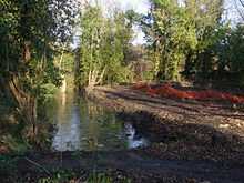 | Richmond | 40.27 hectares (99.5 acres) | 51°25′55″N 0°17′53″W / 51.432°N 0.298°W TQ 184 718 | Map | Details | YES | The main trees in Ham Common are birch and oak, and there are also areas of acid grassland.[85] |
| Ham Lands | 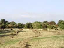 | Richmond | 60.01 hectares (148.3 acres) | 51°26′06″N 0°19′30″W / 51.435°N 0.325°W TQ 165 720 | Map | Details | YES | This is a former gravel quarry filled with soil types from across London, thus creating an unusual mosaic of habitats.[86] |
| High Elms | 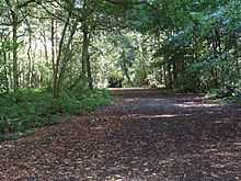 | Bromley | 102.33 hectares (252.9 acres) | 51°20′46″N 0°04′19″E / 51.346°N 0.072°E TQ 444 628 | Map | Details | YES | This country park is a Site of Special Scientific Interest. Most of it is secondary woodland, but it retains much of the original ground flora with some rare species.[87] |
| Hogsmill River Park[lower-alpha 7] | 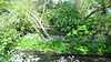 | Kingston | 22.26 hectares (55.0 acres)[lower-alpha 7] | 51°23′53″N 0°16′34″W / 51.398°N 0.276°W TQ 200 680 51°22′59″N 0°15′50″W / 51.383°N 0.264°W TQ 209 663 | Map Map[lower-alpha 7] | Details | YES | This is a linear park along the Hogsmill River. The landscape is varied, with pasture and mature willow and oak woodland.[88] |
| Hounslow Heath |  | Hounslow | 83.14 hectares (205.4 acres) | 51°27′25″N 0°23′06″W / 51.457°N 0.385°W TQ 123 743 | Map | Details | YES | The heath has extensive acid grassland with some hay meadows, marsh and woodland.[89] |
| Hutchinson's Bank |  | Croydon | 21.77 hectares (53.8 acres) | 51°20′13″N 0°01′08″W / 51.337°N 0.019°W TQ 381 616 | Map | Details | YES | Hutchinson's Bank is managed by the London Wildlife Trust. It is a sloping meadow bank, with a diverse ecology including the rare greater yellow-rattle.[90] |
| Ingrebourne Valley |  | Havering | 146.62 hectares (362.3 acres) | 51°32′06″N 0°12′25″E / 51.535°N 0.207°E TQ 532 841 51°31′26″N 0°11′49″E / 51.524°N 0.197°E TQ 525 828 | Map | Details | YES | This has the largest freshwater reed beds in London and diverse bird life. It is designated a Site of Special Scientific Interest[91] |
| Isleworth Ait |  | Hounslow | 3.49 hectares (8.6 acres) | 51°28′05″N 0°19′12″W / 51.468°N 0.320°W TQ 168 757 | Map | Details | NO | This is an island in the Thames which is managed by the London Wildlife Trust. Rare species include a beetle and two molluscs.[92] |
| Islip Manor Meadows |  | Ealing | 23.75 hectares (58.7 acres) | 51°32′53″N 0°23′17″W / 51.548°N 0.388°W TQ 119 845 | Map | Details | YES | This is a diverse wet meadow site with over twenty grass and ten leguminous species. There are ponds with the protected great crested newt.[93] |
| Jubilee Country Park |  | Bromley | 28.67 hectares (70.8 acres) | 51°23′35″N 0°03′47″E / 51.393°N 0.063°E TQ 436 680 | Map | Details | YES | The park has chalk grassland and woods with oaks, hawthorns and field maples. Some species are rare in London.[94] |
| Jubilee Wood |  | Kingston | 2.24 hectares (5.5 acres) | 51°20′35″N 0°19′37″W / 51.343°N 0.327°W TQ 166 618 | Map[lower-alpha 8] | Details | YES | Trees in this wood include birch, pedunculate oak, field maple, goat willow and wych elm.[95] |
| Kempton |  | Hounslow | 22.80 hectares (56.3 acres) | 51°25′26″N 0°23′35″W / 51.424°N 0.393°W TQ 118 707 | Map | Details | NO | This is a disused reservoir which is a Site of Special Scientific Interest for its many bird species.[96] |
| Lavender Pond |  | Southwark | 0.70 hectares (1.7 acres) | 51°30′18″N 0°02′17″W / 51.505°N 0.038°W TQ 363 803 | Map | Details | PP | This used to be part of the Surrey Commercial Docks, now converted to a small wildlife pond.[97] |
| Lesnes Abbey Woods |  | Bexley | 73.13 hectares (180.7 acres) | 51°29′10″N 0°07′55″E / 51.486°N 0.132°E TQ 481 785 | Map | Details | YES | This is a geological Site of Special Scientific Interest due to its important Palaeocene fossils.[9] It also has ancient woodland.[98] |
| Litten |  | Ealing | 10.7 hectares (26 acres) | 51°31′55″N 0°21′04″W / 51.532°N 0.351°W TQ 145 827 | Map | Details | YES | Litten has a pond, woodland and a wildflower meadow.[99] |
| Long Wood | 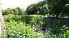 | Ealing | 1.20 hectares (3.0 acres) | 51°29′49″N 0°20′17″W / 51.497°N 0.338°W TQ 155 789 | Map | Details | YES | This is ancient woodland which has varied tree and wildlife species.[100] |
| Lonsdale Road Reservoir (Leg of Mutton Reservoir) | 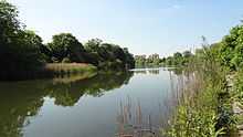 | Richmond | 8.19 hectares (20.2 acres) | 51°28′55″N 0°14′49″W / 51.482°N 0.247°W TQ 218 774 | Map | Details | YES | This disused reservoir has a wide variety of water birds, including tufted ducks and widgeons.[101] |
| Lower Wandle | 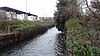 | Merton | 2.52 hectares (6.2 acres) | 51°25′59″N 0°11′31″W / 51.433°N 0.192°W TQ 258 720 | Map | Details | YES | This is a stretch of the River Wandle, which is lined with mature trees, grassland and patches of herbs.[102] |
| Manor, TheThe Manor | 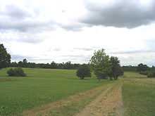 | Havering | 67.96 hectares (167.9 acres) | 51°36′50″N 0°14′13″E / 51.614°N 0.237°E TQ 550 930 51°36′29″N 0°14′38″E / 51.608°N 0.244°E TQ 555 923 | Map | Details | YES | The Manor comprises several parks and diverse habitats. Plants include the common spotted-orchid and square stemmed St John's wort.[103] |
| Maryon Wilson Park and Gilbert's Pit (including Maryon Park) |  | Greenwich | 17.52 hectares (43.3 acres) | 51°29′13″N 0°02′31″E / 51.487°N 0.042°E TQ 419 784 | Map | Details | YES | Gilbert's Pit is a geological Site of Special Scientific Interest. Maryon Wilson Park has a stream with rare plants.[104] |
| Masons Field | 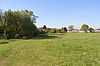 | Brent | 2.87 hectares (7.1 acres) | 51°35′00″N 0°16′25″W / 51.5833°N 0.27367240°W TQ 197 886 | Map | Details | YES | This is a former London Underground sports ground next to Fryent Country Park, which has been converted to a wildflower meadow.[105] |
| Mayesbrook Park South | 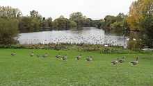 | Barking and Dagenham | 7.55 hectares (18.7 acres) | 51°32′24″N 0°06′29″E / 51.540°N 0.108°E TQ 463 844 | Map | Details | YES | The park has a nature reserve with two large lakes, rough grassland and woodland.[106] |
| Merton Park Green Walks | 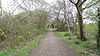 | Merton | 1.49 hectares (3.7 acres) | 51°24′43″N 0°12′00″W / 51.412°N 0.200°W TQ 253 697 | Map | Details | YES | This site has a variety of habitats, including grassland and an inaccessible area of elm scrub and brambles.[107] |
| Morden Park | 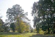 | Merton | 28.19 hectares (69.7 acres) | 51°23′35″N 0°12′43″W / 51.393°N 0.212°W TQ 245 675 | Map | Details | YES | This park has woodland with 300 year old oak trees. Birds include coal tits and spotted flycatchers.[108] |
| Mudchute Park and Farm | .jpg) | Tower Hamlets | 13.31 hectares (32.9 acres) | 51°29′31″N 0°00′43″W / 51.492°N 0.012°W TQ 381 789 | Map | Details | YES | This is a city farm and nature reserve, with varied habitats including wetlands. There are invertebrates such as smooth newts and slow worms.[109] |
| Myrna Close |  | Merton | 0.75 hectares (1.9 acres) | 51°24′58″N 0°10′26″W / 51.416°N 0.174°W TQ 271 701 | Map | Details | YES | This is a linear park on the route of a former railway. It has a small stream and two ponds, and wetland plants include brooklime.[110] |
| Northolt Manor |  | Ealing | 1.79 hectares (4.4 acres) | 51°32′38″N 0°22′08″W / 51.544°N 0.369°W TQ 132 841 | Map | Details | YES | The site of a fourteenth century moated manor, this is a Scheduled Monument. It has wetland with a wide range of species.[111] |
| Nunhead Cemetery |  | Southwark | 20.23 hectares (50.0 acres) | 51°27′43″N 0°03′07″W / 51.462°N 0.052°W TQ 354 755 | Map | Details | YES | This is one of London's Magnificent Seven cemeteries.[112] It has a wide range of plants, and sixteen species of butterflies have been recorded.[113] |
| Oak Avenue, Hampton |  | Richmond | 1.85 hectares (4.6 acres) | 51°25′41″N 0°23′17″W / 51.428°N 0.388°W TQ 122 711 | Map | Details | YES | This is former wasteland, where some new habitats have been created, including meadows and a pond, and others have grown up naturally.[114] |
| Oak Hill Wood |  | Barnet | 9.88 hectares (24.4 acres) | 51°38′24″N 0°09′04″W / 51.640°N 0.151°W TQ 280 951 | Map | Details | YES | This is a medieval oak wood managed by the London Wildlife Trust. It has pipistrelle and brown long-eared bats.[115] |
| Oakleigh Way |  | Merton | 0.64 hectares (1.6 acres) | 51°24′43″N 0°08′56″W / 51.412°N 0.149°W TQ 288 698 | Map | Details | YES | Oakleigh Way is a former railway depot converted to a nature reserve, which has birch woodland and wildflower meadows.[116] |
| One Tree Hill |  | Southwark | 6.95 hectares (17.2 acres) | 51°27′04″N 0°03′04″W / 51.451°N 0.051°W TQ 355 743 | Map | Details | YES | Queen Elizabeth I is said to have picnicked under an oak at the top of the hill. It has many ancient trees.[117] |
| Oxleas/Shooters Hill Woodlands |  | Greenwich | 119.60 hectares (295.5 acres) | 51°28′08″N 0°03′25″E / 51.469°N 0.057°E TQ 430 764 51°27′36″N 0°04′23″E / 51.460°N 0.073°E TQ 441 755 | Map | Details | YES | The woods are a Site of Special Scientific Interest. They have a wide variety of fungi and invertebrates, including the rare palmate newt. Oxleas Wood is over 8,000 years old.[118] |
| Parkland Walk |  | Haringey/Islington | 14.31 hectares (35.4 acres) | 51°34′26″N 0°07′16″W / 51.574°N 0.121°W TQ 303 878 | Map | Details | YES | This is a 4.5 mile walk along the route of a former railway line.[11] It has an area of acidic grassland with rare plants and insects.[119] |
| Parsloes Park Squatts |  | Barking and Dagenham | 4.28 hectares (10.6 acres) | 51°32′42″N 0°07′48″E / 51.545°N 0.130°E TQ 478 851 | Map | Details | YES | This is an area of neutral and acidic grassland in the park which has been set aside as a nature reserve. It has ancient hedgerows.[120] |
| Perivale Wood |  | Ealing | 8.02 hectares (19.8 acres) | 51°32′24″N 0°19′44″W / 51.540°N 0.329°W TQ 160 837 | Map | Details | NO | Perivale Wood is ancient woodland of oak and ash. It also has rough grassland, and ponds and streams.[121] |
| Pevensey Road |  | Hounslow | 10.21 hectares (25.2 acres) | 51°26′53″N 0°23′24″W / 51.448°N 0.390°W TQ 120 733 | Map | Details | YES | This is an area of scrub, woodland and wetland next to the River Crane.[122] |
| Pyl Brook |  | Merton | 1.31 hectares (3.2 acres) | 51°23′13″N 0°12′07″W / 51.387°N 0.202°W TQ 252 669 | Map | Details | YES | This is a stretch of Pyl Brook and adjacent land. It is mainly mature hawthorn and elm scrub.[123] |
| Queen's Wood |  | Haringey | 21.07 hectares (52.1 acres) | 51°34′52″N 0°08′31″W / 51.581°N 0.142°W TQ 288 885 | Map | Details | YES | The wood is mainly oak and hornbeam. Over a hundred species of spider have been recorded.[124] |
| Raeburn Open Space |  | Kingston | 5.00 hectares (12.4 acres) | 51°23′35″N 0°16′48″W / 51.393°N 0.280°W TQ 198 674 | Map | Details | YES | The Tolworth Brook flows through this site, which has young woodland, old hedgerows and rough grassland.[125] |
| Railway Fields |  | Haringey | 0.87 hectares (2.1 acres) | 51°34′34″N 0°06′04″W / 51.576°N 0.101°W TQ 317 881 | Map | Details | YES | Railway Fields has varied habitats, including a pond, marshland, a meadow and woodland. Over 200 species of wild flowers have been recorded.[126] |
| Rainham Marshes |  | Havering | 79.19 hectares (195.7 acres) | 51°29′28″N 0°13′26″E / 51.491°N 0.224°E TQ 545 792 | Map | Details | YES | The grasslands on this site have rare plants, insects and birds, and a large population of water voles.[127] |
| Ravensbury Park |  | Merton | 7.04 hectares (17.4 acres) | 51°23′49″N 0°10′48″W / 51.397°N 0.180°W TQ 267 680 | Map | Details | YES | The park is next to the River Wandle and it has wetland bird species such as kingfishers and grey wagtails, together with woodland areas.[128] |
| Ripple Nature Reserve |  | Barking and Dagenham | 3.68 hectares (9.1 acres) | 51°31′16″N 0°06′54″E / 51.521°N 0.115°E TQ 468 824 | Map | Details | YES | The Ripple is managed by the London Wildlife Trust. Much of it is damp grassland, while drier areas have rare species such as yellow vetchling. There are a number of scarce insect species including the emerald damselfly.[129] |
| Rose Walk |  | Kingston | 2.69 hectares (6.6 acres) | 51°23′53″N 0°16′41″W / 51.398°N 0.278°W TQ 199 680 | Map | Details | YES | Rose Walk is unmanaged grassland with wild flowers. The main grasses are oat grass, tall fescue and rye-grass.[130] |
| Roundshaw Downs |  | Sutton | 19.61 hectares (48.5 acres) | 51°21′04″N 0°07′26″W / 51.351°N 0.124°W TQ 307 630 | Map | Details | YES | Roundshaw Downs is chalk downland and woodland which has a wide variety of bird species, including great spotted woodpeckers.[131] |
| Rowley Green Common |  | Barnet | 5.82 hectares (14.4 acres) | 51°39′04″N 0°14′38″W / 51.651°N 0.244°W TQ 216 961 | Map | Details | YES | The common is mainly oak and birch woodland, with some grassland, but it also has a sphagnum bog, which is rare in south-east England.[132] |
| Ruffett and Big Woods |  | Sutton | 7.01 hectares (17.3 acres) | 51°19′34″N 0°09′40″W / 51.326°N 0.161°W TQ 282 602 | Map | Details | YES | Ruffett Wood has many sycamores and some old wild cherries, while Big Wood is dominated by sycamores. The ground flora is diverse.[133] |
| Ruislip Local Nature Reserve |  | Hillingdon | 4.42 hectares (10.9 acres)[lower-alpha 9] | 51°35′49″N 0°25′41″W / 51.597°N 0.428°W TQ 090 899 | Map[lower-alpha 9] | Details | NO | The woods have a diverse mixture of woodland, willow carr and open heath.[135] |
| Scadbury Park |  | Bromley | 117.02 hectares (289.2 acres) | 51°24′40″N 0°05′38″E / 51.411°N 0.094°E TQ 457 701 | Map | Details | YES | Scadbury Park has extensive ancient woodland, neutral grassland, and pasture which is let to a tenant farmer.[136] |
| Scratchwood and Moat Mount Open Space |  | Barnet | 55.16 hectares (136.3 acres) | 51°38′10″N 0°15′36″W / 51.636°N 0.260°W TQ 205 945 | Map | Details | YES | Scratchwood has areas of ancient oak and hornbeam woodland. Moat Mount has open pasture and woodland.[137] |
| Scrattons Ecopark and extension |  | Barking and Dagenham | 1.92 hectares (4.7 acres) | 51°31′44″N 0°08′02″E / 51.529°N 0.134°E TQ 481 833 | Map | Details | PP | This is former allotments converted to an ecopark to provide a range of habitats for plants and animals.[138] |
| Selsdon Wood | 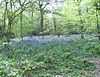 | Croydon | 78.96 hectares (195.1 acres) | 51°20′17″N 0°02′35″W / 51.338°N 0.043°W TQ 364 617 | Map | Details | YES | Selsdon Wood is a former shooting estate, which is now open pasture and woodland with a Memorial Pond.[139] |
| Sir Joseph Hood Memorial Wood |  | Merton | 1.66 hectares (4.1 acres) | 51°23′24″N 0°14′24″W / 51.390°N 0.240°W TQ 226 671 | Map | Details | YES | The wood has a varied range of birds and tree species.[140] |
| South Norwood Country Park | 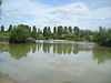 | Croydon | 43.55 hectares (107.6 acres) | 51°23′53″N 0°03′25″W / 51.398°N 0.057°W TQ 353 683 | Map | Details | YES | The park has a lake and meadows. Over a hundred bird species have been recorded.[141] |
| Southwood Open Space[lower-alpha 7] | 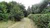 | Kingston | 12.91 hectares (31.9 acres) | 51°23′06″N 0°16′12″W / 51.385°N 0.270°W TQ 205 665 | Map | Details | YES | This is a linear park along the Hogsmill River. It is mainly meadow with elm scrub.[74] |
| Spencer Road Wetlands | 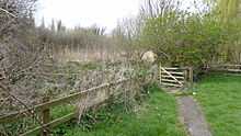 | Sutton | 1.05 hectares (2.6 acres) | 51°23′06″N 0°09′47″W / 51.385°N 0.163°W TQ 279 667 | Map | Details | NO | The wetland is next to the River Wandle. Habitats include reed swamp, willow Carr, a sedge bed and a pond.[142] |
| Spinney, Carshalton, TheThe Spinney, Carshalton |  | Sutton | 0.40 hectares (0.99 acres) | 51°22′30″N 0°09′43″W / 51.375°N 0.162°W TQ 280 656 | Map | Details | NO | This is mainly sycamore and London plane. Breeding birds include dunnocks and wrens.[143] |
| Springfield Park | 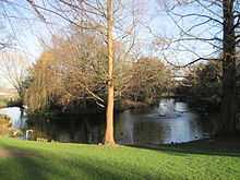 | Hackney | 13.59 hectares (33.6 acres) | 51°34′12″N 0°03′32″W / 51.570°N 0.059°W TQ 346 875 | Map | Details | YES | The park is a Regionally Important Geological Site. It has diverse habitats and fifty-six species of birds.[144] |
| St. John's Wood Church Grounds | 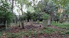 | Westminster | 1.99 hectares (4.9 acres) | 51°31′55″N 0°10′08″W / 51.532°N 0.169°W TQ 271 830 | Map | Details | YES | This closed cemetery has a wildlife area, trees and a formal garden.[145] |
| Stanmore Common | 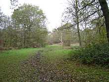 | Harrow | 49.2 hectares (122 acres) | 51°37′55″N 0°19′41″W / 51.632°N 0.328°W TQ 158 939 | Map | Details | YES | The common has heathland and woodland. It also has two former village ponds, one of which still has a pump.[146] |
| Stanmore Country Park |  | Harrow | 30.73 hectares (75.9 acres) | 51°37′19″N 0°18′25″W / 51.622°N 0.307°W TQ 173 928 | Map | Details | YES | The park has large areas of acidic grassland, mainly common bent and Yorkshire fog. It also has woodland which is relatively young.[147] |
| Streatham Common | _-_geograph.org.uk_-_1639440.jpg) | Lambeth | 13.77 hectares (34.0 acres) | 51°25′19″N 0°07′08″W / 51.422°N 0.119°W TQ 309 709 | Map | Details | YES | The common has woodland mainly of oak, with other trees such as sycamore and beech. A damp area has rare plants.[148] |
| Sue Godfrey Nature Park | 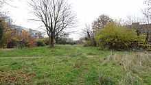 | Lewisham | 0.60 hectares (1.5 acres) | 51°28′44″N 0°01′23″W / 51.479°N 0.023°W TQ 374 774 | Map | Details | YES | This site became a nature park in 1984 after a campaign by local residents. It has over two hundred species of flowers, trees and shrubs.[149] |
| Sutcliffe Park | 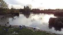 | Greenwich | 5.86 hectares (14.5 acres) | 51°27′18″N 0°01′44″E / 51.455°N 0.029°E TQ 411 748 | Map | Details | YES | The River Quaggy flows through this park, which also has wetlands and a lake with extensive reed beds.[150] |
| Sutton Ecology Centre Grounds |  | Sutton | 1.33 hectares (3.3 acres) | 51°21′58″N 0°09′58″W / 51.366°N 0.166°W TQ 278 646 | Map | Details | YES | The centre has a plane tree which is listed as one of the Great Trees of London. A pond has damselflies and dragonflies.[151] |
| Sydenham Hill Wood and Fern Bank | 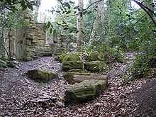 | Southwark | 28.17 hectares (69.6 acres) | 51°26′06″N 0°04′26″W / 51.435°N 0.074°W TQ 340 724 | Map | Details | YES | This is a mixture of ancient and modern woodland, and Victorian garden plants including a monkey puzzle tree.[152] |
| Ten Acre Wood | 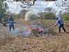 | Hillingdon | Not available[lower-alpha 10] | 51°32′31″N 0°25′12″W / 51.542°N 0.420°W TQ 097 838 | Map[lower-alpha 10] | Details | YES | This is an oak plantation, with some hawthorns and blackthorns which provide a source of berries for birds. It is managed by the London Wildlife Trust.[153] |
| Totteridge Fields |  | Barnet | 6.92 hectares (17.1 acres) | 51°37′55″N 0°14′02″W / 51.632°N 0.234°W TQ 223 940 | Map | Details | YES | The fields are managed by the London Wildlife Trust. They are ancient hay meadows with hawthorn and blackthorn hedgerows, which provide nesting sites for birds.[154] |
| Tower Hamlets Cemetery Park | 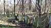 | Tower Hamlets | 11.60 hectares (28.7 acres) | 51°31′23″N 0°01′48″W / 51.523°N 0.030°W TQ 368 823 | Map | Details | YES | This closed nineteenth century cemetery has ancient woodland and pastures sown with wild flowers.[155] |
| Wandle Meadow Nature Park | 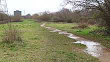 | Merton | 3.44 hectares (8.5 acres) | 51°25′26″N 0°10′59″W / 51.424°N 0.183°W TQ 264 710 | Map | Details | YES | This site has woodland, wet grassland and temporary ponds. Breeding birds include bullfinches, whitethroats and reed buntings.[156] |
| Wandle Valley Wetland | 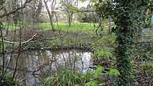 | Sutton | 0.63 hectares (1.6 acres) | 51°23′02″N 0°09′54″W / 51.384°N 0.165°W TQ 278 666 | Map | Details | NO | The wetland has frogs, toads and newts, and brown hawker dragonflies.[157] |
| Westbere Copse |  | Camden | 0.39 hectares (0.96 acres) | 51°33′11″N 0°12′25″W / 51.553°N 0.207°W TQ 244 853 | Map | Details | PL | The main trees in Westbere Copse are sycamore, oak, ash and aspen, with an understorey including snowberry, elder and elm.[158] |
| Wilderness Island |  | Sutton | 2.73 hectares (6.7 acres) | 51°22′19″N 0°09′36″W / 51.372°N 0.160°W TQ 282 653 | Map | Details | YES | This is an island in the River Wandle managed by the London Wildlife Trust. It has diverse habitats, with woods, ponds, wild flower meadows and wetlands.[159] |
| Wood and Richard Jefferies Bird Sanctuary, TheThe Wood and Richard Jefferies Bird Sanctuary |  | Kingston | 1.46 hectares (3.6 acres) | 51°23′24″N 0°18′11″W / 51.390°N 0.303°W TQ 182 670 | Map | Details | PP | This used to be the garden of a large Victorian house. It has ancient woodland, and insects including stag beetles.[160] |
| Wormwood Scrubs | .JPG) | Hammersmith & Fulham | 13.40 hectares (33.1 acres) | 51°31′16″N 0°14′13″W / 51.521°N 0.237°W TQ 223 817 | Map | Details | YES | The nature area in the park has a wide variety of trees, including pedunculate oak and silver birch. Rare birds include marsh harrier and whinchat. There are also meadows with a large population of butterflies.[161] |
| Yeading Brook Meadows |  | Hillingdon/Ealing | 17.00 hectares (42.0 acres)[lower-alpha 11] | 51°31′44″N 0°24′40″W / 51.529°N 0.411°W TQ 103 823 | Map[lower-alpha 11] | Details | YES | This is a meadow site along the Yeading Brook managed by the London Wildlife Trust. Invertebrates include Roesel's bush-crickets and shield bugs.[162] |
| Yeading Woods (Gutteridge Wood and Meadows) |  | Hillingdon | Not available[lower-alpha 12] | 51°32′42″N 0°25′37″W / 51.545°N 0.427°W TQ 092 841 | Map[lower-alpha 12] | Details | YES | This site is managed by the London Wildlife Trust. It has ancient oak and hazel woodland and wildflower meadows.[164] |
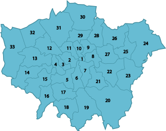
Map of London boroughs
 |
See also
| Wikimedia Commons has media related to Local Nature Reserves in London. |
- Parks and open spaces in London
- List of Sites of Special Scientific Interest in Greater London
- List of National Nature Reserves in England
- List of Local Nature Reserves in England
Notes
- ↑ There are 143 LNRs listed by Natural England at 3 April 2015. The figure excludes Tolworth Court Farm Meadows, which Kingston Council has designated as an LNR,[6][7] but is missing from the Natural England database.[8]
- ↑ Unless specified otherwise, the area is taken from the Natural England map of each site. (Click on the identify icon (i) in the "Feature Tools" and then click on the site.)[8]
- ↑ The location is taken from the Natural England details page for the site
- ↑ Unless specified otherwise, the maps are on the Natural England database of local nature reserves.
- ↑ Details are on the pages on each site in the Natural England database of local nature reserves.[8]
- ↑ 6.0 6.1 6.2 6.3 Maps are missing for Adelaide and Bedfords Park. In these cases the area and map taken from the Greenspace Information for Greater London database.[20]
- ↑ 7.0 7.1 7.2 7.3 7.4 The coordinates and description in the details page for Hogsmill River Park in the Natural England database put it in the same location as Elmbridge Open Space (the northern half of Hogsmill River Park) and Southwood Open Space (the southern half). The map for Hogsmill River Park wrongly shows a small closed wood called Hogsmill Wood.[73] The two maps in this table for Hogsmill River Park are those of Elmbridge and Southwood, and area shown for Hogsmill is the total area of its two halves.
- ↑ Jubilee Wood is in two parts separated by an electricity substation. The Natural England map incorrectly shows the western wood as the LNR. Kingston Council's own map of LNRs[7] and a notice on the site shows the eastern wood as the LNR.
- ↑ 9.0 9.1 The Natural England details page gives the correct grid reference for Ruislip LNR, but the map wrongly shows Highgrove Wood. Ruislip Woods National Nature Reserve Management Plan gives the area and has maps of the site.[134]
- ↑ 10.0 10.1 Ten Acre Wood is described on the Natural England details page as part of Yeading Woods LNR, managed by the London Wildlife Trust. This page has a grid reference and map which is correct according to the LWT. However the separate Natural England map shows a different location, the southern half of Yeading Brook Meadows. The LWT gives a map but not the area for this site.
- ↑ 11.0 11.1 The Natural England details page for Yeading Brook Meadows describes the site as located in Hillingdon and Ealing and managed by the London Wildlife Trust. However the Natural England map shows a small area in Ealing which is not part of the reserve according to the LWT. The map and area for this site are taken from the LWT.
- ↑ 12.0 12.1 This site is described on the Natural England details page as including Gutteridge Wood. The Ten Acre Wood details page has a map of the site showing it in two adjoining blocks, and states that it is part of Yeading Woods. The Natural England map of Yeading Woods shows Gutteridge Wood and part of Ten Acre Wood. The map in this table is an LWT one, but the LWT does not show the area.[163]
Coordinates: 51°30′N 0°5′W / 51.500°N 0.083°W
References
- ↑ Watson, Jo (25 July 2009). "Access to Nature Regional Targeting Plan - LONDON" (PDF). Natural England. Retrieved 13 July 2014.
- ↑ "London". Natural England. Retrieved 28 May 2014.
- ↑ "2011 Census first results: London boroughs' populations by age by sex" (PDF). Greater London Authority. July 2012. Retrieved 6 June 2014.
- ↑ "Why declare Local Nature Reserves?". Natural England. Retrieved 28 May 2014.
- ↑ "How are Local Nature Reserves declared?". Natural England. Retrieved 28 May 2014.
- ↑ "Townscape & Visual Impact Assessment: Tesco Tolworth" (PDF). Royal Borough of Kingston upon Thames. p. 17. Retrieved 28 May 2014.
- ↑ 7.0 7.1 "Map Tools". Royal Borough of Kingston upon Thames. Retrieved 28 May 2014.
- ↑ 8.0 8.1 8.2 8.3 "Local Nature Reserves: Search Results for Greater London". Natural England. Retrieved 2 February 2014.
- ↑ 9.0 9.1 "Brent Reservoir citation" (PDF). Sites of Special Scientific Interest. Natural England. Retrieved 23 July 2014.
- ↑ 10.0 10.1 "Burnt Ash Pond". London Borough of Lewisham. Retrieved 30 May 2014.
- ↑ 11.0 11.1 "Parkland Walk Local Nature Reserve". London Parks and Gardens Trust. Retrieved 6 June 2014.
- ↑ Hall, Rae and Pedley, Andy. "The Selborne Society and Perivale Wood". London Parks Trust. Retrieved 23 July 2014.
- ↑ "Coldfall Wood". Local Nature Reserves. Natural England. 20 March 2014. Retrieved 23 July 2014.
- ↑ 14.0 14.1 "Alexandra Palace & Park". Local Nature Reserves. Natural England. 20 March 2014. Retrieved 29 May 2014.
- ↑ "Masons Field". Local Nature Reserves. Natural England. 10 March 2015. Retrieved 21 April 2015.
- ↑ "Find a nature reserve". London Wildlife Trust. Retrieved 23 July 2014.
- ↑ "Abney Park Cemetery". London Parks and Gardens Trust. Retrieved 29 May 2014.
- ↑ "Tower Hamlets Cemetery Park & Ackroyd Drive Green Link Nature Reserve". London Borough of Tower Hamlets. Retrieved 29 May 2014.
- ↑ "Chalk Farm Embankment and Adelaide Nature Reserve". Greenspace Information for Greater London. 2013. Retrieved 28 May 2014.
- ↑ "iGiGL data portal (map)". Greenspace Information for Greater London. Retrieved 2 February 2014.
- ↑ "Chalk Farm Embankment and Adelaide Nature Reserve". Greenspace Information for Greater London. 2013. Retrieved 29 May 2014.
- ↑ "Ainslie Wood". London Gardens Online. Retrieved 29 May 2014.
- ↑ "Anton Crescent Wetland LNR". London Borough of Sutton. Retrieved 29 May 2014.
- ↑ "Barnes Common". London Parks and Gardens Trust. Retrieved 30 May 2014.
- ↑ "Barnsbury Wood". London Parks and Gardens Trust. Retrieved 30 May 2014.
- ↑ "Battersea Park Nature Areas". Local Nature Reserves. Natural England. 1 March 2012. Retrieved 30 May 2014.
- ↑ "Beam Valley". Local Nature Reserves. Natural England. 1 March 2013. Retrieved 30 May 2014.
- ↑ "Beam Valley (Environment Agency)". Local Nature Reserves. Natural England. 1 March 2013. Retrieved 30 May 2014.
- ↑ "Beckenham Place Park". Local Nature Reserves. Natural England. 1 March 2013. Retrieved 30 May 2014.
- ↑ "Bedfont Lakes Country Park". London Parks and Gardens Trust. Retrieved 30 May 2014.
- ↑ "Bedfords Park". Greenspace Information for Greater London. 2013. Retrieved 28 May 2014.
- ↑ "Bedford's Park". Local Nature Reserves. Natural England. 18 December 2013. Retrieved 30 May 2014.
- ↑ "Belmont Pastures". Local Nature Reserves. Natural England. 1 March 2013. Retrieved 30 May 2014.
- ↑ "Belsize Wood". Local Nature Reserves. Natural England. 1 March 2013. Retrieved 30 May 2014.
- ↑ "Belsize Wood Nature Reserve and Russell Nurseries". London Parks and Gardens Trust. Retrieved 30 May 2014.
- ↑ 36.0 36.1 "Nature reserves". London Borough of Merton. Retrieved 30 May 2014.
- ↑ "Bentley Priory". Local Nature Reserves. Natural England. 1 March 2013. Retrieved 30 May 2014.
- ↑ "Big Wood & Little Wood". Local Nature Reserves. Natural England. 1 March 2013. Retrieved 30 May 2014.
- ↑ "Blondin Park and Blondin Nature Area". London Parks and Gardens Trust. Retrieved 30 May 2014.
- ↑ 40.0 40.1 "Castle Hill and Bonesgate Open Space". Greenspace Information for Greater London. 2013. Retrieved 30 May 2014.
- ↑ "Bramley Bank". London Wildlife Trust. Retrieved 30 May 2014.
- ↑ "Welsh Harp or Brent Reservoir". London Parks and Gardens Trust. Retrieved 30 May 2014.
- ↑ "Brookmill nature reserve". London Borough of Lewisham. Retrieved 30 May 2014.
- ↑ "Camley Street Natural Park". London Wildlife Trust. Retrieved 30 May 2014.
- ↑ "Cannon Hill Common". Local Nature Reserves. Natural England. 1 March 2013. Retrieved 30 May 2014.
- ↑ "The Chase - Barking". Local Nature Reserves. Natural England. 7 March 2013. Retrieved 4 June 2014.
- ↑ "The Chase - Havering". Local Nature Reserves. Natural England. 7 March 2013.
- ↑ "Cherry Wood". Local Nature Reserves. Natural England. 1 March 2013. Retrieved 30 May 2014.
- ↑ "Chiswick Eyot". Thames Wilderness. Retrieved 30 May 2014.
- ↑ "Coldfall Wood". Greenspace Information for Greater London. 2013. Retrieved 31 May 2014.
- ↑ "Coombe Hill Wood". Surrey County. Retrieved 31 May 2014.
- ↑ "Coppett's Wood and Scrublands Local Nature Reserve". Greenspace Information for Greater London. 2013. Retrieved 31 May 2014.
- ↑ "Coppetts Wood and Glebelands". Local Nature Reserves. Natural England. 4 March 2013. Retrieved 31 May 2014.
- ↑ "Covert Way". Local Nature Reserves. Natural England. 4 March 2013. Retrieved 31 May 2014.
- ↑ "Crane Park Island". Local Nature Reserves. Natural England. 4 March 2013. Retrieved 31 May 2014.
- ↑ "Cranebank, Hatton". Local Nature Reserves. Natural England. 4 March 2013. Retrieved 31 May 2014.
- ↑ "Cranham Brickfields". Local Nature Reserves. Natural England. 4 March 2013. Retrieved 31 May 2014.
- ↑ "Cranham Marsh". London Parks and Gardens Trust. Retrieved 31 May 2014.
- ↑ "Mitcham Greens (Fair Green, Three Kings Piece, Cranmer Green/Piece, Cricket Green, Lower Green, Vestry Hall Green)". London Parks and Gardens Trust. Retrieved 31 May 2014.
- ↑ "Crossness". Local Nature Reserves. Natural England. 4 March 2013. Retrieved 31 May 2014.
- ↑ "Cuddington Meadows". Local Nature Reserves. Natural England. 4 March 2013. Retrieved 31 May 2014.
- ↑ "Dacres Wood Nature Reserve". London Parks and Gardens Trust. Retrieved 31 May 2014.
- ↑ "Dagenham Village Churchyard". Local Nature Reserves. Natural England. 4 March 2013. Retrieved 31 May 2014.
- ↑ "Danson Park Bog Garden, Welling". Local Nature Reserves. Natural England. 4 March 2013. Retrieved 31 May 2014.
- ↑ "Denham Country Park". Local Nature Reserves. Natural England. 4 March 2013. Retrieved 31 May 2014.
- ↑ "Derwent Road Flood Wash". Greenspace Information for Greater London. 2013. Retrieved 31 May 2014.
- ↑ "Devonshire Avenue Nature Area". Local Nature Reserves. Natural England. 4 March 2013. Retrieved 31 May 2014.
- ↑ "Downham Woodland Walk". Local Nature Reserves. Natural England. 4 March 2013. Retrieved 1 June 2014.
- ↑ "Duke's Hollow". Greenspace Information for Greater London. 2013. Retrieved 1 June 2014.
- ↑ "Dulwich Upper Wood". Local Nature Reserves. Natural England. 4 March 2013. Retrieved 1 June 2014.
- ↑ "Eastbrookend Country Park". London Borough of Barking and Dagenham Council. Retrieved 1 June 2014.
- ↑ Swales, Sue et al (1992). Nature Conservation in Kingston upon Thames. London Ecology Unit. p. 78. ISBN 1-871045-13-4.
- ↑ "Map of Hogsmill River Park". Local Nature Reserves. Natural England. Retrieved 26 May 2014.
- ↑ 74.0 74.1 "Thames Down Link" (PDF). Surrey County Council. pp. 1–2. Retrieved 1 June 2014.
- ↑ "Fishpond Wood and Beverley Meads". Local Nature Reserves. Natural England. 4 March 2013. Retrieved 1 June 2014.
- ↑ "Foots Cray Meadows". Local Nature Reserves. Natural England. 4 March 2013. Retrieved 1 June 2014.
- ↑ "Hanger Hill Park, including Fox Wood". London Parks and Gardens Trust. Retrieved 1 June 2014.
- ↑ "Foxley Wood". Local Nature Reserves. Natural England. 4 March 2013. Retrieved 1 June 2014.
- ↑ "Frays Valley". Local Nature Reserves. Natural England. 4 March 2013. Retrieved 1 June 2014.
- ↑ "Fryent Country Park". Local Nature Reserves. Natural England. 5 March 2013. Retrieved 1 June 2014.
- ↑ "Gillespie Park". Local Nature Reserves. Natural England. 5 March 2013. Retrieved 1 June 2014.
- ↑ "Greenford parks". London Borough of Ealing. Retrieved 1 June 2014.
- ↑ "Gunnersbury Triangle". London Wildlife Trust. Retrieved 1 June 2014.
- ↑ "Hainault Lodge". Local Nature Reserves. Natural England. 5 March 2013. Retrieved 2 June 2014.
- ↑ "Ham Common, Richmond". Local Nature Reserves. Natural England. 5 March 2013. Retrieved 2 June 2014.
- ↑ "Ham Lands". Local Nature Reserves. Natural England. 5 March 2013. Retrieved 2 June 2014.
- ↑ "Downe Bank and High Elms citation" (PDF). Sites of Special Scientific Interest. Natural England. Retrieved 2 June 2014.
- ↑ "Hogsmill River Park". London Parks and Gardens Trust. Retrieved 2 June 2014.
- ↑ "Hounslow Heath". Local Nature Reserves. Natural England. 5 March 2013. Retrieved 2 June 2014.
- ↑ "Hutchinson's Bank, Chapel Bank & Threecorner Grove". London Wildlife Trust. Retrieved 2 June 2014.
- ↑ "Ingrebourne Valley Nature Reserve". London Borough of Havering. Retrieved 2 June 2014.
- ↑ "Isleworth Ait". London Wildlife Trust. Retrieved 2 June 2014.
- ↑ "Islip Manor Meadows". London Borough of Ealing. Retrieved 2 June 2014.
- ↑ "Jubilee Country Park". Local Nature Reserves. Natural England. 5 March 2013. Retrieved 2 June 2014.
- ↑ "Jubilee Wood". Local Nature Reserves. Natural England. 5 March 2013. Retrieved 3 June 2014.
- ↑ "Kempton Nature Reserve". Thames Water. Retrieved 3 June 2014.
- ↑ "Lavender Pond Nature Park". London Parks and Gardens Trust. Retrieved 2 June 2014.
- ↑ "Lesnes Abbey Woods". Local Nature Reserves. Natural England. 5 March 2013. Retrieved 2 June 2014.
- ↑ "Litten". Local Nature Reserves. Natural England. 5 March 2013. Retrieved 2 June 2014.
- ↑ "Other parks in Southall". London Borough of Ealing. Retrieved 2 June 2014.
- ↑ "Lonsdale Road Reservoir (Leg of Mutton Reservoir)". Local Nature Reserves. Natural England. 5 March 2013. Retrieved 2 June 2014.
- ↑ "Lower Wandle". Local Nature Reserves. Natural England. 5 March 2013. Retrieved 2 June 2014.
- ↑ "The Manor Nature Reserve". London Borough of Havering. Retrieved 4 June 2014.
- ↑ "Maryon Wilson Park and Gilbert's Pit". Local Nature Reserves. Natural England. 6 March 2013. Retrieved 2 June 2014.
- ↑ "Masons Field". Barn Hill Conservation Group. Retrieved 23 April 2015.
- ↑ "Mayesbrook Park South". Local Nature Reserves. Natural England. 6 March 2013. Retrieved 2 June 2014.
- ↑ "Merton Park Green Walks". Greenspace Information for Greater London. 2013. Retrieved 2 June 2014.
- ↑ "Morden Park". Local Nature Reserves. Natural England. 6 March 2013. Retrieved 2 June 2014.
- ↑ "Mudchute Farm and Park". Greenspace Information for Greater London. 2013. Retrieved 2 June 2014.
- ↑ "Myrna Close Valley". Greenspace Information for Greater London. 2013. Retrieved 3 June 2014.
- ↑ "Northolt Manor and Belvue Park". Greenspace Information for Greater London. 2013. Retrieved 3 June 2014.
- ↑ "Nunhead Cemetery". London Parks and Gardens Trust. Retrieved 3 June 2014.
- ↑ "Nunhead Cemetery". Local Nature Reserves. Natural England. 6 March 2013. Retrieved 3 June 2014.
- ↑ "Oak Avenue Local Nature Reserve". Greenspace Information for Greater London. 2013. Retrieved 3 June 2014.
- ↑ "Oak Hill Wood". London Wildlife Trust. Retrieved 3 June 2014.
- ↑ "Oakleigh Way Nature Area". Greenspace Information for Greater London. 2013. Retrieved 3 June 2014.
- ↑ "One Tree Hill". Local Nature Reserves. Natural England. 6 March 2013. Retrieved 3 June 2014.
- ↑ "Oxleas/Shooters Hill Woodlands". Local Nature Reserves. Natural England. 6 March 2013. Retrieved 3 June 2014.
- ↑ "Parkland Walk". Local Nature Reserves. Natural England. 6 March 2013. Retrieved 6 June 2014.
- ↑ "Parsloes Park Squatts". Local Nature Reserves. Natural England. 6 March 2013. Retrieved 3 June 2014.
- ↑ "Perivale Wood Local Nature Reserve". Greenspace Information for Greater London. 2013. Retrieved 6 June 2014.
- ↑ "Pevensey Road". Local Nature Reserves. Natural England. 6 March 2013. Retrieved 3 June 2014.
- ↑ "Pyl Brook". Local Nature Reserves. Natural England. 6 March 2013. Retrieved 3 June 2014.
- ↑ "Queen's Wood". Local Nature Reserves. Natural England. 6 March 2013. Retrieved 3 June 2014.
- ↑ "Raeburn Open Space". Greenspace Information for Greater London. 2013. Retrieved 3 June 2014.
- ↑ "Railway Fields Local Nature Reserve". London Borough of Haringey. Retrieved 3 June 2014.
- ↑ "Rainham Marshes". Local Nature Reserves. Natural England. 6 March 2013. Retrieved 3 June 2014.
- ↑ "Ravensbury Park". Local Nature Reserves. Natural England. 6 March 2013. Retrieved 3 June 2014.
- ↑ "The Ripple Nature Reserve". Greenspace Information for Greater London. 2013. Retrieved 3 June 2014.
- ↑ Swales, Sue et al (1992). Nature Conservation in Kingston upon Thames. London Ecology Unit. p. 43. ISBN 1-871045-13-4.
- ↑ "Roundshaw Downs". Local Nature Reserves. Natural England. 7 March 2013. Retrieved 3 June 2014.
- ↑ "Rowley Green Common". London Parks and Gardens Trust. Retrieved 3 June 2014.
- ↑ "Ruffett, Big Wood and adjacent meadow". Greenspace Information for Greater London. 2013. Retrieved 3 June 2014.
- ↑ "Ruislip Woods National Nature Reserve Management Plan 2003-2008" (PDF). London Borough of Hillingdon. pp. 7, 94, 154. Retrieved 27 May 2014.
- ↑ "Ruislip (now part of the NNR)". Local Nature Reserves. Natural England. 7 March 2013. Retrieved 3 June 2014.
- ↑ "Scadbury Park, St Paul's Cray Common, Pett's Wood & Hawkwood Estate". Greenspace Information for Greater London. 2013. Retrieved 4 June 2014.
- ↑ "Scratchwood and Moat Mount Open Spaces". Local Nature Reserves. Natural England. 7 March 2013. Retrieved 4 June 2014.
- ↑ "Scrattons Farm Eco Park". London Borough of Barking and Dagenham. Retrieved 4 June 2014.
- ↑ "Selsdon Wood Nature Reserve". London Parks and Gardens Trust. Retrieved 3 June 2014.
- ↑ "Sir Joseph Hood Memorial Wood". Local Nature Reserves. Natural England. 7 March 2013. Retrieved 3 June 2014.
- ↑ "South Norwood Country Park". Local Nature Reserves. Natural England. 7 March 2013. Retrieved 3 June 2014.
- ↑ "Spencer Road Wetlands". London Wildlife Trust. Retrieved 3 June 2014.
- ↑ "The Spinney LNR". London Borough of Sutton. Retrieved 4 June 2014.
- ↑ "Wild about Springfield Park" (PDF). London Borough of Hackney. Retrieved 3 June 2014.
- ↑ "St John's Wood Church Grounds". London Parks and Gardens Trust. Retrieved 3 June 2014.
- ↑ "Stanmore Common". Local Nature Reserves. Natural England. 7 March 2013. Retrieved 4 June 2014.
- ↑ "Stanmore Country Park". Local Nature Reserves. Natural England. 7 March 2013. Retrieved 4 June 2014.
- ↑ "Streatham Common and The Rookery". Greenspace Information for Greater London. 2013. Retrieved 4 June 2014.
- ↑ "Sue Godfrey Nature Park". London Borough of Lewisham. Retrieved 4 June 2014.
- ↑ "Sutcliffe Park Flood Alleviation Scheme". Greenspace Information for Greater London. 2013. Retrieved 4 June 2014.
- ↑ "Sutton Ecology Centre". Greenspace Information for Greater London. 2013. Retrieved 4 June 2014.
- ↑ "Sydenham Hill Wood and Fern Bank". Local Nature Reserves. Natural England. 7 March 2013. Retrieved 4 June 2014.
- ↑ "Ten Acre Wood". London Wildlife Trust. Retrieved 4 June 2014.
- ↑ "Totteridge Fields". London Wildlife Trust. Retrieved 5 June 2014.
- ↑ "Tower Hamlets Cemetery Park". Local Nature Reserves. Natural England. 31 July 2013. Retrieved 7 June 2014.
- ↑ "Wandle Meadow Nature Park and the Lower River Wandle". Greenspace Information for Greater London. 2013. Retrieved 7 June 2014.
- ↑ "Wandle Valley Wetland LNR". London Borough of Sutton. Retrieved 7 June 2014.
- ↑ "West Hampstead Railsides, Medley Orchard and Westbere Copse". Greenspace Information for Greater London. 2013. Retrieved 7 June 2014.
- ↑ "Wilderness Island". London Wildlife Trust. Retrieved 7 June 2014.
- ↑ "The Wood and Richard Jefferies Bird Sanctuary". Local Nature Reserves. Natural England. Retrieved 3 June 2014.
- ↑ "Wormwood Scrubs Park". Greenspace Information for Greater London. 2013. Retrieved 7 June 2014.
- ↑ "Yeading Brook Meadows". London Wildlife Trust. Retrieved 7 June 2014.
- ↑ "Yeading Brook Meadows". London Wildlife Trust. Retrieved 26 May 2014.
- ↑ "Gutteridge Wood". London Wildlife Trust. Retrieved 7 June 2014.
| ||||||||||||||||||||||||||||||||||||||||||||||||||||||||||||||||||||||||||||||||||||||||||||||||||||||||||||||||||||||||||