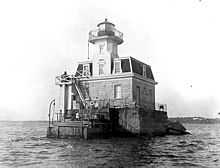
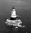
List of lighthouses in Rhode Island

This is a list of all lighthouses in the U.S. state of Rhode Island as identified by the United States Coast Guard. There are fifteen active lights in the state as well as two skeleton towers erected to replace earlier manned lights.

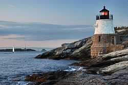
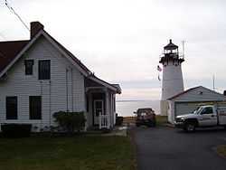
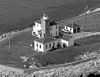
The first lighthouse in the state was erected in 1749[1] and the last in 1962 (ignoring automated towers erected later); the oldest surviving structure is the much-modified Poplar Point Light, although the tower now standing at Prudence Island Light was first erected at Goat Island in 1824. The tallest extant tower is that at Beavertail Light, though the focal plane of the Block Island Southeast Light is much higher on account of the bluffs upon which it sits.

If not otherwise noted, focal height and coordinates are taken from the United States Coast Guard Light List,[2] while location and dates of activation, automation, and deactivation are taken from the United States Coast Guard Historical information site for lighthouses.[3] Locations of demolished lights have been estimated using National Oceanic and Atmospheric Administration (NOAA) navigational charts.

Name Location Coordinates Image Focal
Height
Built[note 1] Automated Deactivated Status
Beavertail Light Conanicut Island 41°26′57″N 71°23′57″W / 41.4493°N 71.3993°W 68 ft (21 m) 1749/1856 1989 Active
Block Island North LightBlock Island41°13′39″N 71°34′34″W / 41.2275°N 71.5761°W 61 ft (19 m) 1829/1867 1955 Active[note 2]
Block Island Southeast LightBlock Island41°09′35″N 71°32′50″W / 41.1597°N 71.5472°W 258 ft (79 m) 1875 1990 Active[note 3]
Brenton Reef Lighteastern approach to Narragansett Bay41°25′35″N 71°23′22″W / 41.4264°N 71.3894°W[4] 87 ft (27 m)[4] 1962 1989 replaced with buoy
Bristol Ferry LightBristol41°38′35″N 71°15′37″W / 41.6431°N 71.2603°W[5] 35 ft (11 m)[5] 1846/1855 1927 inactive
Bullock's Point LightProvidence River southwest of Bullock's Point41°44′16″N 71°21′51″W / 41.7377°N 71.3642°W 50 ft (15 m) 1876 1939 replaced with steel tower
Castle Hill LightNewport41°27′43″N 71°21′48″W / 41.4619°N 71.3633°W 40 ft (12 m) 1890 1957 active
Conanicut Island LightJamestown41°34′24″N 71°22′21″W / 41.5733°N 71.3725°W 47 ft (14 m)[6] 1886 1933 inactive
Conimicut Shoal LightWarwick41°43′01″N 71°20′45″W / 41.7169°N 71.3458°W 29 ft (8.8 m) 1883 1966 active
Dutch Island LightJamestown41°29′44″N 71°24′16″W / 41.4956°N 71.4044°W 56 ft (17 m)[7] 1826/1857 1947 1979 house demolished;
tower reactivated as private light in 2007[8]
Fort Adams LightFort Adams, Newport41°28′54″N 71°20′14″W / 41.4818°N 71.3373°W 20 ft (6.1 m) c. 1889 c. 1950 replaced by skeleton light;
demolished c. 1960
Fuller Rock LightProvidence River41°47′23″N 71°22′47″W / 41.7898°N 71.3796°W 28 ft (8.5 m)[9] 1872[9] 1918[9] 1923[9] destroyed by explosion;
replaced with skeleton tower[9]
Gould Island LightGould Island[10]41°32′02″N 71°20′35″W / 41.534°N 71.343°W[10] 52 ft (16 m)[10] 1889[10] 1947[10] replaced by skeleton light;
demolished in 1960[10]
Gull Rocks LightNewport harbor entrance41°30′09″N 71°19′59″W / 41.5024°N 71.3331°W 33 ft (10 m) 1887/1928 1960 1969 demolished
Hog Island Shoal Lightoff of Hog Island41°37′56″N 71°16′25″W / 41.6322°N 71.2736°W 54 ft (16 m) 1901 1964 active
Ida Lewis Rock Light[note 4]Lime Rock in Newport harbor41°28′40″N 71°19′35″W / 41.4778°N 71.3264°W 1854 1927 1963 inactive
Musselbed Shoals Lightwest entrance to Mount Hope Bay41°38′11″N 71°15′36″W / 41.6363°N 71.2599°W 35 ft (11 m)[11] 1873[11] 1938[11] replaced with skeleton tower[11]
Nayatt Point LightBarrington41°43′30″N 71°20′23″W / 41.7250°N 71.3397°W 1828/1856 1868 inactive
Newport Harbor Light[note 5]Goat Island41°29′36″N 71°19′37″W / 41.4933°N 71.3270°W 33 ft (10 m) 1824/1865[note 6] 1923 active
Plum Beach LightNorth Kingston41°31′48″N 71°24′20″W / 41.5300°N 71.4056°W 1899 1941 reactivated as private aid in 2003
Point Judith LightNarragansett41°21′39″N 71°28′55″W / 41.3608°N 71.4819°W 51 ft (16 m) 1810/1857 1954 active
Pomham Rocks LightEast Providence41°46′39″N 71°22′11″W / 41.7775°N 71.3696°W 67 ft (20 m) 1871 1974 active[note 7]
Poplar Point LightNorth Kingstown41°34′15″N 71°26′23″W / 41.5708°N 71.4397°W 1831 1882 inactive/
private residence
Prudence Island Light[note 8]Prudence Island41°36′20″N 71°18′11″W / 41.6056°N 71.3031°W 28 ft (8.5 m) 1852[note 9] 1961 active;
house destroyed in 1938
Rose Island LightRose Island41°29′44″N 71°20′35″W / 41.4956°N 71.3431°W 48 ft (15 m) 1870 1971 reactivated as private aid in 1993
Sabin Point LightProvidence River41°45′43″N 71°22′27″W / 41.7619°N 71.3742°W 36 ft (11 m) 1872 1956 1968 replaced with day beacon
Sakonnet Lightmouth of Sakonnet River41°27′11″N 71°12′11″W / 41.4531°N 71.2031°W 58 ft (18 m) 1884[12] Active[note 10][12]
Sassafras Point LightProvidence River41°48′00″N 71°23′31″W / 41.800°N 71.392°W[13] 25 ft (7.6 m)[14] 1872[14] 1912[14] demolished
Warwick LightWarwick41°40′01″N 71°22′43″W / 41.6669°N 71.3786°W 66 ft (20 m) 1827/1932 1985 Active
Watch Hill LightWatch Hill41°18′14″N 71°51′30″W / 41.3039°N 71.8584°W 61 ft (19 m) 1808/1857 1986 Active
Whale Rock LightWhale Rock41°26′37″N 71°25′25″W / 41.4436°N 71.4236°W 73 ft (22 m)[15] 1882 1938 demolished by hurricane
Wickford Harbor LightWickford41°34′24″N 71°26′10″W / 41.5734°N 71.4362°W 42 ft (13 m) 1882 1930 replaced with skeleton tower

Notes

  1. If there is a second date, it represents the date the most recent tower was lit.
  2. Inactive 1970-1989.
  3. Inactive 1990-1994.
  4. Originally known as Lime Rock Light
  5. Also known as Goat Island Light
  6. The original tower was moved to Prudence Island in 1851.
  7. From 1974 to 2006 the light was carried on a skeleton tower adjacent to the lighthouse.
  8. Also known as Sandy Point Light
  9. The tower was originally erected in 1824 on Goat Island before being moved to this location.
  10. Inactive 1955-1997.

References

  1. "Rhode Island Lighthouse History: Beavertail Light". R. Holmes.
  2. Light List, Volume I, Atlantic Coast, St. Croix River, Maine to Shrewsbury River, New Jersey (PDF). Light List. United States Coast Guard. 2010.
  3. "Historic Light Station Information and Photography: Rhode Island". United States Coast Guard Historian's Office.
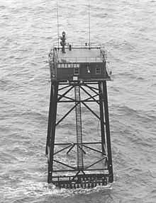
  4. 4.0 4.1 "Brenton Reef Offshore Light station". R. Holmes.
  5. 5.0 5.1 "Bristol Ferry Light". Jeremy D'Entremont.
  6. D'Entremont, Jeremy. "Conanicut Lighthouse". Retrieved 2014-08-26.
  7. D'Entremont, Jeremy. "Dutch Island Lighthouse". Retrieved 2014-08-26.
  8. D'Entremont, Jeremy. "History of Dutch Island Lighthouse". Retrieved 2014-08-26.
  9. 9.0 9.1 9.2 9.3 9.4 "Fuller Rock Lighthouse History". Jeremy D'Entremont. Retrieved 2011-01-06.
  10. 10.0 10.1 10.2 10.3 10.4 10.5 "Gould Island Light". Jeremy D'Entremont.
  11. 11.0 11.1 11.2 11.3 "Musselbed Shoals Lighthouse: History". Jeremy D'Entremont. Retrieved 2010-08-26.
  12. 12.0 12.1 "Sakonnet, RI". LighthouseFriends.
  13. Church, Earl (1920). Triangulation in Rhode Island. Government Printing Office. p. 40. Retrieved 2014-01-14.
  14. 14.0 14.1 14.2 "Sassafras Point Lighthouse". Jeremy D'Entremont. Retrieved 2014-01-14.
  15. D'Entremont, Jeremy. "Whale Rock Lighthouse". Retrieved 2014-08-26.