List of islands of Arizona

Islands of the state of Arizona

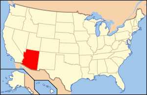
Location of Arizona within the United States
Geography
Location Arizona
Total islands 34 named
Country
State  Arizona

The following is a list of islands of Arizona. With 113,634.57 mi² (294,312 km²) of land, the state of Arizona is the sixth largest state in the country. It is the third largest state to not have an ocean coastline—after Montana and New Mexico. Despite being landlocked, Arizona does contain islands, even though the state has the third lowest amount of water at only 363.73 mi² (942 km²) after West Virginia and New Mexico. Arizona's 0.32% of water is the second lowest percentage after New Mexico's 0.2% of water.[1] The majority of Arizona's islands are in the Colorado River (mainly Lake Mead). Lake Roosevelt also contains a number of islands.

Island Body of water County Coordinates
Antelope Island Lake Powell Coconino 36°59′00″N 111°26′00″W / 36.98333°N 111.43333°W
Beaver Island Colorado River Mohave 34°25′18″N 114°17′28″W / 34.42167°N 114.29111°W
Beehive Island Colorado River Mohave 36°04′20″N 114°43′34″W / 36.07222°N 114.72611°W
Bulls Head Rock Lake Mohave Mohave 35°12′17″N 114°34′22″W / 35.20472°N 114.57278°W
Channel Island Colorado River Mohave 36°01′42″N 114°08′30″W / 36.02833°N 114.14167°W
Decision Island Lake Mead Mohave 36°02′22″N 114°17′04″W / 36.03944°N 114.28444°W
Deer Island Colorado River La Paz 34°07′00″N 114°22′30″W / 34.11667°N 114.37500°W
Driftwood Island Colorado River Mohave 36°11′34″N 114°01′31″W / 36.19278°N 114.02528°W
Haulapai Island Colorado River Mohave 36°01′54″N 114°08′09″W / 36.03167°N 114.13583°W
Haystack Island Lake Roosevelt Gila 33°41′47″N 111°07′45″W / 33.69639°N 111.12917°W
Heron Point Lake Mead Mohave 36°02′51″N 114°18′41″W / 36.04750°N 114.31139°W
Hi Isle Lake Havasu Mohave 34°18′57″N 114°08′35″W / 34.31583°N 114.14306°W
Hog Island Bartlett Lake Maricopa 33°50′25″N 111°37′01″W / 33.84028°N 111.61694°W
Houseboat Island Lake Mead Mohave 36°04′03″N 114°20′09″W / 36.06750°N 114.33583°W
Mohave Rock Colorado River Mohave 34°36′46″N 114°25′28″W / 34.61278°N 114.42444°W
Napoleans Tomb Lake Mead Mohave 36°07′09″N 114°21′27″W / 36.11917°N 114.35750°W
Panic Rock Bartlett Lake Maricopa 33°49′29″N 111°37′18″W / 33.82472°N 111.62167°W
Pittsburg Point Colorado River Mohave 34°27′37″N 114°21′36″W / 34.46028°N 114.36000°W
Plane Crash Island Lake Mead Mohave 36°03′26″N 114°19′57″W / 36.05722°N 114.33250°W
Pool Islands (5 islands) Lake Mead Mohave 36°05′54″N 114°27′58″W / 36.09833°N 114.46611°W
Punk Rock Verde River Yavapai 34°25′33″N 111°46′43″W / 34.42583°N 111.77861°W
Rabbit Island Lake Roosevelt Gila 33°41′49″N 111°08′49″W / 33.69694°N 111.14694°W
River Island Colorado River Mohave 34°39′28″N 114°26′58″W / 34.65778°N 114.44944°W
Rock Island Lake Roosevelt Gila 33°41′16″N 111°08′25″W / 33.68778°N 111.14028°W
Saddle Island Lake Roosevelt Gila 33°39′32″N 111°04′16″W / 33.65889°N 111.07111°W
Shelter Island Lake Roosevelt Gila 33°40′05″N 111°04′48″W / 33.66806°N 111.08000°W
Ship Rock Saguaro Lake Maricopa 33°33′48″N 111°29′47″W / 33.56333°N 111.49639°W
Steamboat Rock Lake Roosevelt Gila 33°40′50″N 111°05′03″W / 33.68056°N 111.08417°W
Two Rocks (2 islands) Colorado River Mohave 35°43′30″N 114°42′00″W / 35.72500°N 114.70000°W

References

External links