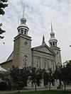
List of historic places in Laval
This article is a list of historic places in Laval, entered on the Canadian Register of Historic Places, whether they are federal, provincial, or municipal. All addresses are in the administrative Region 13. For all other listings in the province of Quebec, see List of historic places in Quebec.
| Name | Address | Municipality | PC | Coordinates | IDF | IDP | IDM | Image |
|---|---|---|---|---|---|---|---|---|
| Maison Charbonneau (also known as Maison Pierre-Thibault) |
8740, boulevard des Mille-Îles | Laval | H7A 4C6 | 45°41′36″N 73°34′45″W / 45.6932°N 73.5793°W | 7032 |  | ||
| Maison Therrien | 9770, boulevard des Mille-Îles | Laval | H7A 4C6 | 45°41′56″N 73°33′28″W / 45.6989°N 73.5577°W | 7028 |  | ||
| Towers (Saint-Vincent-de-Paul Penitentiary) |
160, Montée Saint-François | Laval | H7C 1S5 | 45°37′02″N 73°38′50″W / 45.6171°N 73.6473°W | 11042 | | ||
| Main Cellblock (Saint-Vincent-de-Paul Penitentiary) |
160, Montée Saint-François | Laval | H7C 1S5 | 45°37′04″N 73°38′45″W / 45.6177°N 73.6458°W | 11094 | | ||
| Saint-Vincent-de-Paul Penitentiary (National Historic Site) |
160, Montée Saint-François | Laval | H7C 1S5 | 45°37′04″N 73°38′45″W / 45.6177°N 73.6458°W | 12742 |  | ||
| Maison Pierre-Paré | 4730, Rang du Haut-Saint-François | Laval | H7E 4P2 | 45°38′13″N 73°40′12″W / 45.637°N 73.6701°W | 8078 |  | ||
| Maison Joseph-Labelle | 570, boulevard des Mille-Îles | Laval | H7J 1A5 | 45°39′46″N 73°44′25″W / 45.6627°N 73.7404°W | 7033 | | ||
| Église de Sainte-Rose-de-Lima | 219, boulevard Sainte-Rose Est | Laval | H7L 1L7 | 45°36′50″N 73°47′14″W / 45.6139°N 73.7871°W | 10548 |  | ||
| Maison André-Benjamin-Papineau | 5475, boulevard Saint-Martin Ouest | Laval | H7T 2X7 | 45°32′26″N 73°47′30″W / 45.5406°N 73.7916°W | 6931 |  |