List of historic places in Alberta
This article is a list of historic places in the province of Alberta entered on the Canadian Register of Historic Places, whether they are federal, provincial, or municipal. Sites in Calgary and Edmonton are split off onto their own pages at
| Name | Address | Municipality | PC | Coordinates | IDF | IDP | IDM | Image |
|---|---|---|---|---|---|---|---|---|
| St. Mary & St. George Anglican Church, Jasper, Alberta Provincial Heritage Site | Jasper |  | ||||||
| Russo Greek Orthodox Church | Smoky Lake County | T0A | 54°02′35″N 112°08′02″W / 54.0431°N 112.134°W | 1818 |  More images | |||
| Krause Milling Company Grain Elevator and Flour Mill Site Complex | First Street East and Railway Avenue | Radway | T0A | 54°03′37″N 112°56′31″W / 54.0602°N 112.942°W | 5106 |  | ||
| Notre Dame De Lourdes (Our Lady of Lourdes) Roman Catholic Church | Lamoureux, near Fort Saskatchewan | T0A | 53°42′58″N 113°13′12″W / 53.7161°N 113.22°W | 5109 |  | |||
| River Lot 3, Victoria Settlement | Victoria Settlement, Smoky Lake County, near Pakan | Smoky Lake, near | T0A | 54°00′29″N 112°23′38″W / 54.008°N 112.394°W | 5759 | | ||
| Obadiah Place | Amber Valley | T0A | 54°43′26″N 112°55′44″W / 54.7238°N 112.929°W | 5914 |  | |||
| Old St. Paul Rectory | St. Paul | T0A | 53°59′25″N 111°17′17″W / 53.9904°N 111.288°W | 6561 |  | |||
| Victoria Settlement National Historic Site of Canada | Smoky Lake | T0A | 53°59′41″N 112°28′55″W / 53.9946°N 112.482°W | 7744 |  | |||
| Newbrook Observatory | Newbrook | T0A | 54°19′28″N 112°57′18″W / 54.3245°N 112.955°W | 8809 |  | |||
| Lac La Biche Mission Site | Lac La Biche | T0A | 54°49′22″N 112°05′38″W / 54.8227°N 112.0938°W | 11122 |  | |||
| Vilna Pool Hall and Barbershop | 5028 - 50 Street | Vilna | T0A | 54°06′58″N 111°55′16″W / 54.1162°N 111.921°W | 12410 |  More images | ||
| Alberta Pacific Grain Elevator Site Complex | Railway Avenue at Main Street | Meeting Creek | T0B | 52°40′59″N 112°43′59″W / 52.683°N 112.733°W | 3190 |  | ||
| Ukrainian Greek Orthodox Church of St. Mary (Szypentiz district) | Hairy Hill, near | T0B | 53°46′24″N 111°51′00″W / 53.7734°N 111.85°W | 5063 |  | |||
| Catholic Church of St. Thomas | Duhamel, near | T0B | 52°56′37″N 112°56′31″W / 52.9437°N 112.942°W | 5136 |  | |||
| St. Norbert's Roman Catholic Church | Provost, near | T0B | 52°15′35″N 110°10′16″W / 52.2597°N 110.171°W | 5148 |  | |||
| Battle River Lutheran Church | near Chauvin | Municipal District of Wainwright No. 61 | T0B | 52°52′21″N 110°11′06″W / 52.8725°N 110.185°W | 5174 |  | ||
| Canadian Bank of Commerce Building | 5204 - 50 Avenue | Innisfree | T0B | 53°22′53″N 111°31′48″W / 53.3815°N 111.53°W | 5215 |  | ||
| Greenridge Farm | Dewberry, near | T0B | 53°40′29″N 110°29′46″W / 53.6746°N 110.496°W | 5347 |  | |||
| St. Mary'S Roumanian Orthodox Church of Boian | Boian | T0B | 53°49′45″N 112°00′18″W / 53.8291°N 112.005°W | 5758 |  | |||
| Lamont United Church | 5102 - 53 Street | Lamont | T0B | 53°45′40″N 112°47′17″W / 53.761°N 112.788°W | 7433 |  | ||
| Nativity of the Holy Virgin Orthodox Church of Kysylew | Andrew, near | T0B | 53°54′53″N 112°21′29″W / 53.9146°N 112.358°W | 7917 |  | |||
| Ukrainian Catholic Church of Spasa (Muskalik) | Mundare, near | T0B | 53°37′27″N 112°12′50″W / 53.6242°N 112.214°W | 7918 |  | |||
| Russo-Orthodox Church of the Transfiguration (Star Edna) | Lamont, near | T0B | 53°51′45″N 112°43′44″W / 53.8624°N 112.729°W | 7919 |  | |||
| St. Nicholas Ukrainian Catholic Church of St. Michael And Bell Tower | St. Michael, near | T0B | 53°48′08″N 112°34′26″W / 53.8022°N 112.574°W | 7920 |  | |||
| Presentation of the Blessed Virgin Mary Ukrainian Catholic Church (Delph) | Lamont, near | T0B | 54°00′53″N 112°40′37″W / 54.0148°N 112.677°W | 7921 |  | |||
| Nativity of the Blessed Virgin Mary Ukrainian Greek Catholic Church | Lamont, near | T0B | 53°59′56″N 112°49′41″W / 53.999°N 112.828°W | 7924 |  | |||
| Diplomat Mine Site | near Forestburg | T0B | 52°30′20″N 112°11′28″W / 52.5055°N 112.191°W | 7985 |  | |||
| Canadian Pacific Railway Station | Paradise Valley | T0B | 53°01′49″N 110°17′46″W / 53.0304°N 110.296°W | 10457 |  | |||
| Bashaw Fire Hall | 5018 - 50 Street | Bashaw | T0B | 52°35′03″N 112°58′16″W / 52.5841°N 112.971°W | 11818 |  | ||
| Village Tresures | 5009-50th Street | Mannville | T0B | 53°20′15″N 111°10′44″W / 53.3375°N 111.179°W | 17905 |  | ||
| Beatty Heritage House | 5002 - 51 Street | Rimbey | T0C | 52°38′24″N 114°14′31″W / 52.6399°N 114.242°W | 18321 | 15010 |  | |
| Leduc No. 1 Discovery Well | near Devon | T0C | 53°19′43″N 113°43′44″W / 53.3287°N 113.729°W | 5059 | More images | |||
| Alberta Pacific Grain Elevator | 49 Avenue | Castor | T0C | 52°13′01″N 111°54′14″W / 52.2169°N 111.904°W | 5099 | 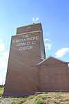 More images | ||
| Fort Ethier | near Wetaskiwin | T0C | 53°01′42″N 113°24′43″W / 53.0283°N 113.412°W | 5180 |  | |||
| Verdun School | near New Norway | T0C | 52°55′51″N 113°05′17″W / 52.9309°N 113.088°W | 5216 |  | |||
| Coronation Boundary Marker | Coronation | T0C | 51°58′08″N 111°25′59″W / 51.9689°N 111.433°W | 5889 |  | |||
| Alberta Hospital Building No. 1 | Alberta Hospital | Ponoka | T0C | 52°39′03″N 113°34′26″W / 52.6507°N 113.574°W | 5894 |  | ||
| Atlantic No. 3 Wild Well Site | near Devon | T0C | 53°19′56″N 113°42′14″W / 53.3322°N 113.704°W | 7295 |  | |||
| Leduc-Woodbend Oilfield National Historic Site of Canada | 50339 Highway 60 | Leduc County | T0C | 53°20′08″N 113°43′44″W / 53.3355°N 113.729°W | 12744 |  | ||
| Rundle's Mission National Historic Site of Canada | Sundance Beach | T0C | 53°05′00″N 114°07′01″W / 53.0833°N 114.117°W | 13218 | More images | |||
| Barn Recognized Federal Heritage Building | T0E | 52°48′14″N 118°10′19″W / 52.804°N 118.172°W | 3463 |  | ||||
| Bunkhouse Recognized Federal Heritage Building | T0E | 52°48′14″N 118°10′19″W / 52.804°N 118.172°W | 3469 |  | ||||
| Cottage - Office Recognized Federal Heritage Building | T0E | 52°48′14″N 118°10′19″W / 52.804°N 118.172°W | 3470 |  | ||||
| Garage Recognized Federal Heritage Building | T0E | 52°48′14″N 118°10′19″W / 52.804°N 118.172°W | 3471 |  | ||||
| Ice House Recognized Federal Heritage Building | T0E | 52°48′14″N 118°10′19″W / 52.804°N 118.172°W | 3472 |  | ||||
| Lodge Recognized Federal Heritage Building | T0E | 52°48′14″N 118°10′19″W / 52.804°N 118.172°W | 3473 |  | ||||
| Saddle Shed Recognized Federal Heritage Building | T0E | 52°48′14″N 118°10′19″W / 52.804°N 118.172°W | 3475 |  | ||||
| Smithy Recognized Federal Heritage Building | T0E | 52°48′14″N 118°10′19″W / 52.804°N 118.172°W | 3476 |  | ||||
| Sharman House | RR #3, near Onoway | T0E | 53°39′38″N 114°12′43″W / 53.6606°N 114.212°W | 7983 |  | |||
| George Pegg Homestead And Botanic Garden | Near Glenevis | T0E | 53°48′30″N 114°31′08″W / 53.8082°N 114.519°W | 8812 |  | |||
| Warden House | Jasper National Park of Canada / Parc national du Canada Jasper | T0E | 52°48′14″N 118°10′19″W / 52.804°N 118.172°W | 3478 |  | |||
| Jasper House National Historic Site of Canada | Highway 16, Roadside pullout 31 km east of Jasper, Jasper National Park | T0E | 53°05′55″N 118°02′24″W / 53.0987°N 118.04°W | 7884 |  More images | |||
| Superintendent's Garage | 510 Robson Street | Jasper | T0E | 52°52′37″N 118°05′02″W / 52.8769°N 118.084°W | 10369 |  | ||
| Superintendent's Residence | 510 Robson Street | Jasper | T0E | 52°52′37″N 118°05′02″W / 52.8769°N 118.084°W | 3604 |  | ||
| Jackman Garage | 411 Patricia Street | Jasper | T0E | 52°52′47″N 118°04′50″W / 52.8796°N 118.0806°W | 3606 |  | ||
| Jackman Residence | 411 Patricia Street | Jasper | T0E | 52°52′50″N 118°04′48″W / 52.8806°N 118.08°W | 3607 |  | ||
| Municipal Library Building | 500 Robson Dr | Jasper | T0E | 52°59′00″N 118°06′36″W / 52.9833°N 118.11°W | 3655 |  | ||
| Canadian National Railway (CNR) Station | 607 Connaught Drive | Jasper | T0E | 52°52′N 118°05′W / 52.87°N 118.08°W | 3090 | | ||
| Information Centre | 500 Connaught Drive | Jasper | T0E | 52°53′00″N 118°04′59″W / 52.8833°N 118.083°W | 3091 |  More images | ||
| Jasper Park Information Centre National Historic Site of Canada | 810 Connaught Drive | Jasper | T0E | 52°52′38″N 118°04′52″W / 52.8773°N 118.081°W | 9367 |  | ||
| Lac Ste. Anne Pilgrimage National Historic Site of Canada | Lac Ste. Anne County | T0E | 53°41′06″N 114°25′44″W / 53.685°N 114.429°W | 9618 |  More images | |||
| St. Bernard Mission (Church and Cemetery) | Grouard | T0G | 55°32′41″N 116°09′29″W / 55.5447°N 116.158°W | 9089 |  | |||
| St. Paul's Anglican Church and Heritage House | 32 - 2 Avenue NE | McLennan | T0H | 55°42′39″N 116°54′07″W / 55.7109°N 116.902°W | 2835 |  | ||
| Ronning Homestead | Grande Prairie County | T0H | 55°21′31″N 119°24′32″W / 55.3586°N 119.409°W | 3192 |  | |||
| Cochrane Farm | RR 1, County of Grande Prairie No. 1 | T0H | 55°14′07″N 118°38′20″W / 55.2354°N 118.639°W | 5003 |  | |||
| Melsness Mercantile Building | Valhalla Centre | T0H | 55°24′13″N 119°22′59″W / 55.4036°N 119.383°W | 5185 |  | |||
| Monkman Homestead | near Cutbank Lake, County of Grande Prairie No. 1 | T0H | 55°15′28″N 119°07′55″W / 55.2577°N 119.132°W | 5186 |  | |||
| Hudson's Bay Company Factor's House | Fort Vermilion | T0H | 58°23′48″N 116°00′07″W / 58.3966°N 116.002°W | 5723 |  | |||
| Sexsmith Blacksmith Shop | Sexsmith | T0H | 55°20′59″N 118°46′01″W / 55.3497°N 118.767°W | 6562 |  | |||
| Northern Alberta Railway Station | Main Street and Railway Avenue | Sexsmith | T0H | 55°20′58″N 118°47′10″W / 55.3495°N 118.786°W | 6852 |  | ||
| Historic Dunvegan | near Dunvegan | T0H | 55°55′25″N 118°36′14″W / 55.9235°N 118.604°W | 8769 | | |||
| Plavin Homestead | near North Star | T0H | 56°50′23″N 117°36′58″W / 56.8397°N 117.616°W | 8991 |  | |||
| McNaught Homestead | near Beaverlodge | T0H | 55°09′07″N 119°26′13″W / 55.152°N 119.437°W | 9090 |  | |||
| Trapper's Shack | 5003 River Road | Fort Vermilion | T0H | 58°14′03″N 116°00′36″W / 58.2342°N 116.01°W | 11482 |  | ||
| St. Augustine's Roman Catholic Mission | Shaftesbury Settlement | Peace River | T0H | 56°09′18″N 117°26′42″W / 56.155°N 117.445°W | 11611 |  | ||
| Bad Heart Straw Church | Teepee Creek | T0H | 55°29′06″N 118°17′17″W / 55.485°N 118.288°W | 11819 |  | |||
| Battle River Hospital | Centre Street and 1st Avenue North | Manning | T0H | 55°55′22″N 117°37′52″W / 55.9229°N 117.631°W | 11821 |  | ||
| All Saints Anglican Church | Cherry Point | T0H | 56°11′18″N 119°56′20″W / 56.1883°N 119.939°W | 17901 |  | |||
| Brooks Aqueduct | Newell County | T0J | 50°31′55″N 111°49′59″W / 50.5319°N 111.833°W | 2895 |  | |||
| Canadian Pacific Railway Station Building | Empress | T0J | 50°57′33″N 110°00′29″W / 50.9591°N 110.008°W | 3191 |  | |||
| St. Edmund's Anglican Church | Big Valley | T0J | 52°02′15″N 112°45′11″W / 52.0374°N 112.753°W | 5007 | More images | |||
| Canadian Pacific Langevin Number 1 and 2 Gas Wells | Cypress County | T0J | 50°16′57″N 111°20′53″W / 50.2825°N 111.348°W | 5895 |  | |||
| Hoodoos | Drumheller | T0J | 51°22′51″N 112°32′02″W / 51.3807°N 112.534°W | 8813 |  More images | |||
| United Grain Growers - Alberta Wheat Pool Grain Elevator Site Complex | near Rowley | T0J | 51°45′39″N 112°46′52″W / 51.7607°N 112.781°W | 8982 |  | |||
| Searle Grain Company Grain Elevator Site Complex | near Rowley | T0J | 51°45′40″N 112°46′48″W / 51.7611°N 112.78°W | 8983 |  | |||
| Atlas Coal Mine | near East Coulee | T0J | 51°19′47″N 112°28′59″W / 51.3298°N 112.483°W | 8998 | More images | |||
| Gleichen Water Tower | Gleichen | T0J | 50°52′07″N 113°03′07″W / 50.8686°N 113.052°W | 9606 | More images | |||
| St. Ambrose Anglican Church | 505 - 5 Street SE | Redcliff | T0J | 50°04′23″N 110°46′55″W / 50.0731°N 110.782°W | 10482 |  | ||
| Alberta Wheat Pool Grain Elevator and Bow Slope Stockyard | EID Historic Park | Scandia | T0J | 50°16′44″N 112°02′56″W / 50.279°N 112.049°W | 11471 |  | ||
| Atlas No. 3 Coal Mine National Historic Site of Canada | Drumheller | T0J | 51°19′47″N 112°28′55″W / 51.3298°N 112.482°W | 11712 | | |||
| Alberta Provincial Police Building | 7809 - 18 Avenue | Municipality of Crowsnest Pass | T0K | 49°38′05″N 114°30′04″W / 49.6348°N 114.501°W | 2890 |  | ||
| Blairmore Courthouse | 13427 - 20 Avenue | Municipality of Crowsnest Pass | T0K | 49°36′26″N 114°25′55″W / 49.6073°N 114.432°W | 2891 | More images | ||
| Old Coleman High School | Mayfair Avenue and Second Street | Municipality of Crowsnest Pass | T0K | 49°38′05″N 114°30′11″W / 49.6348°N 114.503°W | 3007 |  | ||
| Cardston Courthouse | 89 - 3 Avenue SW | Cardston | T0K | 49°11′57″N 113°18′14″W / 49.1992°N 113.304°W | 3051 |  | ||
| C.O. Card House | 337 Main Street | Cardston | T0K | 49°11′54″N 113°18′07″W / 49.1982°N 113.302°W | 5743 |  | ||
| Drewry House | near Cowley | T0K | 49°36′16″N 114°07′16″W / 49.6045°N 114.121°W | 5890 |  | |||
| Stirling Agricultural Village National Historic Site of Canada | Stirling | T0K | 49°30′00″N 112°31′01″W / 49.5°N 112.517°W | 7773 | More images | |||
| Hoyt Tipi Ring Site | near Del Bonita | T0K | 49°03′05″N 112°56′38″W / 49.0515°N 112.944°W | 8137 |  | |||
| Noble Cultivators Retail Manufacturing Building | 914 Highway Avenue | Nobleford | T0K | 49°31′44″N 113°01′55″W / 49.5289°N 113.032°W | 8251 |  | ||
| Magrath Canal | Magrath | T0K | 49°24′14″N 112°52′12″W / 49.4039°N 112.87°W | 8355 |  | |||
| Leitch (Passberg) Collieries | near Burmis | T0K | 49°33′32″N 114°19′19″W / 49.5588°N 114.322°W | 8746 | More images | |||
| Old Hillcrest Cemetery | near Crowsnest Pass - Hillcrest | T0K | 49°34′31″N 114°22′48″W / 49.5754°N 114.3799°W | 8747 |  | |||
| Latter Day Saints Park Avenue Chapel | 4 Park Avenue | Raymond | T0K | 49°27′40″N 112°39′43″W / 49.4612°N 112.662°W | 8760 |  | ||
| Raymond Buddhist Church | 35 Broadway Avenue | Raymond | T0K | 49°27′38″N 112°39′43″W / 49.4605°N 112.662°W | 8773 |  | ||
| Áísínai'pi National Historic Site of Canada | Milk River | T0K | 49°04′54″N 111°37′01″W / 49.0817°N 111.617°W | 10424 | More images | |||
| Isolation Hospital | 1920 - 7 Avenue South | Lethbridge | T0K | 49°24′49″N 112°29′17″W / 49.4137°N 112.488°W | 10480 |  | ||
| Cobblestone Manor | 173 - 7 Avenue West | Cardston | T0K | 49°11′32″N 113°18′22″W / 49.1923°N 113.306°W | 10934 |  | ||
| Frank Slide | Near Crowsnest Pass - Frank | T0K | 49°35′43″N 114°23′49″W / 49.5952°N 114.397°W | 11500 | | |||
| Ross Archaeological Site | Near Coaldale | T0K | 49°51′51″N 112°31′08″W / 49.8641°N 112.519°W | 11561 |  | |||
| Coleman Union Hall / Hospital | 7805 - 18 Avenue, Crowsnest Pass - Coleman | T0K | 49°38′05″N 114°30′07″W / 49.6348°N 114.502°W | 11844 |  | |||
| Andreas Michelsen Farmstead | 533 - 2 Avenue | Stirling | T0K | 49°30′23″N 112°31′55″W / 49.5065°N 112.532°W | 11903 |  More images | ||
| Coleman National Historic Site of Canada | Crowsnest Pass | T0K | 49°38′07″N 114°30′04″W / 49.6352°N 114.501°W | 11933 |  More images | |||
| Temple of the Church of Jesus Christ of Latter Day Saints National Historic Site of Canada | 348 Third Street West | Cardston | T0K | 49°11′53″N 113°18′40″W / 49.198°N 113.311°W | 12645 | 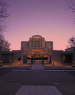 More images | ||
| Fort Macleod National Historic Site of Canada | Fort MacLeod | T0L | 49°43′27″N 113°24′29″W / 49.7241°N 113.408°W | 1140 |  More images | |||
| E.P. Ranch | RR 2, High River | T0L | 50°24′29″N 114°16′59″W / 50.4081°N 114.283°W | 1171 |  | |||
| Grier Block | 2305/2311 - 2 Avenue | Fort MacLeod | T0L | 49°43′30″N 113°24′32″W / 49.7251°N 113.409°W | 4944 |  | ||
| Alequiers | MD of Foothills No. 31 | T0L | 50°30′49″N 114°23′38″W / 50.5136°N 114.394°W | 4995 |  | |||
| Empress Theatre | 235 - 24 Street | Fort MacLeod | T0L | 49°43′32″N 113°24′29″W / 49.7255°N 113.408°W | 5891 |  | ||
| Fort MacLeod Courthouse (Town Hall) | 236 - 23 Street | Fort MacLeod | T0L | 49°43′29″N 113°24′25″W / 49.7247°N 113.407°W | 5917 |  | ||
| Turner Valley Gas Plant National Historic Site of Canada | Turner Valley | T0L | 50°40′22″N 114°16′52″W / 50.6727°N 114.281°W | 7749 | | |||
| McDougall Memorial United Church | Morleyville Settlement | Morley | T0L | 51°11′14″N 114°49′30″W / 51.1871°N 114.825°W | 8788 |  More images | ||
| A.Y. Young Drug Store | 210 - 24 Street | Fort MacLeod | T0L | 49°44′43″N 113°24′29″W / 49.7452°N 113.408°W | 8789 |  | ||
| Milnes Block | 105, 107, 109 - 50 Avenue West, and 4925 / 4927 - 1 Street | Claresholm | T0L | 50°01′34″N 113°34′55″W / 50.0262°N 113.582°W | 8805 |  | ||
| Colonel's Cabin | near Seebe | T0L | 51°01′44″N 115°02′06″W / 51.0289°N 115.035°W | 9017 |  | |||
| Village of Lille | Near Crowsnest Pass | T0L | 49°39′08″N 114°23′49″W / 49.6521°N 114.397°W | 11391 |  | |||
| Hetherington Erratics Field | Near Fort MacLeod | T0L | 49°33′54″N 113°26′20″W / 49.565°N 113.439°W | 11476 |  | |||
| Howse Pass National Historic Site of Canada | Banff National Park of Canada | T0L | 51°53′09″N 116°47′35″W / 51.8859°N 116.793°W | 11480 | 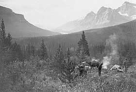 More images | |||
| Rat's Nest Cave | Bighorn No. 8 | T0L | 51°03′28″N 115°15′14″W / 51.0579°N 115.254°W | 11578 |  More images | |||
| Circle L Ranch | Near Claresholm | T0L | 50°02′01″N 113°52′37″W / 50.0337°N 113.877°W | 11615 |  | |||
| Bar U Ranch National Historic Site of Canada | PO Box 168 | Longview | T0L | 50°25′22″N 114°14′42″W / 50.4228°N 114.245°W | 11640 | More images | ||
| The Leavings at Willow Creek | Claresholm | T0L | 50°05′24″N 113°34′55″W / 50.09°N 113.582°W | 11967 |  | |||
| Territorial Court House National Historic Site of Canada | 234 23rd Street | Fort MacLeod | T0L | 49°43′28″N 113°24′25″W / 49.7244°N 113.407°W | 12566 | More images | ||
| Renwick Building | 223 - 24 Street | Fort MacLeod | T0L | 49°43′33″N 113°24′29″W / 49.7257°N 113.408°W | 13348 |  | ||
| A.G.T. Building | 232 - Centre Street | Vulcan | T0L | 50°24′12″N 113°15′50″W / 50.4032°N 113.264°W | 13372 |  | ||
| Hiebert Residence | 2102 - 24 Avenue | Didsbury | T0M | 51°39′53″N 114°08′24″W / 51.6646°N 114.14°W | 5738 |  | ||
| Canadian Pacific Railway Station | Railway Street | Didsbury | T0M | 51°39′35″N 114°07′37″W / 51.6598°N 114.127°W | 5740 | 8770 |  | |
| Stephan G. Stephanson House | near Markerville | T0M | 52°09′35″N 114°12′04″W / 52.1597°N 114.201°W | 5892 |  | |||
| Dickson Store and Site | Dickson | T0M | 52°03′27″N 114°18′40″W / 52.0574°N 114.311°W | 6557 |  | |||
| Rocky Mountain House National Historic Site of Canada | Hwy. 11A, Rocky Mountain House | T0M | 52°21′40″N 114°58′16″W / 52.361°N 114.971°W | 7827 |  More images | |||
| Markerville Creamery, The | Markerville | T0M | 52°07′25″N 114°10′19″W / 52.1236°N 114.172°W | 8453 |  | |||
| St. Anne Ranch | near Trochu | T0M | 51°48′37″N 113°13′26″W / 51.8103°N 113.224°W | 9204 |  | |||
| Nordegg National Historic Site of Canada | Clearwater County | T0M | 52°16′48″N 116°03′07″W / 52.2801°N 116.052°W | 12009 |  | |||
| Markerville Lutheran Church | Near Red Deer | T0M | 52°07′29″N 114°10′12″W / 52.1247°N 114.17°W | 13354 |  | |||
| 1880 Anglican Church of St. Paul the Apostle and the 1874 Day School | Fort Chipewyan | T0P | 58°42′33″N 111°06′58″W / 58.7093°N 111.116°W | 9088 |  | |||
| Fort Chipewyan III | Fort Chipewyan | T0P | 58°42′44″N 111°08′56″W / 58.7123°N 111.149°W | 11935 |  | |||
| Fort Chipewyan National Historic Site of Canada | Fort Chipewyan | T0P | 58°38′59″N 110°36′25″W / 58.6496°N 110.607°W | 17705 |  | |||
| Medatla Potteries | 460 - 1 Street SE | Medicine Hat | T1A | 50°01′54″N 110°39′00″W / 50.0317°N 110.65°W | 3444 |  | ||
| Cousins Residence | 271 - 1 Street SE | Medicine Hat | T1A | 50°02′21″N 110°41′02″W / 50.0393°N 110.684°W | 5916 | More images | ||
| Medicine Hat Courthouse | 460 - 1 Street SE | Medicine Hat | T1A | 50°02′27″N 110°40′48″W / 50.0407°N 110.68°W | 5918 | More images | ||
| Ewart-Duggan Residence | 443 - 1 Street SE | Medicine Hat | T1A | 50°02′24″N 110°40′48″W / 50.0401°N 110.68°W | 7515 | More images | ||
| Cypress Club | 218 - 6 Avenue SE | Medicine Hat | T1A | 50°02′24″N 110°40′34″W / 50.0401°N 110.676°W | 8486 | More images | ||
| Hycroft China Ltd. Factory | 701 - 703 Wood Street | Medicine Hat | T1A | 50°01′51″N 110°39′25″W / 50.0309°N 110.657°W | 11505 | More images | ||
| Medalta Potteries National Historic Site of Canada | 713 Medalta Avenue | Medicine Hat | T1A | 50°01′54″N 110°39′04″W / 50.0317°N 110.651°W | 12132 | | ||
| St. Patrick's Roman Catholic Church National Historic Site of Canada | 238 2nd Avenue | Medicine Hat | T1A | 50°02′43″N 110°40′52″W / 50.0453°N 110.681°W | 12913 | 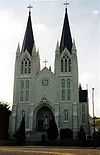 More images | ||
| Saamis Site | Medicine Hat | T1B | 50°01′01″N 110°41′46″W / 50.0169°N 110.696°W | 11513 |  | |||
| Canadian Imperial Bank of Commerce | 5227 - 48 Avenue | Taber | T1G | 49°47′05″N 112°08′42″W / 49.7846°N 112.145°W | 8761 |  | ||
| Conybeare Residence | 422 - 6 Avenue South | Lethbridge | T1J | 49°41′27″N 112°50′24″W / 49.6907°N 112.84°W | 2120 |  | ||
| Bowman Arts Centre | 811 - 5 Avenue South | Lethbridge | T1J | 49°41′36″N 112°50′04″W / 49.6933°N 112.8344°W | 2892 |  | ||
| Chinese Free Masons Building | 310 - 2 Avenue South | Lethbridge | T1J | 49°41′47″N 112°50′35″W / 49.6964°N 112.843°W | 2893 |  | ||
| Riverview C.A. Magrath House | 109 - 7 Avenue South | Lethbridge | T1J | 49°41′19″N 112°50′46″W / 49.6887°N 112.846°W | 5893 | 11074 |  | |
| Lethbridge Fire Hall No. 1 | 402 - 2 Avenue South | Lethbridge | T1J | 49°41′47″N 112°50′31″W / 49.6965°N 112.842°W | 8083 |  | ||
| Kuo Min Tang (Chinese National League) Building | 309 - 2 Avenue South | Lethbridge | T1J | 49°41′48″N 112°50′35″W / 49.6968°N 112.843°W | 8729 |  | ||
| Dr. Arthur Haig Residence | 1115 - 8 Avenue South | Lethbridge | T1J | 49°41′18″N 112°49′44″W / 49.6883°N 112.829°W | 8785 |  | ||
| W.D.L. Hardie Residence | 1242 - 5 Avenue South | Lethbridge | T1J | 49°41′35″N 112°49′34″W / 49.6931°N 112.826°W | 8786 |  | ||
| Lethbridge Canadian Pacific Railway Station | 801 - 1 Avenue South | Lethbridge | T1J | 49°41′54″N 112°50′10″W / 49.6982°N 112.836°W | 11966 |  | ||
| Tanglewood | 208 Beaver Street | Banff | T1L | 51°10′37″N 115°34′08″W / 51.177°N 115.569°W | 2204 | More images | ||
| Luxton Residence | 206 Beaver Street | Banff | T1L | 51°10′36″N 115°34′08″W / 51.1768°N 115.569°W | 2205 | More images | ||
| Beaver Lodge | 212 Beaver Street | Banff | T1L | 51°10′38″N 115°34′08″W / 51.1772°N 115.569°W | 2206 | More images | ||
| Tarry-A-While | 117 Grizzly Street | Banff | T1L | 51°10′30″N 115°33′54″W / 51.175°N 115.565°W | 2208 | More images | ||
| Dave White Block | 103 / 105 Banff Avenue | Banff | T1L | 51°10′29″N 115°34′19″W / 51.1747°N 115.572°W | 2209 | More images | ||
| Harmony Lane | 111 Banff Avenue | Banff | T1L | 51°10′30″N 115°34′19″W / 51.1751°N 115.572°W | 2211 | More images | ||
| Cave and Basin Bathing Pavilion | 311 Cave Avenue | Banff | T1L | 51°10′N 115°34′W / 51.17°N 115.57°W | 3088 | More images | ||
| Administration Building | 101 Mountain Avenue | Banff | T1L | 51°10′16″N 115°34′16″W / 51.171°N 115.571°W | 3340 | More images | ||
| Banff Springs Hotel National Historic Site of Canada | 405 Spray Avenue | Banff | T1L | 51°09′51″N 115°33′42″W / 51.1643°N 115.5618°W | 7373 | 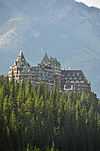 More images | ||
| Upper Hot Springs Bath House | Mountain Avenue | Banff | T1L | 51°09′03″N 115°33′40″W / 51.1508°N 115.561°W | 7379 |  More images | ||
| Cave and Basin National Historic Site of Canada | 311 Cave Avenue, 1.5 km from Bow River Bridge | Banff | T1L | 51°10′10″N 115°35′28″W / 51.1694°N 115.591°W | 7567 | 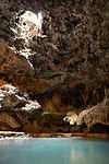 More images | ||
| Devonian Pavilion | Cascades of Time Garden, Banff National Park of Canada | Banff | T1L | 51°10′15″N 115°34′23″W / 51.1708°N 115.573°W | 9490 |  More images | ||
| Rustic Lookout Pavilion | Cascades of Time Garden, Banff National Park of Canada | Banff | T1L | 51°10′14″N 115°34′21″W / 51.1706°N 115.5726°W | 9582 |  More images | ||
| Cambrian Pavilion | Cascades of Time Garden, Banff National Park of Canada | Banff | T1L | 51°10′15″N 115°34′21″W / 51.1708°N 115.5724°W | 9586 |  More images | ||
| Upper Hot Pool Residence | Mountain Avenue | Banff | T1L | 51°09′04″N 115°33′40″W / 51.1512°N 115.561°W | 10100 |  More images | ||
| Superintendent's Residence | 313 Buffalo Street | Banff | T1L | 51°10′26″N 115°34′08″W / 51.174°N 115.569°W | 10136 | More images | ||
| Information Building | 224 Banff Avenue | Banff | T1L | 51°10′41″N 115°34′12″W / 51.178°N 115.570°W | 10941 |  More images | ||
| Banff Park Museum National Historic Site of Canada | 91 Banff Avenue | Banff | T1L | 51°10′26″N 115°34′19″W / 51.1738°N 115.572°W | 14621 | More images | ||
| Duke of Sutherland Site Complex | Brooks | T1R | 50°34′21″N 111°50′17″W / 50.5725°N 111.838°W | 5138 |  | |||
| Former Engineer's House | 50 and 54 Evergreen Park Close | Brooks | T1R | 50°33′56″N 111°54′14″W / 50.5656°N 111.904°W | 11929 |  | ||
| Clark Residence, The | 725 Macleod Trail | High River | T1V | 50°34′36″N 113°52′59″W / 50.5767°N 113.883°W | 6563 |  | ||
| Museum of the Highwood | 401 - 1 Street West | High River | T1V | 50°34′45″N 113°52′19″W / 50.5792°N 113.872°W | 6564 |  | ||
| Canmore North West Mounted Police Barracks | 609 - 8 Street | Canmore | T1W | 51°05′21″N 115°21′22″W / 51.0891°N 115.356°W | 4999 |  More images | ||
| Ralph Connor Memorial United Church | 621 - 8 Street | Canmore | T1W | 51°05′21″N 115°21′25″W / 51.0891°N 115.357°W | 10413 |  More images | ||
| Cochrane Ranche | Near Cochrane | T4C | 51°11′48″N 114°28′12″W / 51.1968°N 114.47°W | 11541 |  | |||
| Dr. Henry George Residence | 5711 - 13 51 Avenue | Innisfail | T4G | 52°01′54″N 113°57′14″W / 52.0316°N 113.954°W | 5739 |  | ||
| Flat Iron Building | 5005 - 50 Avenue | Lacombe | T4L | 52°27′47″N 113°43′52″W / 52.463°N 113.731°W | 3032 |  | ||
| Roland Michener House | 5036 - 51 Street | Lacombe | T4L | 52°27′51″N 113°43′55″W / 52.4643°N 113.732°W | 5006 |  | ||
| Urquhart Block | 4923 - 50 Avenue | Lacombe | T4L | 52°27′47″N 113°43′48″W / 52.463°N 113.73°W | 8252 |  | ||
| M and J Hardware Building | 4910 to 4912 - 50 Avenue | Lacombe | T4L | 52°27′48″N 113°43′48″W / 52.4632°N 113.73°W | 8753 |  | ||
| Campbell Block | 4922 and 4918 - 50 Avenue | Lacombe | T4L | 52°27′48″N 113°43′48″W / 52.4632°N 113.73°W | 12411 |  | ||
| Cronquist House | 4707 Fountain Drive, Bower Ponds, Great Chief Park | Red Deer | T4N | 52°16′11″N 113°49′55″W / 52.2696°N 113.832°W | 1649 |  | ||
| Canadian Pacific Railroad Bridge | Red Deer | T4N | 52°16′33″N 113°49′01″W / 52.2757°N 113.817°W | 1651 |  | |||
| Clark Residence, The | 4757 – 56 Street | Red Deer | T4N | 52°16′30″N 113°48′32″W / 52.2751°N 113.809°W | 14088 | 1652 |  | |
| Allen Bungalow | 6316 - 45 Avenue | Red Deer | T4N | 52°17′07″N 113°47′46″W / 52.2853°N 113.796°W | 1656 |  | ||
| Parsons Residence | 4801 - 49 Street | Red Deer | T4N | 52°16′05″N 113°48′32″W / 52.268°N 113.809°W | 1658 |  | ||
| Old Red Deer Court House | 4836 Ross Street | Red Deer | T4N | 52°16′09″N 113°48′40″W / 52.2693°N 113.811°W | 3445 | 1663 |  | |
| Red Deer Armoury / Fire Hall #1 | 4905 - 49 Street | Red Deer | T4N | 52°16′06″N 113°48′32″W / 52.2683°N 113.809°W | 1665 |  | ||
| Former Calgary and Edmonton Railway Station | 5102 Ross St. (or 50th St.) CPR Right of Way | Red Deer | T4N | 52°16′05″N 113°48′58″W / 52.268°N 113.816°W | 6471 |  | ||
| Normal School / Rosehaven | 4612 - 53 Street | Camrose | T4V | 53°00′55″N 112°49′59″W / 53.0152°N 112.833°W | 5005 |  | ||
| Camrose Feed Mill | 4919 - 47 Street | Camrose | T4V | 53°01′18″N 112°49′12″W / 53.0216°N 112.82°W | 5102 |  | ||
| Camrose Public Library | 4859 and 4863 - 50 Street | Camrose | T4V | 53°01′12″N 112°49′30″W / 53.02°N 112.825°W | 5135 |  | ||
| The Bailey Theatre | 5041 - 50 Street | Camrose | T4V | 53°01′24″N 112°49′30″W / 53.0233°N 112.825°W | 10818 | _1.jpg) More images | ||
| Building J-3 (Headquarters, Army Western Command) Recognized Federal Heritage Building | CFB Edmonton - Garrison | T5Y | 53°40′N 113°28′W / 53.67°N 113.47°W | 2656 |  | |||
| Holy Trinity Anglican Church | Red Deer | 13353 |  | |||||
| Fort Assiniboine National Historic Site of Canada | Fort Assiniboine | T7N | 54°20′01″N 114°46′26″W / 54.3336°N 114.774°W | 17704 |  | |||
| Fort Saskatchewan Museum | 10104 - 101 Street | Fort Saskatchewan | T8L | 53°42′48″N 113°13′01″W / 53.7133°N 113.217°W | 5103 | 8957 |  | |
| Bishop's Palace | 5 Rue St. Vital | St. Albert | T8N | 53°38′20″N 113°37′48″W / 53.6389°N 113.63°W | 4997 |  More images | ||
| Father Lacombe Church | 7 Rue St. Vital | St. Albert | T8N | 53°38′19″N 113°37′52″W / 53.6386°N 113.631°W | 5004 |  | ||
| Alberta Grain Company Grain Elevator | 4C Meadowview Drive | St. Albert | T8N | 53°37′57″N 113°38′31″W / 53.6326°N 113.642°W | 7305 |  | ||
| Alberta Wheat Pool Grain Elevator | 4B Meadowview Drive | St. Albert | T8N | 53°37′57″N 113°38′31″W / 53.6326°N 113.642°W | 10403 | .jpg) More images | ||
| Notre Dame Convent | 10010 - 101 Street | Morinville | T8R | 53°48′10″N 113°38′49″W / 53.8027°N 113.647°W | 3006 |  | ||
| St. Jean Baptiste Church and Rectory | 10034 - 100 Avenue | Morinville | T8R | 53°48′08″N 113°38′49″W / 53.8021°N 113.647°W | 5008 |  | ||
| Peace River N.A.R. Station | 9409 - 100 Street | Peace River | T8S | 56°14′22″N 117°17′35″W / 56.2394°N 117.293°W | 11390 |  | ||
| Fort Fork National Historic Site of Canada | River Lot 19, Shaftesbury Settlement | Peace River | T8S | 56°08′11″N 117°28′01″W / 56.1364°N 117.467°W | 17661 | More images | ||
| Reverend Forbes Homestead | 10424 - 96 Street | Grande Prairie | T8V | 55°10′34″N 118°46′59″W / 55.1762°N 118.783°W | 3050 |  | ||
| Grande Prairie High School | 10209 - 99 Street | Grande Prairie | T8V | 55°10′23″N 118°47′28″W / 55.173°N 118.791°W | 5000 |  | ||
| Wetaskiwin Court House | 4705 - 50 Avenue | Wetaskiwin | T9A | 52°58′07″N 113°22′01″W / 52.9687°N 113.367°W | 7552 | 5188 | More images | |
| Alberta Wheat Pool Grain Elevator Site Complex | 5209 - 47 Street | Leduc | T9E | 53°16′00″N 113°32′49″W / 53.2668°N 113.547°W | 4996 |  | ||
| Dr. Woods House | 4801 - 49 Avenue | Leduc | T9E | 53°15′49″N 113°32′53″W / 53.2636°N 113.548°W | 8804 |  | ||
| Athabasca United Church | 4817 - 48 Street | Athabasca | T9S | 54°43′08″N 113°16′59″W / 54.719°N 113.283°W | 5178 | More images | ||
| Wainwright Hotel | 202 - 10 Street | Wainwright | T9W | 52°50′02″N 110°51′40″W / 52.8339°N 110.861°W | 11129 |  | ||
| Abbot Pass Refuge Cabin National Historic Site of Canada | Banff National Park of Canada | 51°21′51″N 116°17′28″W / 51.3643°N 116.291°W | 1971 |  | ||||
| Abbot Pass Refuge Cabin | Banff National Park of Canada | 51°21′33″N 116°17′49″W / 51.3593°N 116.297°W | 1972 |  More images | ||||
| Hangar 3 | CFB Cold Lake - 4 Wing | 54°24′47″N 110°16′26″W / 54.413°N 110.274°W | 11232 |  | ||||
| Bunkhouse, Skoki Lodge | Banff National Park of Canada | 51°31′23″N 116°04′41″W / 51.5231°N 116.0781°W | 2017 |  More images | ||||
| Creek Cabin, Skoki Lodge | Banff National Park of Canada | 51°31′22″N 116°04′42″W / 51.5229°N 116.0784°W | 2018 |  More images | ||||
| Former Bathhouse, Skoki Lodge | Banff National Park of Canada | 51°31′24″N 116°04′41″W / 51.5232°N 116.0780°W | 2020 |  More images | ||||
| Honeymoon Cabin, Skoki Lodge | Banff National Park of Canada | 51°31′23″N 116°04′38″W / 51.5231°N 116.0772°W | 2021 |  More images | ||||
| Main Building, Skoki Lodge | Banff National Park of Canada | 51°31′22″N 116°04′39″W / 51.5229°N 116.0776°W | 2027 |  More images | ||||
| Wolverine Cabin, Skoki Lodge | Banff National Park of Canada | 51°31′22″N 116°04′38″W / 51.5228°N 116.0771°W | 2028 |  More images | ||||
| Wardens Cabin | Banff National Park | 51°10′26″N 115°34′23″W / 51.174°N 115.573°W | 2834 |  | ||||
| Picnic Shelter | Jasper National Park | 52°52′15″N 118°05′56″W / 52.8708°N 118.099°W | 14861 |  | ||||
| Senior Non Commissioned Officer's Building B-30 | Cold Lake | 54°24′47″N 110°16′26″W / 54.413°N 110.274°W | 2839 |  | ||||
| Halfway Hut | Banff National Park | 51°27′00″N 116°06′50″W / 51.45°N 116.114°W | 2846 |  More images | ||||
| Hay Shed | Longview | 50°25′26″N 114°14′49″W / 50.424°N 114.247°W | 2934 |  More images | ||||
| Implement Shed | Longview | 50°25′26″N 114°14′49″W / 50.424°N 114.247°W | 10469 | 11016 |  | |||
| Livestock Shed | Longview | 50°25′11″N 114°15′00″W / 50.4198°N 114.25°W | 2942 |  | ||||
| Percheron Box Stalls | Longview | 50°25′37″N 114°26′42″W / 50.427°N 114.445°W | 9835 |  | ||||
| Piggery | Longview | 50°25′11″N 114°15′00″W / 50.4198°N 114.25°W | 2945 |  | ||||
| Post Office, Building 5 | Longview | 50°25′37″N 114°26′42″W / 50.427°N 114.445°W | 2946 |  More images | ||||
| Poultry Shed, Building 21A | Longview | 50°25′11″N 114°15′00″W / 50.4198°N 114.25°W | 2947 |  | ||||
| Poultry Building 21 | Longview | 50°25′26″N 114°14′49″W / 50.424°N 114.247°W | 2948 |  | ||||
| Privy, Building 28 | Longview | 50°25′26″N 114°14′49″W / 50.424°N 114.247°W | 2949 |  | ||||
| Root Cellar, Building 13 | Longview | 50°25′26″N 114°14′49″W / 50.424°N 114.247°W | 2950 | 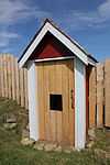 More images | ||||
| Saddle Horse Barn, Building 16 | Longview | 50°25′26″N 114°14′49″W / 50.424°N 114.247°W | 2952 |  More images | ||||
| Self Feeder, former Bunkhouse, Building 30 | Longview | 50°25′11″N 114°15′00″W / 50.4198°N 114.25°W | 2955 |  | ||||
| Abattoir | Longview | 50°25′37″N 114°26′42″W / 50.427°N 114.445°W | 2956 |  | ||||
| Storage Building 10 | Longview | 50°25′37″N 114°26′42″W / 50.427°N 114.445°W | 2957 |  More images | ||||
| Storage Building 8 | Longview | 50°25′37″N 114°26′42″W / 50.427°N 114.445°W | 2958 |  More images | ||||
| Ukrainian Pioneer Home | Elk Island National Park | 53°40′36″N 112°49′48″W / 53.6767°N 112.83°W | 3089 |  | ||||
| Coal Shed | Longview | 50°25′26″N 114°14′49″W / 50.424°N 114.247°W | 11468 |  | ||||
| Dairy Barn | Longview | 50°25′26″N 114°14′49″W / 50.424°N 114.247°W | 3107 |  More images | ||||
| Feed Mill | Longview | 50°25′26″N 114°14′49″W / 50.424°N 114.247°W | 3116 |  More images | ||||
| Pearson's House | Longview | 50°25′26″N 114°14′49″W / 50.424°N 114.247°W | 3117 |  | ||||
| Foreman’s House | Longview | 50°25′37″N 114°14′49″W / 50.427°N 114.247°W | 3118 |  More images | ||||
| Harness Shop | Longview | 50°25′26″N 114°14′49″W / 50.424°N 114.247°W | 3119 |  More images | ||||
| Blacksmith Shop | Longview | 50°25′26″N 114°14′49″W / 50.424°N 114.247°W | 3120 | 3748 |  More images | |||
| Bunkhouse and Cookhouse | Longview | 50°25′26″N 114°14′49″W / 50.424°N 114.247°W | 3121 |  More images | ||||
| Storage Building 9 | Longview | 50°25′26″N 114°14′49″W / 50.424°N 114.247°W | 3123 |  More images | ||||
| Stud Horse Barn, Building 1 | Longview | 50°25′26″N 114°14′49″W / 50.424°N 114.247°W | 3125 |  More images | ||||
| Tractor Garage, Building 7 | Longview | 50°25′11″N 114°15′00″W / 50.4198°N 114.25°W | 3127 |  More images | ||||
| Vehicle Garage, Building 35 | Longview | 50°25′11″N 114°15′00″W / 50.4198°N 114.25°W | 3128 |  | ||||
| Vehicle Garage, Building 24 | Longview | 50°25′37″N 114°14′49″W / 50.427°N 114.247°W | 3129 |  | ||||
| Work Horse Barn, Building 17 | Longview | 50°25′26″N 114°14′49″W / 50.424°N 114.247°W | 3130 |  More images | ||||
| Hangar 1 | 4 Wing Cold Lake | Cold Lake | 54°24′22″N 110°16′41″W / 54.4062°N 110.278°W | 3357 |  | |||
| Hangar 2 | 4 Wing Cold Lake | Cold Lake | 54°24′47″N 110°16′26″W / 54.413°N 110.274°W | 3358 |  | |||
| Hangar 4 | 4 Wing Cold Lake | Cold Lake | 54°24′47″N 110°16′26″W / 54.413°N 110.274°W | 3365 |  | |||
| Registration Building | Waterton Lakes National Park | 49°05′00″N 113°52′01″W / 49.0833°N 113.867°W | 3423 |  More images | ||||
| Bull Pen | Centre national de formation / National Training Centre | 52°57′46″N 118°03′29″W / 52.9629°N 118.058°W | 3464 |  | ||||
| Wardens Operational Centre, former Fish Hatchery | Jasper National Park | 52°59′00″N 118°06′00″W / 52.9833°N 118.1°W | 3483 |  | ||||
| Chalet | Jasper National Park | 52°39′58″N 117°31′01″W / 52.666°N 117.517°W | 3547 |  | ||||
| Superintendent's Residence | Elk Island National Park of Canada | 53°41′07″N 112°51′50″W / 53.6852°N 112.864°W | 3561 |  | ||||
| Pavilion | Sandy Beach | 53°41′00″N 112°49′59″W / 53.6834°N 112.833°W | 3562 |  | ||||
| RCMP Detachment Building | 202 Waterton Avenue, Waterton | 49°06′01″N 113°54′32″W / 49.1003°N 113.909°W | 3601 |  | ||||
| RCMP Detachment Garage | Waterton | 49°06′01″N 113°54′32″W / 49.1003°N 113.909°W | 3602 |  | ||||
| First Oil Well in Western Canada National Historic Site | Akamina Parkway, Waterton Lakes National Park of Canada | 49°04′16″N 113°59′13″W / 49.071°N 113.987°W | 4210 | More images | ||||
| Prince of Wales Hotel National Historic Site of Canada | Waterton Lakes National Park | 49°03′22″N 113°54′43″W / 49.0562°N 113.912°W | 4307 | 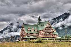 More images | ||||
| Jasper National Park of Canada, Wardens Residence No.1 | Poboktan Creek, Sunwapta Falls | 52°48′14″N 118°10′19″W / 52.804°N 118.172°W | 4387 |  | ||||
| Bitumount Site | near Fort McMurray | 57°23′11″N 111°38′46″W / 57.3865°N 111.646°W | 4998 | More images | ||||
| Stony Plain School | 5411 - 51 Street | Stony Plain | 53°31′31″N 114°00′32″W / 53.5253°N 114.009°W | 5187 |  | |||
| Walker School | Bruderheim | 53°48′13″N 112°55′41″W / 53.8036°N 112.928°W | 7300 |  | ||||
| East Gate Registration Buildings, Building 1 | Banff National Park of Canada | 51°08′06″N 115°24′25″W / 51.1349°N 115.407°W | 7380 |  | ||||
| East Gate Registration Buildings, Building 2 | Banff National Park of Canada | 51°08′06″N 115°24′25″W / 51.1349°N 115.407°W | 7381 |  | ||||
| East Gate Registration Buildings, Building 3 | Banff National Park of Canada | 51°08′06″N 115°24′25″W / 51.1349°N 115.407°W | 7382 |  More images | ||||
| Superintendent's Residence, Building 22 | Lacombe Experimental Farm, Lacombe | 52°26′55″N 113°43′19″W / 52.4486°N 113.722°W | 7516 |  | ||||
| Perrenoud Homestead | near Cochrane | 51°16′24″N 114°30′36″W / 51.2732°N 114.51°W | 8997 |  | ||||
| Hangar 6 | 4 Wing Cold Lake, Base des Forces canadiennes Cold Lake | 54°24′28″N 110°16′52″W / 54.4078°N 110.281°W | 12981 |  | ||||
| Little Heaven Warden Patrol Cabin | Jasper National Park of Canada / Parcs national du Canada Jasper | 53°23′54″N 118°33′14″W / 53.3982°N 118.554°W | 9481 |  | ||||
| Rocky Forks Warden Cabin | Jasper National Park | 52°50′42″N 117°24′07″W / 52.8451°N 117.402°W | 9484 |  | ||||
| Cuthead Warden Cabin | Banff National Park of Canada | 51°36′00″N 116°02′56″W / 51.6°N 116.049°W | 9486 |  | ||||
| Camp Parker Warden Cabin | Banff National Park | 52°09′56″N 117°02′17″W / 52.1656°N 117.038°W | 9487 |  | ||||
| Medicine Tent Warden Cabin | South Boundary Trail | Jasper | 51°29′10″N 116°14′31″W / 51.486°N 116.242°W | 9495 |  | |||
| Jacques Lake Warden Cabin Tack Shed | South Boundary Trail, Jasper National Park | 52°59′00″N 118°06′00″W / 52.9833°N 118.1°W | 9497 |  | ||||
| Fourpoint Warden Cabin | Jasper National Park | 52°59′00″N 118°06′00″W / 52.9833°N 118.1°W | 9498 |  | ||||
| Isaac Creek Warden Cabin | South Boundary Trail | Jasper | 52°59′00″N 118°06′00″W / 52.9833°N 118.1°W | 9499 |  | |||
| Topaz Warden Patrol Cabin | North Boundary Trail, Jasper National Park | 53°23′18″N 118°47′42″W / 53.3882°N 118.795°W | 9502 |  | ||||
| Central Laboratory (B-1) | Canadian Forces Base Suffield / Base des Forces canadiennes de Suffield | 50°27′40″N 110°44′35″W / 50.4612°N 110.743°W | 9587 |  | ||||
| Horse Barn, Building 1 | Sundre | 51°44′15″N 115°35′46″W / 51.7375°N 115.596°W | 9602 |  | ||||
| Ralston School (R2) | Suffield | 50°14′46″N 111°09′54″W / 50.2461°N 111.165°W | 9626 |  | ||||
| Blood Indian Hospital | 95 - 1 Avenue North | Cardston | 49°12′00″N 113°18′00″W / 49.1999°N 113.3°W | 9737 |  | |||
| Egypt Lakes Warden Cabin | Banff National Park of Canada / Parc national du Canada Banff | 51°06′N 115°54′W / 51.1°N 115.9°W | 9738 |  | ||||
| Fortune Warden Cabin | Banff National Park of Canada | 51°06′N 115°30′W / 51.1°N 115.5°W | 9739 |  | ||||
| Sandhills Wardens Cabin | Banff National Park of Canada/ Parc national du Canada Banff | 51°36′20″N 115°53′06″W / 51.6055°N 115.885°W | 9837 |  | ||||
| Clearwater Lakes Warden Cabin | Banff National Park of Canada / Parc national du Canada Banff | 51°36′00″N 116°02′56″W / 51.6°N 116.049°W | 9845 |  | ||||
| Windy Lodge Warden Cabin | Banff National Park of Canada / Parc national du Canada Banff | 51°36′N 115°40′W / 51.6°N 115.67°W | 9911 |  | ||||
| Adolphus Warden Patrol Cabin | Jasper National Park of Canada / Parc national du Canada Jasper | 53°11′02″N 119°06′32″W / 53.1839°N 119.109°W | 9958 |  | ||||
| Bryant Creek Warden Cabin | Banff National Park of Canada/ Parc national du Canada Banff | 50°31′N 115°14′W / 50.52°N 115.23°W | 10040 |  | ||||
| Divide Warden Cabin | Banff National Park of Canada/ Parc national du Canada Banff | 51°36′N 116°03′W / 51.6°N 116.05°W | 10049 |  | ||||
| Skoki Ski Lodge National Historic Site of Canada | Banff National Park | 51°31′23″N 116°04′41″W / 51.523°N 116.078°W | 2030 |  More images | ||||
| Comfort Station 1 | Waterton Lakes National Park of Canada / Parc national du Canada des Lacs-Waterton | 49°03′03″N 113°54′32″W / 49.0507°N 113.909°W | 10137 |  | ||||
| Comfort Station 2 | Waterton Lakes National Park of Canada / Parc national du Canada des Lacs-Waterton | 49°02′53″N 113°54′32″W / 49.0481°N 113.909°W | 10138 |  | ||||
| Comfort Station 6 | Waterton Lakes National Park of Canada / Parc national du Canada des Lacs-Waterton | 49°02′52″N 113°54′43″W / 49.0478°N 113.912°W | 10139 |  | ||||
| Comfort Station 8 | Waterton Lakes National Park of Canada / Parc national du Canada des Lacs-Waterton | 49°02′49″N 113°54′43″W / 49.0469°N 113.912°W | 10140 |  | ||||
| Comfort Station 9 | Waterton Lakes National Park of Canada / Parc national du Canada des Lacs-Waterton | 49°02′39″N 113°54′54″W / 49.0442°N 113.915°W | 10141 |  | ||||
| Rescue Building | Jasper | 52°52′39″N 118°04′44″W / 52.8775°N 118.079°W | 10144 |  | ||||
| Interpretive Building | Waterton Lakes National Park of Canada / Parc national du Canada des Lacs-Waterton | 49°02′55″N 113°54′29″W / 49.0485°N 113.908°W | 10146 |  | ||||
| Byng Warden Patrol Cabin | North Boundary Trail, Jasper National Park of Canada | 53°21′53″N 119°01′23″W / 53.3646°N 119.023°W | 10152 |  | ||||
| Middle Forks Warden Patrol Cabin | Jasper National Park of Canada / Parc national du Canada Jasper | 52°32′53″N 118°03′58″W / 52.548°N 118.066°W | 10153 |  | ||||
| Kitchen Shelter 7 | Waterton Lakes National Park of Canada / Parc national du Canada des Lacs-Waterton | 49°02′42″N 113°54′54″W / 49.0449°N 113.915°W | 10203 |  | ||||
| Kitchen Shelter 13 | Waterton Lakes National Park of Canada / Parc national du Canada des Lacs-Waterton | 49°02′56″N 113°54′36″W / 49.049°N 113.91°W | 10204 |  | ||||
| Kitchen Shelter 1 | Waterton Lakes National Park of Canada / Parc national du Canada des Lacs-Waterton | 49°02′51″N 113°54′32″W / 49.0476°N 113.909°W | 10205 |  | ||||
| Kitchen Shelter 2 | Waterton Lakes National Park of Canada / Parc national du Canada des Lacs-Waterton | 49°02′51″N 113°54′32″W / 49.0474°N 113.909°W | 10206 |  | ||||
| Kitchen Shelter 6 | Waterton Lakes National Park of Canada / Parc national du Canada des Lacs-Waterton | 49°02′42″N 113°54′50″W / 49.045°N 113.914°W | 10207 |  | ||||
| Kitchen Shelter 8 | Waterton Lakes National Park of Canada / Parc national du Canada des Lacs-Waterton | 49°02′47″N 113°54′50″W / 49.0465°N 113.914°W | 10208 |  | ||||
| Kitchen Shelter 9 | Waterton Lakes National Park of Canada / Parc national du Canada des Lacs-Waterton | 49°02′48″N 113°54′50″W / 49.0467°N 113.914°W | 10209 |  | ||||
| Kitchen Shelter 11 | Waterton Lakes National Park of Canada / Parc national du Canada des Lacs-Waterton | 49°02′56″N 113°54′40″W / 49.0488°N 113.911°W | 10210 |  | ||||
| Kitchen Shelter 14 | Waterton Lakes National Park of Canada / Parc national du Canada des Lacs-Waterton | 49°02′55″N 113°54′32″W / 49.0485°N 113.909°W | 10211 |  | ||||
| Saskatchewan Crossing Warden’s Residence No. 1 | Parc national du Canada Banff / Banff National Park of Canada | 51°58′24″N 116°43′30″W / 51.9734°N 116.725°W | 10236 |  More images | ||||
| Athabasca Pass National Historic Site of Canada | Jasper National Park of Canada | 52°51′48″N 118°13′30″W / 52.8632°N 118.225°W | 10499 | 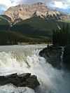 More images | ||||
| Yellowhead Pass National Historic Site of Canada | Roadside pullout, 9 km west of Jasper on Highway 16, Jasper National Park of Canada | 52°51′48″N 118°13′30″W / 52.8632°N 118.225°W | 10690 | 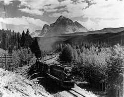 More images | ||||
| Laidlaw Antelope Trap | Near Bow Valley | 10861 |  | |||||
| Beaver River Quarry Archaeological Site | Near Fort MacKay | 10935 |  | |||||
| Fort Whoop-Up Archaeological Site | Near Lethbridge | 10972 |  | |||||
| Hoodoo Warden Cabin | Jasper National Park of Canada / Parc national du Canada Jasper | 53°15′10″N 118°53′02″W / 53.2528°N 118.884°W | 10995 |  | ||||
| Whitecourt / Woodlands Meteorite Impact Crater | Near Whitecourt | 11389 |  | |||||
| Sulphur Mountain Weather Station | Banff National Park of Canada / Parc national du Canada Banff | 51°08′41″N 115°34′30″W / 51.1447°N 115.575°W | 11395 | | ||||
| Ward Effigy Archaeological Site | Near Cluny | 11403 |  | |||||
| Women's Buffalo Jump | Near Cayley | 11515 | More images | |||||
| Eaglenest Portage Site | Near Fort MacKay | 11517 |  | |||||
| Dinosaur Egg Site | Near Warner | 11518 |  | |||||
| Baptiste River Metis Settlement Site | Near Rocky Mountain House | 11557 |  | |||||
| Buffalo Lake Metis Settlement | Near Stettler | 11558 |  | |||||
| Fort De L'Isle | Myrnam | 11562 |  | |||||
| Fort White Earth | Near Smoky Lake | 11576 |  | |||||
| Fort Vermilion | Lea Park, Near Marwayne | 11577 |  | |||||
| Sir Alexander Galt Hospital | 502 - 1 Street South | Lethbridge | 49°41′32″N 112°50′49″W / 49.6922°N 112.847°W | 11623 |  | |||
| Sulphur Mountain Cosmic Ray Station National Historic Site of Canada | Banff National Park of Canada | 51°08′46″N 115°34′41″W / 51.1461°N 115.578°W | 11747 |  More images | ||||
| Zephyr Creek Pictographs | Near Longview | 11910 |  | |||||
| Medicine Hat Clay Industries National Historic Site of Canada | 703 Wood Street SE | Medicine Hat | 50°01′53″N 110°38′53″W / 50.0314°N 110.648°W | 12133 |  | |||
| MacKenzie School | Building 83, Hickory Street | Cold Lake | 54°25′04″N 110°15′50″W / 54.4179°N 110.264°W | 13079 |  | |||
| École Voyageur | Building 82, Birch Avenue | Cold Lake | 54°25′04″N 110°15′50″W / 54.4179°N 110.264°W | 13083 |  | |||
| Brazeau Warden Cabin | South Boundary Trail, Jasper National Park of Canada / Parc national du Canada de Jasper | 52°23′47″N 117°01′37″W / 52.3964°N 117.027°W | 13123 |  | ||||
| British Block Cairn National Historic Site of Canada | Suffield | 50°36′30″N 110°35′32″W / 50.6084°N 110.5923°W | 14944 |  More images | ||||
| Notre Dame des Victoires / Lac La Biche Mission National Historic Site of Canada | Lac la Biche | 54°49′00″N 112°06′00″W / 54.8167°N 112.1°W | 15064 | More images | ||||
| Jacques Lake Warden Cabin | South Boundary Trail, Jacques Lake/ Lac Jacques | 52°59′00″N 118°06′00″W / 52.9833°N 118.1°W | 15275 |  | ||||
| Leighton House and Art Centre | Near Okotoks | 50°47′44″N 114°12′43″W / 50.7956°N 114.212°W | 15486 |  | ||||
| Crowsnest Pass Polish Hall | 1406 - 82 Street, Crowsnest Pass | Coleman | 49°37′54″N 114°29′49″W / 49.6317°N 114.497°W | 15493 |  | |||
| Edmonton Residential School | St. Albert | 53°39′09″N 113°34′19″W / 53.6525°N 113.572°W | 15527 |  | ||||
| Nordegg / Brazeau Collieries Minesite | Nordegg | 52°27′58″N 116°05′24″W / 52.466°N 116.09°W | 15529 |  More images | ||||
| Turner Valley Gas Works | Near Turner Valley | 50°40′15″N 114°16′08″W / 50.6707°N 114.269°W | 15532 |  More images | ||||
| Our Lady of the Rosary Hospital | 5406 - 47 Street | Castor | 52°13′26″N 111°54′29″W / 52.2238°N 111.908°W | 15687 |  | |||
| Alberta Government Telephones Exchange Building | 5041 A - 50 Street | Mannville | 53°20′20″N 111°10′44″W / 53.3389°N 111.179°W | 15695 |  | |||
| Majorville Cairn and Medicine Wheel | Near Bassano | 15835 |  | |||||
| Treaty Nº 7 Signing Site National Historic Site of Canada | Wheatland County | 50°47′12″N 112°53′42″W / 50.7867°N 112.895°W | 15908 | More images | ||||
| Suffield Tipi Rings National Historic Site of Canada | Cypress County | 50°12′00″N 111°10′01″W / 50.2°N 111.167°W | 16001 |  | ||||
| Doukhobor Prayer Home | 753 Kettles Street | Lundbreck | 49°35′03″N 114°09′43″W / 49.5841°N 114.162°W | 16362 |  | |||
| Donalda Creamery | Foster Street | Donalda | 52°35′10″N 112°34′34″W / 52.5861°N 112.576°W | 16522 |  | |||
| Fort Vermilion National Historic Site of Canada | Southeast corner of River Road and 45th Street | Fort Vermilion | 58°23′02″N 116°02′24″W / 58.384°N 116.04°W | 16741 | More images | |||
| Brooks Aqueduct National Historic Site of Canada | off the Trans-Canada Highway | Brooks | 50°31′54″N 111°50′17″W / 50.5318°N 111.838°W | 17702 | More images | |||
| Acadia Block | 614 (616) 3 Avenue South | Lethbridge | 49°41′44″N 112°50′17″W / 49.6956°N 112.838°W | 17904 |  | |||
| St. Monica's Anglican Church | 4910 - 53 Street | Mirror | 52°27′53″N 113°06′40″W / 52.4646°N 113.111°W | 17945 |  | |||
| St. Laurence Anglican Church | Monitor | 51°58′43″N 110°34′08″W / 51.9786°N 110.569°W | 17946 |  | ||||
| R.T. Barker Building | 232 - 24 Street | Fort MacLeod | 49°43′31″N 113°24′29″W / 49.7253°N 113.408°W | 18050 |  | |||
| Sunnyslope Sandstone Shelter | Near Didsbury | 51°40′18″N 113°36′54″W / 51.6718°N 113.615°W | 18051 |  More images | ||||
| St. Aidan and St. Hilda Anglican Church | Fallis | 53°35′07″N 114°33′58″W / 53.5853°N 114.566°W | 18322 |  | ||||
| Northern Defence Radar Station | Cold Lake | 54°26′06″N 110°10′55″W / 54.4349°N 110.182°W | 18390 |  | ||||
| Red Brick School | 2118 - 21 Avenue | Didsbury | 51°39′44″N 114°08′28″W / 51.6621°N 114.141°W | 18593 |  | |||
| West Canadian Collieries Mine | Near Crowsnest Pass - Bellevue | 49°34′38″N 114°21′54″W / 49.5772°N 114.365°W | 18807 |  | ||||
| Lethbridge Manual Training School | 811 - 5 Avenue South | Lethbridge | 49°41′36″N 112°50′10″W / 49.6933°N 112.836°W | 18864 |  | |||
| Canadian Pacific Railway Station | 200 Sentinel Road | Lake Louise | 51°25′34″N 116°10′59″W / 51.426°N 116.183°W | 4516 |  More images | |||
| Earthlodge Village National Historic Site of Canada | Siksika 146 | 19552 | More images |
See also
| Wikimedia Commons has media related to Cultural heritage monuments in Alberta. |