List of highways in Hudspeth County, Texas
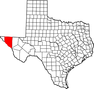
Location of Hudspeth County
The following is a list of all state highways in Hudspeth County, Texas maintained by the Texas Department of Transportation. All state highways in Texas are paved.
Interstates
| Route Name | Direction | Termini | Junctions | Length | Remarks |
|---|---|---|---|---|---|
| W/E | El Paso County to Culberson County |
73.5 miles (118.3 km)[2] | Bypasses Fort Hancock, Sierra Blanca, Allamoore |
Interstate business routes
| Route Name | Direction | Termini | Junctions | Length | Remarks |
|---|---|---|---|---|---|
| W/E | 2.7 miles (4.3 km)[3] | Sierra Blanca business loop |
U.S. highways
| Route Name | Direction | Termini | Junctions | Length | Remarks |
|---|---|---|---|---|---|
| W/E | El Paso County to Culberson County |
65.5 miles (105.4 km)[5] | Overlays US 180 | ||
| W/E | El Paso County to Culberson County |
65.5 miles (105.4 km)[5] | Overlays US 62 | ||
State highways
| Route Name | Direction | Termini | Junctions | Length | Remarks |
|---|---|---|---|---|---|
| W/E | El Paso County to |
16.3 miles (26.2 km)[8] | Passes through Acala | ||
State highway spurs
| Route Name | Direction | Termini | Junctions | Length | Remarks |
|---|---|---|---|---|---|
| W/E | 1.4 miles (2.3 km)[9] | Fort Hancock spur | |||
Farm and ranch to market roads
| Route Name | Direction | Termini | Junctions | Length | Remarks |
|---|---|---|---|---|---|
| S/N | 2.6 miles (4.2 km)[10] | ||||
| S/N | Ranch Road along Rio Grande |
25.4 miles (40.9 km)[11] | Passes through Esperanza, Fort Quitman | ||
| S/N | 0.9 miles (1.4 km)[12] | ||||
| S/N | Indian Hot Springs Road and Cowan Road to |
47.0 miles (75.6 km)[13] | |||
| S/N | CR 2025 |
16.4 miles (26.4 km)[14] | |||
| S/N | Otero County, New Mexico local road |
23.9 miles (38.5 km)[15] | |||
| S/N | 1.3 miles (2.1 km)[16] | ||||
| W/E | CR 2009 and CR 2030 to |
5.1 miles (8.2 km)[17] | |||
| W/E | 12.3 miles (19.8 km)[18] |
Historic roads
| Route Name | Direction | Termini | Remarks |
|---|---|---|---|
| W/E | El Paso County Culberson County |
Replaced by I-10, SH 20, and Bus. I-10-C in 1991 | |
| W/E | El Paso County Culberson County |
Replaced by US 80 in 1939 | |
| W/E | El Paso County Culberson County |
Replaced by US 62 in 1939 |
Adjacent counties
- New Mexico (north)
- Culberson County (east)
- Jeff Davis County (southeast)
- Mexico (south)
- El Paso County (west)
References
- ↑ Transportation Planning and Programming Division. "I No. 10". Highway Designation Files. Texas Department of Transportation. Retrieved 2009-10-09.
- ↑ Map of I-10 in Hudspeth County (Map). Google Maps. Retrieved 2009-10-10.
- ↑ 3.0 3.1 Texas Department of Transportation, "Highway Designation File - Business Interstate Highway No. 10-C". Retrieved 2009-10-09
- ↑ Transportation Planning and Programming Division. "U.S. Highway No. 62". Highway Designation Files. Texas Department of Transportation. Retrieved 2009-10-09.
- ↑ 5.0 5.1 Map of US 62 and US 180 in Hudspeth County (Map). Google Maps. Retrieved 2009-10-10.
- ↑ Transportation Planning and Programming Division. "U.S. Highway No. 180". Highway Designation Files. Texas Department of Transportation. Retrieved 2009-10-09.
- ↑ Transportation Planning and Programming Division. "State Highway No. 20". Highway Designation Files. Texas Department of Transportation. Retrieved 2009-10-09.
- ↑ Map of SH 20 in Hudspeth County (Map). Google Maps. Retrieved 2009-10-10.
- ↑ 9.0 9.1 Transportation Planning and Programming Division. "State Highway Spur No. 148". Highway Designation Files. Texas Department of Transportation. Retrieved 2009-10-09.
- ↑ 10.0 10.1 Transportation Planning and Programming Division. "Farm to Market Road No. 34". Highway Designation Files. Texas Department of Transportation. Retrieved 2009-10-09.
- ↑ 11.0 11.1 Transportation Planning and Programming Division. "Farm to Market Road No. 192". Highway Designation Files. Texas Department of Transportation. Retrieved 2009-10-09.
- ↑ 12.0 12.1 Transportation Planning and Programming Division. "Farm to Market Road No. 1088". Highway Designation Files. Texas Department of Transportation. Retrieved 2009-10-09.
- ↑ 13.0 13.1 Transportation Planning and Programming Division. "Ranch to Market Road No. 1111". Highway Designation Files. Texas Department of Transportation. Retrieved 2009-10-09.
- ↑ 14.0 14.1 Transportation Planning and Programming Division. "Farm to Market Road No. 1437". Highway Designation Files. Texas Department of Transportation. Retrieved 2009-10-09.
- ↑ 15.0 15.1 Transportation Planning and Programming Division. "Farm to Market Road No. 1576". Highway Designation Files. Texas Department of Transportation. Retrieved 2009-10-09.
- ↑ 16.0 16.1 Transportation Planning and Programming Division. "Farm to Market Road No. 2217". Highway Designation Files. Texas Department of Transportation. Retrieved 2009-10-09.
- ↑ 17.0 17.1 Transportation Planning and Programming Division. "Farm to Market Road No. 2249". Highway Designation Files. Texas Department of Transportation. Retrieved 2009-10-09.
- ↑ 18.0 18.1 Transportation Planning and Programming Division. "Ranch to Market Road No. 2317". Highway Designation Files. Texas Department of Transportation. Retrieved 2009-10-09.
- ↑ Transportation Planning and Programming Division. "U.S. Highway No. 80". Highway Designation Files. Texas Department of Transportation.
- ↑ 20.0 20.1 20.2 Texas State Library and Archives Commission, "Official Map of the Highway System of Texas", 15 June 1933