List of airports in Bhutan
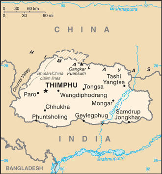
Map of Bhutan
This is a list of airports in Bhutan, sorted by location.
Bhutan, officially the Kingdom of Bhutan, is a landlocked country in South Asia, located at the eastern end of the Himalaya Mountains and bordered to the south, east and west by the Republic of India and to the north by Tibet. Bhutan was separated from the nearby state of Nepal to the west by the Indian state of Sikkim, and from Bangladesh to the south by West Bengal. The capital city is Thimphu.
Airports
Airport names shown in bold have scheduled passenger service on commercial airlines.
| Location | ICAO | IATA | Airport name | Coordinates | Runway | Elev. |
|---|---|---|---|---|---|---|
| Paro | VQPR | PBH | Paro Airport | 27°24′11″N 089°25′28″E / 27.40306°N 89.42444°E | 15/33: 1964 x 29 m, Asphalt | 2235 m |
| Trashigang | VQTY | YON | Yongphulla Airport (Yonphula Airport) | 27°15′22″N 091°30′53″E / 27.25611°N 91.51472°E | 12/30: 1266 x 37 m, Asphalt | 2743 m |
| Jakar | VQBT | BUT | Bathpalathang Airport (Bumthang Airport) | 27°33′50″N 090°44′50″E / 27.56389°N 90.74722°E | 14/33: 1200 m, Asphalt | 2473 m |
| Gelephu | VQGP | GLU | Gelephu Airport | 26°53′04″N 090°27′50″E / 26.88444°N 90.46389°E | 11/29: 1500 m, Asphalt | 290 m |
Bagdogra Airport (26°40′52″N 088°19′43″E / 26.68111°N 88.32861°E) in neighbouring India is also accessible for flights to Bhutan.
See also
References
- "ICAO Location Indicators by State" (PDF). International Civil Aviation Organization. 17 September 2010.
- "UN Location Codes: Bhutan (includes IATA codes)". UN/LOCODE 2011-2. UNECE. 28 February 2012.
- Airports in Bhutan World Aero Data
- Airports in Bhutan Great Circle Mapper
- Airports in Bhutan FallingRain.com
| ||||||||||
| ||||||||||||||