List of United States cities by population
| Population tables of U.S. cities |
|---|
 |
| Cities |
| Urban areas |
| Populous cities and metropolitan areas |
| Metropolitan areas |
| Megaregions |
The following is a list of the most populous incorporated places of the United States. As defined by the United States Census Bureau, an "incorporated place" includes a variety of designations, including city, town, village, borough, and municipality.[1] A few exceptional Census Designated Places (CDPs) are also included in the Census Bureau's listing of incorporated places.[2] Consolidated city-counties represent a distinct type of government that includes the entire population of a county, or county equivalent. Some consolidated city-counties, however, include multiple incorporated places. This list presents only that portion (or "balance") of such consolidated city-counties that are not a part of another incorporated place.
This list refers only to the population of individual municipalities within their defined limits, which does not include other municipalities or unincorporated suburban areas within urban agglomerations. A different ranking is evident when considering U.S. metropolitan area populations.
United States

The following table lists the 295 incorporated places in the United States with a population of at least 100,000 on July 1, 2013, as estimated by the United States Census Bureau. A city is displayed in bold if it is a state or federal capital, and in italics if it is the largest city in the state. Five states—Delaware, Maine, Vermont, West Virginia and Wyoming—do not have cities with populations of 100,000 or more. The table below contains the following information:
- The city rank by population as of July 1, 2013, as estimated by the United States Census Bureau[3]
- The city name[3]
- The name of the state in which the city lies[3]
- The city population as of July 1, 2013, as estimated by the United States Census Bureau[3]
- The city population as of April 1, 2010, as enumerated by the 2010 United States Census[3]
- The city percent population change from April 1, 2010, to July 1, 2013
- The city land area as of January 1, 2013[4]
- The city population density as of July 1, 2013 (residents per unit of land area)[4]
- The city latitude and longitude coordinates
| 2013 rank | City | State[5] | 2013 estimate | 2010 Census | Change | 2013 land area | 2013 population density | Location |
|---|---|---|---|---|---|---|---|---|
| 1 | New York[6] | New York | 8,405,837 | 8,175,133 | +2.82% | 302.6 sq mi 783.8 km2 |
27,012 per sq mi 10,430 km−2 |
40°39′51″N 73°56′19″W / 40.6643°N 73.9385°W |
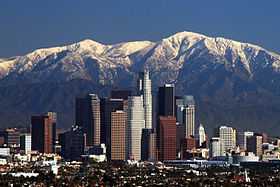
| 2 | Los Angeles | California | 3,884,307 | 3,792,621 | +2.42% | 468.7 sq mi 1,213.9 km2 |
8,092 per sq mi 3,124 km−2 |
34°01′10″N 118°24′39″W / 34.0194°N 118.4108°W |
| 3 | Chicago | Illinois | 2,718,782 | 2,695,598 | +0.86% | 227.6 sq mi 589.6 km2 |
11,842 per sq mi 4,572 km−2 |
41°50′15″N 87°40′54″W / 41.8376°N 87.6818°W |
| 4 | Houston[7] | Texas | 2,195,914 | 2,100,263 | +4.55% | 599.6 sq mi 1,552.9 km2 |
3,501 per sq mi 1,352 km−2 |
29°46′50″N 95°23′11″W / 29.7805°N 95.3863°W |
| 5 | Philadelphia[8] | Pennsylvania | 1,553,165 | 1,526,006 | +1.78% | 134.1 sq mi 347.3 km2 |
11,379 per sq mi 4,394 km−2 |
40°00′34″N 75°08′00″W / 40.0094°N 75.1333°W |
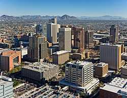
| 6 | Phoenix | Arizona | 1,513,367 | 1,445,632 | +4.69% | 516.7 sq mi 1,338.3 km2 |
2,798 per sq mi 1,080 km−2 |
33°34′20″N 112°05′17″W / 33.5722°N 112.0880°W |
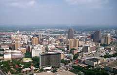
| 7 | San Antonio | Texas | 1,409,019 | 1,327,407 | +6.15% | 460.9 sq mi 1,193.8 km2 |
2,880 per sq mi 1,112 km−2 |
29°28′21″N 98°31′30″W / 29.4724°N 98.5251°W |
| 8 | San Diego | California | 1,355,896 | 1,307,402 | +3.71% | 325.2 sq mi 842.2 km2 |
4,020 per sq mi 1,552 km−2 |
32°48′55″N 117°08′06″W / 32.8153°N 117.1350°W |
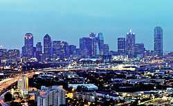
| 9 | Dallas | Texas | 1,257,676 | 1,197,816 | +5.00% | 340.5 sq mi 881.9 km2 |
3,518 per sq mi 1,358 km−2 |
32°46′33″N 96°47′48″W / 32.7757°N 96.7967°W |
| 10 | San Jose | California | 998,537 | 945,942 | +5.56% | 176.5 sq mi 457.2 km2 |
5,359 per sq mi 2,069 km−2 |
37°17′49″N 121°49′09″W / 37.2969°N 121.8193°W |
| 11 | Austin | Texas | 885,400 | 790,390 | +12.02% | 297.9 sq mi 771.5 km2 |
2,653 per sq mi 1,024 km−2 |
30°18′26″N 97°45′22″W / 30.3072°N 97.7560°W |
| 12 | Indianapolis[9] | Indiana | 843,393 | 820,445 | +2.80% | 361.4 sq mi 936.1 km2 |
2,270 per sq mi 876 km−2 |
39°46′36″N 86°08′45″W / 39.7767°N 86.1459°W |
| 13 | Jacksonville[10] | Florida | 842,583 | 821,784 | +2.53% | 747.0 sq mi 1,934.7 km2 |
1,120 per sq mi 433 km−2 |
30°20′13″N 81°39′41″W / 30.3370°N 81.6613°W |
| 14 | San Francisco[11] | California | 837,442 | 805,235 | +4.00% | 46.9 sq mi 121.4 km2 |
17,179 per sq mi 6,633 km−2 |
37°46′30″N 122°25′09″W / 37.7751°N 122.4193°W |
| 15 | Columbus | Ohio | 822,553 | 787,033 | +4.51% | 217.2 sq mi 562.5 km2 |
3,624 per sq mi 1,399 km−2 |
39°59′05″N 82°59′06″W / 39.9848°N 82.9850°W |
| 16 | Charlotte | North Carolina | 792,862 | 731,424 | +8.40% | 297.7 sq mi 771.0 km2 |
2,457 per sq mi 949 km−2 |
35°12′31″N 80°49′51″W / 35.2087°N 80.8307°W |
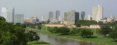
| 17 | Fort Worth | Texas | 792,727 | 741,206 | +6.95% | 339.8 sq mi 880.1 km2 |
2,181 per sq mi 842 km−2 |
32°46′46″N 97°20′47″W / 32.7795°N 97.3463°W |
| 18 | Detroit | Michigan | 688,701 | 713,777 | −3.51% | 138.8 sq mi 359.4 km2 |
5,144 per sq mi 1,986 km−2 |
42°22′59″N 83°06′08″W / 42.3830°N 83.1022°W |
| 19 | El Paso | Texas | 674,433 | 649,121 | +3.90% | 255.2 sq mi 661.1 km2 |
2,543 per sq mi 982 km−2 |
31°50′54″N 106°25′37″W / 31.8484°N 106.4270°W |
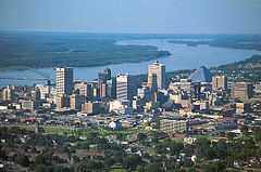
| 20 | Memphis | Tennessee | 653,450 | 646,889 | +1.01% | 315.1 sq mi 816.0 km2 |
2,053 per sq mi 793 km−2 |
35°06′13″N 89°58′43″W / 35.1035°N 89.9785°W |
| 21 | Seattle | Washington | 652,405 | 608,660 | +7.19% | 83.9 sq mi 217.4 km2 |
7,251 per sq mi 2,800 km−2 |
47°37′14″N 122°21′03″W / 47.6205°N 122.3509°W |
| 22 | Denver[12] | Colorado | 649,495 | 600,158 | +8.22% | 153.0 sq mi 396.3 km2 |
3,923 per sq mi 1,515 km−2 |
39°45′42″N 104°52′50″W / 39.7618°N 104.8806°W |
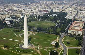
| 23 | Washington[13] | District of Columbia | 646,449 | 601,723 | +7.43% | 61.0 sq mi 158.1 km2 |
9,856 per sq mi 3,806 km−2 |
38°54′15″N 77°01′02″W / 38.9041°N 77.0171°W |
| 24 | Boston | Massachusetts | 645,966 | 617,594 | +4.59% | 48.3 sq mi 125.0 km2 |
12,793 per sq mi 4,939 km−2 |
42°19′55″N 71°01′13″W / 42.3320°N 71.0202°W |
| 25 | Nashville[14] | Tennessee | 634,464 | 601,222 | +5.53% | 475.1 sq mi 1,230.8 km2 |
1,265 per sq mi 489 km−2 |
36°10′18″N 86°47′06″W / 36.1718°N 86.7850°W |
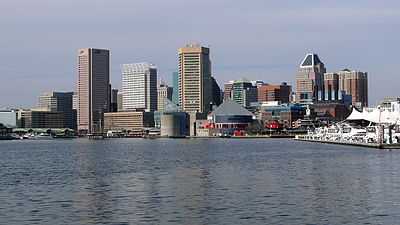
| 26 | Baltimore[15] | Maryland | 622,104 | 620,961 | +0.18% | 80.9 sq mi 209.6 km2 |
7,672 per sq mi 2,962 km−2 |
39°18′01″N 76°36′38″W / 39.3002°N 76.6105°W |
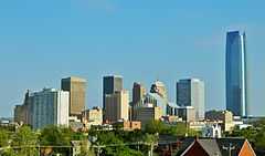
| 27 | Oklahoma City | Oklahoma | 610,613 | 579,999 | +5.28% | 606.4 sq mi 1,570.6 km2 |
956 per sq mi 369 km−2 |
35°28′02″N 97°30′49″W / 35.4671°N 97.5137°W |
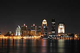
| 28 | Louisville[16] | Kentucky | 609,893 | 597,337 | +2.10% | 325.2 sq mi 842.4 km2 |
1,837 per sq mi 709 km−2 |
38°10′41″N 85°40′00″W / 38.1781°N 85.6667°W |
| 29 | Portland | Oregon | 609,456 | 583,776 | +4.40% | 133.4 sq mi 345.6 km2 |
4,375 per sq mi 1,689 km−2 |
45°32′13″N 122°39′00″W / 45.5370°N 122.6500°W |
| 30 | Las Vegas | Nevada | 603,488 | 583,756 | +3.38% | 135.8 sq mi 351.8 km2 |
4,298 per sq mi 1,660 km−2 |
36°13′40″N 115°15′50″W / 36.2277°N 115.2640°W |
| 31 | Milwaukee | Wisconsin | 599,164 | 594,833 | +0.73% | 96.1 sq mi 249.0 km2 |
6,188 per sq mi 2,389 km−2 |
43°03′48″N 87°58′00″W / 43.0633°N 87.9667°W |
| 32 | Albuquerque | New Mexico | 556,495 | 545,852 | +1.95% | 187.7 sq mi 486.2 km2 |
2,908 per sq mi 1,123 km−2 |
35°06′20″N 106°38′51″W / 35.1056°N 106.6474°W |
| 33 | Tucson | Arizona | 526,116 | 520,116 | +1.15% | 226.7 sq mi 587.2 km2 |
2,294 per sq mi 886 km−2 |
32°09′15″N 110°52′16″W / 32.1543°N 110.8711°W |
| 34 | Fresno | California | 509,924 | 494,665 | +3.08% | 112.0 sq mi 290.0 km2 |
4,418 per sq mi 1,706 km−2 |
36°46′58″N 119°47′40″W / 36.7827°N 119.7945°W |
| 35 | Sacramento | California | 479,686 | 466,488 | +2.83% | 97.9 sq mi 253.6 km2 |
4,764 per sq mi 1,839 km−2 |
38°34′00″N 121°28′07″W / 38.5666°N 121.4686°W |
| 36 | Long Beach | California | 469,428 | 462,257 | +1.55% | 50.3 sq mi 130.3 km2 |
9,191 per sq mi 3,549 km−2 |
33°48′33″N 118°09′19″W / 33.8091°N 118.1553°W |
| 37 | Kansas City | Missouri | 467,007 | 459,787 | +1.57% | 315.0 sq mi 815.7 km2 |
1,460 per sq mi 564 km−2 |
39°07′31″N 94°33′04″W / 39.1252°N 94.5511°W |
| 38 | Mesa | Arizona | 457,587 | 439,041 | +4.22% | 136.5 sq mi 353.4 km2 |
3,218 per sq mi 1,242 km−2 |
33°24′07″N 111°43′03″W / 33.4019°N 111.7174°W |
| 39 | Virginia Beach[15] | Virginia | 448,479 | 437,994 | +2.39% | 249.0 sq mi 644.9 km2 |
1,759 per sq mi 679 km−2 |
36°46′45″N 76°01′26″W / 36.7793°N 76.0240°W |
| 40 | Atlanta | Georgia | 447,841 | 420,003 | +6.63% | 133.2 sq mi 344.9 km2 |
3,154 per sq mi 1,218 km−2 |
33°45′46″N 84°25′22″W / 33.7629°N 84.4227°W |
| 41 | Colorado Springs | Colorado | 439,886 | 416,427 | +5.63% | 194.5 sq mi 503.9 km2 |
2,141 per sq mi 826 km−2 |
38°52′02″N 104°45′39″W / 38.8673°N 104.7607°W |
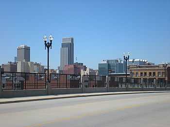
| 42 | Omaha | Nebraska | 434,353 | 408,958 | +6.21% | 127.1 sq mi 329.2 km2 |
3,218 per sq mi 1,242 km−2 |
41°15′53″N 96°02′31″W / 41.2647°N 96.0419°W |
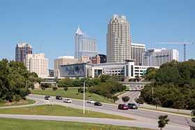
| 43 | Raleigh | North Carolina | 431,746 | 403,892 | +6.90% | 142.9 sq mi 370.1 km2 |
2,826 per sq mi 1,091 km−2 |
35°49′49″N 78°38′29″W / 35.8302°N 78.6414°W |
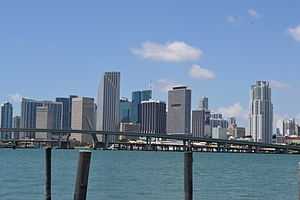
| 44 | Miami | Florida | 417,650 | 399,457 | +4.55% | 35.9 sq mi 92.9 km2 |
11,539 per sq mi 4,455 km−2 |
25°46′31″N 80°12′31″W / 25.7752°N 80.2086°W |
| 45 | Oakland | California | 406,253 | 390,724 | +3.97% | 55.8 sq mi 144.5 km2 |
7,004 per sq mi 2,704 km−2 |
37°46′12″N 122°13′32″W / 37.7699°N 122.2256°W |
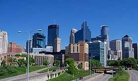
| 46 | Minneapolis | Minnesota | 400,070 | 382,578 | +4.57% | 54.0 sq mi 139.8 km2 |
7,088 per sq mi 2,737 km−2 |
44°57′48″N 93°16′06″W / 44.9633°N 93.2683°W |
| 47 | Tulsa | Oklahoma | 398,121 | 391,906 | +1.59% | 196.8 sq mi 509.6 km2 |
1,992 per sq mi 769 km−2 |
36°07′40″N 95°54′08″W / 36.1279°N 95.9023°W |
| 48 | Cleveland | Ohio | 390,113 | 396,815 | −1.69% | 77.7 sq mi 201.2 km2 |
5,107 per sq mi 1,972 km−2 |
41°28′41″N 81°40′46″W / 41.4781°N 81.6795°W |
| 49 | Wichita | Kansas | 386,552 | 382,368 | +1.09% | 159.3 sq mi 412.6 km2 |
2,400 per sq mi 927 km−2 |
37°41′27″N 97°20′34″W / 37.6907°N 97.3427°W |
| 50 | Arlington | Texas | 379,577 | 365,438 | +3.87% | 95.9 sq mi 248.3 km2 |
3,811 per sq mi 1,472 km−2 |
32°42′03″N 97°07′29″W / 32.7007°N 97.1247°W |
| 51 | New Orleans[17] | Louisiana | 378,715 | 343,829 | +10.15% | 169.4 sq mi 438.8 km2 |
2,029 per sq mi 784 km−2 |
30°04′07″N 89°56′20″W / 30.0686°N 89.9390°W |
| 52 | Bakersfield | California | 363,630 | 347,483 | +4.65% | 142.2 sq mi 368.2 km2 |
2,444 per sq mi 944 km−2 |
35°19′16″N 119°01′06″W / 35.3212°N 119.0183°W |
| 53 | Tampa | Florida | 352,957 | 335,709 | +5.14% | 113.4 sq mi 293.7 km2 |
3,077 per sq mi 1,182 km−2 |
27°58′12″N 82°28′47″W / 27.9701°N 82.4797°W |
| 54 | Honolulu[2] | Hawai'i | 347,884 | 337,256 | +3.15% | 60.5 sq mi 156.7 km2 |
5,573 per sq mi 2,152 km−2 |
21°19′33″N 157°50′43″W / 21.3259°N 157.8453°W |
| 55 | Aurora | Colorado | 345,803 | 325,078 | +6.38% | 154.1 sq mi 369.1 km2 |
2,110 per sq mi 881 km−2 |
39°42′30″N 104°49′25″W / 39.7082°N 104.8235°W |
| 56 | Anaheim | California | 345,012 | 336,265 | +2.60% | 49.8 sq mi 129.1 km2 |
6,748 per sq mi 2,605 km−2 |
33°51′20″N 117°45′36″W / 33.8555°N 117.7601°W |
| 57 | Santa Ana | California | 334,227 | 324,528 | +2.99% | 27.3 sq mi 70.6 km2 |
11,901 per sq mi 4,595 km−2 |
33°44′11″N 117°52′57″W / 33.7365°N 117.8826°W |
| 58 | St. Louis[15] | Missouri | 318,416 | 319,294 | −0.27% | 61.9 sq mi 160.3 km2 |
5,157 per sq mi 1,991 km−2 |
38°38′09″N 90°14′41″W / 38.6357°N 90.2446°W |
| 59 | Riverside | California | 316,619 | 303,871 | +4.20% | 81.1 sq mi 210.2 km2 |
3,745 per sq mi 1,446 km−2 |
33°56′17″N 117°23′36″W / 33.9381°N 117.3932°W |
| 60 | Corpus Christi | Texas | 316,381 | 305,215 | +3.66% | 160.6 sq mi 416.0 km2 |
1,900 per sq mi 734 km−2 |
27°45′15″N 97°10′24″W / 27.7543°N 97.1734°W |
| 61 | Lexington[18] | Kentucky | 308,428 | 295,803 | +4.27% | 283.6 sq mi 734.6 km2 |
1,043 per sq mi 403 km−2 |
38°02′25″N 84°27′30″W / 38.0402°N 84.4584°W |
| 62 | Pittsburgh | Pennsylvania | 305,841 | 305,704 | +0.04% | 55.4 sq mi 143.4 km2 |
5,521 per sq mi 2,132 km−2 |
40°26′23″N 79°58′36″W / 40.4398°N 79.9766°W |
| 63 | Anchorage[19] | Alaska | 300,950 | 291,826 | +3.13% | 1,704.7 sq mi 4,415.1 km2 |
171 per sq mi 66 km−2 |
61°13′03″N 149°53′43″W / 61.2176°N 149.8953°W |
| 64 | Stockton | California | 298,118 | 291,707 | +2.20% | 61.7 sq mi 159.7 km2 |
4,730 per sq mi 1,826 km−2 |
37°58′35″N 121°18′48″W / 37.9763°N 121.3133°W |
| 65 | Cincinnati | Ohio | 297,517 | 296,943 | +0.19% | 77.9 sq mi 201.9 km2 |
3,810 per sq mi 1,471 km−2 |
39°08′24″N 84°30′23″W / 39.1399°N 84.5064°W |
| 66 | Saint Paul | Minnesota | 294,873 | 285,068 | +3.44% | 52.0 sq mi 134.6 km2 |
5,484 per sq mi 2,118 km−2 |
44°56′56″N 93°06′14″W / 44.9489°N 93.1039°W |
| 67 | Toledo | Ohio | 282,313 | 287,208 | −1.70% | 80.7 sq mi 209.0 km2 |
3,559 per sq mi 1,374 km−2 |
41°39′51″N 83°34′55″W / 41.6641°N 83.5819°W |
| 68 | Greensboro | North Carolina | 279,639 | 269,666 | +3.70% | 126.5 sq mi 327.7 km2 |
2,131 per sq mi 823 km−2 |
36°05′47″N 79°49′38″W / 36.0965°N 79.8271°W |
| 69 | Newark | New Jersey | 278,427 | 277,140 | +0.46% | 24.2 sq mi 62.6 km2 |
11,458 per sq mi 4,424 km−2 |
40°43′27″N 74°10′21″W / 40.7242°N 74.1726°W |
| 70 | Plano | Texas | 274,409 | 259,841 | +5.61% | 71.6 sq mi 185.4 km2 |
3,630 per sq mi 1,402 km−2 |
33°03′03″N 96°44′52″W / 33.0508°N 96.7479°W |
| 71 | Henderson | Nevada | 270,811 | 257,729 | +5.08% | 107.7 sq mi 279.0 km2 |
2,392 per sq mi 924 km−2 |
36°00′44″N 115°02′15″W / 36.0122°N 115.0375°W |
| 72 | Lincoln | Nebraska | 268,738 | 258,379 | +4.01% | 89.1 sq mi 230.8 km2 |
2,899 per sq mi 1,119 km−2 |
40°48′32″N 96°40′49″W / 40.8090°N 96.6804°W |
| 73 | Buffalo | New York | 258,959 | 261,310 | −0.90% | 40.4 sq mi 104.6 km2 |
6,471 per sq mi 2,498 km−2 |
42°53′33″N 78°51′35″W / 42.8925°N 78.8597°W |
| 74 | Jersey City | New Jersey | 257,342 | 247,597 | +3.94% | 14.8 sq mi 38.3 km2 |
16,737 per sq mi 6,462 km−2 |
40°42′41″N 74°03′53″W / 40.7114°N 74.0648°W |
| 75 | Chula Vista | California | 256,780 | 243,916 | +5.27% | 49.6 sq mi 128.5 km2 |
4,915 per sq mi 1,898 km−2 |
32°37′40″N 117°00′55″W / 32.6277°N 117.0152°W |
| 76 | Fort Wayne | Indiana | 256,496 | 253,691 | +1.11% | 110.6 sq mi 286.5 km2 |
2,293 per sq mi 885 km−2 |
41°05′18″N 85°08′38″W / 41.0882°N 85.1439°W |
| 77 | Orlando | Florida | 255,483 | 238,300 | +7.21% | 102.4 sq mi 265.2 km2 |
2,327 per sq mi 899 km−2 |
28°24′57″N 81°17′56″W / 28.4159°N 81.2988°W |
| 78 | St. Petersburg | Florida | 249,688 | 244,769 | +2.01% | 61.7 sq mi 159.9 km2 |
3,964 per sq mi 1,531 km−2 |
27°45′43″N 82°38′39″W / 27.7620°N 82.6441°W |
| 79 | Chandler | Arizona | 249,146 | 236,123 | +5.52% | 64.4 sq mi 166.8 km2 |
3,666 per sq mi 1,415 km−2 |
33°16′58″N 111°51′18″W / 33.2829°N 111.8549°W |
| 80 | Laredo | Texas | 248,142 | 236,091 | +5.10% | 88.9 sq mi 230.3 km2 |
2,655 per sq mi 1,025 km−2 |
27°32′52″N 99°29′13″W / 27.5477°N 99.4869°W |
| 81 | Norfolk[15] | Virginia | 246,139 | 242,803 | +1.37% | 54.1 sq mi 140.2 km2 |
4,486 per sq mi 1,732 km−2 |
36°55′23″N 76°14′41″W / 36.9230°N 76.2446°W |
| 82 | Durham | North Carolina | 245,475 | 228,330 | +7.51% | 107.4 sq mi 278.1 km2 |
2,127 per sq mi 821 km−2 |
35°58′52″N 78°54′20″W / 35.9810°N 78.9056°W |
| 83 | Madison | Wisconsin | 243,344 | 233,209 | +4.35% | 76.8 sq mi 198.9 km2 |
3,037 per sq mi 1,173 km−2 |
43°05′16″N 89°25′48″W / 43.0878°N 89.4301°W |
| 84 | Lubbock | Texas | 239,538 | 229,573 | +4.34% | 122.4 sq mi 317.0 km2 |
1,875 per sq mi 724 km−2 |
33°33′59″N 101°53′12″W / 33.5665°N 101.8867°W |
| 85 | Irvine | California | 236,716 | 212,375 | +11.46% | 66.1 sq mi 171.2 km2 |
3,213 per sq mi 1,240 km−2 |
33°40′42″N 117°46′17″W / 33.6784°N 117.7713°W |
| 86 | Winston–Salem | North Carolina | 236,441 | 229,617 | +2.97% | 132.4 sq mi 343.0 km2 |
1,734 per sq mi 669 km−2 |
36°06′12″N 80°15′38″W / 36.1033°N 80.2606°W |
| 87 | Glendale | Arizona | 234,632 | 226,721 | +3.49% | 60.0 sq mi 155.3 km2 |
3,780 per sq mi 1,460 km−2 |
33°31′59″N 112°11′24″W / 33.5331°N 112.1899°W |
| 88 | Garland | Texas | 234,566 | 226,876 | +3.39% | 57.1 sq mi 147.8 km2 |
3,974 per sq mi 1,535 km−2 |
32°54′35″N 96°37′49″W / 32.9098°N 96.6304°W |
| 89 | Hialeah | Florida | 233,394 | 224,669 | +3.88% | 21.5 sq mi 55.6 km2 |
10,474 per sq mi 4,044 km−2 |
25°52′12″N 80°18′10″W / 25.8699°N 80.3029°W |
| 90 | Reno | Nevada | 233,294 | 225,221 | +3.58% | 103.0 sq mi 266.8 km2 |
2,186 per sq mi 844 km−2 |
39°28′28″N 119°46′35″W / 39.4745°N 119.7765°W |
| 91 | Chesapeake[15] | Virginia | 230,571 | 222,209 | +3.76% | 340.8 sq mi 882.7 km2 |
652 per sq mi 252 km−2 |
36°40′46″N 76°18′06″W / 36.6794°N 76.3018°W |
| 92 | Gilbert[20] | Arizona | 229,972 | 208,453 | +10.32% | 68.0 sq mi 176.0 km2 |
3,067 per sq mi 1,184 km−2 |
33°18′37″N 111°44′32″W / 33.3102°N 111.7422°W |
| 93 | Baton Rouge[21] | Louisiana | 229,426 | 229,493 | −0.03% | 76.9 sq mi 199.3 km2 |
2,982 per sq mi 1,152 km−2 |
30°26′55″N 91°07′33″W / 30.4485°N 91.1259°W |
| 94 | Irving | Texas | 228,653 | 216,290 | +5.72% | 67.0 sq mi 173.6 km2 |
3,227 per sq mi 1,246 km−2 |
32°51′28″N 96°58′12″W / 32.8577°N 96.9700°W |
| 95 | Scottsdale | Arizona | 226,918 | 217,385 | +4.39% | 183.9 sq mi 476.4 km2 |
1,182 per sq mi 456 km−2 |
33°40′07″N 111°49′25″W / 33.6687°N 111.8237°W |
| 96 | North Las Vegas | Nevada | 226,877 | 216,961 | +4.57% | 101.3 sq mi 262.5 km2 |
2,141 per sq mi 827 km−2 |
36°16′59″N 115°05′21″W / 36.2830°N 115.0893°W |
| 97 | Fremont | California | 224,922 | 214,089 | +5.06% | 77.5 sq mi 200.6 km2 |
2,764 per sq mi 1,067 km−2 |
37°29′40″N 121°56′28″W / 37.4944°N 121.9411°W |
| 98 | Boise[22] | Idaho | 214,237 | 205,671 | +4.16% | 79.4 sq mi 205.56 km2 |
2,592 per sq mi 1,001 km−2 |
43°35′55″N 116°13′52″W / 43.5985°N 116.2311°W |
| 99 | Richmond[15] | Virginia | 214,114 | 204,214 | +4.85% | 59.8 sq mi 154.9 km2 |
3,415 per sq mi 1,318 km−2 |
37°31′53″N 77°28′34″W / 37.5314°N 77.4760°W |
| 100 | San Bernardino | California | 213,708 | 209,924 | +1.80% | 59.2 sq mi 153.3 km2 |
3,546 per sq mi 1,369 km−2 |
34°08′21″N 117°17′43″W / 34.1393°N 117.2953°W |
| 101 | Birmingham | Alabama | 212,113 | 212,237 | −0.06% | 146.1 sq mi 378.3 km2 |
1,453 per sq mi 561 km−2 |
33°31′39″N 86°47′56″W / 33.5274°N 86.7990°W |
| 102 | Spokane | Washington | 210,721 | 208,916 | +0.86% | 59.2 sq mi 153.4 km2 |
3,526 per sq mi 1,361 km−2 |
47°40′25″N 117°25′00″W / 47.6736°N 117.4166°W |
| 103 | Rochester | New York | 210,358 | 210,565 | −0.10% | 35.8 sq mi 92.7 km2 |
5,885 per sq mi 2,272 km−2 |
43°10′12″N 77°37′01″W / 43.1699°N 77.6169°W |
| 104 | Des Moines | Iowa | 207,510 | 203,433 | +2.00% | 80.9 sq mi 209.5 km2 |
2,516 per sq mi 971 km−2 |
41°34′26″N 93°37′00″W / 41.5739°N 93.6167°W |
| 105 | Modesto | California | 204,933 | 201,165 | +1.87% | 36.9 sq mi 95.5 km2 |
5,456 per sq mi 2,107 km−2 |
37°39′39″N 120°59′21″W / 37.6609°N 120.9891°W |
| 106 | Fayetteville | North Carolina | 204,408 | 200,564 | +1.92% | 145.8 sq mi 377.7 km2 |
1,375 per sq mi 531 km−2 |
35°05′06″N 78°58′49″W / 35.0851°N 78.9803°W |
| 107 | Tacoma | Washington | 203,446 | 198,397 | +2.54% | 49.7 sq mi 128.8 km2 |
3,990 per sq mi 1,541 km−2 |
47°15′08″N 122°27′35″W / 47.2522°N 122.4598°W |
| 108 | Oxnard | California | 203,007 | 197,899 | +2.58% | 26.9 sq mi 69.7 km2 |
7,358 per sq mi 2,841 km−2 |
34°12′08″N 119°12′17″W / 34.2023°N 119.2046°W |
| 109 | Fontana | California | 203,003 | 196,069 | +3.54% | 42.4 sq mi 109.9 km2 |
4,621 per sq mi 1,784 km−2 |
34°06′32″N 117°27′46″W / 34.1088°N 117.4627°W |
| 110 | Columbus[23] | Georgia | 202,824 | 189,885 | +6.81% | 216.4 sq mi 560.4 km2 |
878 per sq mi 339 km−2 |
32°30′37″N 84°52′30″W / 32.5102°N 84.8749°W |
| 111 | Montgomery | Alabama | 201,332 | 205,764 | −2.15% | 159.6 sq mi 413.3 km2 |
1,290 per sq mi 498 km−2 |
32°20′47″N 86°16′07″W / 32.3463°N 86.2686°W |
| 112 | Moreno Valley | California | 201,175 | 193,365 | +4.04% | 51.3 sq mi 132.8 km2 |
3,771 per sq mi 1,456 km−2 |
33°55′24″N 117°12′21″W / 33.9233°N 117.2057°W |
| 113 | Shreveport | Louisiana | 200,327 | 199,311 | +0.51% | 105.4 sq mi 272.9 km2 |
1,891 per sq mi 730 km−2 |
32°28′01″N 93°47′34″W / 32.4670°N 93.7927°W |
| 114 | Aurora | Illinois | 199,963 | 197,899 | +1.04% | 44.9 sq mi 116.4 km2 |
4,404 per sq mi 1,700 km−2 |
41°45′49″N 88°17′24″W / 41.7635°N 88.2901°W |
| 115 | Yonkers | New York | 199,766 | 195,976 | +1.93% | 18.0 sq mi 46.7 km2 |
10,880 per sq mi 4,201 km−2 |
40°56′45″N 73°52′03″W / 40.9459°N 73.8674°W |
| 116 | Akron | Ohio | 198,100 | 199,110 | −0.51% | 62.0 sq mi 160.7 km2 |
3,210 per sq mi 1,239 km−2 |
41°04′50″N 81°31′17″W / 41.0805°N 81.5214°W |
| 117 | Huntington Beach | California | 197,575 | 189,992 | +3.99% | 26.7 sq mi 69.3 km2 |
7,103 per sq mi 2,742 km−2 |
33°41′26″N 118°00′33″W / 33.6906°N 118.0093°W |
| 118 | Little Rock | Arkansas | 197,357 | 193,524 | +1.98% | 119.2 sq mi 308.7 km2 |
1,624 per sq mi 627 km−2 |
34°43′31″N 92°21′31″W / 34.7254°N 92.3586°W |
| 119 | Augusta[24] | Georgia | 197,350 | 195,844 | +0.77% | 302.5 sq mi 783.4 km2 |
647 per sq mi 250 km−2 |
33°21′56″N 82°04′24″W / 33.3655°N 82.0734°W |
| 120 | Amarillo | Texas | 196,429 | 190,695 | +3.01% | 99.5 sq mi 257.6 km2 |
1,917 per sq mi 740 km−2 |
35°11′52″N 101°49′43″W / 35.1978°N 101.8287°W |
| 121 | Glendale | California | 196,021 | 191,719 | +2.24% | 30.5 sq mi 78.9 km2 |
6,295 per sq mi 2,431 km−2 |
34°10′53″N 118°14′45″W / 34.1814°N 118.2458°W |
| 122 | Mobile | Alabama | 194,899 | 195,111 | −0.11% | 139.1 sq mi 360.3 km2 |
1,403 per sq mi 542 km−2 |
30°40′06″N 88°06′01″W / 30.6684°N 88.1002°W |
| 123 | Grand Rapids | Michigan | 192,294 | 188,040 | +2.26% | 44.4 sq mi 115.0 km2 |
4,236 per sq mi 1,635 km−2 |
42°57′40″N 85°39′20″W / 42.9612°N 85.6556°W |
| 124 | Salt Lake City | Utah | 191,180 | 186,440 | +2.54% | 111.1 sq mi 287.8 km2 |
1,678 per sq mi 648 km−2 |
40°46′43″N 111°55′53″W / 40.7785°N 111.9314°W |
| 125 | Tallahassee | Florida | 186,411 | 181,376 | +2.78% | 100.2 sq mi 259.6 km2 |
1,809 per sq mi 699 km−2 |
30°27′18″N 84°15′12″W / 30.4551°N 84.2534°W |
| 126 | Huntsville | Alabama | 186,254 | 180,105 | +3.41% | 209.1 sq mi 541.4 km2 |
862 per sq mi 333 km−2 |
34°47′03″N 86°32′20″W / 34.7843°N 86.5390°W |
| 127 | Grand Prairie | Texas | 183,372 | 175,396 | +4.55% | 72.1 sq mi 186.8 km2 |
2,433 per sq mi 939 km−2 |
32°41′03″N 97°01′16″W / 32.6842°N 97.0210°W |
| 128 | Knoxville | Tennessee | 183,270 | 178,874 | +2.46% | 98.5 sq mi 255.2 km2 |
1,816 per sq mi 701 km−2 |
35°58′15″N 83°56′47″W / 35.9709°N 83.9465°W |
| 129 | Worcester | Massachusetts | 182,544 | 181,045 | +0.83% | 37.4 sq mi 96.8 km2 |
4,845 per sq mi 1,870 km−2 |
42°16′10″N 71°48′28″W / 42.2695°N 71.8078°W |
| 130 | Newport News[15] | Virginia | 182,020 | 180,719 | +0.72% | 68.7 sq mi 178.0 km2 |
2,630 per sq mi 1,015 km−2 |
37°04′34″N 76°31′18″W / 37.0760°N 76.5217°W |
| 131 | Brownsville | Texas | 181,860 | 175,023 | +3.91% | 132.3 sq mi 342.7 km2 |
1,323 per sq mi 511 km−2 |
26°01′06″N 97°27′14″W / 26.0183°N 97.4538°W |
| 132 | Overland Park | Kansas | 181,260 | 173,372 | +4.55% | 74.8 sq mi 193.8 km2 |
2,317 per sq mi 894 km−2 |
38°53′20″N 94°41′26″W / 38.8890°N 94.6906°W |
| 133 | Santa Clarita | California | 179,590 | 176,320 | +1.85% | 52.7 sq mi 136.5 km2 |
3,345 per sq mi 1,291 km−2 |
34°24′18″N 118°30′17″W / 34.4049°N 118.5047°W |
| 134 | Providence | Rhode Island | 177,994 | 178,042 | −0.03% | 18.4 sq mi 47.7 km2 |
9,676 per sq mi 3,736 km−2 |
41°49′23″N 71°25′08″W / 41.8231°N 71.4188°W |
| 135 | Garden Grove | California | 175,140 | 170,883 | +2.49% | 17.9 sq mi 46.5 km2 |
9,525 per sq mi 3,677 km−2 |
33°46′44″N 117°57′38″W / 33.7788°N 117.9605°W |
| 136 | Chattanooga | Tennessee | 173,366 | 167,674 | +3.39% | 137.2 sq mi 355.2 km2 |
1,223 per sq mi 472 km−2 |
35°03′59″N 85°14′50″W / 35.0665°N 85.2471°W |
| 137 | Oceanside | California | 172,794 | 167,086 | +3.42% | 41.2 sq mi 106.8 km2 |
4,052 per sq mi 1,565 km−2 |
33°13′29″N 117°18′22″W / 33.2246°N 117.3062°W |
| 138 | Jackson | Mississippi | 172,638 | 173,514 | −0.50% | 111.0 sq mi 287.6 km2 |
1,563 per sq mi 603 km−2 |
32°18′57″N 90°12′46″W / 32.3158°N 90.2128°W |
| 139 | Fort Lauderdale | Florida | 172,389 | 165,521 | +4.15% | 34.8 sq mi 90.0 km2 |
4,761 per sq mi 1,838 km−2 |
26°08′29″N 80°08′38″W / 26.1413°N 80.1439°W |
| 140 | Santa Rosa | California | 171,990 | 167,815 | +2.49% | 41.3 sq mi 107.0 km2 |
4,064 per sq mi 1,569 km−2 |
38°26′48″N 122°42′22″W / 38.4468°N 122.7061°W |
| 141 | Rancho Cucamonga | California | 171,386 | 165,269 | +3.70% | 39.9 sq mi 103.2 km2 |
4,147 per sq mi 1,601 km−2 |
34°07′24″N 117°33′51″W / 34.1233°N 117.5642°W |
| 142 | Port St. Lucie | Florida | 171,016 | 164,603 | +3.90% | 114.0 sq mi 295.1 km2 |
1,444 per sq mi 558 km−2 |
27°16′52″N 80°23′02″W / 27.2810°N 80.3838°W |
| 143 | Tempe | Arizona | 168,228 | 161,719 | +4.02% | 39.9 sq mi 103.4 km2 |
4,050 per sq mi 1,564 km−2 |
33°23′18″N 111°55′54″W / 33.3884°N 111.9318°W |
| 144 | Ontario | California | 167,500 | 163,924 | +2.18% | 49.9 sq mi 129.3 km2 |
3,282 per sq mi 1,267 km−2 |
34°02′22″N 117°36′32″W / 34.0395°N 117.6088°W |
| 145 | Vancouver | Washington | 167,405 | 161,791 | +3.47% | 46.5 sq mi 120.3 km2 |
3,483 per sq mi 1,345 km−2 |
45°38′14″N 122°35′47″W / 45.6372°N 122.5965°W |
| 146 | Cape Coral | Florida | 165,831 | 154,305 | +7.47% | 105.7 sq mi 273.7 km2 |
1,460 per sq mi 564 km−2 |
26°38′35″N 81°59′50″W / 26.6431°N 81.9973°W |
| 147 | Sioux Falls | South Dakota | 164,676 | 153,888 | +7.01% | 73.0 sq mi 189.0 km2 |
2,109 per sq mi 814 km−2 |
43°32′18″N 96°43′55″W / 43.5383°N 96.7320°W |
| 148 | Springfield | Missouri | 164,122 | 159,498 | +2.90% | 81.7 sq mi 211.7 km2 |
1,952 per sq mi 754 km−2 |
37°11′39″N 93°17′29″W / 37.1942°N 93.2913°W |
| 149 | Peoria | Arizona | 162,592 | 154,065 | +5.53% | 174.4 sq mi 451.7 km2 |
883 per sq mi 341 km−2 |
33°47′16″N 112°18′40″W / 33.7877°N 112.3111°W |
| 150 | Pembroke Pines | Florida | 162,329 | 154,019 | +5.40% | 33.1 sq mi 85.8 km2 |
4,672 per sq mi 1,804 km−2 |
26°01′16″N 80°20′25″W / 26.0212°N 80.3404°W |
| 151 | Elk Grove | California | 161,007 | 153,015 | +5.22% | 42.2 sq mi 109.3 km2 |
3,627 per sq mi 1,400 km−2 |
38°24′52″N 121°23′06″W / 38.4144°N 121.3849°W |
| 152 | Salem | Oregon | 160,614 | 154,637 | +3.87% | 47.9 sq mi 124.0 km2 |
3,229 per sq mi 1,247 km−2 |
44°55′25″N 123°01′23″W / 44.9237°N 123.0231°W |
| 153 | Lancaster | California | 159,523 | 156,633 | +1.85% | 94.3 sq mi 244.2 km2 |
1,661 per sq mi 641 km−2 |
34°41′37″N 118°10′31″W / 34.6936°N 118.1753°W |
| 154 | Corona | California | 159,503 | 152,374 | +4.68% | 38.8 sq mi 100.6 km2 |
3,925 per sq mi 1,515 km−2 |
33°51′45″N 117°33′50″W / 33.8624°N 117.5639°W |
| 155 | Eugene | Oregon | 159,190 | 156,185 | +1.92% | 43.7 sq mi 113.2 km2 |
3,572 per sq mi 1,379 km−2 |
44°03′24″N 123°06′58″W / 44.0567°N 123.1162°W |
| 156 | Palmdale | California | 157,161 | 152,750 | +2.89% | 106.0 sq mi 274.4 km2 |
1,442 per sq mi 557 km−2 |
34°35′29″N 118°06′32″W / 34.5913°N 118.1090°W |
| 157 | Salinas | California | 155,662 | 150,441 | +3.47% | 23.2 sq mi 60.0 km2 |
6,490 per sq mi 2,506 km−2 |
36°41′25″N 121°38′01″W / 36.6902°N 121.6337°W |
| 158 | Springfield | Massachusetts | 153,703 | 153,060 | +0.42% | 31.9 sq mi 82.5 km2 |
4,803 per sq mi 1,855 km−2 |
42°06′56″N 72°32′24″W / 42.1155°N 72.5400°W |
| 159 | Pasadena | Texas | 152,735 | 149,043 | +2.48% | 42.8 sq mi 110.8 km2 |
3,485 per sq mi 1,346 km−2 |
29°39′30″N 95°09′02″W / 29.6583°N 95.1505°W |
| 160 | Fort Collins | Colorado | 152,061 | 143,986 | +5.61% | 54.3 sq mi 140.6 km2 |
2,653 per sq mi 1,024 km−2 |
40°32′54″N 105°03′53″W / 40.5482°N 105.0648°W |
| 161 | Hayward | California | 151,574 | 144,186 | +5.12% | 45.3 sq mi 117.4 km2 |
3,181 per sq mi 1,228 km−2 |
37°37′41″N 122°06′23″W / 37.6281°N 122.1063°W |
| 162 | Pomona | California | 151,348 | 149,058 | +1.54% | 23.0 sq mi 59.4 km2 |
6,494 per sq mi 2,508 km−2 |
34°03′31″N 117°45′41″W / 34.0586°N 117.7613°W |
| 163 | Cary[25] | North Carolina | 151,088 | 135,234 | +11.72% | 54.3 sq mi 140.8 km2 |
2,488 per sq mi 961 km−2 |
35°46′56″N 78°48′51″W / 35.7821°N 78.8141°W |
| 164 | Rockford | Illinois | 150,251 | 152,871 | −1.71% | 61.1 sq mi 158.2 km2 |
2,503 per sq mi 966 km−2 |
42°15′48″N 89°03′46″W / 42.2634°N 89.0628°W |
| 165 | Alexandria[15] | Virginia | 148,892 | 139,966 | +6.38% | 15.0 sq mi 38.9 km2 |
9,314 per sq mi 3,596 km−2 |
38°49′06″N 77°04′55″W / 38.8183°N 77.0820°W |
| 166 | Escondido | California | 148,738 | 143,911 | +3.35% | 36.8 sq mi 95.3 km2 |
3,909 per sq mi 1,509 km−2 |
33°08′01″N 117°04′24″W / 33.1336°N 117.0732°W |
| 167 | McKinney | Texas | 148,559 | 131,117 | +13.30% | 62.2 sq mi 161.1 km2 |
2,108 per sq mi 814 km−2 |
33°12′04″N 96°40′05″W / 33.2012°N 96.6680°W |
| 168 | Kansas City[26] | Kansas | 148,483 | 145,786 | +1.85% | 124.8 sq mi 323.3 km2 |
1,168 per sq mi 451 km−2 |
39°07′21″N 94°44′30″W / 39.1225°N 94.7418°W |
| 169 | Joliet | Illinois | 147,806 | 147,433 | +0.25% | 62.1 sq mi 160.9 km2 |
2,374 per sq mi 916 km−2 |
41°31′05″N 88°09′30″W / 41.5181°N 88.1584°W |
| 170 | Sunnyvale | California | 147,559 | 140,081 | +5.34% | 22.0 sq mi 56.9 km2 |
6,371 per sq mi 2,460 km−2 |
37°23′09″N 122°01′35″W / 37.3858°N 122.0263°W |
| 171 | Torrance | California | 147,478 | 145,438 | +1.40% | 20.5 sq mi 53.0 km2 |
7,102 per sq mi 2,742 km−2 |
33°50′06″N 118°20′29″W / 33.8350°N 118.3414°W |
| 172 | Bridgeport | Connecticut | 147,216 | 144,229 | +2.07% | 16.0 sq mi 41.4 km2 |
9,029 per sq mi 3,486 km−2 |
41°11′15″N 73°11′45″W / 41.1874°N 73.1957°W |
| 173 | Lakewood | Colorado | 147,214 | 142,980 | +2.96% | 42.9 sq mi 111.1 km2 |
3,334 per sq mi 1,287 km−2 |
39°41′56″N 105°07′03″W / 39.6989°N 105.1176°W |
| 174 | Hollywood | Florida | 146,526 | 140,768 | +4.09% | 27.4 sq mi 70.9 km2 |
5,144 per sq mi 1,986 km−2 |
26°01′52″N 80°09′53″W / 26.0311°N 80.1646°W |
| 175 | Paterson | New Jersey | 145,948 | 146,199 | −0.17% | 8.4 sq mi 21.8 km2 |
17,346 per sq mi 6,697 km−2 |
40°54′53″N 74°09′46″W / 40.9147°N 74.1628°W |
| 176 | Naperville | Illinois | 144,864 | 141,853 | +2.12% | 38.8 sq mi 100.4 km2 |
3,659 per sq mi 1,413 km−2 |
41°44′57″N 88°09′43″W / 41.7492°N 88.1620°W |
| 177 | Syracuse | New York | 144,669 | 145,170 | −0.35% | 25.0 sq mi 64.9 km2 |
5,797 per sq mi 2,238 km−2 |
43°02′28″N 76°08′37″W / 43.0410°N 76.1436°W |
| 178 | Mesquite | Texas | 143,484 | 139,824 | +2.62% | 46.0 sq mi 119.2 km2 |
3,038 per sq mi 1,173 km−2 |
32°45′50″N 96°35′33″W / 32.7639°N 96.5924°W |
| 179 | Dayton | Ohio | 143,355 | 141,527 | +1.29% | 55.7 sq mi 144.1 km2 |
2,543 per sq mi 982 km−2 |
39°46′39″N 84°11′59″W / 39.7774°N 84.1996°W |
| 180 | Savannah | Georgia | 142,772 | 136,286 | +4.76% | 103.2 sq mi 267.2 km2 |
1,321 per sq mi 510 km−2 |
32°00′09″N 81°09′13″W / 32.0025°N 81.1536°W |
| 181 | Clarksville | Tennessee | 142,357 | 132,929 | +7.09% | 97.6 sq mi 252.8 km2 |
1,362 per sq mi 526 km−2 |
36°33′59″N 87°20′43″W / 36.5664°N 87.3452°W |
| 182 | Orange | California | 139,969 | 136,416 | +2.60% | 24.8 sq mi 64.2 km2 |
5,501 per sq mi 2,124 km−2 |
33°48′17″N 117°49′30″W / 33.8048°N 117.8249°W |
| 183 | Pasadena | California | 139,731 | 137,122 | +1.90% | 23.0 sq mi 59.5 km2 |
5,970 per sq mi 2,305 km−2 |
34°09′38″N 118°08′23″W / 34.1606°N 118.1396°W |
| 184 | Fullerton | California | 138,981 | 135,161 | +2.83% | 22.4 sq mi 57.9 km2 |
6,047 per sq mi 2,335 km−2 |
33°53′09″N 117°55′41″W / 33.8857°N 117.9280°W |
| 185 | Killeen | Texas | 137,147 | 127,921 | +7.21% | 53.6 sq mi 138.8 km2 |
2,387 per sq mi 922 km−2 |
31°04′40″N 97°43′55″W / 31.0777°N 97.7320°W |
| 186 | Frisco | Texas | 136,791 | 116,989 | +16.93% | 61.8 sq mi 160.1 km2 |
1,893 per sq mi 731 km−2 |
33°09′04″N 96°49′09″W / 33.1510°N 96.8193°W |
| 187 | Hampton[15] | Virginia | 136,699 | 137,436 | −0.54% | 51.4 sq mi 133.2 km2 |
2,673 per sq mi 1,032 km−2 |
37°02′53″N 76°17′50″W / 37.0480°N 76.2971°W |
| 188 | McAllen | Texas | 136,639 | 129,877 | +5.21% | 48.3 sq mi 125.2 km2 |
2,687 per sq mi 1,037 km−2 |
26°13′07″N 98°14′46″W / 26.2185°N 98.2461°W |
| 189 | Warren | Michigan | 134,873 | 134,056 | +0.61% | 34.4 sq mi 89.0 km2 |
3,899 per sq mi 1,505 km−2 |
42°29′34″N 83°01′30″W / 42.4929°N 83.0250°W |
| 190 | Bellevue | Washington | 133,992 | 122,363 | +9.50% | 32.0 sq mi 82.8 km2 |
3,828 per sq mi 1,478 km−2 |
47°35′52″N 122°09′23″W / 47.5978°N 122.1565°W |
| 191 | West Valley City | Utah | 133,579 | 129,480 | +3.17% | 35.6 sq mi 92.1 km2 |
3,642 per sq mi 1,406 km−2 |
40°41′19″N 112°00′42″W / 40.6885°N 112.0118°W |
| 192 | Columbia | South Carolina | 133,358 | 129,272 | +3.16% | 132.2 sq mi 342.4 km2 |
978 per sq mi 378 km−2 |
34°01′47″N 80°53′48″W / 34.0298°N 80.8966°W |
| 193 | Olathe | Kansas | 131,885 | 125,872 | +4.78% | 59.7 sq mi 154.5 km2 |
2,110 per sq mi 815 km−2 |
38°53′03″N 94°49′08″W / 38.8843°N 94.8188°W |
| 194 | Sterling Heights | Michigan | 131,224 | 129,699 | +1.18% | 36.5 sq mi 94.5 km2 |
3,553 per sq mi 1,372 km−2 |
42°34′52″N 83°01′49″W / 42.5812°N 83.0303°W |
| 195 | New Haven | Connecticut | 130,660 | 129,779 | +0.68% | 18.7 sq mi 48.4 km2 |
6,948 per sq mi 2,683 km−2 |
41°18′39″N 72°55′30″W / 41.3108°N 72.9250°W |
| 196 | Miramar | Florida | 130,288 | 122,041 | +6.76% | 29.5 sq mi 76.5 km2 |
4,134 per sq mi 1,596 km−2 |
25°58′37″N 80°20′09″W / 25.9770°N 80.3358°W |
| 197 | Waco | Texas | 129,030 | 124,805 | +3.39% | 89.0 sq mi 230.4 km2 |
1,403 per sq mi 542 km−2 |
31°33′36″N 97°11′10″W / 31.5601°N 97.1860°W |
| 198 | Thousand Oaks | California | 128,731 | 126,683 | +1.62% | 55.0 sq mi 142.5 km2 |
2,302 per sq mi 889 km−2 |
34°11′36″N 118°52′27″W / 34.1933°N 118.8742°W |
| 199 | Cedar Rapids | Iowa | 128,429 | 126,326 | +1.66% | 70.8 sq mi 183.4 km2 |
1,784 per sq mi 689 km−2 |
41°58′01″N 91°40′40″W / 41.9670°N 91.6778°W |
| 200 | Charleston | South Carolina | 127,999 | 120,083 | +6.59% | 109.0 sq mi 282.3 km2 |
1,102 per sq mi 425 km−2 |
32°49′04″N 79°57′32″W / 32.8179°N 79.9589°W |
| 201 | Visalia | California | 127,763 | 124,442 | +2.67% | 36.2 sq mi 93.9 km2 |
3,433 per sq mi 1,326 km−2 |
36°19′38″N 119°19′24″W / 36.3272°N 119.3234°W |
| 202 | Topeka | Kansas | 127,679 | 127,473 | +0.16% | 60.2 sq mi 155.8 km2 |
2,119 per sq mi 818 km−2 |
39°02′10″N 95°41′41″W / 39.0362°N 95.6948°W |
| 203 | Elizabeth | New Jersey | 127,558 | 124,969 | +2.07% | 12.3 sq mi 31.9 km2 |
10,144 per sq mi 3,917 km−2 |
40°39′59″N 74°11′37″W / 40.6663°N 74.1935°W |
| 204 | Gainesville | Florida | 127,488 | 124,354 | +2.52% | 61.3 sq mi 158.8 km2 |
2,028 per sq mi 783 km−2 |
29°40′44″N 82°20′45″W / 29.6788°N 82.3459°W |
| 205 | Thornton | Colorado | 127,359 | 118,772 | +7.23% | 34.8 sq mi 90.2 km2 |
3,409 per sq mi 1,316 km−2 |
39°55′05″N 104°56′43″W / 39.9180°N 104.9454°W |
| 206 | Roseville | California | 127,035 | 118,788 | +6.94% | 36.2 sq mi 93.8 km2 |
3,279 per sq mi 1,266 km−2 |
38°45′57″N 121°18′12″W / 38.7657°N 121.3032°W |
| 207 | Carrollton | Texas | 126,700 | 119,097 | +6.38% | 36.3 sq mi 94.0 km2 |
3,281 per sq mi 1,267 km−2 |
32°59′18″N 96°53′59″W / 32.9884°N 96.8998°W |
| 208 | Coral Springs | Florida | 126,604 | 121,096 | +4.55% | 23.8 sq mi 61.6 km2 |
5,090 per sq mi 1,965 km−2 |
26°16′15″N 80°15′33″W / 26.2708°N 80.2593°W |
| 209 | Stamford | Connecticut | 126,456 | 122,643 | +3.11% | 37.6 sq mi 97.5 km2 |
3,258 per sq mi 1,258 km−2 |
41°04′48″N 73°32′46″W / 41.0799°N 73.5460°W |
| 210 | Simi Valley | California | 126,181 | 124,237 | +1.56% | 41.5 sq mi 107.4 km2 |
2,995 per sq mi 1,156 km−2 |
34°16′01″N 118°44′55″W / 34.2669°N 118.7485°W |
| 211 | Concord | California | 125,880 | 122,067 | +3.12% | 30.5 sq mi 79.1 km2 |
3,996 per sq mi 1,543 km−2 |
37°58′20″N 122°00′06″W / 37.9722°N 122.0016°W |
| 212 | Hartford | Connecticut | 125,017 | 124,775 | +0.19% | 17.4 sq mi 45.0 km2 |
7,179 per sq mi 2,772 km−2 |
41°45′58″N 72°41′00″W / 41.7660°N 72.6833°W |
| 213 | Kent | Washington | 124,435 | 92,411 | +34.65% | 28.6 sq mi 74.1 km2 |
3,228 per sq mi 1,246 km−2 |
47°23′07″N 122°13′01″W / 47.3853°N 122.2169°W |
| 214 | Lafayette[27] | Louisiana | 124,276 | 120,623 | +3.03% | 49.2 sq mi 127.5 km2 |
2,450 per sq mi 946 km−2 |
30°12′42″N 92°01′53″W / 30.2116°N 92.0314°W |
| 215 | Midland | Texas | 123,933 | 111,147 | +11.50% | 72.1 sq mi 186.7 km2 |
1,542 per sq mi 595 km−2 |
32°01′48″N 102°06′35″W / 32.0299°N 102.1097°W |
| 216 | Surprise | Arizona | 123,546 | 117,517 | +5.13% | 105.7 sq mi 273.9 km2 |
1,111 per sq mi 429 km−2 |
33°40′14″N 112°27′10″W / 33.6706°N 112.4527°W |
| 217 | Denton | Texas | 123,099 | 113,383 | +8.57% | 88.0 sq mi 227.8 km2 |
1,289 per sq mi 498 km−2 |
33°12′54″N 97°08′30″W / 33.2151°N 97.1417°W |
| 218 | Victorville | California | 121,096 | 115,903 | +4.48% | 73.2 sq mi 189.5 km2 |
1,584 per sq mi 612 km−2 |
34°31′40″N 117°21′13″W / 34.5277°N 117.3536°W |
| 219 | Evansville | Indiana | 120,310 | 117,429 | +2.45% | 44.2 sq mi 114.4 km2 |
2,660 per sq mi 1,027 km−2 |
37°59′16″N 87°32′05″W / 37.9877°N 87.5347°W |
| 220 | Santa Clara | California | 120,245 | 116,468 | +3.24% | 18.4 sq mi 47.7 km2 |
6,327 per sq mi 2,443 km−2 |
37°21′53″N 121°58′04″W / 37.3646°N 121.9679°W |
| 221 | Abilene | Texas | 120,099 | 117,063 | +2.59% | 106.8 sq mi 276.6 km2 |
1,096 per sq mi 423 km−2 |
32°27′16″N 99°44′17″W / 32.4545°N 99.7381°W |
| 222 | Athens[28] | Georgia | 119,980 | 115,452 | +3.92% | 116.4 sq mi 301.4 km2 |
992 per sq mi 383 km−2 |
33°56′59″N 83°22′12″W / 33.9496°N 83.3701°W |
| 223 | Vallejo | California | 118,837 | 115,942 | +2.50% | 30.7 sq mi 79.4 km2 |
3,780 per sq mi 1,460 km−2 |
38°06′28″N 122°15′50″W / 38.1079°N 122.2639°W |
| 224 | Allentown | Pennsylvania | 118,577 | 118,032 | +0.46% | 17.5 sq mi 45.4 km2 |
6,727 per sq mi 2,597 km−2 |
40°35′38″N 75°28′42″W / 40.5940°N 75.4782°W |
| 225 | Norman | Oklahoma | 118,197 | 110,925 | +6.56% | 178.8 sq mi 463.0 km2 |
621 per sq mi 240 km−2 |
35°14′26″N 97°20′43″W / 35.2406°N 97.3453°W |
| 226 | Beaumont | Texas | 117,796 | 118,296 | −0.42% | 82.8 sq mi 214.5 km2 |
1,429 per sq mi 552 km−2 |
30°05′03″N 94°08′45″W / 30.0843°N 94.1458°W |
| 227 | Independence | Missouri | 117,240 | 116,830 | +0.35% | 77.6 sq mi 200.9 km2 |
1,506 per sq mi 582 km−2 |
39°05′07″N 94°21′05″W / 39.0853°N 94.3513°W |
| 228 | Murfreesboro | Tennessee | 117,044 | 108,755 | +7.62% | 55.3 sq mi 143.3 km2 |
1,965 per sq mi 759 km−2 |
35°51′08″N 86°24′58″W / 35.8522°N 86.4161°W |
| 229 | Ann Arbor | Michigan | 117,025 | 113,934 | +2.71% | 27.8 sq mi 72.1 km2 |
4,094 per sq mi 1,581 km−2 |
42°16′32″N 83°43′53″W / 42.2756°N 83.7313°W |
| 230 | Springfield | Illinois | 117,006 | 116,250 | +0.65% | 59.5 sq mi 154.1 km2 |
1,954 per sq mi 755 km−2 |
39°45′50″N 89°40′15″W / 39.7639°N 89.6708°W |
| 231 | Berkeley | California | 116,768 | 112,580 | +3.72% | 10.5 sq mi 27.1 km2 |
10,752 per sq mi 4,152 km−2 |
37°52′00″N 122°17′57″W / 37.8667°N 122.2991°W |
| 232 | Peoria | Illinois | 116,513 | 115,007 | +1.31% | 48.0 sq mi 124.3 km2 |
2,396 per sq mi 925 km−2 |
40°45′08″N 89°37′02″W / 40.7523°N 89.6171°W |
| 233 | Provo | Utah | 116,288 | 112,488 | +3.38% | 41.7 sq mi 107.9 km2 |
2,699 per sq mi 1,042 km−2 |
40°14′43″N 111°38′41″W / 40.2453°N 111.6448°W |
| 234 | El Monte | California | 115,708 | 113,475 | +1.97% | 9.6 sq mi 24.8 km2 |
11,867 per sq mi 4,582 km−2 |
34°04′29″N 118°01′45″W / 34.0746°N 118.0291°W |
| 235 | Columbia | Missouri | 115,276 | 108,500 | +6.25% | 63.1 sq mi 163.4 km2 |
1,720 per sq mi 664 km−2 |
38°56′52″N 92°19′34″W / 38.9479°N 92.3261°W |
| 236 | Lansing | Michigan | 113,972 | 114,297 | −0.28% | 36.0 sq mi 93.4 km2 |
3,171 per sq mi 1,224 km−2 |
42°42′35″N 84°33′22″W / 42.7098°N 84.5562°W |
| 237 | Fargo | North Dakota | 113,658 | 105,549 | +7.68% | 48.8 sq mi 126.4 km2 |
2,162 per sq mi 835 km−2 |
46°51′55″N 96°49′44″W / 46.8652°N 96.8290°W |
| 238 | Downey | California | 113,242 | 111,772 | +1.32% | 12.4 sq mi 32.1 km2 |
9,008 per sq mi 3,478 km−2 |
33°56′18″N 118°07′51″W / 33.9382°N 118.1309°W |
| 239 | Costa Mesa | California | 112,174 | 109,960 | +2.01% | 15.7 sq mi 40.5 km2 |
7,025 per sq mi 2,712 km−2 |
33°39′57″N 117°54′44″W / 33.6659°N 117.9123°W |
| 240 | Wilmington | North Carolina | 112,067 | 106,476 | +5.25% | 51.5 sq mi 133.4 km2 |
2,068 per sq mi 798 km−2 |
34°12′33″N 77°53′09″W / 34.2092°N 77.8858°W |
| 241 | Arvada | Colorado | 111,707 | 106,433 | +4.96% | 35.1 sq mi 91.0 km2 |
3,029 per sq mi 1,169 km−2 |
39°48′35″N 105°06′24″W / 39.8097°N 105.1066°W |
| 242 | Inglewood | California | 111,542 | 109,673 | +1.70% | 9.1 sq mi 23.5 km2 |
12,095 per sq mi 4,670 km−2 |
33°57′22″N 118°20′39″W / 33.9561°N 118.3443°W |
| 243 | Miami Gardens | Florida | 111,378 | 107,167 | +3.93% | 18.2 sq mi 47.2 km2 |
5,878 per sq mi 2,270 km−2 |
25°56′56″N 80°14′37″W / 25.9489°N 80.2436°W |
| 244 | Carlsbad | California | 110,972 | 105,328 | +5.36% | 37.7 sq mi 97.7 km2 |
2,792 per sq mi 1,078 km−2 |
33°07′26″N 117°16′58″W / 33.1239°N 117.2828°W |
| 245 | Westminster | Colorado | 110,945 | 106,114 | +4.55% | 31.6 sq mi 81.7 km2 |
3,363 per sq mi 1,299 km−2 |
39°52′56″N 105°03′52″W / 39.8822°N 105.0644°W |
| 246 | Rochester | Minnesota | 110,742 | 106,769 | +3.72% | 54.6 sq mi 141.4 km2 |
1,956 per sq mi 755 km−2 |
44°00′55″N 92°28′38″W / 44.0154°N 92.4772°W |
| 247 | Odessa | Texas | 110,720 | 99,940 | +10.79% | 42.0 sq mi 108.7 km2 |
2,382 per sq mi 920 km−2 |
31°52′49″N 102°20′36″W / 31.8804°N 102.3434°W |
| 248 | Manchester | New Hampshire | 110,378 | 109,565 | +0.74% | 33.1 sq mi 85.7 km2 |
3,310 per sq mi 1,278 km−2 |
42°59′05″N 71°26′38″W / 42.9847°N 71.4439°W |
| 249 | Elgin | Illinois | 110,145 | 108,188 | +1.81% | 37.2 sq mi 96.3 km2 |
2,911 per sq mi 1,124 km−2 |
42°02′23″N 88°19′18″W / 42.0396°N 88.3217°W |
| 250 | West Jordan | Utah | 110,077 | 103,712 | +6.14% | 32.5 sq mi 84.1 km2 |
3,195 per sq mi 1,234 km−2 |
40°36′08″N 112°00′04″W / 40.6023°N 112.0010°W |
| 251 | Round Rock | Texas | 109,821 | 99,887 | +9.95% | 34.1 sq mi 88.4 km2 |
2,928 per sq mi 1,131 km−2 |
30°31′25″N 97°40′03″W / 30.5237°N 97.6674°W |
| 252 | Clearwater | Florida | 109,703 | 107,685 | +1.87% | 25.6 sq mi 66.2 km2 |
4,213 per sq mi 1,627 km−2 |
27°58′46″N 82°45′59″W / 27.9795°N 82.7663°W |
| 253 | Waterbury | Connecticut | 109,676 | 110,366 | −0.63% | 28.5 sq mi 73.9 km2 |
3,870 per sq mi 1,494 km−2 |
41°33′31″N 73°02′12″W / 41.5585°N 73.0367°W |
| 254 | Gresham | Oregon | 109,397 | 105,594 | +3.60% | 23.2 sq mi 60.1 km2 |
4,551 per sq mi 1,757 km−2 |
45°30′08″N 122°26′30″W / 45.5023°N 122.4416°W |
| 255 | Fairfield | California | 109,320 | 105,321 | +3.80% | 37.4 sq mi 96.8 km2 |
2,817 per sq mi 1,088 km−2 |
38°15′24″N 122°02′23″W / 38.2568°N 122.0397°W |
| 256 | Billings | Montana | 109,059 | 104,170 | +4.69% | 43.4 sq mi 112.4 km2 |
2,399 per sq mi 926 km−2 |
45°47′22″N 108°33′00″W / 45.7895°N 108.5499°W |
| 257 | Lowell | Massachusetts | 108,861 | 106,519 | +2.20% | 13.6 sq mi 35.2 km2 |
7,842 per sq mi 3,028 km−2 |
42°38′20″N 71°19′20″W / 42.6389°N 71.3221°W |
| 258 | Ventura[29] | California | 108,817 | 106,433 | +2.24% | 21.7 sq mi 56.1 km2 |
4,915 per sq mi 1,898 km−2 |
34°16′05″N 119°15′18″W / 34.2681°N 119.2550°W |
| 259 | Pueblo | Colorado | 108,249 | 106,595 | +1.55% | 53.6 sq mi 138.9 km2 |
1,987 per sq mi 767 km−2 |
38°16′23″N 104°36′45″W / 38.2731°N 104.6124°W |
| 260 | High Point | North Carolina | 107,741 | 104,371 | +3.23% | 53.8 sq mi 139.3 km2 |
1,940 per sq mi 749 km−2 |
35°59′08″N 79°59′25″W / 35.9855°N 79.9902°W |
| 261 | West Covina | California | 107,740 | 106,098 | +1.55% | 16.0 sq mi 41.5 km2 |
6,614 per sq mi 2,554 km−2 |
34°03′21″N 117°54′36″W / 34.0559°N 117.9099°W |
| 262 | Richmond | California | 107,571 | 103,701 | +3.73% | 30.1 sq mi 77.9 km2 |
3,449 per sq mi 1,332 km−2 |
37°57′11″N 122°21′34″W / 37.9530°N 122.3594°W |
| 263 | Murrieta | California | 107,479 | 103,466 | +3.88% | 33.6 sq mi 87.0 km2 |
3,081 per sq mi 1,190 km−2 |
33°34′19″N 117°11′27″W / 33.5719°N 117.1907°W |
| 264 | Cambridge | Massachusetts | 107,289 | 105,162 | +2.02% | 6.4 sq mi 16.5 km2 |
16,469 per sq mi 6,359 km−2 |
42°22′34″N 71°07′06″W / 42.3760°N 71.1183°W |
| 265 | Antioch | California | 107,100 | 102,372 | +4.62% | 28.3 sq mi 73.4 km2 |
3,611 per sq mi 1,394 km−2 |
37°58′39″N 121°47′51″W / 37.9775°N 121.7976°W |
| 266 | Temecula | California | 106,780 | 100,097 | +6.68% | 30.2 sq mi 78.1 km2 |
3,320 per sq mi 1,282 km−2 |
33°30′07″N 117°07′29″W / 33.5019°N 117.1246°W |
| 267 | Norwalk | California | 106,589 | 105,549 | +0.99% | 9.7 sq mi 25.1 km2 |
10,873 per sq mi 4,198 km−2 |
33°54′25″N 118°05′00″W / 33.9069°N 118.0834°W |
| 268 | Centennial | Colorado | 106,114 | 100,377 | +5.72% | 28.7 sq mi 74.4 km2 |
3,495 per sq mi 1,349 km−2 |
39°35′26″N 104°52′09″W / 39.5906°N 104.8691°W |
| 269 | Everett | Washington | 105,370 | 103,019 | +2.28% | 33.4 sq mi 86.6 km2 |
3,080 per sq mi 1,189 km−2 |
48°00′12″N 122°10′27″W / 48.0033°N 122.1742°W |
| 270-(T) | Palm Bay | Florida | 104,898 | 103,190 | +1.66% | 65.7 sq mi 170.2 km2 |
1,571 per sq mi 606 km−2 |
27°59′08″N 80°39′45″W / 27.9856°N 80.6626°W |
| 270-(T) | Wichita Falls | Texas | 104,898 | 104,553 | +0.33% | 72.1 sq mi 186.8 km2 |
1,449 per sq mi 560 km−2 |
33°54′24″N 98°31′33″W / 33.9067°N 98.5259°W |
| 272 | Green Bay | Wisconsin | 104,779 | 104,057 | +0.69% | 45.5 sq mi 117.8 km2 |
2,289 per sq mi 884 km−2 |
44°31′15″N 87°59′03″W / 44.5207°N 87.9842°W |
| 273 | Daly City | California | 104,739 | 101,123 | +3.58% | 7.7 sq mi 19.8 km2 |
13,195 per sq mi 5,095 km−2 |
37°42′03″N 122°27′54″W / 37.7009°N 122.4650°W |
| 274 | Burbank | California | 104,709 | 103,340 | +1.32% | 17.3 sq mi 44.9 km2 |
5,959 per sq mi 2,301 km−2 |
34°11′20″N 118°19′30″W / 34.1890°N 118.3249°W |
| 275 | Richardson | Texas | 104,475 | 99,223 | +5.29% | 28.6 sq mi 74.0 km2 |
3,474 per sq mi 1,341 km−2 |
32°58′20″N 96°42′29″W / 32.9723°N 96.7081°W |
| 276 | Pompano Beach | Florida | 104,410 | 99,845 | +4.57% | 24.0 sq mi 62.2 km2 |
4,160 per sq mi 1,606 km−2 |
26°14′33″N 80°07′44″W / 26.2426°N 80.1290°W |
| 277 | North Charleston | South Carolina | 104,054 | 97,471 | +6.75% | 76.6 sq mi 119.5 km2 |
1,393 per sq mi 538 km−2 |
32°53′07″N 80°01′01″W / 32.8853°N 80.0169°W |
| 278 | Broken Arrow | Oklahoma | 103,500 | 98,850 | +4.70% | 61.6 sq mi 159.5 km2 |
1,605 per sq mi 620 km−2 |
36°02′11″N 95°46′52″W / 36.0365°N 95.7810°W |
| 279 | Boulder | Colorado | 103,166 | 97,385 | +5.94% | 25.7 sq mi 66.5 km2 |
3,947 per sq mi 1,524 km−2 |
40°01′03″N 105°16′47″W / 40.0175°N 105.2797°W |
| 280 | West Palm Beach | Florida | 102,436 | 99,919 | +2.52% | 55.3 sq mi 143.2 km2 |
1,807 per sq mi 698 km−2 |
26°44′54″N 80°07′36″W / 26.7483°N 80.1266°W |
| 281 | Santa Maria | California | 102,216 | 99,553 | +2.67% | 22.8 sq mi 58.9 km2 |
4,375 per sq mi 1,689 km−2 |
34°56′00″N 120°26′38″W / 34.9332°N 120.4438°W |
| 282 | El Cajon | California | 102,211 | 99,478 | +2.75% | 14.4 sq mi 37.4 km2 |
6,892 per sq mi 2,661 km−2 |
32°48′06″N 116°57′38″W / 32.8017°N 116.9605°W |
| 283 | Davenport | Iowa | 102,157 | 99,685 | +2.48% | 62.9 sq mi 163.0 km2 |
1,584 per sq mi 611 km−2 |
41°33′15″N 90°36′14″W / 41.5541°N 90.6040°W |
| 284 | Rialto | California | 101,910 | 99,171 | +2.76% | 22.4 sq mi 57.9 km2 |
4,437 per sq mi 1,713 km−2 |
34°06′42″N 117°23′18″W / 34.1118°N 117.3883°W |
| 285 | Edison | New Jersey | 101,450 | 99,967 | +1.48% | 30.638 sq mi 79.351 km2 |
3,339.0 per sq mi 1289.2 km−2 |
40°30′14.37″N 74°20′57.88″W / 40.5039917°N 74.3494111°W |
| 286 | Las Cruces | New Mexico | 101,324 | 97,618 | +3.80% | 76.3 sq mi 197.6 km2 |
1,279 per sq mi 494 km−2 |
32°19′11″N 106°45′55″W / 32.3197°N 106.7653°W |
| 287 | San Mateo | California | 101,128 | 97,207 | +4.03% | 15.9 sq mi 41.1 km2 |
8,014 per sq mi 3,094 km−2 |
37°33′15″N 122°18′47″W / 37.5542°N 122.3131°W |
| 288 | Lewisville | Texas | 101,074 | 95,290 | +6.07% | 42.5 sq mi 110.0 km2 |
2,618 per sq mi 1,011 km−2 |
33°02′18″N 97°00′22″W / 33.0383°N 97.0061°W |
| 289 | South Bend | Indiana | 100,886 | 101,168 | −0.28% | 41.5 sq mi 107.4 km2 |
2,440 per sq mi 942 km−2 |
41°40′37″N 86°16′08″W / 41.6769°N 86.2690°W |
| 290 | Lakeland | Florida | 100,710 | 97,422 | +3.38% | 74.4 sq mi 193.0 km2 |
1,711 per sq mi 661 km−2 |
28°02′28″N 81°57′32″W / 28.0411°N 81.9589°W |
| 291 | Erie | Pennsylvania | 100,671 | 101,786 | −1.10% | 19.1 sq mi 49.4 km2 |
5,334 per sq mi 2,060 km−2 |
42°07′00″N 80°04′25″W / 42.1166°N 80.0735°W |
| 292 | Woodbridge | New Jersey | 100,574 | 99,585 | +0.99% | 24.587 sq mi 63.473 km2 |
4,290.0 per sq mi 1656.4 km−2 |
40°33′39″N 74°17′33″W / 40.56075°N 74.29262°W |
| 293 | Tyler | Texas | 100,223 | 96,900 | +3.43% | 54.4 sq mi 140.8 km2 |
1,782 per sq mi 688 km−2 |
32°21′N 95°18′W / 32.35°N 95.30°W |
| 294 | Pearland | Texas | 100,065 | 91,252 | +9.66% | 47.5 sq mi 122.9 km2 |
1,900 per sq mi 740 km−2 |
29°33′16″N 95°17′45″W / 29.5544°N 95.2958°W |
| 295 | College Station | Texas | 100,050 | 93,857 | +6.60% | 49.6 sq mi 128.5 km2 |
1,978 per sq mi 764 km−2 |
30°36′05″N 96°18′52″W / 30.6013°N 96.3144°W |
Distribution
For cities with populations of 100,000 or more, the following distributions hold. Smaller incorporated places are not included.
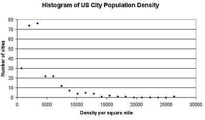
The mean density is 4,128.21 inhabitants per square mile (1,593.91/km2).
The median is 3,160.85 inhabitants per square mile (1,220.41/km2).
| Population | Number of municipal governments[30] |
|---|---|
| 1,000,000+ | 9 |
| 300,000–999,999 | 54 |
| 200,000–299,999 | 50 |
| 100,000–199,999 | 182 |
| Total | 295 |
| State | Number of cities |
|---|---|
| CA | 70 |
| TX | 36 |
| FL | 21 |
| CO | 11 |
| AZ | 10 |
| NC | 9 |
| IL | 8 |
| VA, WA | 7 |
| MI, NJ, OH, TN | 6 |
| CT, GA, KS, MA, MO, NY | 5 |
| AL, IN, LA, NV, OK, OR, PA, UT | 4 |
| IA, MN, SC, WI | 3 |
| KY, NE, NM | 2 |
| AK, AR, DC, HI, ID, MD, MS, MT, ND, NH, RI, SD | 1 |
| DE, ME, VT, WV, WY | 0 |
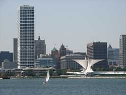
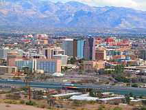
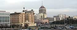
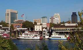
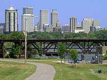
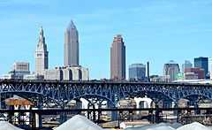
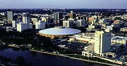
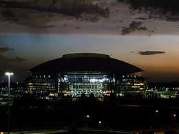
Gallery
|


.jpg)


Puerto Rico

The following table lists the five municipalities (municipios) of Puerto Rico with a population greater than 100,000 on July 1, 2013, as estimated by the United States Census Bureau.
The table below contains the following information:
- The municipio rank by population as of July 1, 2012, as estimated by the United States Census Bureau[31]
- The municipio[31]
- The municipio population as of July 1, 2013, as estimated by the United States Census Bureau[31]
- The municipio population as of April 1, 2010, as enumerated by the 2010 United States Census[31]
- The municipio percent population change from April 1, 2010, to July 1, 2013
- The municipio land area as of January 1, 2010[4]
- The municipio population density as of April 1, 2010 (residents per land area)[4]
- The municipio latitude and longitude coordinates
| 2013 rank | Municipio | 2013 estimate | 2010 Census | Change | 2010 land area | 2010 population density | Location |
|---|---|---|---|---|---|---|---|
| 1 | San Juan | 374,682 | 395,326 | −5.22% | 39.5 sq mi 102.3 km2 |
10,008 per sq mi 3,864 km−2 |
18°24′23″N 66°03′50″W / 18.4064°N 66.0640°W |
| 2 | Bayamón | 198,958 | 208,116 | −4.40% | 27.0 sq mi 69.9 km2 |
7,716 per sq mi 2,979 km−2 |
18°22′48″N 66°09′48″W / 18.3801°N 66.1633°W |
| 3 | Carolina | 169,597 | 176,762 | −4.05% | 20.7 sq mi 53.5 km2 |
8,559 per sq mi 3,305 km−2 |
18°24′44″N 65°58′47″W / 18.4121°N 65.9798°W |
| 4 | Ponce | 157,118 | 166,327 | −5.54% | 30.6 sq mi 79.3 km2 |
5,434 per sq mi 2,098 km−2 |
17°59′15″N 66°36′35″W / 17.9874°N 66.6097°W |
| 5 | Caguas | 139,559 | 142,893 | −2.33% | 10.9 sq mi 28.3 km2 |
13,090 per sq mi 5,054 km−2 |
18°13′57″N 66°02′20″W / 18.2324°N 66.0390°W |
Census-designated places
The following table lists U.S. census-designated places (CDPs) with populations of at least 100,000 according to the 2010 Census. A CDP is a concentration of population identified by the United States Census Bureau for statistical purposes. CDPs are delineated for each decennial census as the statistical counterparts of incorporated places such as cities, towns and villages. CDPs are populated areas that lack separate municipal government, but which otherwise physically resemble incorporated places. Unlike the incorporated cities in the main list, the US Census Bureau does not release annual population estimates for CDPs.
The table below contains the following information:
- The city
- The state
- The city population as of April 1, 2010, as enumerated by the 2010 United States Census
- The city population as of April 1, 2000, as enumerated by the 2010 United States Census
- The city percent population change from April 1, 2000, to April 1, 2010
- The city land area as of January 1, 2010[4]
- The city population density as of April 1, 2010 (residents per land area)[4]
- The city ANSI INCITS 446-2008 geographic code
- The city latitude and longitude coordinates
| City | State | 2010 Census | 2000 Census | Change | 2010 land area | 2010 population density | ANSI | Location |
|---|---|---|---|---|---|---|---|---|
| Paradise | Nevada | 223,167 | 186,070 | +19.94% | 46.717 sq mi 120.997 km2 |
4,777 per sq mi 1,844 km−2 |
02409023 | 36°04′51″N 115°08′12″W / 36.08073°N 115.1368°W |
| Arlington | Virginia | 207,627 | 189,453 | +9.59% | 25.98 sq mi 3085 km2 |
7,992 per sq mi 3100 km−2 |
38°52′48″N 77°10′59″W / 38.880°N 77.183°W | |
| Sunrise Manor | Nevada | 189,372 | 156,120 | +21.30% | 33.352 sq mi 86.382 km2 |
5,678 per sq mi 2,192 km−2 |
02410035 | 36°10′43″N 115°02′56″W / 36.1785°N 115.0490°W |
| Spring Valley | Nevada | 178,395 | 117,390 | +51.97% | 33.226 sq mi 86.056 km2 |
5,369 per sq mi 2,073 km−2 |
02408797 | 36°05′55″N 115°15′43″W / 36.0987°N 115.2619°W |
| Metairie | Louisiana | 138,481 | 146,136 | −5.24% | 23.222 sq mi 60.144 km2 |
5,963 per sq mi 2,302 km−2 |
02403282 | 29°59′52″N 90°10′40″W / 29.9978°N 90.1779°W |
| East Los Angeles | California | 126,496 | 124,283 | +1.78% | 7.448 sq mi 19.291 km2 |
16,984 per sq mi 6,557 km−2 |
02408711 | 34°01′53″N 118°10′07″W / 34.0315°N 118.1686°W |
| Enterprise | Nevada | 108,481 | 14,676 | +639.17% | 46.513 sq mi 120.467 km2 |
2,332 per sq mi 901 km−2 |
02408084 | 36°01′06″N 115°12′55″W / 36.0182°N 115.2154°W |
| Brandon | Florida | 103,483 | 77,895 | +32.85% | 33.101 sq mi 85.731 km2 |
3,126 per sq mi 1,207 km−2 |
02402711 | 27°56′10″N 82°17′57″W / 27.9360°N 82.2993°W |
Cities formerly over 100,000 people
The following table lists U.S. cities that, in past censuses, have had populations of at least 100,000 but have since decreased beneath this threshold or have been consolidated with or annexed into a neighboring city.
The table below contains the following information:
- Name of city
- Name of state
- The city population as of July 1, 2013, as estimated by the United States Census Bureau[3]
- The city's peak population based on highest official enumeration recorded by the Census (and the year of that particular Census)
- The numeric decline in population from its peak Census count to the most recent Census estimate in 2013.
- The percent decline in population from its peak Census count to the most recent Census estimate in 2013.
- Any additional notes of significant importance.
| City | State | 2013 estimated population | Peak population (year) | Numeric decline from peak population |
Percent decline from peak population |
Notes |
|---|---|---|---|---|---|---|
| Albany | New York | 98,424 | 134,995 (1950) | |||
| Allegheny | Pennsylvania | N/A | 129,896 (1900) | – | – | annexed by Pittsburgh in 1907 |
| Brooklyn | New York | N/A[32] | 806,343 (1890) | – | – | consolidated with New York City in 1898 |
| Camden | New Jersey | 76,903 | 124,555 (1950) | |||
| Canton | Ohio | 72,535 | 116,912 (1950) | |||
| Dearborn | Michigan | 95,884 | 112,007 (1960) | |||
| Duluth | Minnesota | 86,128 | 107,312 (1960) | |||
| Fall River | Massachusetts | 88,697 | 120,485 (1920) | |||
| Flint | Michigan | 99,763 | 196,940 (1960) | |||
| Gary | Indiana | 78,450 | 178,320 (1960) | |||
| Hammond | Indiana | 78,967 | 111,698 (1960) | |||
| Kenosha | Wisconsin | 99,889 | 100,150 (2012 est)* | *Only recorded instance of surpassing 100,000 was July 1, 2012 estimate | ||
| Livonia | Michigan | 95,208 | 110,109 (1970) | |||
| Lynn | Massachusetts | 91,589 | 102,320 (1930) | |||
| Macon | Georgia | 89,981 | 122,423 (1970) | |||
| New Bedford | Massachusetts | 95,078 | 121,217 (1920) | |||
| Niagara Falls | New York | 49,468 | 102,394 (1960) | |||
| Parma | Ohio | 80,429 | 100,216 (1970) | |||
| Portsmouth | Virginia | 96,205 | 114,773 (1960) | |||
| Reading | Pennsylvania | 87,893 | 111,171 (1930) | |||
| Roanoke | Virginia | 98,465 | 100,220 (1980) | |||
| Scranton | Pennsylvania | 75,806 | 143,333 (1930) | |||
| Somerville | Massachusetts | 78,804 | 103,908 (1930) | |||
| St. Joseph | Missouri | 77,147 | 102,979 (1900) | |||
| Trenton | New Jersey | 84,349 | 128,009 (1950) | |||
| Utica | New York | 61,808 | 101,740 (1930) | |||
| Wilmington | Delaware | 71,525 | 112,504 (1940) | |||
| Youngstown | Ohio | 65,184 | 170,002 (1930) |
See also
- Demographics of the United States
- United States Census Bureau
- List of U.S. states and territories by population
- List of metropolitan areas of the United States
- List of United States cities by population
- List of United States counties and county-equivalents
- United States Office of Management and Budget
- The OMB has defined 1098 statistical areas comprising 388 MSAs, 541 μSAs, and 169 CSAs
- Primary statistical area – List of the 574 PSAs
- Combined Statistical Area – List of the 169 CSAs
- Core Based Statistical Area – List of the 929 CBSAs
- Metropolitan Statistical Area – List of the 388 MSAs
- Micropolitan Statistical Area – List of the 541 μSAs
- Primary statistical area – List of the 574 PSAs
- The OMB has defined 1098 statistical areas comprising 388 MSAs, 541 μSAs, and 169 CSAs
- United States Census Bureau
- Largest cities in the United States by population by decade
- List of U.S. states' largest cities by population
- List of cities proper by population (most populous cities in the world)
- List of lists of settlements in the United States
- List of United States cities by area
- List of United States cities by population density
- Shrinking cities in the USA
References
- ↑ Towns in New England, while incorporated on a level similar to cities in other states, are considered minor civil divisions by the Census Bureau and are not included in its list of incorporated places. A detailed discussion on this subject can be found at New England town#Census treatment of the New England town system.
- ↑ 2.0 2.1 The State of Hawaiʻi has no incorporated municipalities other than the City and County of Honolulu, which comprises the entire Island of Oʻahu. In accordance with Hawaiian law, the United States Census Bureau defines the state's "cities" and "towns" as Census Designated Places (CDPs). The Census Bureau defines the Urban Honolulu CDP as the portion of the City and County of Honolulu that is coextensive with the Judicial District of Honolulu. The Urban Honolulu CDP is what is generally thought of as the "city" of Honolulu, and its population is used here and in other population comparisons. The Urban Honolulu CDP is currently the most populous Census Designated Place in the United States. The Honolulu, HI Metropolitan Statistical Area comprises the entire City and County of Honolulu.
- ↑ 3.0 3.1 3.2 3.3 3.4 3.5 "•Annual Estimates of the Resident Population for Incorporated Places over 50,000, Ranked by July 1, 2013 Population: April 1, 2010 to July 1, 2013" (CSV). 2013 Population Estimates. United States Census Bureau, Population Division. May 2013. Retrieved May 22, 2014.
- ↑ 4.0 4.1 4.2 4.3 4.4 4.5 "2013 U.S. Gazetteer Files". U.S. Gazetteer Files. United States Census Bureau. January 2013. Retrieved May 23, 2014.
- ↑ Or Federal District in the case of Washington, D.C.
- ↑ Since 1898, the City of New York, New York, has comprised five boroughs with consolidated borough–county governments:
The Borough of Manhattan and New York County
The Borough of Brooklyn and Kings County
The Borough of Queens and Queens County
The Borough of the Bronx and Bronx County
The Borough of Staten Island and Richmond County - ↑ City wins census appeal; count adjusted - Houston Chronicle. Chron.com (December 3, 2012). Retrieved on July 12, 2013.
- ↑ The City of Philadelphia, Pennsylvania, and Philadelphia County, Pennsylvania, are separate but coterminous entities with a single consolidated city–county government.
- ↑ The City of Indianapolis, Indiana, and Marion County, Indiana, are separate entities with a single consolidated city–county government. The City of Indianapolis comprises all of Marion County except the other incorporated municipalities within the county. See Indianapolis (balance).
- ↑ The City of Jacksonville, Florida, and Duval County, Florida, are separate entities with a single consolidated city–county government. The City of Jacksonville comprises all of Duval County except the other incorporated municipalities within the county.
- ↑ The City and County of San Francisco, California has a consolidated city and county government.
- ↑ The City and County of Denver, Colorado, has a consolidated city and county government.
- ↑ The City of Washington was consolidated with the District of Columbia in 1871.
- ↑ Nashville is a consolidated city-county. The population given is for the entire city-county, excluding other incorporated places lying within the city-county limits. (See Nashville-Davidson (balance), Tennessee). As of 2010, the population of the city-county including other incorporated places was 626,681.
- ↑ 15.0 15.1 15.2 15.3 15.4 15.5 15.6 15.7 15.8 This is an independent city that is not part of any county.
- ↑ The City of Louisville, Kentucky, and Jefferson County, Kentucky, are separate entities with a single consolidated city–county government. The City of Louisville comprises all of Jefferson County except the other incorporated municipalities within the county. See Louisville/Jefferson County metro government (balance), Kentucky.
- ↑ The City of New Orleans, Louisiana, and Orleans Parish, Louisiana, are separate but coterminous entities with a single consolidated city–parish government.
- ↑ The City of Lexington, Kentucky, and Fayette County, Kentucky, are separate but coterminous entities with a single consolidated city–county government.
- ↑ The Municipality of Anchorage, Alaska, is a unified home rule municipality that functions as both a city and a borough.
- ↑ The Town of Gilbert, Arizona, is currently the most populous incorporated town in the United States.
- ↑ The City of Baton Rouge, Louisiana, and East Baton Rouge Parish, Louisiana, are separate entities with a single consolidated city–parish government. The City of Baton Rouge has retained its own city limits within East Baton Rouge Parish.
- ↑ Officially listed in US Census Bureau records as Boise City
- ↑ The City of Columbus, Georgia, and Muscogee County, Georgia, are separate but coterminous entities with a single consolidated city–county government.
- ↑ The City of Augusta, Georgia, and Richmond County, Georgia, are separate entities with a single consolidated city–county government. The City of Augusta comprises all of Richmond County except the two other incorporated municipalities within the county.
- ↑ The Town of Cary, North Carolina, is currently the second most populous incorporated town in the United States.
- ↑ Kansas City, Kansas, and Wyandotte County, Kansas, are separate entities with a single consolidated city–county government. Kansas City comprises all of Wyandotte County except the other incorporated municipalities within the county.
- ↑ The City of Lafayette, Louisiana, and Lafayette Parish, Louisiana, are separate entities with a single consolidated city–parish government. The City of Lafayette comprises all of Lafayette Parish except the other incorporated municipalities within the parish.
- ↑ The City of Athens, Georgia, and Clarke County, Georgia, are separate entities with a single consolidated city–county government. The City of Athens comprises all of Clarke County except the other incorporated municipalities within the county.
- ↑ Official name is San Buenaventura
- ↑ "Census of Governments" (PDF). Government Organization. U.S. Census Bureau. December 2002. Retrieved December 30, 2010.
- ↑ 31.0 31.1 31.2 31.3 "Puerto Rico Municipios Totals: Vintage 2013". 2013 Census Population Estimates. U.S. Census Bureau, Population Division. July 1, 2014. Retrieved May 23, 2013.
- ↑ The population for Brooklyn in the 2010 Census was 2,504,700. However, since Brooklyn is now a borough of the City of New York and thus no longer its own separate city, for the purposes of this chart, its current population will be regarded as negligible.
External links