List of U.S. Highways in Alabama
|
| |
|
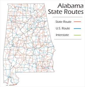
Map of Alabama State Route System U.S. routes | |
| Highway names | |
|---|---|
| Interstates: | Interstate nn (I-nn) |
| US Routes: | U.S. Route nn (US-nn) |
| State: | State Route nn (SR-nn) |
| System links | |
| |


The U.S. routes in Alabama are the subset of the United States numbered highway system maintained by the Alabama Department of Transportation (ALDOT). There are 19 U.S. routes that cross through Alabama, totaling 3,852.85 miles (6,200.56 km). US-31 is the highway with the longest segment in Alabama, with 386.449 miles (621.929 km). The shortest is US-72 Alternate, crossing 68.3 miles (109.9 km) of North Alabama.[1] One former U.S. highway existed in Alabama; US-241 ran through eastern Alabama and was replaced with US-280 and US-431 in 1954.[2]
List
| Number | Length (mi)[1] | Length (km) | Southern or western terminus | Northern or eastern terminus | Formed | Removed | Notes | |
|---|---|---|---|---|---|---|---|---|
| 250.671 | 403.416 | US-11/US-80 at the Mississippi state line near Cuba | US-11 at the Georgia state line near Sulphur Springs | — | — | US-11 closely follows the route of I-59 through Alabama. After entering the state from Mississippi, it heads northeast to Tuscaloosa. Near North Bibb, it joins I-20/I-59 until it splits in Bessemer. In Birmingham, it follows 3rd Avenue, then 1st Avenue. It then passes to the west and north of Gadsden, then through Fort Payne on its way to Georgia.[3][4][5][6][7][8][9][10][11] | ||
| 226.550 | 364.597 | US-29 at the Florida state line near Flomaton | US-29 at the Georgia state line near Lanett | — | — | US-29 enters the state from Florida near Flomaton. It runs concurrently with US-31 from Flomaton to Brewton, the continues easterly towards Andalusia, after which it meanders northeast to Troy. It then goes east, then north through Union Springs and Tuskegee, before joining I-85 through Auburn. It then splits from I-85, but continues to follow it through Valley and Lanett, crossing into Georgia at West Point.[12][13][14][15][16][17][18][19][20] | ||
| 386.449 | 621.929 | US-90 in Spanish Fort | I-65/US-31 at the Tennessee state line near Ardmore | — | — | US-31 is a north-south route, closely following I-65 for the majority of its route. It begins in Spanish Fort. It then heads north to Bay Minette, then northwesterly along I-65 to Montgomery. It continues north through Birmingham and Decatur, and runs concurrently with I-65 from Athens to the Tennessee state line.[7][13][21][22][23][24][25][26][27][28][29][30][31][32][33][34] | ||
| 350.978 | 564.844 | US-90 in Mobile | US-43 at the Tennessee state line near Green Hill | — | — | US-43 is a north-south route in the western part of the state. It begins in Mobile and heads north through Saraland and Thomasville to Demopolis. It crosses I-20/I-59 and then goes through Tuscaloosa. It then continues north through Fayette and Hamilton, and eventually crosses the Tennessee River at The Shoals. It briefly follows US-72 west, but splits north toward Tennessee near Killen.[5][6][35][36][37][38][39][40][41][42][43][44] | ||
| 59.181 | 95.243 | US-98 in Mobile | US-45 at the Mississippi state line near Yellow Pine | — | — | US-45 begins at the Bankhead Tunnel in Mobile, then moves northwest out of the city to Prichard along Spring Hill Avenue and St. Stephens Road. It then heads northwest to Citronelle before passing into Mississippi north of Yellow Pine.[36][37][45] | ||
| 167.211 | 269.100 | US-72 at the Mississippi state line near Lime Kiln | US-72 at the Tennessee state line near Bridgeport | — | — | US-72 runs west to east in the northern part of the state, roughly following the Tennessee River. It enters the state from Mississippi and heads west to Tuscumbia. There, it turns north, crossing the river into Florence, while US-72 Alternate continues south of the river. Through Florence, it continues west along the north bank of the river through Athens and northern Madison before reaching Huntsville as University Drive . The route then goes to Scottsboro, then to the northwest, crossing into Tennessee near Bridgeport on its way to Chattanooga.[34][43][44][46][47][48] | ||
| 68.3 | 109.9 | US-72 south of Muscle Shoals | I-565/US-72 in Huntsville | — | — | US-72 Alternate splits from US-72 near Tuscumbia, and follows the south bank of the Tennessee River to Decatur. There, it crosses the river, and soon joins with Interstate 565. Through Madison, it splits off and runs parallel to I-565, before rejoining to go through Huntsville. It re-joins US-72 on the east side of Huntsville.[33][34][43][47][49][50] | ||
| 192.192 | 309.303 | US-78 at the Mississippi state line near Bexar | US-78 at the Georgia state line near Muscadine | — | — | US-78 is a west-to-east route across central Alabama. Much of US-78 west of Birmingham is also the route for future Interstate 22. It enters the state from Mississippi and heads southeast, passing Hamilton, Winfield, and Jasper on its way to Birmingham. East of Birmingham, it closely follows I-20 through Pell City and Anniston to Georgia.[7][8][41][51][52][53][54][55] | ||
| 218.621 | 351.836 | US-11/US-80 at Mississippi state line near Cuba | US-80 at the Chattahoochee River/Georgia state line in Phenix City | — | — | US-80 traverses Alabama's Black Belt in the southern third of the state. It enters from Mississippi near I-20/I-59 and moves east, passing through Demopolis and Selma before reaching Montgomery. East of Montgomery, it travels to the south of Interstate 85, passing through Tuskegee and Phenix City before crossing the Chattahoochee River into Columbus, Georgia.[4][14][15][25][26][39][56][57][58][59][60] | ||
| 239.895 | 386.074 | US-82 at the Mississippi state line near Stafford | US-82 at the Chattahoochee River/Georgia state line in Eufaula | — | — | US-82 cuts southeasterly across central Alabama. Entering from Columbus, Mississippi, it runs through Tuscaloosa on it way to Montgomery. It then runs through Union Springs before crossing into Georgia at Eufaula.[6][11][20][26][27][28][29][61][62][63] | ||
| 231.682 | 372.856 | US-84 at the Mississippi state line near Isney | US-84/SR-38 at the Chattahoochee River/Georgia state line near Alaga | — | — | US-84 runs west to east across southern Alabama. From Mississippi, it heads southeasterly to Monroeville, then Andalusia and Opp. From Opp, it bears northeast in a semi-circular pattern to Elba and Enterprise. It then continues southeasterly to Dothan and Bainbridge, Georgia.[17][23][38][64][65][66][67][68][69] | ||
| 77.031 | 123.969 | US-90 at the Mississippi state line near Grand Bay | US-90 at the Perdido River/Florida state line near Seminole | — | — | US-90 enters from Mississippi near I-10, and follows I-10's general path into downtown Mobile. It crosses Mobile Bay with the Bankhead Tunnel and the Cochrane–Africatown USA Bridge. It continues east across Baldwin County, staying to the south of I-10 before crossing the Perdido River into Florida.[22][36][70] | ||
| 80.248 | 129.147 | US-98 at the Mississippi state line near Wilmer | US-98 at the Perdido River/Florida state line near Lillian | — | — | US-98 enters the state from Mississippi to the west of Wilmer, and bears southeast to downtown Mobile. It crosses Mobile Bay with the Bankhead Tunnel and the Cochrane–Africatown USA Bridge. Upon reaching Spanish Fort, it turns south and follows the eastern coast of the bay until Barnwell. It then turns due east, passing through Foley before crossing Perdido Bay into Florida.[22][36][71] | ||
| 331 | 533 | US-231 at the Florida state line near State Line | US-231/US-431 at the Tennessee state line near Fisk | — | — | US-231 winds from south to north across the eastern side of the state. From Florida, it goes north to Dothan, then northeast through Ozark and Troy to Montgomery. From there, it remains to the east of the Coosa River through Wetumpka and Sylacauga before crossing at Childersburg. It then winds through Pell City, Oneonta, and Arab before reaching Huntsville. In Huntsville, it follows Memorial Parkway, the major north-south thoroughfare through the city, and meets with US-431 before heading north to Tennessee.[8][19][26][27][30][31][34][47][52][65][66][72][73][74] | ||
| 359 | 578 | US-84/SR-52/SR-12 in Dothan, Alabama | US-241 at the Tennessee state line near Fisk | 1930 | 1954 | US-241 was a north-south route in eastern Alabama. From Dothan, it followed the current US-431 north to Opelika, then followed US-280 to Sylacauga. From there, it followed Alabama State Route 21 to Anniston, and then US-431's current route through Huntsville to Tennessee. It was decommissioned in favor of US-280 and US-431 in 1954.[2][75][76] | ||
| 199.162 | 320.520 | US-278 at the Mississippi state line near Sulligent | US-278 at the Georgia state line near Palestine | — | — | US-278 travels from Mississippi to Georgia across the northern third of Alabama. It enters near Sulligent, and takes a sharp northwesterly turn in Guin, towards Hamilton. From Hamilton, it moves east to Cullman and Gadsden before reaching Georgia.[9][31][32][41][54][77][78][79][80] | ||
| 141.256 | 227.329 | I-20/I-59/US-31 in Birmingham | US-280/SR-520 at the Chattahoochee River/Georgia state line in Phenix City | — | — | US-280 begins in Birmingham and heads southeast, passing through Sylacauga and Alexander City before reaching Auburn and its suburb Opelika. Through Opelika, it is briefly signed with Interstate 85, before joining US-431 to Phenix City and Columbus, Georgia.[7][15][16][30][52][57][73][81][82] | ||
| 103 | 166 | US-331 at the Florida state line in Florala | US-80/US-82 in Montgomery | — | — | US-331 serves as a major route from Alabama to beaches in northwest Florida. The route enters Alabama from Florida near Florala and heads north through Opp and Luverne before reaching Montgomery.[17][18][26][83] | ||
| 87.6 | 141.0 | US-78 in Leeds | US-411 at the Georgia state line near Forney | — | — | US-411 begins in Leeds, and generally follows I-59 running alongside it to its south. US-411 briefly runs concurrently with US-231 before Ashville, before passing through the eastern part of Gadsden. After reaching Weiss Lake, US-411 turns due east, and it passes into Georgia.[7][8][9][78][84] | ||
| 341.824 | 550.112 | US-231 in Dothan | US-231/US-431 at the Tennessee state line near Fisk | — | — | US-431 is north-south route in eastern Alabama, running to the east of, and briefly concurrently with US-231. It begins in Dothan and goes north along the Georgia state line through Eufaula and Phenix City. It then juts northwesterly to Opelika, before continuing north, eventually crossing I-20 near Anniston and I-59 near Gadsden. It then crosses Sand Mountain and Lake Guntersville before reaching Huntsville as Governors Drive. It joins with US-231 for its last 20 miles (32 km) into Tennessee.[9][15][16][47][53][54][57][62][65][74][85][86][87] | ||
| ||||||||
See also
- Alabama portal
- U.S. Roads portal
References
- ↑ 1.0 1.1 County Milepost Maps (PDF) (Map). Alabama Department of Transportation. Retrieved September 2007.
- ↑ 2.0 2.1 "Alabama US-Highways". Retrieved December 4, 2008.
- ↑ Google (December 4, 2008). "Overview Map of US-11" (Map). Google Maps. Google. Retrieved December 4, 2008.
- ↑ 4.0 4.1 General Highway Map, Sumter County (PDF) (Map). Alabama Department of Transportation. 2001. Retrieved October 23, 2008.
- ↑ 5.0 5.1 General Highway Map, Greene County (PDF) (Map). Alabama Department of Transportation. 2001. Retrieved October 23, 2008.
- ↑ 6.0 6.1 6.2 General Highway Map, Tuscaloosa County (PDF) (Map). Alabama Department of Transportation. 2001. Retrieved October 23, 2008.
- ↑ 7.0 7.1 7.2 7.3 7.4 General Highway Map, Jefferson County (PDF) (Map). Alabama Department of Transportation. 2001. Retrieved October 23, 2008.
- ↑ 8.0 8.1 8.2 8.3 General Highway Map, St. Clair County (PDF) (Map). Alabama Department of Transportation. 2001. Retrieved October 23, 2008.
- ↑ 9.0 9.1 9.2 9.3 General Highway Map, Etowah County (PDF) (Map). Alabama Department of Transportation. 2001. Retrieved October 23, 2008.
- ↑ General Highway Map, DeKalb County (PDF) (Map). Alabama Department of Transportation. 2001. Retrieved October 23, 2008.
- ↑ 11.0 11.1 General Highway Map, Bibb County (PDF) (Map). Alabama Department of Transportation. 2001. Retrieved October 23, 2008.
- ↑ Google (December 4, 2008). "Overview Map of US-29" (Map). Google Maps. Google. Retrieved December 4, 2008.
- ↑ 13.0 13.1 General Highway Map, Escambia County (PDF) (Map). Alabama Department of Transportation. 2001. Retrieved October 23, 2008.
- ↑ 14.0 14.1 General Highway Map, Macon County (PDF) (Map). Alabama Department of Transportation. 2001. Retrieved October 23, 2008.
- ↑ 15.0 15.1 15.2 15.3 General Highway Map, Lee County (PDF) (Map). Alabama Department of Transportation. 2001. Retrieved October 23, 2008.
- ↑ 16.0 16.1 16.2 General Highway Map, Chambers County (PDF) (Map). Alabama Department of Transportation. 2001. Retrieved October 23, 2008.
- ↑ 17.0 17.1 17.2 General Highway Map, Covington County (PDF) (Map). Alabama Department of Transportation. 2001. Retrieved October 23, 2008.
- ↑ 18.0 18.1 General Highway Map, Crenshaw County (PDF) (Map). Alabama Department of Transportation. 2001. Retrieved October 23, 2008.
- ↑ 19.0 19.1 General Highway Map, Pike County (PDF) (Map). Alabama Department of Transportation. 2001. Retrieved October 23, 2008.
- ↑ 20.0 20.1 General Highway Map, Bullock County (PDF) (Map). Alabama Department of Transportation. 2001. Retrieved October 23, 2008.
- ↑ Google (December 4, 2008). "Overview Map of US-31" (Map). Google Maps. Google. Retrieved December 4, 2008.
- ↑ 22.0 22.1 22.2 General Highway Map, Baldwin County (PDF) (Map). Alabama Department of Transportation. 2001. Retrieved October 23, 2008.
- ↑ 23.0 23.1 General Highway Map, Conecuh County (PDF) (Map). Alabama Department of Transportation. 2001. Retrieved October 23, 2008.
- ↑ General Highway Map, Butler County (PDF) (Map). Alabama Department of Transportation. 2001. Retrieved October 23, 2008.
- ↑ 25.0 25.1 General Highway Map, Lowndes County (PDF) (Map). Alabama Department of Transportation. 2001. Retrieved October 23, 2008.
- ↑ 26.0 26.1 26.2 26.3 26.4 General Highway Map, Montgomery County (PDF) (Map). Alabama Department of Transportation. 2001. Retrieved October 23, 2008.
- ↑ 27.0 27.1 27.2 General Highway Map, Elmore County (PDF) (Map). Alabama Department of Transportation. 2001. Retrieved October 23, 2008.
- ↑ 28.0 28.1 General Highway Map, Autauga County (PDF) (Map). Alabama Department of Transportation. 2001. Retrieved October 23, 2008.
- ↑ 29.0 29.1 General Highway Map, Chilton County (PDF) (Map). Alabama Department of Transportation. 2001. Retrieved October 23, 2008.
- ↑ 30.0 30.1 30.2 General Highway Map, Shelby County (PDF) (Map). Alabama Department of Transportation. 2001. Retrieved October 23, 2008.
- ↑ 31.0 31.1 31.2 General Highway Map, Blount County (PDF) (Map). Alabama Department of Transportation. 2001. Retrieved October 23, 2008.
- ↑ 32.0 32.1 General Highway Map, Cullman County (PDF) (Map). Alabama Department of Transportation. 2001. Retrieved October 23, 2008.
- ↑ 33.0 33.1 General Highway Map, Morgan County (PDF) (Map). Alabama Department of Transportation. 2001. Retrieved October 23, 2008.
- ↑ 34.0 34.1 34.2 34.3 General Highway Map, Limestone County (PDF) (Map). Alabama Department of Transportation. 2001. Retrieved October 23, 2008.
- ↑ Google (December 4, 2008). "Overview Map of US-43" (Map). Google Maps. Google. Retrieved December 4, 2008.
- ↑ 36.0 36.1 36.2 36.3 General Highway Map, Mobile County (PDF) (Map). Alabama Department of Transportation. 2001. Retrieved October 23, 2008.
- ↑ 37.0 37.1 General Highway Map, Washington County (PDF) (Map). Alabama Department of Transportation. 2001. Retrieved October 23, 2008.
- ↑ 38.0 38.1 General Highway Map, Clarke County (PDF) (Map). Alabama Department of Transportation. 2001. Retrieved October 23, 2008.
- ↑ 39.0 39.1 General Highway Map, Marengo County (PDF) (Map). Alabama Department of Transportation. 2001. Retrieved October 23, 2008.
- ↑ General Highway Map, Fayette County (PDF) (Map). Alabama Department of Transportation. 2001. Retrieved October 23, 2008.
- ↑ 41.0 41.1 41.2 General Highway Map, Marion County (PDF) (Map). Alabama Department of Transportation. 2001. Retrieved October 23, 2008.
- ↑ General Highway Map, Franklin County (PDF) (Map). Alabama Department of Transportation. 2001. Retrieved October 23, 2008.
- ↑ 43.0 43.1 43.2 General Highway Map, Colbert County (PDF) (Map). Alabama Department of Transportation. 2001. Retrieved October 23, 2008.
- ↑ 44.0 44.1 General Highway Map, Lauderdale County (PDF) (Map). Alabama Department of Transportation. 2001. Retrieved October 23, 2008.
- ↑ Google (December 4, 2008). "Overview Map of US-45" (Map). Google Maps. Google. Retrieved December 4, 2008.
- ↑ Google (December 4, 2008). "Overview Map of US-72" (Map). Google Maps. Google. Retrieved December 4, 2008.
- ↑ 47.0 47.1 47.2 47.3 General Highway Map, Madison County (PDF) (Map). Alabama Department of Transportation. 2001. Retrieved October 23, 2008.
- ↑ General Highway Map, Jackson County (PDF) (Map). Alabama Department of Transportation. 2001. Retrieved October 23, 2008.
- ↑ Google (October 25, 2008). "Overview Map of US-72 Alternate" (Map). Google Maps. Google. Retrieved October 25, 2008.
- ↑ General Highway Map, Lawrence County (PDF) (Map). Alabama Department of Transportation. 2001. Retrieved October 23, 2008.
- ↑ Google (December 4, 2008). "Overview Map of US-78" (Map). Google Maps. Google. Retrieved December 4, 2008.
- ↑ 52.0 52.1 52.2 General Highway Map, Talladega County (PDF) (Map). Alabama Department of Transportation. 2001. Retrieved October 23, 2008.
- ↑ 53.0 53.1 General Highway Map, Calhoun County (PDF) (Map). Alabama Department of Transportation. 2001. Retrieved October 23, 2008.
- ↑ 54.0 54.1 54.2 General Highway Map, Cleburne County (PDF) (Map). Alabama Department of Transportation. 2001. Retrieved October 23, 2008.
- ↑ General Highway Map, Walker County (PDF) (Map). Alabama Department of Transportation. 2001. Retrieved October 23, 2008.
- ↑ Google (December 4, 2008). "Overview Map of US-80" (Map). Google Maps. Google. Retrieved December 4, 2008.
- ↑ 57.0 57.1 57.2 General Highway Map, Russell County (PDF) (Map). Alabama Department of Transportation. 2001. Retrieved October 23, 2008.
- ↑ General Highway Map, Hale County (PDF) (Map). Alabama Department of Transportation. 2001. Retrieved December 4, 2008.
- ↑ General Highway Map, Perry County (PDF) (Map). Alabama Department of Transportation. 2001. Retrieved October 23, 2008.
- ↑ General Highway Map, Dallas County (PDF) (Map). Alabama Department of Transportation. 2001. Retrieved October 23, 2008.
- ↑ Google (December 4, 2008). "Overview Map of US-82" (Map). Google Maps. Google. Retrieved December 4, 2008.
- ↑ 62.0 62.1 General Highway Map, Barbour County (PDF) (Map). Alabama Department of Transportation. 2001. Retrieved October 23, 2008.
- ↑ General Highway Map, Pickens County (PDF) (Map). Alabama Department of Transportation. 2001. Retrieved October 23, 2008.
- ↑ Google (December 4, 2008). "Overview Map of US-84" (Map). Google Maps. Google. Retrieved December 4, 2008.
- ↑ 65.0 65.1 65.2 General Highway Map, Houston County (PDF) (Map). Alabama Department of Transportation. 2001. Retrieved October 23, 2008.
- ↑ 66.0 66.1 General Highway Map, Dale County (PDF) (Map). Alabama Department of Transportation. 2001. Retrieved October 23, 2008.
- ↑ General Highway Map, Choctaw County (PDF) (Map). Alabama Department of Transportation. 2001. Retrieved October 23, 2008.
- ↑ General Highway Map, Monroe County (PDF) (Map). Alabama Department of Transportation. 2001. Retrieved October 23, 2008.
- ↑ General Highway Map, Coffee County (PDF) (Map). Alabama Department of Transportation. 2001. Retrieved October 23, 2008.
- ↑ Google (December 4, 2008). "Overview Map of US-90" (Map). Google Maps. Google. Retrieved December 4, 2008.
- ↑ Google (December 4, 2008). "Overview Map of US-98" (Map). Google Maps. Google. Retrieved December 4, 2008.
- ↑ Google (December 4, 2008). "Overview Map of US-231" (Map). Google Maps. Google. Retrieved December 4, 2008.
- ↑ 73.0 73.1 General Highway Map, Coosa County (PDF) (Map). Alabama Department of Transportation. 2001. Retrieved October 23, 2008.
- ↑ 74.0 74.1 General Highway Map, Marshall County (PDF) (Map). Alabama Department of Transportation. 2001. Retrieved October 23, 2008.
- ↑ Google (December 4, 2008). "Overview Map of US-241" (Map). Google Maps. Google. Retrieved December 4, 2008.
- ↑ "Alabama US-System Routes". Retrieved December 4, 2008.
- ↑ Google (December 4, 2008). "Overview Map of US-278" (Map). Google Maps. Google. Retrieved December 4, 2008.
- ↑ 78.0 78.1 General Highway Map, Cherokee County (PDF) (Map). Alabama Department of Transportation. 2001. Retrieved October 23, 2008.
- ↑ General Highway Map, Lamar County (PDF) (Map). Alabama Department of Transportation. 2001. Retrieved December 4, 2008.
- ↑ General Highway Map, Winston County (PDF) (Map). Alabama Department of Transportation. 2001. Retrieved October 23, 2008.
- ↑ Google (December 4, 2008). "Overview Map of US-280" (Map). Google Maps. Google. Retrieved December 4, 2008.
- ↑ General Highway Map, Tallapoosa County (PDF) (Map). Alabama Department of Transportation. 2001. Retrieved October 23, 2008.
- ↑ Google (December 4, 2008). "Overview Map of US-331" (Map). Google Maps. Google. Retrieved December 4, 2008.
- ↑ Google (December 4, 2008). "Overview Map of US-411" (Map). Google Maps. Google. Retrieved December 4, 2008.
- ↑ Google (December 4, 2008). "Overview Map of US-431" (Map). Google Maps. Google. Retrieved December 4, 2008.
- ↑ General Highway Map, Henry County (PDF) (Map). Alabama Department of Transportation. 2001. Retrieved October 23, 2008.
- ↑ General Highway Map, Randolph County (PDF) (Map). Alabama Department of Transportation. 2001. Retrieved October 23, 2008.