List of Scheduled Monuments in Cheshire (1066–1539)
There are over 200 Scheduled Monuments in Cheshire, a county in North West England, which date from the Neolithic period to the middle of the 20th century. This list includes the scheduled monuments in Cheshire between the years 1066 and 1539, the period accepted by Revealing Cheshire's Past[1] as the medieval period.
A scheduled monument is a nationally important archaeological site or monument which is given legal protection by being placed on a list (or "schedule") by the Secretary of State for Culture, Media and Sport; English Heritage takes the leading role in identifying such sites. The current legislation supporting this is the Ancient Monuments and Archaeological Areas Act 1979. The term "monument" can apply to the whole range of archaeological sites, and they are not always visible above ground. Such sites have to have been deliberately constructed by human activity. They range from prehistoric standing stones and burial sites, through Roman remains and medieval structures such as castles and monasteries, to later structures such as industrial sites and buildings constructed for the World Wars or the Cold War.[2]
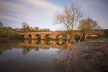
At least 129 scheduled monuments, over half of the total in Cheshire, date from the medieval period. The most frequently found monuments are moats or moated sites, of which there are 55. These are followed by the remains of crosses, 15 of which are churchyard crosses and 11 are wayside crosses, and the remains of 12 castles. There are seven deserted villages, three boundary stones, and the remains of three abbeys, two holy wells, and two halls. There are individual remains of a lime kiln, a pottery kiln, a hospital, a former chapel, a monastic grange, a tomb, an ice house and a hunting lodge. Chester city walls, the Dee Bridge and Farndon Bridge are scheduled monuments which are largely intact and continue in use today.
During the medieval period, houses were built on moated sites partly for defensive purposes but also as a sign of prestige. Cheshire contains over 200 moated sites out of more than 6,000 in England. Crosses in churchyards were used for a variety of purposes, including sites for prayer and pilgrimage, and for public proclamations. Many of them were destroyed following the Reformation and some were converted into sundials by Catholic recusants to prevent their destruction. Other standing stones were part of wayside crosses acting as guides to local abbeys, or plague stones which were used for the transfer of money and items during periods of plague. Motte and bailey castles were introduced to Britain by the Normans and were used in Cheshire to defend its agricultural resources. In many cases the monuments consist only of earthworks or foundations, and where significant structural remains are present, they are often also listed buildings.[1]
|
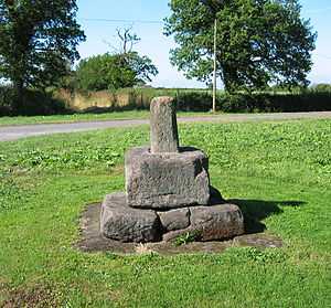
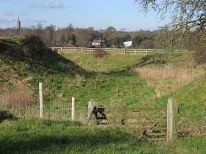
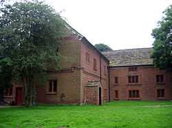
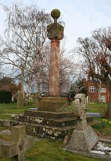 Former cross in Acton churchyard converted into a sundial  Agricola Tower, Chester Castle  Barrow churchyard cross 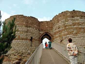 Beeston Castle gateway to main keep 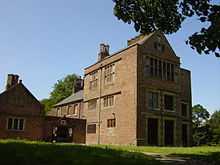 Bewsey Old Hall. The site on which it stands is scheduled 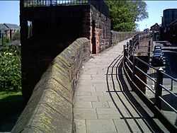 Part of Chester city walls 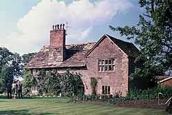 Chorley Old Hall medieval range  Ruins of Halton Castle  Hulme Hall Moat 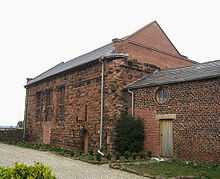 Ince Manor Hall April 2008 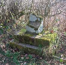 Longstone 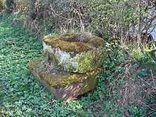 Longstone Lane wayside cross 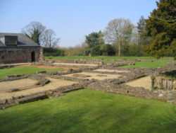 Norton Priory ruins 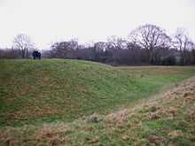 Earthworks of Shotwick Castle  Part of St John's church ruins  Sutton End Farm cross 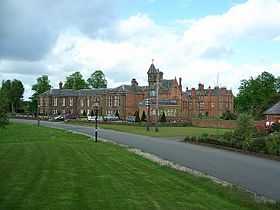 Vale Royal Abbey in 2008 |


See also
- List of Scheduled Monuments in Cheshire (pre-1066)
- List of Scheduled Monuments in Cheshire (post-1539)
- Grade I listed buildings in Cheshire
References
- ↑ 1.0 1.1 Revealing Cheshire's Past, retrieved 28 February 2009
- ↑ The Schedule of Monuments, English Heritage, retrieved 28 February 2009
- ↑ Historic England. "Standing cross in St Mary's churchyard, Acton (1017058)". National Heritage List for England. Retrieved 6 November 2012.
- ↑ Historic England. "Monument No. 1302402 (1302402 )". PastScape. Retrieved 6 November 2012.
- ↑ Revealing Cheshire's Past: Standing Cross, St Mary's Churchyard, Monks Lane, retrieved 25 January 2009
- ↑ Historic England. "Sundial in St. Mary's Churchyard north-east of the Church, Acton (1136328)". National Heritage List for England. Retrieved 6 November 2012.
- ↑ Historic England. "Moated site, fishpond and connecting channel at Alderhedge Wood (1011889)". National Heritage List for England. Retrieved 6 November 2012.
- ↑ Historic England. "Monument No. 73367 (73367 )". PastScape. Retrieved 6 November 2012.
- ↑ Revealing Cheshire's Past: Medieval Moat at Alderhedge Wood, retrieved 5 February 2009
- ↑ Historic England. "Aldford motte and bailey and shell keep castle (1007605)". National Heritage List for England. Retrieved 6 November 2012.
- ↑ Historic England. "Aldford Castle (68791 )". PastScape. Retrieved 6 November 2012.
- ↑ Revealing Cheshire's Past: Motte & Bailey Castle, Aldford, retrieved 23 January 2009
- ↑ Revealing Cheshire's Past: Motte & Bailey Castle, Aldford, retrieved 23 January 2009
- ↑ Historic England. "14th century kiln, Ashton Hayes (1006776)". National Heritage List for England. Retrieved 6 November 2012.
- ↑ Historic England. "Monument No. 71295 (71295 )". PastScape. Retrieved 6 November 2012.
- ↑ Revealing Cheshire's Past: Ashton Medieval Kiln, retrieved 11 February 2009
- ↑ Historic England. "Standing cross in St Mary's churchyard, Newbold Astbury (1020625)". National Heritage List for England. Retrieved 6 November 2012.
- ↑ Historic England. "Cross base and shaft in churchyard of St Mary, Newbold Astbury (1138741)". National Heritage List for England. Retrieved 6 November 2012.
- ↑ Historic England. "Medieval village remains 230m east of Baddiley Hall (1018822)". National Heritage List for England. Retrieved 6 November 2012.
- ↑ Historic England. "Baddiley (72830 )". PastScape. Retrieved 6 November 2012.
- ↑ Revealing Cheshire's Past: Medieval village remains 230m east of Baddiley Hall, retrieved 3 February 2009
- ↑ Historic England. "Standing cross in St Bartholomew's churchyard, Barrow (1016855)". National Heritage List for England. Retrieved 6 November 2012.
- ↑ Historic England. "Monument No. 1259532 (1259532 )". PastScape. Retrieved 6 November 2012.
- ↑ Revealing Cheshire's Past: Standing Cross in St Bartholomew's Churchyard, retrieved 24 January 2009
- ↑ Historic England. "Sundial in St Batholomew's churchyard, Barrow (1130663)". National Heritage List for England. Retrieved 6 November 2012.
- ↑ Historic England. "Barrow Old Hall moated site, Great Sankey (1013363)". National Heritage List for England. Retrieved 6 November 2012.
- ↑ Historic England. "Barrow Old Hall (71694 )". PastScape. Retrieved 6 November 2012.
- ↑ Revealing Cheshire's Past: Barrow Old Hall moated site, Great Sankey, retrieved 23 January 2009
- ↑ Historic England. "Beeston Castle; medieval enclosure castle and site of late prehistoric hillfort (1007900)". National Heritage List for England. Retrieved 6 November 2012.
- ↑ Historic England. "Beeston Castle (71073 )". PastScape. Retrieved 6 November 2012.
- ↑ Revealing Cheshire's Past: Beeston Castle, retrieved 23 January 2009
- ↑ Revealing Cheshire's Past: Beeston Castle - Inner Bailey, retrieved 23 January 2009
- ↑ Revealing Cheshire's Past: Beeston Castle - Outer Bailey, retrieved 23 January 2009
- ↑ Revealing Cheshire's Past: Beeston Castle Deer Park, retrieved 23 January 2009
- ↑ Revealing Cheshire's Past: Beeston Castle Hillfort, retrieved 23 January 2009
- ↑ Revealing Cheshire's Past: Beeston Castle - Lower Green, retrieved 23 January 2009
- ↑ Historic England. "Walls, towers and gatehouse of the Inner Bailey at Beeston Castle (1330329)". National Heritage List for England. Retrieved 6 November 2012.
- ↑ Historic England. "Walls of the Outer Bailey at Beeston Castle (1130513)". National Heritage List for England. Retrieved 6 November 2012.
- ↑ Historic England. "Belgrave moated site and medieval garden (1013214)". National Heritage List for England. Retrieved 6 November 2012.
- ↑ Historic England. "Belgrave (66981 )". PastScape. Retrieved 6 November 2012.
- ↑ Revealing Cheshire's Past: Belgrave moated site and medieval garden, retrieved 19 January 2009
- ↑ Revealing Cheshire's Past: Belgrave, retrieved 19 January 2009
- ↑ Revealing Cheshire's Past: Belgrave moated site and medieval garden, retrieved 19 January 2009
- ↑ Historic England. "Belmont moated site and fishpond (1018593)". National Heritage List for England. Retrieved 6 November 2012.
- ↑ Historic England. "Monument No. 72959 (72959 )". PastScape. Retrieved 6 November 2012.
- ↑ Revealing Cheshire's Past: Belmont Moat, retrieved 4 February 2009
- ↑ Historic England. "Bewsey Old Hall moated site, fishpond and connecting channel (1012324)". National Heritage List for England. Retrieved 6 November 2012.
- ↑ Historic England. "Bewsey Old Hall (71693 )". PastScape. Retrieved 6 November 2012.
- ↑ Revealing Cheshire's Past: Bewsey Old Hall moated site and fishpond, retrieved 23 January 2009
- ↑ Revealing Cheshire's Past: Bewsey Old Hall, retrieved 23 January 2009
- ↑ Revealing Cheshire's Past: Bewsey Old Hall, retrieved 23 January 2009
- ↑ Historic England. "Bostock Hall moated site (1012357)". National Heritage List for England. Retrieved 6 November 2012.
- ↑ Historic England. "Monument No. 72866 (72866 )". PastScape. Retrieved 6 November 2012.
- ↑ Revealing Cheshire's Past: Moat south of Bostock Hall, retrieved 5 February 2009
- ↑ Historic England. "Bradlegh Old Hall moated site and fishpond (1011885)". National Heritage List for England. Retrieved 6 November 2012.
- ↑ Historic England. "Bradlegh Old Hall (71862 )". PastScape. Retrieved 6 November 2012.
- ↑ Revealing Cheshire's Past: Bradlegh Old Hall moated site and fishpond, retrieved 23 January 2009
- ↑ Historic England. "Medieval village and field system remains immediately south of Bradley Hall (1016527)". National Heritage List for England. Retrieved 6 November 2012.
- ↑ Historic England. "Monument No. 70952 (70952 )". PastScape. Retrieved 6 November 2012.
- ↑ Revealing Cheshire's Past: Bradley Green, retrieved 21 January 2009
- ↑ Historic England. "Bradley Hall moated site (1011924)". National Heritage List for England. Retrieved 6 November 2012.
- ↑ Historic England. "Bradley Hall (73374 )". PastScape. Retrieved 6 November 2012.
- ↑ Revealing Cheshire's Past: Bradley Hall moated site, retrieved 23 January 2009
- ↑ Historic England. "Standing cross in St Mary's churchyard (1017313)". National Heritage List for England. Retrieved 6 November 2012.
- ↑ Historic England. "Monument No. 69408 (69408 )". PastScape. Retrieved 6 November 2012.
- ↑ Revealing Cheshire's Past: Standing Cross in St Mary's Churchyard (Bruera), retrieved 23 January 2009
- ↑ Revealing Cheshire's Past: Churchyard to the Church of St Mary the Virgin, Bruera, retrieved 23 January 2009
- ↑ Historic England. "Bruera moated site and adjacent field system (1012110)". National Heritage List for England. Retrieved 6 November 2012.
- ↑ Historic England. "Monument No. 69422 (69422 )". PastScape. Retrieved 6 November 2012.
- ↑ Revealing Cheshire's Past: Field system at Bruera Moat, retrieved 18 January 2009
- ↑ Revealing Cheshire's Past: Moated Site at Bruera, retrieved 18 January 2009
- ↑ Historic England. "Earthwork remains of a medieval hall, chapel and settlement, 290m south east of Capesthorne Hall (1016590)". National Heritage List for England. Retrieved 6 November 2012.
- ↑ Historic England. "Capesthorne Hall and Chapel (76451 )". PastScape. Retrieved 6 November 2012.
- ↑ Historic England. "Capesthorne (76472 )". PastScape. Retrieved 6 November 2012.
- ↑ Revealing Cheshire's Past: Capesthorne Hall, retrieved 24 January 2009
- ↑ Historic England. "Castle Cob motte (1011122)". National Heritage List for England. Retrieved 6 November 2012.
- ↑ Historic England. "Castle Cob (71622 )". PastScape. Retrieved 6 November 2012.
- ↑ Revealing Cheshire's Past: Castle Cob Motte, retrieved 17 January 2009
- ↑ Historic England. "Castle Hill motte, Malpas (1012105)". National Heritage List for England. Retrieved 6 November 2012.
- ↑ Historic England. "Castle Hill (68683 )". PastScape. Retrieved 6 November 2012.
- ↑ Revealing Cheshire's Past: Castle Hill motte, Malpas, retrieved 23 January 2009
- ↑ Historic England. "Castle Hill motte and ditch system, Oldcastle (1012124)". National Heritage List for England. Retrieved 6 November 2012.
- ↑ Historic England. "Castle Hill (68721 )". PastScape. Retrieved 6 November 2012.
- ↑ Revealing Cheshire's Past: Castle Hill motte and ditch system, Oldcastle, retrieved 23 January 2009
- ↑ Historic England. "Medieval settlement and part of field system at Castletown Farm (1016588)". National Heritage List for England. Retrieved 6 November 2012.
- ↑ Historic England. "Castletown (68914 )". PastScape. Retrieved 6 November 2012.
- ↑ Revealing Cheshire's Past: Castletown, retrieved 4 April 2009
- ↑ Historic England. "Dam and millpond 150m east of Cheersgreen Farm (1018081)". National Heritage List for England. Retrieved 6 November 2012.
- ↑ Historic England. "Monument No. 1151833 (1151833 )". PastScape. Retrieved 6 November 2012.
- ↑ Revealing Cheshire's Past: Dam and millpond 150m east of Cheersgreen Farm, retrieved 4 April 2009
- ↑ Historic England. "The walls, towers, gates and posterns of the City of Chester (1006785)". National Heritage List for England. Retrieved 7 November 2012.
- ↑ Historic England. "Monument No. 69073 (69073 )". PastScape. Retrieved 7 November 2012.
- ↑ Revealing Cheshire's Past: Chester City Walls, retrieved 23 January 2009
- ↑ Revealing Cheshire's Past: Chester City Walls - Northgate, retrieved 23 January 2009
- ↑ Historic England. "Chorley Old Hall moated site and four fishponds (1009562)". National Heritage List for England. Retrieved 7 November 2012.
- ↑ Historic England. "Chorley Old Hal (76391 )". PastScape. Retrieved 7 November 2012.
- ↑ Revealing Cheshire's Past: Chorley Old Hall fishponds, retrieved 19 January 2009
- ↑ Historic England. "Cranshaw Hall moated site (1011888)". National Heritage List for England. Retrieved 7 November 2012.
- ↑ Historic England. "Cranshaw Hall (71711 )". PastScape. Retrieved 7 November 2012.
- ↑ Revealing Cheshire's Past: Cranshaw Hall Moated Site, retrieved 5 February 2009
- ↑ Historic England. "Darley Hall moated site (1011145)". National Heritage List for England. Retrieved 7 November 2012.
- ↑ Historic England. "Monument No. 72933 (72933 )". PastScape. Retrieved 7 November 2012.
- ↑ Revealing Cheshire's Past: Drawbridge at Darley Hall, retrieved 19 January 2009
- ↑ Revealing Cheshire's Past: Darley Hall Moated Site, retrieved 27 February 2009
- ↑ Historic England. "Dee Bridge (1006771)". National Heritage List for England. Retrieved 7 November 2012.
- ↑ Historic England. "Dee Bridge (69114 )". PastScape. Retrieved 7 November 2012.
- ↑ Historic England. "Old Dee Bridge (1375850)". National Heritage List for England. Retrieved 7 November 2012.
- ↑ Historic England. "St Andrew's medieval hospital and limekiln, Denhall (1007635)". National Heritage List for England. Retrieved 7 November 2012.
- ↑ Historic England. "Hospital of St Andrew (67143 )". PastScape. Retrieved 7 November 2012.
- ↑ Historic England. "Monument No. 1133165 (1133165 )". PastScape. Retrieved 7 November 2012.
- ↑ Revealing Cheshire's Past: St. Andrew's Hospital, Denhall, retrieved 18 January 2009
- ↑ Historic England. "Dodleston motte and bailey castle (1012419)". National Heritage List for England. Retrieved 7 November 2012.
- ↑ Historic England. "Monument No. 67014 (67014 )". PastScape. Retrieved 7 November 2012.
- ↑ Revealing Cheshire's Past: Dodleston Castle, retrieved 23 January 2009
- ↑ Historic England. "Dodleston Hall moated site (1011786)". National Heritage List for England. Retrieved 7 November 2012.
- ↑ Historic England. "Monument No. 66972 (66972 )". PastScape. Retrieved 7 November 2012.
- ↑ Revealing Cheshire's Past: Dodleston Hall moated site, retrieved 23 January 2009
- ↑ Historic England. "Drakelow Hall moated site, fishponds and moated enclosure (1020100)". National Heritage List for England. Retrieved 7 November 2012.
- ↑ Historic England. "Drakelow Hall (74840 )". PastScape. Retrieved 7 November 2012.
- ↑ Revealing Cheshire's Past: Drakelow Hall moated site, fishponds & moated enclosure, retrieved 5 February 2009
- ↑ Historic England. "Motte and associated earthworks east of Old Rectory, Eccleston (1011118)". National Heritage List for England. Retrieved 7 November 2012.
- ↑ Historic England. "Monument No. 69378 (69378 )". PastScape. Retrieved 7 November 2012.
- ↑ Revealing Cheshire's Past: Motte & associated earthworks east of Old Rectory, retrieved 23 January 2009
- ↑ Historic England. "Edleston moated site and fishpond (1009866)". National Heritage List for England. Retrieved 7 November 2012.
- ↑ Historic England. "Monument No. 72777 (72777 )". PastScape. Retrieved 7 November 2012.
- ↑ Revealing Cheshire's Past: Edleston moated site and fishpond, retrieved 3 February 2009
- ↑ Historic England. "Moated site, fishpond and connecting channel, Elton (1012122)". National Heritage List for England. Retrieved 7 November 2012.
- ↑ Historic England. "Monument No. 69589 (69589 )". PastScape. Retrieved 7 November 2012.
- ↑ Revealing Cheshire's Past: Moated site, fishpond & connecting channel, Elton, retrieved 5 February 2009
- ↑ Historic England. "Farndon Holt Bridge (1006758)". National Heritage List for England. Retrieved 8 November 2012.
- ↑ Historic England. "Farndon Bridge (68906 )". PastScape. Retrieved 8 November 2012.
- ↑ Revealing Cheshire's Past: Farndon-Holt Bridge, retrieved 23 January 2009
- ↑ Historic England. "Farndon Bridge (1279428)". National Heritage List for England. Retrieved 8 November 2012.
- ↑ Historic England. "Standing cross in St Luke's churchyard, Farnworth, beside the south porch (1013781)". National Heritage List for England. Retrieved 8 November 2012.
- ↑ Historic England. "Monument No. 71715 (71715 )". PastScape. Retrieved 8 November 2012.
- ↑ Revealing Cheshire's Past: Standing cross in St Luke's churchyard, Farnworth, beside the south porch, retrieved 25 January 2009
- ↑ Historic England. "Moated site 180m W of Fir Tree Farm (1011882)". National Heritage List for England. Retrieved 8 November 2012.
- ↑ Historic England. "Monument No. 66988 (66988 )". PastScape. Retrieved 8 November 2012.
- ↑ Revealing Cheshire's Past: Moated site 180m W of Fir Tree Farm, retrieved 4 February 2009
- ↑ Historic England. "Foulk Stapleford moated site (1011790)". National Heritage List for England. Retrieved 8 November 2012.
- ↑ Historic England. "Monument No. 69248 (69248 )". PastScape. Retrieved 8 November 2012.
- ↑ Revealing Cheshire's Past: Foulk Stapleford moated site, retrieved 4 February 2009
- ↑ Historic England. "Foxtwist moated site, two fishponds and connecting channels (1011864)". National Heritage List for England. Retrieved 8 November 2012.
- ↑ Historic England. "Foxtwist (76307 )". PastScape. Retrieved 8 November 2012.
- ↑ Revealing Cheshire's Past: Foxtwist Moated Site, two fishponds and connecting channels., retrieved 21 January 2009
- ↑ Historic England. "Cross in the churchyard of the Church of St James, Gawsworth (1017842)". National Heritage List for England. Retrieved 8 November 2012.
- ↑ Historic England. "Monument No. 1121056 (1121056 )". PastScape. Retrieved 8 November 2012.
- ↑ Revealing Cheshire's Past: Cross in the churchyard of the Church of St James, retrieved 19 January 2009
- ↑ Historic England. "Cross base in churchyard of St James, Gawsworth (1139498)". National Heritage List for England. Retrieved 8 November 2012.
- ↑ Historic England. "Standing cross base near the junction of Church Lane and Woodhouse Lane, 600m NNW of New Hall Farm, Gawsworth (1013783)". National Heritage List for England. Retrieved 11 November 2012.
- ↑ Historic England. "Monument No. 76416 (76416 )". PastScape. Retrieved 11 November 2012.
- ↑ Revealing Cheshire's Past: Standing cross base near junction of Church Lane & Woodhouse Lane, retrieved 19 January 2009
- ↑ Historic England. "Glassworking remains in Glazier's Hollow, 330m south of Kingswood Cottage (1020705)". National Heritage List for England. Retrieved 11 November 2012.
- ↑ Historic England. "Glaziers Hollow (71633 )". PastScape. Retrieved 11 November 2012.
- ↑ Revealing Cheshire's Past: Glaziers Hollow, Delamere Forest, retrieved 6 February 2009
- ↑ Historic England. "The Golden Stone boundary marker, 250m north west of Edge House Farm (1020192)". National Heritage List for England. Retrieved 11 November 2012.
- ↑ Historic England. "The Golden Stone (1346484 )". PastScape. Retrieved 11 November 2012.
- ↑ Revealing Cheshire's Past: The Golden Stone Boundary Marker, 250m north west of Edge House Farm, retrieved 25 January 2009
- ↑ Historic England. "Grafton deserted medieval village and ornamental moat (1011031)". National Heritage List for England. Retrieved 11 November 2012.
- ↑ Historic England. "Monument No. 68913 (68913 )". PastScape. Retrieved 11 November 2012.
- ↑ Revealing Cheshire's Past: Grafton deserted medieval village & ornamental pond, retrieved 23 January 2009
- ↑ Revealing Cheshire's Past: Grafton deserted medieval village & ornamental pond, retrieved 23 January 2009
- ↑ Historic England. "The Great Merestone medieval boundary marker on Finlow Hill, 245m east of Mottram House (1020194)". National Heritage List for England. Retrieved 11 November 2012.
- ↑ Historic England. "Great Merestone (1346450 )". PastScape. Retrieved 11 November 2012.
- ↑ Revealing Cheshire's Past: The Great Merestone medieval boundary marker on Finlow Hill, retrieved 23 January 2009
- ↑ Historic England. "Hall Bank moated site, Wybunbury (1012118)". National Heritage List for England. Retrieved 11 November 2012.
- ↑ Historic England. "Monument No. 74469 (74469 )". PastScape. Retrieved 11 November 2012.
- ↑ Revealing Cheshire's Past: Hall Bank moated site, Wybunbury, retrieved 23 January 2009
- ↑ Historic England. "Halton Castle: a ruined shell keep castle on the site of an earlier motte and bailey (1015606)". National Heritage List for England. Retrieved 11 November 2012.
- ↑ Historic England. "Halton Castle (71756 )". PastScape. Retrieved 11 November 2012.
- ↑ Revealing Cheshire's Past: Halton Castle: ruined shell keep castle on site of motte & bailey, retrieved 2009-01-19
- ↑ Revealing Cheshire's Past: Halton Castle: ruined shell keep castle on site of motte & bailey, retrieved 21 January 2009
- ↑ Revealing Cheshire's Past: Halton Castle: ruined shell keep castle on site of motte & bailey, retrieved 21 January 2009
- ↑ Historic England. "Halton Castle (1130460)". National Heritage List for England. Retrieved 11 November 2012.
- ↑ Historic England. "Motte and bailey 360m N of Harthill Bank (1011792)". National Heritage List for England. Retrieved 11 November 2012.
- ↑ Historic England. "Monument No. 71605 (71605 )". PastScape. Retrieved 11 November 2012.
- ↑ Revealing Cheshire's Past: Motte and bailey 360m N of Harthill Bank, retrieved 19 January 2009
- ↑ Historic England. "Hatton Hall moated site (1011787)". National Heritage List for England. Retrieved 11 November 2012.
- ↑ Historic England. "Hatton Hall (69264 )". PastScape. Retrieved 11 November 2012.
- ↑ Revealing Cheshire's Past: Hatton Hall, retrieved 23 January 2009
- ↑ Revealing Cheshire's Past: Hatton Hall moated site, retrieved 23 January 2009
- ↑ Historic England. "Medieval village and field system remains immediately east of Haycroft (1018821)". National Heritage List for England. Retrieved 11 November 2012.
- ↑ Historic England. "Monument No. 71059 (71059 )". PastScape. Retrieved 11 November 2012.
- ↑ Revealing Cheshire's Past: Medieval village & field system remains immediately east of Haycroft, retrieved 21 January 2009
- ↑ Historic England. "The Headless Cross on Tarporley Road 230m north west of Greenlands (1013476)". National Heritage List for England. Retrieved 11 November 2012.
- ↑ Historic England. "The Headless Cross (71214 )". PastScape. Retrieved 11 November 2012.
- ↑ Revealing Cheshire's Past: The Headless Cross on Tarporley Road 230m NW of Greenlands, retrieved 24 January 2009
- ↑ Historic England. "Holford Hall moated site (1012413)". National Heritage List for England. Retrieved 11 November 2012.
- ↑ Historic England. "Holford Hall (74808 )". PastScape. Retrieved 11 November 2012.
- ↑ Revealing Cheshire's Past: Holford Hall moated site, retrieved 6 April 2009
- ↑ Historic England. "Hough Hall moated site, ancillary enclosure and fishpond (1011884)". National Heritage List for England. Retrieved 13 November 2012.
- ↑ Historic England. "Hough Hall (74937 )". PastScape. Retrieved 13 November 2012.
- ↑ Revealing Cheshire's Past: Hough Hall moated site, ancillary enclosure & fishpond, retrieved 4 February 2009
- ↑ Historic England. "Hulme Hall moated site (1012356)". National Heritage List for England. Retrieved 13 November 2012.
- ↑ Historic England. "Hulme Hall (74845 )". PastScape. Retrieved 13 November 2012.
- ↑ Revealing Cheshire's Past: Hulme Hall moated site, retrieved 5 February 2009
- ↑ Historic England. "Huntington Hall moated site (1012112)". National Heritage List for England. Retrieved 13 November 2012.
- ↑ Revealing Cheshire's Past: Huntington Hall Moated Site, retrieved 4 April 2009
- ↑ Historic England. "Moated site and fishpond S of Huntington Hall (1012080)". National Heritage List for England. Retrieved 13 November 2012.
- ↑ Revealing Cheshire's Past: Moated site south of Huntington Hall, retrieved 23 January 2009
- ↑ Historic England. "Iddinshall Hall moated site (1011870)". National Heritage List for England. Retrieved 13 November 2012.
- ↑ Historic England. "Monument No. 71445 (71445 )". PastScape. Retrieved 13 November 2012.
- ↑ Revealing Cheshire's Past: Iddinshall Hall and Moat, retrieved 3 February 2009
- ↑ Historic England. "Ince Manor monastic grange and fishpond (1009635)". National Heritage List for England. Retrieved 13 November 2012.
- ↑ Historic England. "Ince Manor (69558 )". PastScape. Retrieved 13 November 2012.
- ↑ Revealing Cheshire's Past: Ince Manor - moat, retrieved 18 January 2009
- ↑ Revealing Cheshire's Past: Ince Manor - stone enclosing wall, retrieved 19 January 2009
- ↑ Revealing Cheshire's Past: Ince Manor - fishpond, retrieved 19 January 2009
- ↑ Revealing Cheshire's Past: Ince Manor, retrieved 24 January 2009
- ↑ Revealing Cheshire's Past: Ince Manor - Hall, retrieved 24 January 2009
- ↑ Revealing Cheshire's Past: Ince Manor - Monastic Cottages, retrieved 24 January 2009
- ↑ To the Manor Reborn, Institute of Historic Building Conservation, retrieved 31 March 2008
- ↑ Historic England. "Manor House of Abbey of St Werburgh Chester, including Old Hall and Monastery Cottages (1138810)". National Heritage List for England. Retrieved 13 November 2012.
- ↑ Historic England. "Moated site at Jarman Farm (1009860)". National Heritage List for England. Retrieved 13 November 2012.
- ↑ Historic England. "Monument No. 873619 (873619 )". PastScape. Retrieved 13 November 2012.
- ↑ Revealing Cheshire's Past: Moated site at Jarman Farm, retrieved 4 February 2009
- ↑ Historic England. "Kinderton Hall moated site, two annexes, five fishponds, garden and prospect mound (1012358)". National Heritage List for England. Retrieved 13 November 2012.
- ↑ Historic England. "Monument No. 74705 (74705 )". PastScape. Retrieved 13 November 2012.
- ↑ Revealing Cheshire's Past: Kinderton Hall moated site & fishponds, retrieved 23 January 2009
- ↑ Historic England. "Site of St John's Church and surrounding burial ground, 400m NW of Booths Mere (1014378)". National Heritage List for England. Retrieved 13 November 2012.
- ↑ Historic England. "St John's Church (74794 )". PastScape. Retrieved 13 November 2012.
- ↑ Revealing Cheshire's Past: St John's Church, retrieved 4 April 2009
- ↑ Historic England. "Moated site of Lea Hall, 80m east of Leahall Farm (1016807)". National Heritage List for England. Retrieved 13 November 2012.
- ↑ Historic England. "Monument No. 68815 (68815 )". PastScape. Retrieved 13 November 2012.
- ↑ Revealing Cheshire's Past: Lea Hall Moat, retrieved 5 February 2009
- ↑ Historic England. "Little Moreton Hall moated site and outlying prospect mound (1011879)". National Heritage List for England. Retrieved 13 November 2012.
- ↑ Historic England. "Little Moreton Hall (76089 )". PastScape. Retrieved 13 November 2012.
- ↑ Revealing Cheshire's Past: Little Moreton Hall, retrieved 23 January 2009
- ↑ Revealing Cheshire's Past: Little Moreton Hall Gardens, retrieved 23 January 2009
- ↑ Revealing Cheshire's Past: Little Moreton Hall Gardens, retrieved 23 January 2009
- ↑ Historic England. "Little Moreton Hall (1161988)". National Heritage List for England. Retrieved 13 November 2012.
- ↑ 232.0 232.1 Historic England. "The Longstone, a part of a cross shaft on Longstone Lane at the junction with Shay's Lane (1013475)". National Heritage List for England. Retrieved 13 November 2012.
- ↑ 233.0 233.1 Historic England. "The Longstone (71221 )". PastScape. Retrieved 13 November 2012.
- ↑ Revealing Cheshire's Past: The Longstone, part of a cross shaft on Longstone Lane/Shay's Lane, retrieved 25 January 2009
- ↑ Historic England. "Long Stone, Little Budworth (1310464)". National Heritage List for England. Retrieved 13 November 2012.
- ↑ Historic England. "Cross base on south side of Longstone Lane 100m WNW of the entrance to Cobden Farm (1013477)". National Heritage List for England. Retrieved 13 November 2012.
- ↑ Revealing Cheshire's Past: Cross base on S side of Longstone Lane 100m WNW of Cobden Frm, retrieved 25 January 2009
- ↑ Historic England. "Plague Stone, Little Budworth (1139205)". National Heritage List for England. Retrieved 13 November 2012.
- ↑ Historic England. "Lovel's Hall moated site and fishpond, Widnes (1014390)". National Heritage List for England. Retrieved 13 November 2012.
- ↑ Historic England. "Lovels Hall (69722 )". PastScape. Retrieved 13 November 2012.
- ↑ Revealing Cheshire's Past: Lovel's Hall moated site and fishpond, retrieved 5 February 2009
- ↑ Historic England. "Lower Huxley Hall moated site (1011796)". National Heritage List for England. Retrieved 13 November 2012.
- ↑ Historic England. "Lower Huxley Hall (69241 )". PastScape. Retrieved 13 November 2012.
- ↑ Revealing Cheshire's Past: Lower Huxley Hall moated site, retrieved 4 February 2009
- ↑ Historic England. "Lymm Hall moated site and ice house (1011146)". National Heritage List for England. Retrieved 13 November 2012.
- ↑ Historic England. "Lymm Hall (73096 )". PastScape. Retrieved 13 November 2012.
- ↑ Revealing Cheshire's Past: Ice House at Lymm Hall, Cheshire County Council, retrieved 23 January 2009
- ↑ Revealing Cheshire's Past: Lymm Hall, retrieved 23 January 2009
- ↑ Historic England. "The Maiden's Cross, wayside cross 520m SSW of Four Lane Ends (1013785)". National Heritage List for England. Retrieved 13 November 2012.
- ↑ Historic England. "The Maidens Cross (71641 )". PastScape. Retrieved 13 November 2012.
- ↑ Revealing Cheshire's Past: Maiden's Cross, retrieved 25 January 2009
- ↑ Historic England. "The Maiden's Cross, Alvanley (1138489)". National Heritage List for England. Retrieved 13 November 2012.
- ↑ Historic England. "Malpas cross at town centre junction of Church Street and Oldhall Street (1014957)". National Heritage List for England. Retrieved 13 November 2012.
- ↑ Historic England. "Monument No. 68673 (68673 )". PastScape. Retrieved 13 November 2012.
- ↑ Revealing Cheshire's Past: Malpas Cross at town centre junction of Church St & Oldhall St, retrieved 25 January 2009
- ↑ Historic England. "Malpas Cross (1130596)". National Heritage List for England. Retrieved 13 November 2012.
- ↑ Historic England. "Churchyard cross at St James' and St Paul's Church (1017841)". National Heritage List for England. Retrieved 13 November 2012.
- ↑ Historic England. "Monument No. 76173 (76173 )". PastScape. Retrieved 13 November 2012.
- ↑ Revealing Cheshire's Past: Churchyard cross at St James' and St Paul's Church, retrieved 24 January 2009
- ↑ Historic England. "Cross in Churchyard of St James and St Paul (1329716)". National Heritage List for England. Retrieved 13 November 2012.
- ↑ Historic England. "Marton moated monastic grange, three fishponds, connecting channels and base of stone cross (1009863)". National Heritage List for England. Retrieved 13 November 2012.
- ↑ Historic England. "Marton Grange (72878 )". PastScape. Retrieved 13 November 2012.
- ↑ Revealing Cheshire's Past: Marton Grange, retrieved 1 March 2009
- ↑ Revealing Cheshire's Past: Marton Grange, retrieved 1 March 2009
- ↑ Historic England. "Eddisbury hillfort east of Old Pale Farm (1013295)". National Heritage List for England. Retrieved 13 November 2012.
- ↑ Historic England. "The Chamber in the Forest (71157 )". PastScape. Retrieved 13 November 2012.
- ↑ Revealing Cheshire's Past: The Chamber, Merricks Hill, retrieved 17 January 2009
- ↑ Historic England. "Middleton moated monastic grange, eight fishponds and connecting channels (1009847)". National Heritage List for England. Retrieved 22 November 2012.
- ↑ Historic England. "Middleton Hall (71498 )". PastScape. Retrieved 22 November 2012.
- ↑ Revealing Cheshire's Past: Middleton Grange, retrieved 23 January 2009
- ↑ Historic England. "Moated site north-west of Mill Hill House Farm (1012109)". National Heritage List for England. Retrieved 22 November 2012.
- ↑ Revealing Cheshire's Past: Moated Site at Mill Hill House Farm, retrieved 23 January 2009
- ↑ Historic England. "Moated site, fishpond and connecting channel, Minshull Vernon (1012077)". National Heritage List for England. Retrieved 22 November 2012.
- ↑ Historic England. "Moat Farm (72919 )". PastScape. Retrieved 22 November 2012.
- ↑ Revealing Cheshire's Past: Moated Site, fishpond and connecting channel, Minshull Vernon, retrieved 3 February 2009
- ↑ Historic England. "Standing cross St Wilfrid's churchyard, Mobberley (1016854)". National Heritage List for England. Retrieved 22 November 2012.
- ↑ Historic England. "Monument No. 74912 (74912 )". PastScape. Retrieved 22 November 2012.
- ↑ Revealing Cheshire's Past: Standing Cross at St Wilfred's Churchyard, retrieved 24 January 2009
- ↑ Historic England. "Cross base in St Wilfrid's churchyard, Mobberley (1229876)". National Heritage List for England. Retrieved 22 November 2012.
- ↑ Historic England. "Monks Lane moated site, Acton (1012104)". National Heritage List for England. Retrieved 22 November 2012.
- ↑ Historic England. "Monument No. 72790 (72790 )". PastScape. Retrieved 22 November 2012.
- ↑ Revealing Cheshire's Past: Monks Lane moated site, Acton, retrieved 3 February 2009
- ↑ Historic England. "Churchyard cross at St Mary's Church, Nether Alderley (1017840)". National Heritage List for England. Retrieved 22 November 2012.
- ↑ Historic England. "Monument No. 76380 (76380 )". PastScape. Retrieved 22 November 2012.
- ↑ Revealing Cheshire's Past: Churchyard cross at St Mary's Church, retrieved 25 January 2009
- ↑ Historic England. "Churchyard cross, Nether Alderley (1366180)". National Heritage List for England. Retrieved 22 November 2012.
- ↑ Historic England. "Cross at Nether Alderley on the crossroads of Welsh Row and Congleton Road (1013784)". National Heritage List for England. Retrieved 22 November 2012.
- ↑ Historic England. "Monument No. 76394 (76394 )". PastScape. Retrieved 22 November 2012.
- ↑ Revealing Cheshire's Past: Village Cross, retrieved 25 January 2009
- ↑ Historic England. "Village cross, Nether Alderley (1216839)". National Heritage List for England. Retrieved 22 November 2012.
- ↑ Historic England. "New Manor Farm moated site (1011891)". National Heritage List for England. Retrieved 22 November 2012.
- ↑ Historic England. "Monument No. 71725 (71725 )". PastScape. Retrieved 22 November 2012.
- ↑ Revealing Cheshire's Past: New Manor Farm moated site, retrieved 18 January 2009
- ↑ Historic England. "Norbury Booths Hall moated site, fishponds and connecting channels (1011668)". National Heritage List for England. Retrieved 22 November 2012.
- ↑ Historic England. "Norbury Booths Hall (74797 )". PastScape. Retrieved 22 November 2012.
- ↑ Revealing Cheshire's Past: Norbury Booths Hall moated site, fishponds and connecting channels, retrieved 4 February 2009
- ↑ Historic England. "Augustinian Abbey known as Norton Priory (1015603)". National Heritage List for England. Retrieved 22 November 2012.
- ↑ Historic England. "Norton Priory (71788 )". PastScape. Retrieved 22 November 2012.
- ↑ Revealing Cheshire's Past: Augustinian Abbey known as Norton Priory, retrieved 21 January 2009
- ↑ Revealing Cheshire's Past: Norton Priory, retrieved 21 January 2009
- ↑ Revealing Cheshire's Past: Norton Priory Church, retrieved 21 January 2009
- ↑ Historic England. "Ruins of Norton Priory (1130433)". National Heritage List for England. Retrieved 22 November 2012.
- ↑ Historic England. "Old Hall Heys moated site (1012101)". National Heritage List for England. Retrieved 22 November 2012.
- ↑ Historic England. "Old Hall Heys (68678 )". PastScape. Retrieved 22 November 2012.
- ↑ Revealing Cheshire's Past: Old Hall Heys moated site, retrieved 4 February 2009
- ↑ Historic England. "Medieval and post-medieval settlement remains and associated field system immediately east of Overton Hall (1016589)". National Heritage List for England. Retrieved 22 November 2012.
- ↑ Historic England. "Monument No. 68710 (68710 )". PastScape. Retrieved 22 November 2012.
- ↑ Revealing Cheshire's Past: Medieval & Post Medieval settlement remains & associated field system immediately E of Overton Hall, retrieved 3 February 2009
- ↑ Historic England. "Peel Hall moated site, Kingsley (1010795)". National Heritage List for England. Retrieved 22 November 2012.
- ↑ Historic England. "Monument No. 71564 (71564 )". PastScape. Retrieved 22 November 2012.
- ↑ Revealing Cheshire's Past: Peel Hall moated site, Kingsley, retrieved 5 February 2009
- ↑ Historic England. "Cross in the churchyard of St Lawrence's Church, Peover Superior (1018027)". National Heritage List for England. Retrieved 22 November 2012.
- ↑ Historic England. "Monument No. 1063911 (1063911 )". PastScape. Retrieved 22 November 2012.
- ↑ Revealing Cheshire's Past: Cross in the churchyard of St Lawrence's Church, retrieved 25 January 2009
- ↑ Revealing Cheshire's Past: Cross in the churchyard of St Lawrence's Church (shaft), retrieved 25 January 2009
- ↑ Historic England. "Cross base and cross in the churchyard of St Lawrence's Church, Peover Superior (1139275)". National Heritage List for England. Retrieved 22 November 2012.
- ↑ Historic England. "Sundial in the churchyard of St Lawrence's Church, Peover Superior (1329814)". National Heritage List for England. Retrieved 22 November 2012.
- ↑ Historic England. "Standing cross in St Christopher's churchyard, Pott Shrigley (1018358)". National Heritage List for England. Retrieved 22 November 2012.
- ↑ Historic England. "Monument No. 78202 (78202 )". PastScape. Retrieved 22 November 2012.
- ↑ Revealing Cheshire's Past: Standing cross in St Christopher's churchyard, retrieved 24 January 2009
- ↑ Historic England. "Cross in St Christopher's churchyard, Pott Shrigley (1277212)". National Heritage List for England. Retrieved 22 November 2012.
- ↑ Historic England. "Standing cross on Prestbury Road, 150m south east of Lane End crossroads (1014113)". National Heritage List for England. Retrieved 22 November 2012.
- ↑ Historic England. "Monument No. 76316 (76316 )". PastScape. Retrieved 22 November 2012.
- ↑ Revealing Cheshire's Past: Standing cross on Prestbury Rd, retrieved 18 January 2009
- ↑ Historic England. "Cross on parish boundary 145m S.E. of junction with Macclesfield Road (1139575)". National Heritage List for England. Retrieved 22 November 2012.
- ↑ Historic England. "Pulford motte and bailey castle (1012078)". National Heritage List for England. Retrieved 2 December 2012.
- ↑ Historic England. "Monument No. 66937 (66937 )". PastScape. Retrieved 2 December 2012.
- ↑ Revealing Cheshire's Past: Pulford Motte and Bailey Castle, retrieved 23 January 2009
- ↑ Revealing Cheshire's Past: Pulford Motte and Bailey Castle, retrieved 23 January 2009
- ↑ Revealing Cheshire's Past: Pulford Motte and Bailey Castle, retrieved 23 January 2009
- ↑ Historic England. "Reaseheath moated site and two annexes (1011228)". National Heritage List for England. Retrieved 2 December 2012.
- ↑ Historic England. "Monument No. 72753 (72753 )". PastScape. Retrieved 2 December 2012.
- ↑ Revealing Cheshire's Past: Reaseheath Moat, retrieved 3 February 2009
- ↑ Historic England. "Ridge Hall moated site and annexe (1012355)". National Heritage List for England. Retrieved 2 December 2012.
- ↑ Historic England. "Monument No. 78317 (78317 )". PastScape. Retrieved 2 December 2012.
- ↑ Revealing Cheshire's Past: Ridge Hall moated site and annexe, retrieved 24 January 2009
- ↑ Historic England. "Rixton Old Hall moated site (1011147)". National Heritage List for England. Retrieved 2 December 2012.
- ↑ Historic England. "Monument No. 73054 (73054 )". PastScape. Retrieved 2 December 2012.
- ↑ Revealing Cheshire's Past: Rixton with Glazebrook, retrieved 5 February 2009
- ↑ Historic England. "Moated site and fishponds 500m SE of Eaton (1011794)". National Heritage List for England. Retrieved 2 December 2012.
- ↑ Historic England. "Rushton Hall and Moat (71406 )". PastScape. Retrieved 2 December 2012.
- ↑ Revealing Cheshire's Past: Moated site and fishponds 500m SE of Eaton, retrieved 5 February 2009
- ↑ Historic England. "Medieval boundary marker at Saddlebole, 180m west of Findlow Farm (1020193)". National Heritage List for England. Retrieved 2 December 2012.
- ↑ Historic England. "Monument No. 1346452 (1346452 )". PastScape. Retrieved 2 December 2012.
- ↑ Revealing Cheshire's Past: Medieval boundary marker at Saddlebole, retrieved 17 January 2009
- ↑ Historic England. "Cross base at Salterswall on the road junction 150m WNW of Westholme Farm (1013478)". National Heritage List for England. Retrieved 2 December 2012.
- ↑ Historic England. "Monument No. 72888 (72888 )". PastScape. Retrieved 2 December 2012.
- ↑ Revealing Cheshire's Past: Cross base at Salterswall on rd junction 150m WNW of Westholme Frm, retrieved 25 January 2009
- ↑ Historic England. "Standing medieval cross 10m south of the nave of St Mary's Church, Sandbach (1016852)". National Heritage List for England. Retrieved 2 December 2012.
- ↑ Historic England. "Monument No. 1259578 (1259578 )". PastScape. Retrieved 2 December 2012.
- ↑ Revealing Cheshire's Past: Standing medieval cross 10m south of the nave of St Mary's Church, retrieved 25 January 2009
- ↑ Historic England. "Shocklach Castle motte and moated enclosure (1012620)". National Heritage List for England. Retrieved 2 December 2012.
- ↑ Historic England. "Shocklach Castle (68887 )". PastScape. Retrieved 2 December 2012.
- ↑ Revealing Cheshire's Past: Shocklach Castle - Motte, retrieved 17 January 2009
- ↑ Historic England. "Shotwick Castle motte and bailey and late medieval garden remains (1016616)". National Heritage List for England. Retrieved 2 December 2012.
- ↑ Historic England. "Shotwick Castle (67153 )". PastScape. Retrieved 2 December 2012.
- ↑ Revealing Cheshire's Past: Shotwick Castle Motte and Bailey, retrieved 17 January 2009
- ↑ Historic England. "Shotwick Hall moated site (1011785)". National Heritage List for England. Retrieved 2 December 2012.
- ↑ Historic England. "Shotwick Hall (67131 )". PastScape. Retrieved 2 December 2012.
- ↑ Revealing Cheshire's Past: Shotwick Hall moated site, retrieved 24 January 2009
- ↑ Historic England. "Moated sites, settlement remains and associated field system 450m east of Southley Farm (1018079)". National Heritage List for England. Retrieved 2 December 2012.
- ↑ Historic England. "Southley Manor (71058 )". PastScape. Retrieved 2 December 2012.
- ↑ Revealing Cheshire's Past: Moated sites, settlement remains & field system, Southley Manor, retrieved 18 January 2009
- ↑ Historic England. "Stanlow Abbey Cistercian monastery and monastic grange (1011117)". National Heritage List for England. Retrieved 2 December 2012.
- ↑ Historic England. "Stanlow Abbey (69550 )". PastScape. Retrieved 2 December 2012.
- ↑ Revealing Cheshire's Past: Stanlow Abbey Cistercian monastery and monastic grange, retrieved 19 January 2009
- ↑ Revealing Cheshire's Past: Stanlow Abbey Cistercian monastery and monastic grange, retrieved 19 January 2009
- ↑ Revealing Cheshire's Past: Stanlow Abbey Cistercian monastery and monastic grange, retrieved 19 January 2009
- ↑ Historic England. "Standing cross in St Lawrence's churchyard, Stoak (1016856)". National Heritage List for England. Retrieved 2 December 2012.
- ↑ Historic England. "Monument No. 69639 (69639 )". PastScape. Retrieved 2 December 2012.
- ↑ Revealing Cheshire's Past: Standing Cross in St Lawrence's Churchyard Stoak, retrieved 2009-01-25
- ↑ Historic England. "Sundial, south west of Church of St Lawrence, Stoak (1138372)". National Heritage List for England. Retrieved 2 December 2012.
- ↑ Historic England. "St Oswald's Well, 150m south of Woodhead (1018082)". National Heritage List for England. Retrieved 2 December 2012.
- ↑ Historic England. "St Oswald's Well (73569 )". PastScape. Retrieved 2 December 2012.
- ↑ Revealing Cheshire's Past: St Oswald's Well, retrieved 5 April 2009
- ↑ Historic England. "St Winefride's Holy Well at Holywell Farm (1018702)". National Heritage List for England. Retrieved 2 December 2012.
- ↑ Historic England. "St Winefride's holy well (68774 )". PastScape. Retrieved 2 December 2012.
- ↑ Revealing Cheshire's Past: St Winefride's Holy Well at Holywell Farm, retrieved 4 April 2009
- ↑ Historic England. "Swineyard Hall moated site (1009585)". National Heritage List for England. Retrieved 2 December 2012.
- ↑ Historic England. "Swineyard Hall (73386 )". PastScape. Retrieved 2 December 2012.
- ↑ Revealing Cheshire's Past: Swineyard Hall, retrieved 5 February 2009
- ↑ Historic England. "Wayside cross 500m north of Sutton End Farm (1012885)". National Heritage List for England. Retrieved 2 December 2012.
- ↑ Historic England. "Cross o' the Moor (78043 )". PastScape. Retrieved 2 December 2012.
- ↑ Revealing Cheshire's Past: Wayside cross 500m north of Sutton End Farm, retrieved 24 January 2009
- ↑ Historic England. "Wayside Cross, Clough Brook (1159467)". National Heritage List for England. Retrieved 2 December 2012.
- ↑ Historic England. "Tabley Old Hall moated site and gatehouse (1012354)". National Heritage List for England. Retrieved 2 December 2012.
- ↑ Historic England. "Tabley Old Hall (74809 )". PastScape. Retrieved 2 December 2012.
- ↑ Revealing Cheshire's Past: Tabley Old Hall, retrieved 23 January 2009
- ↑ Revealing Cheshire's Past: Chapel of St Peter, retrieved 23 January 2009
- ↑ Historic England. "Tabley Old Hall (1139011)". National Heritage List for England. Retrieved 2 December 2012.
- ↑ Historic England. "Cross base and shaft in St Helen's churchyard, Tarporley (1018077)". National Heritage List for England. Retrieved 2 December 2012.
- ↑ Historic England. "Monument No. 71371 (71371 )". PastScape. Retrieved 2 December 2012.
- ↑ Revealing Cheshire's Past: Cross Base and Shaft in St Helen's Churchyard, retrieved 25 January 2009
- ↑ Historic England. "Cross Base and shaft in Churchyard of St Helen, Tarporley (1138447)". National Heritage List for England. Retrieved 2 December 2012.
- ↑ Historic England. "Tatton medieval settlement, prehistoric settlement remains, the buried remains of Tatton Old Hall and mill dam (1016586)". National Heritage List for England. Retrieved 2 December 2012.
- ↑ Historic England. "Tatton (74924 )". PastScape. Retrieved 2 December 2012.
- ↑ Revealing Cheshire's Past: Tatton Old Hall Deserted Village, retrieved 19 January 2009
- ↑ Revealing Cheshire's Past: Tatton Old Hall, retrieved 21 January 2009
- ↑ Revealing Cheshire's Past: Tatton Medieval Mill., retrieved 21 January 2009
- ↑ Revealing Cheshire's Past: Neolithic settlement at Tatton Park, retrieved 21 January 2009
- ↑ Revealing Cheshire's Past: Tatton medieval settlement, prehistoric settlement, Old hall and mill dam., retrieved 21 January 2009
- ↑ Revealing Cheshire's Past: Tatton Old Hall Deserted Village, retrieved 21 January 2009
- ↑ Revealing Cheshire's Past: Tatton Neolithic Settlement, retrieved 21 January 2009
- ↑ Historic England. "Standing cross in St Mary's churchyard, Tilston (1018078)". National Heritage List for England. Retrieved 2 December 2012.
- ↑ Historic England. "Monument No. 68870 (68870 )". PastScape. Retrieved 2 December 2012.
- ↑ Revealing Cheshire's Past: Standing cross in St Mary's churchyard, retrieved 23 January 2009
- ↑ Historic England. "Deerpound on Toot Hill (1011163)". National Heritage List for England. Retrieved 2 December 2012.
- ↑ Historic England. "Monument No. 78231 (78231 )". PastScape. Retrieved 2 December 2012.
- ↑ Revealing Cheshire's Past: Quadrilateral earthwork on Toot Hill, retrieved 23 January 2009
- ↑ Historic England. "Moated site at Upton Grange, Upton (1012123)". National Heritage List for England. Retrieved 2 December 2012.
- ↑ Historic England. "Monument No. 69033 (69033 )". PastScape. Retrieved 2 December 2012.
- ↑ Revealing Cheshire's Past: Moated site at Upton Grange, retrieved 5 February 2009
- ↑ Historic England. "Vale Royal Abbey (1016862)". National Heritage List for England. Retrieved 2 December 2012.
- ↑ Historic England. "Vale Royal Abbey (72883 )". PastScape. Retrieved 2 December 2012.
- ↑ Revealing Cheshire's Past: Vale Royal Abbey Church, retrieved 23 January 2009
- ↑ Revealing Cheshire's Past: Vale Royal Abbey, retrieved 23 January 2009
- ↑ Revealing Cheshire's Past: Vale Royal Abbey, retrieved 23 January 2009
- ↑ Revealing Cheshire's Past: Vale Royal Abbey Chapter House, retrieved 23 January 2009
- ↑ Revealing Cheshire's Past: Vale Royal Abbey, retrieved 23 January 2009
- ↑ Revealing Cheshire's Past: The Nun's Grave Cross, Vale Royal Abbey, retrieved 23 January 2009
- ↑ Revealing Cheshire's Past: Monk's Cemetery, Vale Royal Abbey, retrieved 23 January 2009
- ↑ Historic England. "Canopied tomb in St Mary's churchyard, Newbold Astbury (1017059)". National Heritage List for England. Retrieved 2 December 2012.
- ↑ Historic England. "Venables' tomb (1024038 )". PastScape. Retrieved 2 December 2012.
- ↑ Revealing Cheshire's Past: Canopied tomb in St Mary's churchyard, retrieved 4 April 2009 2009 Check date values in:
|accessdate=(help) - ↑ Historic England. "Canopied tomb of a member of the Venables family in churchyard of St Mary, Newbold Astbury (1161887)". National Heritage List for England. Retrieved 2 December 2012.
- ↑ Historic England. "Stepped cross base in the churchyard of St Leonard's Church, Warmingham (1017839)". National Heritage List for England. Retrieved 2 December 2012.
- ↑ Revealing Cheshire's Past: Stepped cross base in the churchyard of St Leonard's Church, retrieved 25 January 2009
- ↑ Historic England. "Medieval cross in grounds of St Leonard's Church, Warmingham (1138698)". National Heritage List for England. Retrieved 2 December 2012.
- ↑ Historic England. "Chapel at Chapel House Farm 200m west of Wervin Old Hall (1014724)". National Heritage List for England. Retrieved 2 December 2012.
- ↑ Historic England. "Monument No. 69634 (69634 )". PastScape. Retrieved 2 December 2012.
- ↑ Revealing Cheshire's Past: Chapel Site at Chapel House Farm, Wervin, retrieved 4 April 2009
- ↑ Historic England. "Moated site and fishpond north east of Wood Farm (1017838)". National Heritage List for England. Retrieved 2 December 2012.
- ↑ Historic England. "Monument No. 72663 (72663 )". PastScape. Retrieved 2 December 2012.
- ↑ Revealing Cheshire's Past: Moated site & fishpond NE of Wood Farm, retrieved 3 February 2009
- ↑ Historic England. "Woodhey Cross (1017062)". National Heritage List for England. Retrieved 2 December 2012.
- ↑ Historic England. "Woodhey Cross (71107 )". PastScape. Retrieved 2 December 2012.
- ↑ Revealing Cheshire's Past: Woodhey Cross, retrieved 25 January 2009
- ↑ Historic England. "Woodhey Cross (1136206)". National Heritage List for England. Retrieved 2 December 2012.
- ↑ Historic England. "Moated site 300m SE of St Chad's Church, Wybunbury (1012107)". National Heritage List for England. Retrieved 2 December 2012.
- ↑ Historic England. "Monument No. 74474 (74474 )". PastScape. Retrieved 2 December 2012.
- ↑ Revealing Cheshire's Past: Moated Site 300m SE of St Chad's Church, retrieved 23 January 2009
| ||||||||||||||||||||||