List of Places of Scenic Beauty of Japan (Okinawa)

This list is of the Places of Scenic Beauty of Japan located within the Prefecture of Okinawa.[1]

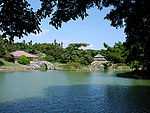
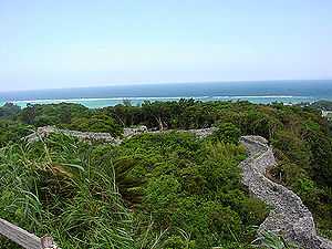
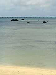
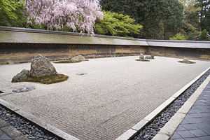
National Places of Scenic Beauty

As of 1 January 2015, thirteen places have been designated at a national level (including one *Special Place of Scenic Beauty).[2][3][4]

Site Municipality Comments Image Coordinates Type Ref.
*Shikina-en
識名園
Shikina-en
Naha inscribed on the UNESCO World Heritage List as one of the Gusuku Sites and Related Properties of the Kingdom of Ryukyu[5] 26°12′16″N 127°42′55″E / 26.20442507°N 127.715335°E 1
Ieudun Detached Residence Gardens
伊江御殿別邸庭園
Ieudun bettei teien
Naha 26°13′38″N 127°43′29″E / 26.22710114°N 127.72461732°E 1
Iedunchi Gardens
伊江殿内庭園
Iedunchi teien
Naha 26°13′12″N 127°43′17″E / 26.22010909°N 127.72146303°E 1
Shimojishima Tōri-ike
下地島の通り池
Shimojishima Tōri-ike
Miyakojima also a Natural Monument 24°49′30″N 125°08′15″E / 24.82486382°N 125.13762353°E 5, 8
Kiyan Coast and Arasaki Coast
喜屋武海岸及び荒崎海岸
Kiyan kaigan oyobi Arasaki kaigan
Itoman also a Natural Monument 26°07′48″N 127°39′55″E / 26.129925°N 127.66518027°E 8
Miyaradunchi Gardens
宮良殿内庭園
Miyaradunchi teien
Ishigaki 24°20′28″N 124°09′35″E / 24.341208°N 124.159782°E 1
Shuri Castle Shoin - Sasunoma Gardens
首里城書院・鎖之間庭園
Shuri-jō shoin・Sasunoma teien
Naha inscribed on the UNESCO World Heritage List as one of the Gusuku Sites and Related Properties of the Kingdom of Ryukyu[5] 26°12′59″N 127°43′09″E / 26.21643454°N 127.71917595°E 1
Ishigaki Family Gardens
石垣氏庭園
Ishigaki-shi teien
Ishigaki 24°20′41″N 124°09′20″E / 24.3447305°N 124.15549004°E 1
Kabira Bay - Mount Omoto
川平湾及び於茂登岳
Kabiara-wan oyobi Omoto-dake
Ishigaki 24°27′07″N 124°08′34″E / 24.45197905°N 124.14283698°E 8, 10, 11
Cape Higashi-Henna
東平安名崎
Higashihenna-zaki
Miyakojima 24°43′31″N 125°27′38″E / 24.72521793°N 125.4605811°E 8
Yabiji
八重干瀬
Yabiji
Miyakojima also a Natural Monument 24°59′56″N 125°15′53″E / 24.998889°N 125.264694°E 8
Tindabana
ティンダバナ
Tindabana
Yonaguni 24°28′00″N 123°00′10″E / 24.4665775°N 123.00281111°E
Kubura Bali - Kubira Furishi
久部良バリ及び久部良フリシ
Kubura Bali oyobi Kubira Furishi
Yonaguni 24°28′00″N 123°00′10″E / 24.4665775°N 123.00281111°E

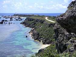
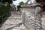
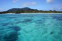
Prefectural Places of Scenic Beauty

As of 1 May 2014, nine places have been designated at a prefectural level.[4][6]

Site Municipality Comments Image Coordinates Type Ref.
Seifa-Utaki
斎場御嶽
Seifa-utaki
Nanjō also an Historic Site; inscribed on the UNESCO World Heritage List as one of the Gusuku Sites and Related Properties of the Kingdom of Ryukyu[5] 26°10′24″N 127°49′36″E / 26.173333°N 127.826667°E
Nakagusuku Castle Site
中城城跡
Nakagusuku-jō ato
Nakagusuku also an Historic Site 26°17′02″N 127°48′05″E / 26.283955°N 127.801273°E
Nakijin Castle Site
今帰仁城跡
Nakijin-jō ato
Nakijin also an Historic Site 26°41′27″N 127°55′49″E / 26.690833°N 127.930278°E
Todoroki Falls
轟の滝
Todoroki no taki
Nago 26°33′45″N 127°59′18″E / 26.562505°N 127.988362°E
Shurikinjō-chō Ishidatami-michi
首里金城町石畳道
Shurikinjō-chō ishidatami-michi
Naha also a Prefectural Historic Site 26°12′58″N 127°42′55″E / 26.216035°N 127.715335°E
Ie Village Mount Gusuku
伊江村の城山
Ie-mura no Gusuku-yama
Ie 26°43′10″N 127°48′25″E / 26.719394°N 127.807045°E
Ginowan City Mori River
宜野湾市森の川
Ginowan-shi Mori-no-kawa
Ginowan 26°16′17″N 127°44′30″E / 26.271482°N 127.741728°E
Cape Manza
万座毛
Manza-mō
Onna 26°30′18″N 127°51′01″E / 26.504912°N 127.850207°E
Sanninudai
サンニヌ台
Sanninudai
Yonaguni 24°27′14″N 123°02′00″E / 24.453762°N 123.033303°E

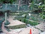
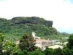
Municipal Places of Scenic Beauty

As of 1 May 2014, a further nineteen places have been designated at a municipal level.[4][7]

Site Municipality Comments Image Coordinates Type Ref.
Waji
ワシ (also 湧出 or わじぃー)
Wajī
Ie 26°43′59″N 127°47′22″E / 26.733001°N 127.789493°E
Innagā
犬名河(インナガー)
Innagā
Uruma 26°23′44″N 127°59′40″E / 26.3955°N 127.994417°E
Futenma-gū Cave
普天満宮洞穴
Futenma-gū dōketsu
Ginowan 26°17′35″N 127°46′39″E / 26.293028°N 127.777389°E
Naminoue
波上
Naminoue
Naha also a Municipal Historic Site 26°13′14″N 127°40′17″E / 26.220636°N 127.671352°E
Garner-Mui Forest
ガーナー森
Gānā-mui
Naha also a Natural Monument 26°12′03″N 127°40′40″E / 26.200826°N 127.677859°E
Hiyajō Banta
比屋定バンタ
Hiyajō banta
Kumejima 26°22′24″N 126°47′23″E / 26.373397°N 126.789801°E
Aka-no-Higemizu
阿嘉のひげ水
Aka-no-higemizu
Kumejima 26°22′00″N 126°47′44″E / 26.366649°N 126.795616°E
Aka-Kurushi
阿嘉黒石
Aka kurushi
Kumejima 26°22′10″N 126°48′12″E / 26.369456°N 126.803298°E
Ueda Forest
上田森
Aka kurushi
Kumejima 26°21′37″N 126°44′58″E / 26.360208°N 126.749396°E
Tokujimu Coast and Andesite Zone
トクジム海岸と一帯の安山岩
Tokujimu kaigan to ittai no anzangan
Kumejima 26°17′39″N 126°48′47″E / 26.294300°N 126.813126°E
View of the Kerama Straits from Mount Nishi
にし山(北山)山頂から望む慶良間海峡
Nishi-yama ssanchō kara nozomu Kerama kaikyō
Tokashiki 26°12′36″N 127°21′46″E / 26.209932°N 127.362742°E
Scenic Spots of Banyahara
番屋原の広場の景勝地
Banyahara no hiroba no keishō-chi
Aguni 26°34′54″N 127°13′26″E / 26.581734°N 127.223825°E
Scenic Spots of Sakakinahara Coast
坂木那原海岸景勝地
Sakakinahara kaigan keishō-chi
Aguni 26°34′39″N 127°13′14″E / 26.577512°N 127.220693°E
Nzōmiji
無蔵水
Nzōmiji
Iheya 27°05′30″N 128°00′45″E / 27.091683°N 128.012438°E
Coral Reef and Lagoon at Sawada Beach
佐和田の浜珊瑚礁・礁湖面
Sawada-no-hama sangoshō・shōko-men
Miyako within Irabu Prefectural Natural Park 24°50′19″N 125°09′31″E / 24.838699°N 125.158739°E
Rocky Coast at Cape Hakuchō
白鳥崎岩礁海岸一帯
Hakuchō-zaki ganshō kaigan ittai
Miyako within Irabu Prefectural Natural Park 27°05′30″N 128°00′45″E / 27.091683°N 128.012438°E
Rocky Coast of West and South Shimojishima
下地島南、西岩礁海岸一帯
Shimojishima minami, nishi ganshō kaigan ittai
Miyako within Irabu Prefectural Natural Park 24°48′49″N 125°08′28″E / 24.813537°N 125.141230°E
Scenery of Takana
高那の景勝
Takana no keishō
Taketomi Hateruma Island 24°03′00″N 123°47′51″E / 24.050040°N 123.797561°E
Ufudaki
大岳
Ufudaki
Taketomi Kohama Island; site of one of the Sakishima Beacons 24°20′49″N 123°58′43″E / 24.346999°N 123.978631°E

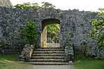
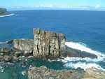
Registered Places of Scenic Beauty

As of 1 January 2015, one monument has been registered (as opposed to designated) as a place of scenic beauty at a national level.[4][8]

Site Municipality Comments Image Coordinates Type Ref.
Nakamoto Family Gardens
仲本氏庭園
Nakamoto-shi teien
Ishigaki 24°20′07″N 124°08′52″E / 24.335327°N 124.147761°E

See also

References

External links