List of Missouri state parks
State Historic Sites (blue)
(Note: Katy Trail State Park is not included on this map because of its linear nature.)
This is a list of state parks and state historic sites in Missouri. In the state of Missouri both state parks and state historic sites are administered by the Division of State Parks of the Missouri Department of Natural Resources. As of 2014, the division manages a total of 87 parks and historic sites plus the Roger Pryor Pioneer Backcountry, which together total more than 200,000 acres (81,000 ha).[1] According to the state, its parks system includes approximately 3,500 campsites, 194 cabins, and 1,000 miles (1,600 km) of trails, including the longest developed rails-to-trails project in the nation.[1]
State parks
| Name | County | Size | Estab- lished | |
|---|---|---|---|---|
| Babler State Park | St. Louis | 2,441 acres | 9.88 km2 | 1937 |
| Sam A. Baker State Park | Wayne | 5,323.62 acres | 21.5439 km2 | 1926 |
| Bennett Spring State Park | Dallas, Laclede | 3,216.74 acres | 13.0177 km2 | 1923 |
| Big Lake State Park | Holt | 407.41 acres | 1.6487 km2 | 1932 |
| Big Oak Tree State Park | Mississippi | 1,028.68 acres | 4.1629 km2 | 1937 |
| Big Sugar Creek State Park | McDonald | 2,082.54 acres | 8.4277 km2 | 1992 |
| Castlewood State Park | St. Louis | 1,818.3 acres | 7.358 km2 | 1974 |
| Crowder State Park | Grundy | 1,912.10 acres | 7.7380 km2 | 1938 |
| Cuivre River State Park | Lincoln | 6,393.94 acres | 25.8754 km2 | 1946 |
| Current River State Park | Shannon | 780 acres | 3.2 km2 | 2008 |
| Don Robinson State Park | Jefferson | 843 acres | 3.41 km2 | 2012 |
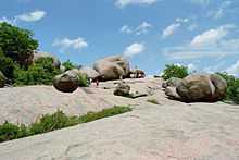
| Elephant Rocks State Park | Iron | 131.74 acres | 0.5331 km2 | 1967 |
| Finger Lakes State Park | Boone | 1,128.69 acres | 4.5676 km2 | 1973 |
| Graham Cave State Park | Montgomery | 369.51 acres | 1.4954 km2 | 1964 |
| Grand Gulf State Park | Oregon | 321.96 acres | 1.3029 km2 | 1984 |
| Ha Ha Tonka State Park | Camden | 3,709.74 acres | 15.0128 km2 | 1978 |
| Harry S Truman State Park | Benton | 1,440 acres | 5.8 km2 | 1976 |
| Hawn State Park | Ste. Genevieve | 4,953.66 acres | 20.0468 km2 | 1955 |
| Johnson's Shut-Ins State Park | Reynolds | 8,549.51 acres | 34.5986 km2 | 1955 |
| Jones-Confluence Point State Park | St. Charles | 1,121.43 acres | 4.5383 km2 | 2001 |
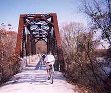
| Katy Trail State Park | multiple | 225.1 mi | 362.3 km | |
| Knob Noster State Park | Johnson | 3,934.38 acres | 15.9219 km2 | 1946 |
| Lake of the Ozarks State Park | Camden, Miller | 17,626.55 acres | 71.3321 km2 | 1946 |
| Lake Wappapello State Park | Wayne | 1,854.23 acres | 7.5038 km2 | 1956 |
| Lewis and Clark State Park | Buchanan | 189.13 acres | 0.7654 km2 | 1934 |
| Long Branch State Park | Macon | 1,828.47 acres | 7.3996 km2 | 1983 |
| Mark Twain State Park | Monroe | 2,775.14 acres | 11.2306 km2 | 1924 |
| Meramec State Park | Franklin, Crawford, Washington | 6,896.33 acres | 27.9085 km2 | 1927 |
| Montauk State Park | Dent | 1,396.12 acres | 5.6499 km2 | 1926 |
| Morris State Park | Dunklin | 161.22 acres | 0.6524 km2 | 2000 |
| Onondaga Cave State Park | Crawford | 1,317.70 acres | 5.3325 km2 | 1982 |
| Pershing State Park | Linn | 3,565.66 acres | 14.4297 km2 | 1937 |
| Pomme de Terre State Park | Hickory | 734.44 acres | 2.9722 km2 | 1960 |
| Prairie State Park | Barton | 3,942 acres | 15.95 km2 | 1980 |
| Roaring River State Park | Barry | 4,093.38 acres | 16.5653 km2 | 1928 |
| Robertsville State Park | Franklin | 1,224.65 acres | 4.9560 km2 | 1979 |
| Rock Bridge Memorial State Park | Boone | 2,272.83 acres | 9.1978 km2 | 1967 |
| Rock Island Trail State Park | multiple | 130 mi | 210 km | In development |
| Roger Pryor Pioneer Backcountry | multiple | 60,000 acres | 240 km2 | 2001 |
| Route 66 State Park | St. Louis | 418.61 acres | 1.6941 km2 | 1997 |
| St. Francois State Park | St. Francois | 2,734.97 acres | 11.0680 km2 | 1964 |
| St. Joe State Park | St. Francois | 8,242.98 acres | 33.3582 km2 | 1976 |
| Stockton State Park | Cedar | 2,175.90 acres | 8.8056 km2 | 1969 |
| Table Rock State Park | Taney, Stone | 356.03 acres | 1.4408 km2 | 1959 |
| Taum Sauk Mountain State Park | Iron, Reynolds | 7,501.09 acres | 30.3558 km2 | 1991 |
| Thousand Hills State Park | Adair | 3,079.70 acres | 12.4631 km2 | 1952 |
| Trail of Tears State Park | Cape Girardeau | 3,415.39 acres | 13.8216 km2 | 1957 |
| Van Meter State Park | Saline | 1,104.63 acres | 4.4703 km2 | 1932 |
| Wakonda State Park | Lewis | 1,053.87 acres | 4.2649 km2 | 1960 |
| Wallace State Park | Clinton | 501.61 acres | 2.0299 km2 | 1932 |
| Washington State Park | Washington | 2,147.57 acres | 8.6909 km2 | 1932 |
| Watkins Woolen Mill State Park | Clay | 1,500.22 acres | 6.0712 km2 | 1964 |
| Weston Bend State Park | Platte | 1,133.08 acres | 4.5854 km2 | 1980 |
State historic sites
See also
| Wikimedia Commons has media related to State parks of Missouri. |
- List of U.S. national parks
External links
- Missouri State Parks and Historic Sites Missouri Department of Natural Resources
- Missouri State Parks - List of Parks and Historic Sites Missouri Department of Natural Resources
References
- ↑ 1.0 1.1 "About the Missouri State Park System". Missouri State Parks. Missouri Department of Natural Resources. Retrieved October 8, 2014.
| ||||||||||||||||||||||||||||||


_crop1.jpg)


