List of Migratory Bird Sanctuaries of Canada
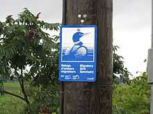
Sign on the limit of Nicolet Migratory Bird Sanctuary.
Migratory Bird Sanctuaries are created in Canada under the Migratory Birds Convention Act, 1994. They are administered by the Canadian Wildlife Service, whether on public or private land and this list is taken from their website.[1] The first sanctuary in North America, Last Mountain Lake, was created by federal order-in-council in 1887.
| Name | Year of Designation | Area |
| Vaseux Lake | 1923 | 282 ha (700 acres) |
| Victoria Harbour | 1923 | 1,700 ha (4,200 acres) |
| Esquimalt Lagoon | 1931 | 129.6 ha (320 acres) |
| Shoal Harbour | 1931 | 150 ha (370 acres) |
| Nechako River | 1944 | 180 ha (440 acres) |
| Christie Islet | 1962 | 0.81 ha (2.0 acres) |
| George C. Reifel | 1967 | 648 ha (1,600 acres) |
| Name | Year of Designation | Area |
| Red Deer | 1924 | 130 ha (320 acres) |
| Saskatoon Lake | 1948 | 1,135 ha (2,800 acres) |
| Richardson Lake | 1949 | 12,705 ha (31,390 acres) |
| Inglewood | 1968 | 1,600 ha (4,000 acres) |
| Name | Year of Designation | Area |
| Last Mountain Lake | 1887 | 4,736 ha (11,700 acres) |
| Sutherland | 1924 | 130 ha (320 acres) |
| Basin and Middle Lakes | 1925 | 8,720 ha (21,500 acres) |
| Indian Head | 1925 | 32 ha (79 acres) |
| Lenore Lake | 1925 | 8,830 ha (21,800 acres) |
| Old Wives Lake | 1925 | 26,060 ha (64,400 acres) |
| Redberry Lake | 1925 | 6,395 ha (15,800 acres) |
| Duncairn Reservoir | 1948 | 1,546 ha (3,820 acres) |
| Murray Lake | 1948 | 1,165 ha (2,880 acres) |
| Scentgrass Lake | 1948 | 633 ha (1,560 acres) |
| Upper Rousay Lake | 1948 | 518 ha (1,280 acres) |
| Val Marie Reservoir | 1948 | 505 ha (1,250 acres) |
| Neely Lake | 1952 | 809 ha (2,000 acres) |
| Opuntia Lake | 1952 | 1,395 ha (3,450 acres) |
| Wascana Lake | 1956 | 104 ha (260 acres) |
There are no Migratory Bird Sanctuaries in Manitoba.
| Name | Year of Designation | Area |
| Hannah Bay | 1939 | 29,500 ha (73,000 acres) |
| St. Joseph's Island | 1951 | 940 ha (2,300 acres) |
| Chantry Island | 1957 | 81 ha (200 acres) |
| Rideau | 1957 | 809.4 ha (2,000 acres) |
| Moose River | 1958 | 1,457 ha (3,600 acres) |
| Mississippi Lake | 1959 | 430 ha (1,100 acres) |
| Upper Canada | 1961 | 2,663 ha (6,580 acres) |
| Beckett Creek | 1969 | 103 ha (250 acres) |
| Eleanor Island | 1971 | 0.6 ha (1.5 acres) |
| Name | Year of Designation | Area | Coordinates |
| Bonaventure Island and Percé Rock | 1919 | 1,360 ha (3,400 acres) |
| Rochers-aux-Oiseaux | 1919 | 625 ha (1,540 acres) |
47°51′N 61°00′W / 47.850°N 61.000°W / 47.850; -61.000 (Bird Rocks Bird Sanctuary) |
| Brador Bay | 1925 | 538 ha (1,330 acres) |
| Baie des Loups | 1925 | 3,550 ha (8,800 acres) |
50°10′N 60°18′W / 50.167°N 60.300°W / 50.167; -60.300 (Baie des Loups Bird Sanctuary) |
| Betchouane | 1925 | 462 ha (1,140 acres) |
50°12′N 63°13′W / 50.200°N 63.217°W / 50.200; -63.217 (Betchouane Bird Sanctuary) |
| Île à la Brume | 1925 | 4,320 ha (10,700 acres) |
50°10′N 60°30′W / 50.167°N 60.500°W / 50.167; -60.500 (Île à la Brume Bird Sanctuary) |
| Îles Sainte-Marie | 1925 | 4,100 ha (10,000 acres) |
50°18′N 59°40′W / 50.300°N 59.667°W / 50.300; -59.667 (Île Sainte-Marie Bird Sanctuary) |
| Saint-Augustin | 1925 | 5,570 ha (13,800 acres) |
51°08′N 58°28′W / 51.133°N 58.467°W / 51.133; -58.467 (Saint-Augustin Bird Sanctuary) |
| Watshishou | 1925 | 11,320 ha (28,000 acres) |
| Île aux Basques | 1927 | 933 ha (2,310 acres) |
| Senneville | 1936 | 569 ha (1,410 acres) |
| Île aux Hérons | 1937 | 622 ha (1,540 acres) |
45°25′N 73°35′W / 45.417°N 73.583°W / 45.417; -73.583 (Île aux Hérons Bird Sanctuary) |
| Ile Carillon | 1937 | 426 ha (1,050 acres) |
45°31′N 74°16′W / 45.517°N 74.267°W / 45.517; -74.267 (Carillon Island Bird Sanctuary) |
| Corossol Island | 1937 | 413 ha (1,020 acres) |
50°05′N 66°25′W / 50.083°N 66.417°W / 50.083; -66.417 (Corossol Island Bird Sanctuary) |
| Boatswain Bay | 1941 | 17,900 ha (44,000 acres) |
| Philipsburg | 1955 | 525 ha (1,300 acres) |
| Mont Saint-Hilaire | 1960 | 955 ha (2,360 acres) |
45°33′N 73°09′W / 45.550°N 73.150°W / 45.550; -73.150 (Mont-Saint-Hilaire Bird Sanctuary) |
| Cap-Saint-Ignace | 1972 | 133 ha (330 acres) |
47°02′30″N 70°28′30″W / 47.04167°N 70.47500°W / 47.04167; -70.47500 (Cap-Saint-Ignace Bird Sanctuary) |
| Îles de la Paix | 1972 | 1,115 ha (2,760 acres) |
45°21′N 73°50′W / 45.350°N 73.833°W / 45.350; -73.833 (Îles de la Paix Bird Sanctuary) |
| Nicolet | 1982 | 2,835 ha (7,010 acres) |
46°12′N 72°40′W / 46.200°N 72.667°W / 46.200; -72.667 (Nicolet Bird Sanctuary) |
| Couvée Islands | 1986 | 17 ha (42 acres) |
45°29′N 73°31′W / 45.483°N 73.517°W / 45.483; -73.517 (Couvée Islands Bird Sanctuary) |
| L'Isle-Verte | 1986 | 303 ha (750 acres) |
48°01′N 69°21′W / 48.017°N 69.350°W / 48.017; -69.350 (L'Isle-Verte Bird Sanctuary) |
| L'Islet | 1986 | 64 ha (160 acres) |
47°08′00″N 70°22′30″W / 47.13333°N 70.37500°W / 47.13333; -70.37500 (L’Islet Bird Sanctuary) |
| Montmagny | 1986 | 80 ha (200 acres) |
46°59′30″N 70°33′30″W / 46.99167°N 70.55833°W / 46.99167; -70.55833 (Montmagny Bird Sanctuary) |
| Saint-Omer | 1986 | 64.6 ha (160 acres) |
48°06′30″N 66°14′00″W / 48.10833°N 66.23333°W / 48.10833; -66.23333 (Saint-Omer Bird Sanctuary) |
| Saint-Vallier | 1986 | 405 ha (1,000 acres) |
46°53′30″N 70°51′00″W / 46.89167°N 70.85000°W / 46.89167; -70.85000 (Saint-Vallier Bird Sanctuary) |
| Trois-Saumons | 1986 | 222 ha (550 acres) |
47°09′30″N 70°20′00″W / 47.15833°N 70.33333°W / 47.15833; -70.33333 (Trois-Saumons Bird Sanctuary) |
| Gros Mécatina | 1996 | 2,310 ha (5,700 acres) |
| Name | Year of Designation | Area |
| Grand Manan | 1931 | 250 ha (620 acres) |
| Machias Seal Island | 1944 | 9.5 ha (23 acres) |
| Inkerman | 1998 | 15.1 ha (37 acres) |
| Name | Year of Designation | Area |
| Big Glace Bay Lake | 1939 | 240 ha (590 acres) |
| Kentville | 1939 | 200 ha (490 acres) |
| Port L'Hebert | 1941 | 350 ha (860 acres) |
| Port Joli | 1941 | 280 ha (690 acres) |
| Sable River | 1941 | 260 ha (640 acres) |
| Amherst Point | 1947 | 429 ha (1,060 acres) |
| Sable Island | 1977 | 2,350 ha (5,800 acres) |
| Haley Lake | 1980 | 100 ha (250 acres) |
| Name | Year of Designation | Area |
| Black Pond | 1936 | 130 ha (320 acres) |
| Name | Year of Designation | Area |
| Terra Nova | 1967 | 870 ha (2,100 acres) |
| Ile aux Canes | 1991 | 150 ha (370 acres) |
| Shepherd Island | 1991 | 16 ha (40 acres) |
Yukon Territory
There are no Migratory Bird Sanctuaries in the Yukon Territory.
| Name | Year of Designation | Area[2] |
| Anderson River Delta | 1961 | 118,417 ha (292,610 acres) |
| Banks Island No. 1 | 1961 | 2,019,997 ha (4,991,520 acres) |
| Banks Island No. 2 | 1961 | 14,302 ha (35,340 acres) |
| Cape Parry | 1961 | 227 ha (560 acres) |
| Kendall Island | 1961 | 61,241 ha (151,330 acres) |
| Name | Year of Designation | Area |
| Hannah Bay | 1939 | 29,500 ha (73,000 acres) |
| Akimiski Island | 1941 | 336,700 ha (832,000 acres) |
| Boatswain Bay | 1941 | 17,900 ha (44,000 acres) |
| Dewey Soper | 1957 | 793,000 ha (1,960,000 acres) |
| East Bay | 1959 | 113,800 ha (281,000 acres) |
| Harry Gibbons | 1959 | 122,400 ha (302,000 acres) |
| McConnell River | 1960 | 33,400 ha (83,000 acres) |
| Queen Maud Gulf | 1961 | 6,176,500 ha (15,262,000 acres) |
| Bylot Island | 1965 | 1,263,500 ha (3,122,000 acres) |
| Seymour Island | 1975 | 2,800 ha (6,900 acres) |
| Prince Leopold Island | 1992 | 31,100 ha (77,000 acres) |
References
External links