List of Local Nature Reserves in Hertfordshire
Hertfordshire is a county in eastern England. It is bordered by Bedfordshire to the north, Cambridgeshire to the north-east, Essex to the east, Buckinghamshire to the west and Greater London to the south. The county town is Hertford. As of June 2013, the county has a population of 1,140,700[1] in an area of 634 square miles (1,640 km2).[2]
Local Nature Reserve (LNR) is a statutory designation by local authorities which gives protection to wildlife habitats and natural features. It allows local authorities to apply local bye-laws to manage and protect sites.[3] The local authority must have a legal interest in the site, by owning or leasing it or having a nature reserve agreement with the owner.[4]
As of April 2015, 42 LNRs in Hertfordshire have been notified to Natural England.[5][lower-alpha 1] The largest site is Therfield Heath with 147.3 hectares. It has some of the richest chalk grassland in England, and it is also a Site of Special Scientific Interest (SSSI).[7] The smallest is Oxleys Wood in Hatfield, which has an area of only 1.2 hectares. This wood often floods, and it provides a habitat for a wide range of insects and birds.[8] Several other sites are also SSSIs, such as Croxley Common Moor[9] and Sherrardspark Wood.[10] The oldest LNR listed by Natural England is Hilfield Park Reservoir, declared in 1969,[11] and the newest Weston Hills in 2012.[6]
Sites
Access
- YES = free public access to all or most of the site
- PP = free public access to part of the site
- PL = public access at limited times
- NO = no public access
| Site | Photograph | Area[lower-alpha 2] | Location[lower-alpha 3] | Map[lower-alpha 4] | Details[lower-alpha 5] | Access | Description |
|---|---|---|---|---|---|---|---|
| Albans Wood |  |
4.1 hectares (10 acres) | 51°41′39″N 0°23′54″W / 51.6941°N 0.3983°W TL 108 007 |
Map | Details | YES | The site is ancient semi-natural woodland. It is mainly oak with other trees such as beech, horse chestnut and sweet chestnut. Mammmals include muntjac deer and noctule bats.[13] |
| Batchworth Heath | 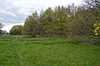 |
4.0 hectares (9.9 acres) | 51°37′12″N 0°26′45″W / 51.6201°N 0.4457°W TQ 077 924 |
Map | Details | YES | This is open land around a road junction.[14] The habitat is heathland with an ancient pond and a variety of wildlife.[15] |
| Batford Springs |  |
3.5 hectares (8.6 acres) | 51°49′22″N 0°20′19″W / 51.8228°N 0.3386°W TL 146 151 |
Map | Details | YES | The main feature of the reserve is a number of small springs which are the source of chalk streams and ponds. The River Lea runs through the site, and there is grassland and a small wood.[16] |
| Cassiobury Park | 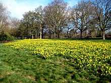 |
25.1 hectares (62 acres) | 51°39′34″N 0°25′32″W / 51.6594°N 0.4256°W TQ 090 968 |
Map | Details | YES | This large park in Watford has a variety of habitats, including streams, ponds, watercress beds, wet grassland and wet woodland. The Grand Union Canal and River Gade run through the site.[17] |
| Cheshunt Park[lower-alpha 6] |  |
40.0 hectares (99 acres) | 51°43′00″N 0°02′45″W / 51.7167°N 0.04575°W TL 351 038 |
Map | Details | YES | The history of the park goes back to Roman times. It is grass and woodland which has ancient hedgerows, wildflower meadows, a pond and an orchard which is cropped by traditional cattle breeds.[18][19] |
| Chorleywood Common | 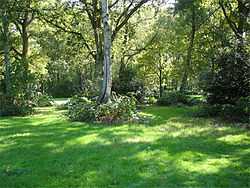 |
75.6 hectares (187 acres) | 51°39′15″N 0°30′40″W / 51.6542°N 0.5110°W TQ 031 961 |
Map | Details | YES | Some 300 fungi, 70 plant species and fifty birds have been recorded on the common, which has habitats including acid heathland, neutral grassland, chalk meadows and secondary woodland.[20] |
| Chorleywood House Estate | 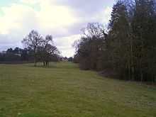 |
64.3 hectares (159 acres) | 51°39′47″N 0°30′08″W / 51.6631°N 0.5021°W TQ 037 971 |
Map | Details | YES | The River Chess runs through the estate, which has formal parkland surrounding a 200 year old manor house, meadows and mature woodland.[21] |
| Colney Heath | 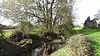 |
22.5 hectares (56 acres) | 51°44′17″N 0°15′38″W / 51.7380°N 0.2606°W TL 202 058 |
Map | Details | YES | The site is acid grassland, which is unusual in Hertfordshire, and the River Colne runs through it. The heath is managed to maintain the grassland and the diversity of plant species along the river.[22] |
| The CommonsThe Commons |  |
13.2 hectares (33 acres) | 51°47′01″N 0°10′34″W / 51.7835°N 0.1762°W TL 259 110 |
Map | Details | YES | The site has a variety of habitats including oak woodland, flower-rich meadows, wet fens, ditches and ponds. The meadows are grazed by livestock.[23] |
| Croxley Common Moor | 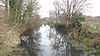 |
41.2 hectares (102 acres) | 51°38′30″N 0°26′11″W / 51.6416°N 0.4363°W TQ 083 948 |
Map | Details | YES | The site is mainly grass heathland with some ancient woodland and hazel coppice. It is also a Site of Special Scientific Interest, and over 250 species of plants have been recorded.[9][24] |
| Danesbury Park |  |
24.5 hectares (61 acres) | 51°50′14″N 0°13′03″W / 51.8372°N 0.2176°W TL 229 169 |
Map | Details | YES | The site was formerly the park of Danesbury House, and it still has some large mature trees which are important to wildlife. Grassland areas, which are managed by rare-breed cattle, have many varieties of flowering plants.[25] |
| Fisher's Field |  |
1.8 hectares (4.4 acres) | 51°39′28″N 0°22′56″W / 51.6579°N 0.3823°W TQ 120 967 |
Map | Details | YES | The area was allotments during the Second World War. There are areas of woodland, with trees including oak, rowan and wild cherry, and a wildflower meadow and scrub with bramble, raspberry and willow herb. Animals include green woodpeckers, shrews and bees.[26] |
| Furzefield Wood and Lower Halfpenny | 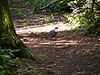 |
7.4 hectares (18 acres) | 51°42′21″N 0°12′14″W / 51.7057°N 0.2040°W TL 242 023 |
Map | Details | YES | The wood has been managed for coppicing for over 300 years. It now provides a habitat for birds, and fallen branches are important for invertebrates. Lower Halfpenny is a meadow which was once the route of an old drovers' track.[27] |
| Garston Park |  |
6.4 hectares (16 acres) | 51°41′28″N 0°22′47″W / 51.6912°N 0.3796°W TL 121 004 |
Map | Details | YES | The nature reserve has woodland which is mainly oak, ash and sycamore, and there are also areas of grassland and wetland. Mammals include muntjac deer and pipistrelle bats.[28] |
| Harebreaks Wood |  |
5.1 hectares (13 acres) | 51°40′51″N 0°24′32″W / 51.6808°N 0.4089°W TQ 101 992 |
Map | Details | YES | The site is semi-natural woodland of oak, ash and cherry, which goes back to at least 1600. Birds include treecreeper and nuthatch, and there mammals such as muntjac deer and pipistrelle bats.[29][30] |
| Hilfield Park Reservoir | 74.7 hectares (185 acres) | 51°38′57″N 0°19′39″W / 51.6491°N 0.3276°W TQ 158 958 |
Map | Details | NO | ||
| Howe Dell |  |
4.0 hectares (9.9 acres) | 51°45′26″N 0°13′20″W / 51.7572°N 0.2222°W TL 228 080 |
Map | Details | YES | The site is woodland which runs along both sides of a stream with steep sides. The main trees are hornbeam, oak and beech.[31] |
| Howe Grove Wood |  |
8.5 hectares (21 acres) | 51°45′58″N 0°28′00″W / 51.7661°N 0.4668°W TL 059 086 |
Map | Details | YES | This site is dense woodland next to the A4147 road in Hemel Hempstead.[32] |
| Ivel Springs | 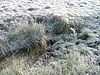 |
15.4 hectares (38 acres) | 51°59′39″N 0°11′38″W / 51.9942°N 0.1939°W TL 241 344 |
Map | Details | YES | The site, which was a rubbish dump until the 1950s, has habitats including woodland, wetland and pasture. Its springs are the source of the River Ivel, and they have a wide variety of wildlife.[33] |
| Lairage Land, TheThe Lairage Land |  |
4.4 hectares (11 acres) | 51°38′41″N 0°24′21″W / 51.6448°N 0.4059°W TQ 104 952 |
Map | Details | YES | The site is mainly rough grassland, with some woodland and scrub. The River Colne runs along its southern boundary, with stream water crowfoot and yellow water lily growing in the water. A notable insect is Roesel's bush-crickets.[34] |
| Mardley Heath |  |
41.1 hectares (102 acres) | 51°50′58″N 0°11′33″W / 51.8494°N 0.1925°W TL 246 183 |
Map | Details | YES | In the middle of the twentieth century the heath was used for gravel extraction, and it is now regenerating naturally. Oak and hornbeam woodland around the perimeter remains, and it is managed to enhance biodiversity.[35] |
| Marshalls Heath | 4.0 hectares (9.9 acres) | 51°49′15″N 0°19′01″W / 51.8207°N 0.3169°W TL 161 149 |
Map | Details | |||
| Northaw Great Wood Country Park |  |
120.7 hectares (298 acres) | 51°43′22″N 0°08′28″W / 51.7227°N 0.14105304°W TL 285 043 |
Map | Details | YES | The park is also a Site of Special Scientific Interest. It has one of the county's most exensive areas of ancient hornbeam woodland, with other trees including oak and silver birch. Glades, streams and springs add to the biodiversity.[36] |
| Norton Common | 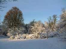 |
25.7 hectares (64 acres) | 51°59′05″N 0°13′40″W / 51.9848°N 0.2278°W TL 218 333 |
Map | Details | YES | Woodland has diverse wildlife including black squirrels, muntjac deer, and birds such as chiff chaffs and blackcaps. There are also meadows with wild flowers, and the Pix Brook, which is fed by mineral-rich springs.[37][38] |
| Oughtonhead Common | 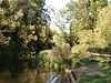 |
17.4 hectares (43 acres) | 51°57′39″N 0°18′05″W / 51.9607°N 0.3015°W TL 168 305 |
Map | Details | YES | The common is part of the Chilterns Area of Outstanding Natural Beauty.[39] It has a wide variety of habitats, and the River Oughton flows along the edge. English Longhorn cattle graze pasture areas.[40] |
| Oxhey Woods |  |
100.2 hectares (248 acres) | 51°37′27″N 0°24′29″W / 51.6241°N 0.4080°W TQ 103 929 |
Map | Details | YES | The site is mainly semi-natural woodland, and some areas date back to the end of the last Ice Age, the Younger Dryas, 11,500 years ago.[41] Plants include bluebells, anemones and violets and the rare wild service tree.[42] |
| Oxleys Wood |  |
1.2 hectares (3.0 acres) | 51°45′03″N 0°13′24″W / 51.7509°N 0.2232°W TL 227 073 |
Map | Details | YES | The wood floods in wet weather, particularly the northern part, which has a pond. Tree species include oak, ash, elm and willow, and they provide a habitat for insects which provide food for birds.[43] |
| Prestwick Road Meadows | 2.8 hectares (6.9 acres) | 51°37′03″N 0°23′17″W / 51.6176°N 0.3880°W TQ 117 922 |
Map | Details | |||
| Purwell Meadows |  |
8.6 hectares (21 acres) | 51°57′14″N 0°15′19″W / 51.9538°N 0.2552°W TL 200 298 |
Map | Details | YES | The River Purwell runs through the meadows. Wildlife includes kingfishers, which are native to the area, and water voles.[44] |
| Rickmansworth Aquadrome | 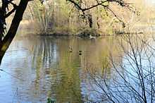 |
41.0 hectares (101 acres) | 51°37′59″N 0°28′43″W / 51.6331°N 0.4785°W TQ 054 938 |
Map | Details | YES | There are two lakes and a diverse range of wildlife habitats.[45] The site has trees such as oaks and willows, birds including herons and moorhens, and small copper and gatekeeper butterflies.[46] |
| Sherrardspark Wood | 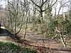 |
73.2 hectares (181 acres) | 51°48′37″N 0°13′02″W / 51.8102°N 0.2172°W TL 230 139 |
Map | Details | YES | Much of this site is sessile oak woodland. Some trees are 250 years old, and the wood is also a Site of Special Scientific Interest. A diverse flora includes violet and broad-leaved helleborine, both of which are rare.[10] |
| Shrubhill Common |  |
9.8 hectares (24 acres) | 51°45′14″N 0°30′07″W / 51.7539°N 0.5020°W TL 035 072 |
Map | Details | YES | The common is woodland and scrub, together with two fields which are chalk grassland. There are over 100 species of wild flowers, and herbs such as marjoram and basil.[47] |
| Singlers Marsh |  |
6.3 hectares (16 acres) | 51°50′07″N 0°13′14″W / 51.8354°N 0.2206°W TL 227 167 |
Map | Details | YES | The River Mimram runs along the edge of this site. It has grassland, which is managed by cattle grazing and cutting, and areas of willow scrub with some more mature trees.[48] |
| Stanborough Reedmarsh | 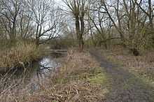 |
3.3 hectares (8.2 acres) | 51°48′37″N 0°13′02″W / 51.8102°N 0.2172°W TL 230 139 |
Map | Details | YES | The site is wet willow woodland on the bank of the River Lea. It is important for water voles and birds such as reed and sedge warblers.[49] Water figwort, common meadow rue and water chickweed grow along the river bank.[50] |
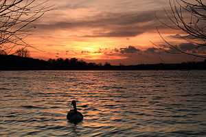
| Stockers Lake | 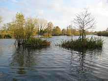 |
37.9 hectares (94 acres) | 51°37′47″N 0°29′19″W / 51.6297°N 0.4887°W TQ 047 934 |
Map | Details | YES | This is an old flooded gravel pit which has over sixty species of breeding birds, including shoveler and goldeneye ducks in nationally important numbers. It is managed by the Herts and Middlesex Wildlife Trust.[51] |
| Therfield Heath | 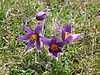 |
147.3 hectares (364 acres) | 52°02′32″N 0°03′18″W / 52.0423°N 0.05491°W TL 335 400 |
Map | Details | YES | This is also a Site of Special Scientific Interest. It is unimproved pasture and has some of the richest chalk grassland in England. Plants include the rare pasque flower, and there are insects such as the chalkhill blue butterfly.[7] |
| Top Field and Cozens Grove | 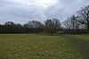 |
6.1 hectares (15 acres) | 51°44′30″N 0°01′54″W / 51.7416°N 0.03164°W TL 360 066 |
Map | Details | YES | Top Field is a wildflower meadow which is mown to provide a habitat for small mammals, birds and insects. Cozens Grove is an ancient wood which has coppiced hornbeam and a medieval sunken ditch.[52][53] |
| Watercress Wildlife Site | 1.2 hectares (3.0 acres) | 51°44′37″N 0°19′58″W / 51.7436°N 0.3328°W TL 152 063 |
Map | Details | |||
| Waterford Heath | 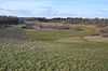 |
35.2 hectares (87 acres) | 51°49′05″N 0°05′32″W / 51.8181°N 0.09215°W TL 316 150 |
Map | Details | YES | The site is mainly grassland, with areas of scrub, wood plantation and semi-natural woodland. Breeding birds include skylarks and willow warblers, and there are reptiles such as slow worms and grass snakes.[54] |
| Weston Hills |  |
18.0 hectares (44 acres)[55] | 51°48′15″N 0°10′55″W / 51.8042°N 0.18189°W TL 250 326 |
Map | Details | YES | Chalk grassland is its most important ecological feature and one of the best examples in Hertfordshire; plants are very diverse because the harsh conditions do not allow vigorous species to become dominant.[55] |
| Wheathampstead | 5.9 hectares (15 acres) | 51°48′15″N 0°10′55″W / 51.8042°N 0.18188°W TL 177 131 |
Map | Details | |||
| The WickThe Wick | 3.4 hectares (8.4 acres) | 51°45′41″N 0°18′43″W / 51.7613°N 0.3119°W TL 166 083 |
Map | Details | |||
| Withey Beds, TheThe Withey Beds |  |
7.5 hectares (19 acres) | 51°38′04″N 0°26′38″W / 51.6345°N 0.4438°W TQ 078 940 |
Map | Details | YES | The site borders the River Colne, and it has a variety of habitats including dry grassland, wet woodland, marsh and ditches. A World War II pillbox has been turned into a bat roost.[56] |
See also
| Wikimedia Commons has media related to Local Nature Reserves in Hertfordshire. |
- List of Sites of Special Scientific Interest in Hertfordshire
- Herts and Middlesex Wildlife Trust
- List of Local Nature Reserves in England
Notes
- ↑ This list also includes Weston Hills, which was declared an LNR in 2012 by North Hertfordshire District Council, but is not in the Natural England list.[6]
- ↑ The area is taken from the Natural England map of each site. (Click on the identify icon (i) in the "Feature Tools" and then click on the site.)[12]
- ↑ The location is taken from the Natural England details page for the site
- ↑ The maps are on the Natural England database of Local Nature Reserves.
- ↑ Details are on the pages on each site in the Natural England database of Local Nature Reserves.[12]
- ↑ This site is wrongly named Chestnut Park on the details page and correctly Cheshunt Park on the map
Coordinates: 51°54′N 0°12′W / 51.9°N 0.2°W
References
- ↑ "Resident Population". Hertfordshire Local Information System. Retrieved 10 February 2015.
- ↑ "Area Measurements". Hertfordshire Local Information System. Retrieved 10 February 2015.
- ↑ "Why declare Local Nature Reserves?". Natural England. Retrieved 28 May 2014.
- ↑ "How are Local Nature Reserves declared?". Natural England. Retrieved 28 May 2014.
- ↑ "Local Nature Reserves: Search Results for Hertfordshire". Nature England. Retrieved 24 April 2015.
- ↑ 6.0 6.1 "Weston Hills". North Hertfordshire District Council. Retrieved 24 April 2015.
- ↑ 7.0 7.1 "Therfield Heath citation" (PDF). Sites of Special Scientific Interest. Natural England. Retrieved 9 February 2015.
- ↑ "Oxleys Wood". Local Nature Reserves. Natural England. 14 March 2013. Retrieved 10 February 2015.
- ↑ 9.0 9.1 "Croxley Common Moor citation" (PDF). Sites of Special Scientific Interest. Natural England. Retrieved 10 December 2014.
- ↑ 10.0 10.1 "Sherrardspark Wood citation" (PDF). Sites of Special Scientific Interest. Natural England. Retrieved 8 February 2015.
- ↑ "Hilfield Park Reservoir". Local Nature Reserves. Natural England. 14 March 2013. Retrieved 10 February 2015.
- ↑ 12.0 12.1 "Local Nature Reserves: Search Results for Hertfordshire". Natural England. Retrieved 5 February 2015.
- ↑ "Albans Wood". Local Nature Reserves. Natural England. 13 March 2013. Retrieved 1 April 2015.
- ↑ "Map of Batchworth Heath". Local Nature Reserves. Natural England. Retrieved 25 April 2015.
- ↑ "Batchworth Heath". Local Nature Reserves. Natural England. 13 March 2013. Retrieved 25 April 2015.
- ↑ "Batford Springs". Local Nature Reserves. Natural England. 13 March 2013. Retrieved 6 February 2015.
- ↑ "Cassiobury Park". Local Nature Reserves. Natural England. 6 October 2014. Retrieved 6 February 2015.
- ↑ "Cheshunt Park". Hertfordshire Countryside Management Service. Retrieved 18 February 2015.
- ↑ "Cheshunt Park leaflet" (PDF). Borough of Broxbourne. Retrieved 18 February 2015.
- ↑ "Chorleywood Common". Local Nature Reserves. Natural England. 13 March 2013. Retrieved 6 February 2015.
- ↑ "Chorleywood House Estate". Three Rivers District Council. Retrieved 6 February 2015.
- ↑ "Colney Heath". Local Nature Reserves. Natural England. 13 March 2013. Retrieved 6 February 2015.
- ↑ "The Commons". Welwyn Hatfield Borough Council. Retrieved 22 March 2015.
- ↑ "Croxley Common Moor". Local Nature Reserves. Natural England. 13 March 2013. Retrieved 10 December 2014.
- ↑ "Danesbury". Welwyn Hatfield Borough Council. Retrieved 22 March 2015.
- ↑ "Fisher's Field nature reserve" (PDF). Hertsmere Borough Council. Retrieved 2 April 2015.
- ↑ "Furzefield Wood" (PDF). Hertfordshire County Council. Retrieved 6 February 2015.
- ↑ "Garston Park". Local Nature Reserves. Natural England. 6 October 2014. Retrieved 1 April 2015.
- ↑ "Harebreaks Wood". Watford Borough Council. Retrieved 2 April 2015.
- ↑ "Home page". Friends of Harebreaks Wood. Retrieved 2 April 2015.
- ↑ "Howe Dell". Local Nature Reserves. Natural England. 17 March 2013. Retrieved 16 February 2015.
- ↑ "Howe Grove Wood". Local Nature Reserves. Natural England. 14 March 2013. Retrieved 26 February 2015.
- ↑ "Ivel Springs". Local Nature Reserves. Natural England. Retrieved 6 February 2015.
- ↑ "The Lairage Land". Local Nature Reserves. Natural England. 14 March 2013. Retrieved 3 April 2015.
- ↑ "Mardley Heath". Welwyn Hatfield Borough Council. Retrieved 6 February 2015.
- ↑ "Northaw Great Wood citation" (PDF). Sites of Special Scientific Interest. Natural England. Retrieved 23 December 2014.
- ↑ "Norton Common". Local Nature Reserves. Natural England. 14 March 2013. Retrieved 6 February 2015.
- ↑ "Welcome to Norton Common" (PDF). North Hertfordshire District Council. Retrieved 6 February 2015.
- ↑ "Oughtonhead Common". Chilterns Conservation Board. Retrieved 8 February 2015.
- ↑ "Oughtonhead Common". North Hertfordshire District Council. Retrieved 8 February 2015.
- ↑ "Local Nature Reserves". Three Rivers District Council. Retrieved 25 September 2013.
- ↑ "Oxhey Woods". Local Nature Reserves. Natural England. Retrieved 25 September 2013.
- ↑ "Oxleys Wood". Local Nature Reserves. Natural England. 14 March 2013. Retrieved 16 February 2015.
- ↑ "Purwell Meadows". North Hertfordshire District Council. Retrieved 7 March 2015.
- ↑ "Rickmansworth Aquadrome". Three Rivers District Council. Retrieved 8 February 2015.
- ↑ "Rickmansworth Aquadrome leaflet" (PDF). Three Rivers District Council. Retrieved 8 February 2015.
- ↑ "Shrubhill Common Nature Reserve". Dacorum Environmental Forum - Members Pages. 3 February 2015.
- ↑ "Singlers Marsh". Welwyn Hatfield Borough Council. Retrieved 22 March 2015.
- ↑ "Stanborough Reedmarsh". Local Nature Reserves. Natural England. 14 March 2013. Retrieved 16 February 2015.
- ↑ "Stanborough Reedmarsh". Herts and Middlesex Wildlife Trust. Retrieved 16 February 2015.
- ↑ "Stockers Lake". Local Nature Reserves. Natural England. 14 March 2013. Retrieved 8 February 2015.
- ↑ "Top Field and Cozens Grove". Local Nature Reserves. Natural England. 15 March 2013. Retrieved 16 February 2015.
- ↑ "Top Field Cozens Grove". Broxbourne Borough Council. Retrieved 16 February 2015.
- ↑ "Waterford Heath". Local Nature Reserves. Natural England. 16 March 2013. Retrieved 4 February 2015.
- ↑ 55.0 55.1 "Newsletter" (PDF). Hertfordshire Wildlife Trusts Partnership. March 2013. Retrieved 29 April 2015.
- ↑ "The Withey Beds". Local Nature Reserves. Natural England. 14 March 2013. Retrieved 25 April 2015.
| ||||||||||||||||||||||||||||||||||||||