List of Christopher Wren churches in London
Churches in the City of London
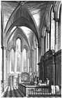
Eighty-eight parish churches were burned during the Great Fire of London in 1666. The office of Christopher Wren rebuilt 51 parish churches and St Paul's Cathedral. Many of these churches were demolished as the population of the City of London declined in the 19th century and more were destroyed or damaged during the Blitz.
Survived in original form
| Image |
Name |
Location |
Date |
Listing |
Coordinates |
 | St Benet Paul's Wharf | Queen Victoria Street, Queenhithe, City of London | 1677-83 | Grade I (1950) | 51°30′42.01″N 0°5′57.38″W / 51.5116694°N 0.0992722°W / 51.5116694; -0.0992722 |
 | St Clement Eastcheap | Clement's Lane, Candlewick, City of London | 1683-87 | Grade I (1950) | 51°30′40.77″N 0°5′12.81″W / 51.5113250°N 0.0868917°W / 51.5113250; -0.0868917 |
 | St Edmund, King and Martyr | Lombard Street, Langbourn, City of London | 1670-79 | Grade I (1950) | 51°30′44.62″N 0°5′10.68″W / 51.5123944°N 0.0863000°W / 51.5123944; -0.0863000 |
 | St James Garlickhythe | Garlick Hill, Vintry, City of London | 1676-83 | Grade I (1950) | 51°30′39.99″N 0°5′37.54″W / 51.5111083°N 0.0937611°W / 51.5111083; -0.0937611 |
 | St Margaret Lothbury | Lothbury, Coleman Street Ward and Broad Street Ward, City of London | 1686-90 | Grade I (1950) | 51°30′52.91″N 0°5′19.92″W / 51.5146972°N 0.0888667°W / 51.5146972; -0.0888667 |
 | St Margaret Pattens | Eastcheap, Billingsgate, City of London | 1684-87 | Grade I (1950) | 51°30′38.75″N 0°4′58.74″W / 51.5107639°N 0.0829833°W / 51.5107639; -0.0829833 |
 | St Martin, Ludgate | Ludgate Hill, Farringdon Within, City of London | 1677-84 | Grade I (1950) | 51°30′50.55″N 0°6′6.99″W / 51.5140417°N 0.1019417°W / 51.5140417; -0.1019417 |
 | St Mary Abchurch | Abchurch Lane, Candlewick, City of London | 1681-86 | Grade I (1950) | 51°30′42.02″N 0°5′18.05″W / 51.5116722°N 0.0883472°W / 51.5116722; -0.0883472 |
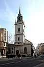
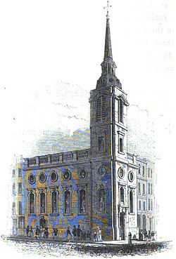
_-_geograph.org.uk_-_560482.jpg) | St Mary Aldermary | Queen Victoria Street, Cordwainer, City of London | 1679-82 | Grade I (1950) | 51°30′46″N 0°05′36″W / 51.51278°N 0.09333°W / 51.51278; -0.09333 |
 | St Michael's Cornhill | Cornhill, Cornhill, City of London | 1669-72 | Grade I (1950) | 51°30′47.50″N 0°5′7.68″W / 51.5131944°N 0.0854667°W / 51.5131944; -0.0854667 |
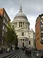 | St Paul's Cathedral | St Paul's Churchyard, Castle Baynard, City of London | 1675-1711 | Grade I (1950) | 51°30′49″N 0°05′53″W / 51.51361°N 0.09806°W / 51.51361; -0.09806 |
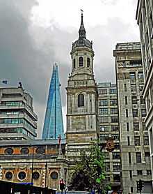
 | St Peter upon Cornhill | Cornhill, Cornhill, City of London | 1677-84 | Grade I (1950) | 51°30′47.7″N 0°5′4.5″W / 51.513250°N 0.084583°W / 51.513250; -0.084583 |
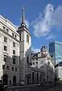
 | St Stephen Walbrook | Walbrook, Walbrook, City of London | 1672-79 | Grade I (1950) | 51°30′45.46″N 0°5′23.71″W / 51.5126278°N 0.0899194°W / 51.5126278; -0.0899194 |
Substantially altered before the Blitz
Substantially rebuilt after the Blitz
The Blitz in 1940-1941 damaged nearly all the churches in the City of London and many were nearly destroyed leaving just the outer walls and tower. However most of them were rebuilt to Wren's original design.
| Image |
Name |
Location |
Date |
Listing |
Comment |
Coordinates |
 | St Andrew-by-the-Wardrobe | Queen Victoria Street, Castle Baynard, City of London | 1685-95 | Grade I (1950) | rededicated in 1961 | 51°30′44.44″N 0°6′4.89″W / 51.5123444°N 0.1013583°W / 51.5123444; -0.1013583 |
 | St Andrew, Holborn | Holborn Viaduct, Farringdon Without, City of London | 1686-87 | Grade I (1950) | re-opened in 1961 | 51°31′2.10″N 0°6′24.14″W / 51.5172500°N 0.1067056°W / 51.5172500; -0.1067056 |
 | St Anne and St Agnes | Gresham Street, Aldersgate, City of London | 1676-87 | Grade I (1950) | rededicated in 1966 | 51°30′59″N 0°5′47″W / 51.51639°N 0.09639°W / 51.51639; -0.09639 |
 | St Bride's Church | Fleet Street, Castle Baynard, City of London | 1670-84 | Grade I (1950) | rededicated in 1957 | 51°30′50″N 0°6′21″W / 51.51389°N 0.10583°W / 51.51389; -0.10583 |
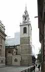
 | St Lawrence Jewry | Gresham Street, Cheap, City of London | 1670-86 | Grade I (1950) | restored in 1957 | 51°30′55″N 0°05′33″W / 51.5152°N 0.0925°W / 51.5152; -0.0925 |
 | St Mary-le-Bow | Cheapside, Cordwainer, City of London | 1670-83 | Grade I (1950) | reconsecrated in 1964 | 51°30′50″N 0°05′37″W / 51.51389°N 0.09361°W / 51.51389; -0.09361 |
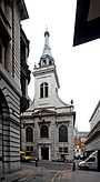
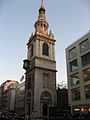
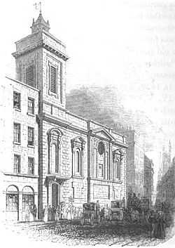
_Royal_-_geograph.org.uk_-_491255.jpg) | St Michael Paternoster Royal | College Hill, Dowgate, City of London | 1686-94 | Grade I (1950) | restored in 1966–8 | 51°30′40.22″N 0°5′31.76″W / 51.5111722°N 0.0921556°W / 51.5111722; -0.0921556 |
 | St Nicholas Cole Abbey | Queen Victoria Street, Bread Street Ward, City of London | 1671-81 | Grade I (1950) | reconsecrated in 1962 | 51°30′43″N 0°5′48″W / 51.51194°N 0.09667°W / 51.51194; -0.09667 |
 | St Vedast Foster Lane | Foster Lane, Cheap, City of London | 1670-97 | Grade I (1950) | restored by 1962 | 51°30′53.56″N 0°5′46.08″W / 51.5148778°N 0.0961333°W / 51.5148778; -0.0961333 |
Tower remaining
These churches were destroyed in the Blitz or demolished in the 19th century. Only their towers remained with perhaps a short section of the outer wall. They are no longer working churches.
| Image |
Name |
Location |
Date |
Listing |
Comment |
Coordinates |
 | St Mary Somerset | Upper Thames Street, Queenhithe, City of London | 1686-94 | Grade I (1950) | Body of the church demolished in 1871. Tower surrounded by small garden | 51°30′40.92″N 0°5′48.80″W / 51.5113667°N 0.0968889°W / 51.5113667; -0.0968889 |
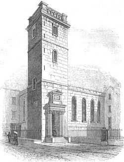
 | St Olave Old Jewry | Ironmonger Lane, Walbrook, City of London | 1670-79 | Grade I (1950) | Body of the church was demolished in 1887. Tower is part of an office building. | 51°30′52.15″N 0°5′28.70″W / 51.5144861°N 0.0913056°W / 51.5144861; -0.0913056 |
 | Christ Church Greyfriars | Newgate Street, Farringdon Within, City of London | 1677-91 | Grade I (1950) | Destroyed in the Blitz. The ruins are a public garden, the tower is private residence | 51°30′56.94″N 0°5′56.93″W / 51.5158167°N 0.0991472°W / 51.5158167; -0.0991472 |
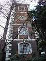
 | St Alban's, Wood Street | Wood Street, Bassishaw, City of London | 1682-87 | Grade II (1950) | Destroyed in the Blitz. The tower is private dwelling | 51°30′59.69″N 0°5′38.95″W / 51.5165806°N 0.0941528°W / 51.5165806; -0.0941528 |
 | St Augustine Watling Street | Watling Street, Bread Street Ward, City of London | 1680-87 | Grade I (1950) | Destroyed in the Blitz. Tower part of St Paul's Cathedral Choir School | 51°30′48.52″N 00°05′49.00″W / 51.5134778°N 0.0969444°W / 51.5134778; -0.0969444 |
 | St Dunstan-in-the-East | St Dunstan's Hill, Billingsgate, City of London | 1698 | Grade I (1950) | Rebuilt in 1817-21, but destroyed in the Blitz. Ruins are a public garden | 51°30′34.82″N 0°4′57.80″W / 51.5096722°N 0.0827222°W / 51.5096722; -0.0827222 |
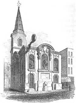
Stones re-used
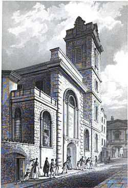
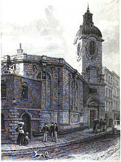
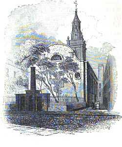
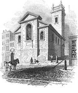
Demolished due to the Union of Benefices Act (chronological order)
The population of the City of London declined sharply in the 19th century, and the Union of Benefices Act 1860 reduced the number of parish churches. The surplus churches were demolished.
| Image |
Name |
Location |
Date |
Comment |
Coordinates |
 | St Benet Gracechurch | Gracechurch Street, Bridge, City of London | 1681-87 | demolished in 1868 | 51°30′42″N 0°5′6″W / 51.51167°N 0.08500°W / 51.51167; -0.08500 |
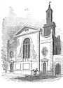
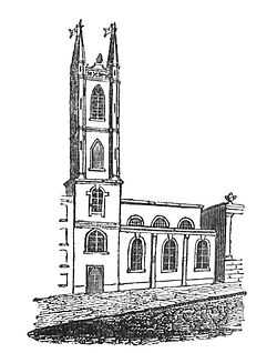
 | St Mildred, Poultry | Poultry, Cheap, City of London | 1670-77 | demolished in 1872 | 51°30′49″N 0°5′24″W / 51.51361°N 0.09000°W / 51.51361; -0.09000 |
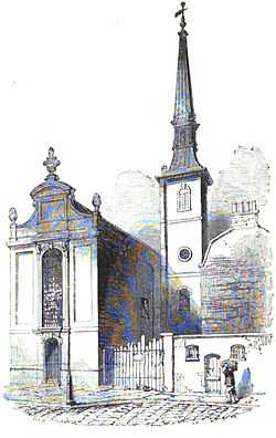
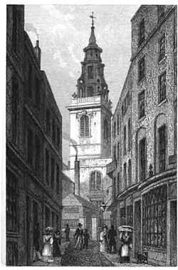
 | St Antholin, Budge Row | Watling Street, Cordwainer, City of London | 1678-84 | demolished in 1875 | 51°30′45″N 0°05′31″W / 51.51250°N 0.09194°W / 51.51250; -0.09194 |
 | St Michael Queenhithe | Upper Thames Street, Queenhithe, City of London | 1676-86 | demolished in 1876 | 51°30′40″N 0°5′42″W / 51.51111°N 0.09500°W / 51.51111; -0.09500 |
 | All Hallows Bread Street | Bread Street, Bread Street Ward, City of London | 1681-1698 | demolished in 1878 | 51°30′47″N 0°05′42″W / 51.5131°N 0.0951°W / 51.5131; -0.0951 |
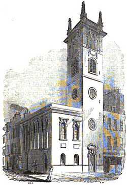
 | St Dionis Backchurch | Fenchurch Street, Langbourn, City of London | 1670-77 | demolished in 1878 | 51°30′43″N 0°5′2″W / 51.51194°N 0.08389°W / 51.51194; -0.08389 |
 | St Matthew Friday Street | Friday Street, Bread Street Ward, City of London | 1682-85 | demolished in 1885 | 51°30′49″N 0°5′44″W / 51.51361°N 0.09556°W / 51.51361; -0.09556 |
 | St Mary Magdalen Old Fish Street | Old Change, Castle Baynard, City of London | 1683-87 | demolished in 1893 | 51°30′45″N 0°5′51″W / 51.51250°N 0.09750°W / 51.51250; -0.09750 |
 | All-Hallows-the-Great | Upper Thames Street, Dowgate, City of London | 1677-84 | demolished in 1894 | 51°30′36″N 0°05′25″W / 51.5100°N 0.0902°W / 51.5100; -0.0902 |
 | St Michael Wood Street | Wood Street, Cripplegate, City of London | 1670-75 | demolished in 1897 | 51°30′56″N 0°5′41.5″W / 51.51556°N 0.094861°W / 51.51556; -0.094861 |
Demolished for other reasons (chronological order)
| Image |
Name |
Location |
Date |
Demolition |
Reason |
Coordinates |
 | St Christopher le Stocks | Threadneedle Street, Broad Street Ward, City of London | 1670-71 | demolished in 1782 | to provide space for the extension of the Bank of England | 51°30′51″N 0°05′19″W / 51.5141°N 0.0886°W / 51.5141; -0.0886 |
 | St Michael, Crooked Lane | Miles's Lane, Candlewick, City of London | 1687 | demolished in 1831 | wider approaches were needed for the rebuilt London Bridge | 51°30′39″N 0°05′14″W / 51.51070°N 0.087280°W / 51.51070; -0.087280 |
 | St Bartholomew-by-the-Exchange | Bartholomew Lane, Broad Street Ward, City of London | 1675-83 | demolished in 1840 | to provide space for the widening of Threadneedle Street | 51°30′50″N 0°05′14″W / 51.51376°N 0.0873°W / 51.51376; -0.0873 |
 | St Benet Fink | Threadneedle Street, Broad Street Ward, City of London | 1670-75 | demolished between 1841 and 1846 | to improve the site of the Royal Exchange | 51°30′50″N 0°5′10″W / 51.51389°N 0.08611°W / 51.51389; -0.08611 |
 | St Michael Bassishaw | Basinghall Street, Bassishaw, City of London | 1675-79 | demolished in 1900 | judged structurally unsafe in 1892 | 51°31′0.1″N 0°5′30″W / 51.516694°N 0.09167°W / 51.516694; -0.09167 |
 | St George Botolph Lane | Botolph Lane, Billingsgate, City of London | 1671-76 | demolished in 1904 | judged structurally unsafe and closed 1901 | 51°30′38″N 0°5′7″W / 51.51056°N 0.08528°W / 51.51056; -0.08528 |
Destroyed in the Blitz
These churches were destroyed in the Blitz and their ruins demolished afterwards.
Interior refurbished by Christopher Wren
Churches built outside the City of London
These churches were outside the area of the Great Fire of London.
| Image |
Name |
Location |
Date |
Listing |
Comment |
Coordinates |
 | St Anne's Church, Soho | Dean Street, Soho, City of Westminster | 1677-85 | Grade II (1958) | The body of the church by Wren and William Talman was destroyed in the Blitz and later totally demolished; the preserved tower was built by S.P. Cockerell in 1801-03 | 51°30′45″N 0°07′56″W / 51.5124°N 0.1323°W / 51.5124; -0.1323 |
 | St Clement Danes | The Strand, City of Westminster | 1680-82 | Grade I (1958) | Destroyed in 1941; reconsecrated in 1958 after the Blitz. | 51°30′47″N 0°06′50″W / 51.513107°N 0.113898°W / 51.513107; -0.113898 |
.jpg) | St James's Church, Piccadilly | Piccadilly, St James's, City of Westminster | 1676-84 | Grade I (1958) | Destroyed in 1940; restored in 1947-54 after the Blitz | 51°30′31″N 0°8′12″W / 51.50861°N 0.13667°W / 51.50861; -0.13667 |
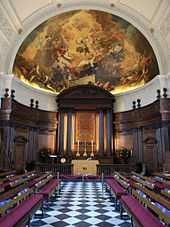 | Chapel of the Royal Hospital Chelsea | Royal Hospital Road, Chelsea, Royal Borough of Kensington and Chelsea | 1682-87 | Grade I (1969) | Wren designed the rest of the Hospital, as well. | 51°29′11″N 0°9′28″W / 51.48639°N 0.15778°W / 51.48639; -0.15778 |
See also
Bibliography
- Betjeman, John (1992) [1967], Sovereign City of London Churches, Andover: Pitkin, ISBN 0-85372-565-9
- Godwin, George (1839), Churches of London, Vols.1-2, C. Tilt
- Huelin, G (1996), Vanished Churches of the City of London, London: Guildhall Library Publications, ISBN 0-900422-42-4
- Reynolds, H (1922), The Churches of the City of London, London: The Bodley Head Limited
External links