List of Canada–United States border crossings
This is a list of border crossings along the International Boundary between Canada and the United States. They are ordered from west to east (crossings with Alaska from north to south).
The Land ports of entry list is limited to places where CBSA and/or CBP now provide border inspection services. Unstaffed crossings are listed in the Unstaffed Road Crossings section. Crossings where border inspection services were once provided, but have since been barricaded are listed in the Closed Land Ports of Entry section. Separate sections are also provided for Rail Crossings and point-to-point Ferry Crossings.
_from_U.S._(Blaine%2C_WA).jpg)
Land ports of entry
Port of entry hours of service for road crossings, except where noted, are open year-round during the day.
| The yellow background indicates a port of entry where travel is permitted in only one direction. |
| The green background indicates a crossing that is located at a bridge or a tunnel. |
| Canada Port of Entry Name | Canada Road / Highway [Community] | United States Port of Entry Name | United States Road / Highway [Community] | Notes | Structure or Notable Feature | Coordinates |
|---|---|---|---|---|---|---|
| Little Gold Creek | Hwy 9 (Top of the World Highway) | Poker Creek | Top of the World Highway | Daytime-evening service seasonal May–September, depending on weather and road conditions (9:00 am–9:00 pm PT = 8:00 am–8:00 pm AKT). Canadian port of entry closed holidays. | Northernmost and highest altitude (1258 m / 4127 ft) Canada-U.S. border crossing | 64°5′8.02″N 141°0′3.92″W / 64.0855611°N 141.0010889°W |
| Beaver Creek | Hwy 1 (Alaska Highway) | Alcan | AK-2 (Alaska Highway) | 24-hour service year round; Canadian port of entry closed holidays. | 62°36′54.78″N 141°0′4.87″W / 62.6152167°N 141.0013528°W | |
| Pleasant Camp | Hwy 3 (Haines Highway) | Dalton Cache | AK-7 (Haines Highway) | Daytime-evening service year round (8:00 am–midnight PT = 7:00 am–11:00 pm AKT). Canadian port of entry is 29 km from the border. | 59°27′1.67″N 136°21′42.42″W / 59.4504639°N 136.3617833°W | |
| Fraser | Hwy 2 (Klondike Highway) | Skagway | AK-98 (Klondike Highway) | Canadian port of entry (12 km north of border): 24-hour service April–October, daytime-evening service November–March (8:00 am–midnight PT). U.S. port of entry (8 mi south of border): 24-hour service year round. | 59°37′45.69″N 135°9′50.15″W / 59.6293583°N 135.1639306°W | |
| Stewart | BC 37A | (closed - was Hyder) | International Street | Canadian port of entry: 24-hour service year round. U.S. border is unstaffed and open (station closed in the 1960s); roads connect only to Canada. | 55°54′43.28″N 130°1′2.86″W / 55.9120222°N 130.0174611°W | |
| Boundary Bay | 56th Street [Delta] | Point Roberts | Tyee Drive | 24-hour service year round | 49°0′7.17″N 123°4′5.66″W / 49.0019917°N 123.0682389°W | |
| Douglas | BC 99 [Surrey] | Blaine - Peace Arch | I‑5 | 24-hour service year round. No commercial vehicles. | Peace Arch Park | 49°0′7.45″N 122°45′23.49″W / 49.0020694°N 122.7565250°W |
| Pacific Highway | BC 15 [Surrey] | Blaine - Pacific Highway | SR 543 | 24-hour service year round. Commercial vehicles must use this crossing between Surrey and Blaine. | 49°0′7.74″N 122°44′7.58″W / 49.0021500°N 122.7354389°W | |
| Aldergrove | BC 13 | Lynden | SR 539 | Daytime-evening service year round (8:00 am–midnight) | 49°0′8.14″N 122°29′6.37″W / 49.0022611°N 122.4851028°W | |
| Abbotsford-Huntingdon | BC 11 | Sumas | SR 9 | 24-hour service year round | 49°0′8.65″N 122°15′55.25″W / 49.0024028°N 122.2653472°W | |
| Chopaka | Nighthawk Road [Cawston] | Nighthawk | Similkameen Road | Daytime service year round (9:00 am–5:00 pm) | 49°0′0.76″N 119°40′15.74″W / 49.0002111°N 119.6710389°W | |
| Osoyoos | BC 97 | Oroville | US 97 | 24-hour service year round. Canadian port of entry closed holidays. | 49°0′0.36″N 119°27′45.72″W / 49.0001000°N 119.4627000°W | |
| Midway | Dominion Street | Ferry | Customs Road [Curlew] | Daytime service year round (9:00 am–5:00 pm) | 49°0′0.36″N 118°45′39.96″W / 49.0001000°N 118.7611000°W | |
| Carson | BC 41 [Grand Forks] | Danville | SR 21 | Daytime-evening service year round (8:00 am–midnight) | 49°0′0.36″N 118°30′11.85″W / 49.0001000°N 118.5032917°W | |
| Cascade | BC 395 [Christina Lake] | Laurier | US 395 | Daytime-evening service year round (8:00 am–midnight) | 49°0′0.36″N 118°13′26.12″W / 49.0001000°N 118.2239222°W | |
| Paterson | BC 22 [Rossland] | Frontier | SR 25 [Northport] | 24-hour service year round | 49°0′1.80″N 117°49′54.12″W / 49.0005000°N 117.8317000°W | |
| Waneta | BC 22A [Montrose] | Boundary | Waneta Road [Northport] | Daytime service year round (9:00 am–5:00 pm) | 49°0′2.52″N 117°37′30.36″W / 49.0007000°N 117.6251000°W | |
| Nelway | BC 6 [Salmo] | Metaline Falls | SR 31 | Daytime-evening service year round (8:00 am–midnight) | 49°0′0.00″N 117°17′58.92″W / 49.0000000°N 117.2997000°W | |
| Rykerts | BC 21 [Creston] | Porthill | SH-1 | Daytime-evening service year round (2nd Sunday March–1st Saturday Nov. (MST=PDT), 7:00 am–11:00 pm; rest of year, 8:00 am–midnight MST = 7:00 am–11:00 pm PST) | 48°59′59.64″N 116°29′58.56″W / 48.9999000°N 116.4996000°W | |
| Kingsgate | BC 95 | Eastport | US-95 | 24-hour service year round. Canadian port of entry closed holidays. | 49°0′1.80″N 116°10′53.40″W / 49.0005000°N 116.1815000°W | |
| Roosville | BC 93 [Grasmere] | Roosville | US 93 [Eureka] | 24-hour service year round | 48°59′58.56″N 115°3′21.24″W / 48.9996000°N 115.0559000°W | |
| Chief Mountain | Hwy 6 [Waterton Park] | Chief Mountain | MT 17 | Daytime service seasonal (May 15–31, 9:00 am–6:00 pm; June 1–Labour Day, 7:00 am–10:00 pm; Day after Labor Day–Sept. 30, 9:00 am–6:00 p.m; Oct. 1–May 14, closed) | Waterton-Glacier International Peace Park | 48°59′58.92″N 113°39′38.88″W / 48.9997000°N 113.6608000°W |
| Carway | Hwy 2 [Cardston] | Piegan | US 89 [Babb] | Daytime-evening service year round (7:00 am–11:00 pm) | 48°59′53.16″N 113°22′44.40″W / 48.9981000°N 113.3790000°W | |
| Del Bonita | Hwy 62 | Del Bonita | S-213 [Cut Bank] | Daytime service year round (June 1–Sept. 15, 8:00 am–9:00 pm; Sept. 16–May 31, 9:00 am–6:00 pm). Canadian port of entry closed holidays. | 48°59′54.96″N 112°47′17.95″W / 48.9986000°N 112.7883194°W | |
| Coutts | Hwy 4 | Sweetgrass | I‑15 | 24-hour service year round | 48°59′54.24″N 111°57′37.44″W / 48.9984000°N 111.9604000°W | |
| Aden | Hwy 880 | Whitlash | S-409 | Daytime service year round (9:00 am–5:00 pm) | 48°59′50.28″N 111°15′31.27″W / 48.9973000°N 111.2586861°W | |
| Wild Horse | Hwy 41 | Wild Horse | S-232 [Havre] | Daytime service year round. Canadian port of entry (May 15–Sept. 30, 8:00 am–9:00 pm; Oct. 1–May 14, 8:00 am–5:00 pm). U.S.port of entry (June 1–Sept. 15, 8:00 am–9:00 pm; Sept. 16–May 14, 8:00 am–5:00 pm). | 48°59′57.48″N 110°12′55.08″W / 48.9993000°N 110.2153000°W | |
| Willow Creek | Hwy 21 [Consul] | Willow Creek | S-233 | Daytime service year round (2nd Sunday March–1st Saturday Nov. (CST=MDT), 9:00 am–5:00 pm; rest of year, 10:00 am–6:00 pm CST = 9:00 am–5:00 pm MST) | 49°0′0.00″N 109°43′53.76″W / 49.0000000°N 109.7316000°W | |
| Climax | Hwy 37 | Turner | S-241 | Daytime service year round (June 1–Sept. 15 (CST=MDT), 8:00 am–9:00 pm; Sept. 16–May 31 Canada matches U.S. 9:00 am–6:00 pm MT) | 48°59′58.20″N 108°23′21.12″W / 48.9995000°N 108.3892000°W | |
| Monchy | Hwy 4 [Climax] | Morgan | US 191 [Loring] | Daytime service year round (June 1–Sept. 15 (CST=MDT), 8:00 am–9:00 pm; Sept. 16–May 31 Canada matches U.S. 9:00 am–6:00 pm MT) | 48°59′59.28″N 107°49′54.84″W / 48.9998000°N 107.8319000°W | |
| West Poplar River | Hwy 2 [Rockglen] | Opheim | MT 24 | Daytime service year round (June 1–Sept. 15 (CST=MDT), 8:00 am–9:00 pm; Sept. 16–May 31 Canada matches U.S. 9:00 am–6:00 pm MT) | 48°59′58.2″N 106°22′40.44″W / 48.999500°N 106.3779000°W | |
| Coronach | Hwy 36 | Scobey | MT 13 | Daytime service year round (June 1–Sept. 15 (CST=MDT), 8:00 am–9:00 pm; Sept. 16–May 31 Canada matches U.S. 9:00 am–6:00 pm MT) | 48°59′58.20″N 105°24′28.08″W / 48.9995000°N 105.4078000°W | |
| Regway | Hwy 6 | Raymond | MT 16 | 24-hour service year round | 48°59′57.12″N 104°34′28.46″W / 48.9992000°N 104.5745722°W | |
| Oungre | Hwy 35 | Fortuna | US 85 | Daytime-evening service year round (2nd Sunday March–1st Saturday Nov. 8:00 am–9:00 pm CST = 9:00 am–10:00 pm CDT; rest of year, 9:00 am–10:00 pm) | 48°59′58.56″N 103°48′34.18″W / 48.9996000°N 103.8094944°W | |
| Torquay | Hwy 350 | Ambrose | ND 42 | Daytime service year round (2nd Sunday March–1st Saturday Nov. 8:00 am–4:00 pm CST = 9:00 am–5:00 pm CDT; rest of year, 9:00 am–5:00 pm) | 48°59′57.48″N 103°29′12.48″W / 48.9993000°N 103.4868000°W | |
| Estevan Highway | Hwy 47 | Noonan | ND 40 | Daytime-evening service year round (2nd Sunday March–1st Saturday Nov. 8:00 am–9:00 pm CST = 9:00 am–10:00 pm CDT; rest of year, 9:00 am–10:00 pm) | 48°59′57.48″N 103°0′17.20″W / 48.9993000°N 103.0047778°W | |
| North Portal | Hwy 39 | Portal | US 52 | 24-hour service year round | 48°59′56.04″N 102°33′10.08″W / 48.9989000°N 102.5528000°W | |
| Northgate | Hwy 9 | Northgate | ND 8 [Flaxton] | Daytime-evening service year round (2nd Sunday March–1st Saturday Nov. 8:00 am–9:00 pm CST = 9:00 am–10:00 pm CDT; rest of year, 9:00 am–10:00 pm) | 48°59′56.04″N 102°16′30.36″W / 48.9989000°N 102.2751000°W | |
| Carievale | Hwy 8 | Sherwood | ND 28 | Daytime-evening service year round (2nd Sunday March–1st Saturday Nov. 8:00 am–9:00 pm CST = 9:00 am–10:00 pm CDT; rest of year, 9:00 am–10:00 pm) | 48°59′57.48″N 101°37′40.51″W / 48.9993000°N 101.6279194°W | |
| Lyleton | PR 256 [Pierson] | Antler | ND 256 | Daytime-evening service year round (9:00 am–10:00 pm) | 48°59′58.56″N 101°17′45.96″W / 48.9996000°N 101.2961000°W | |
| Coulter | PTH 83 [Melita] | Westhope | US 83 | Daytime-evening service year round (8:00 am–9:00 pm) | 48°59′58.56″N 101°1′4.80″W / 48.9996000°N 101.0180000°W | |
| Goodlands | PTH 21 [Deloraine] | Carbury | ND 14 [Souris] | Daytime-evening service year round (9:00 am–10:00 pm) | 48°59′57.84″N 100°33′20.11″W / 48.9994000°N 100.5555861°W | |
| Boissevain | PTH 10 | Dunseith | US 281 | 24-hour service year round | International Peace Garden | 48°59′57.48″N 100°3′8.28″W / 48.9993000°N 100.0523000°W |
| Lena | PTH 18 [Killarney] | Saint John | ND 30 | Daytime-evening service year round (8:00 am–9:00 pm) | 48°59′57.84″N 99°39′32.15″W / 48.9994000°N 99.6589306°W | |
| Cartwright | PTH 5 | Hansboro | ND 4 | Daytime-evening service year round (8:00 am–9:00 pm) | 48°59′58.92″N 99°20′48.84″W / 48.9997000°N 99.3469000°W | |
| Crystal City | PTH 34 | Sarles | ND 20 | Daytime-evening service year round (9:00 am–10:00 pm) | 49°0′0″N 98°56′15.79″W / 49.00000°N 98.9377194°W | |
| Snowflake | PR 242 | Hannah | Port Road | Daytime-evening service year round (9:00 am–10:00 pm) | 49°0′0.72″N 98°41′39.48″W / 49.0002000°N 98.6943000°W | |
| Windygates | PTH 31 [Darlingford] | Maida | ND 1 [Langdon] | Daytime-evening service year round (9:00 am–10:00 pm) | 49°0′1.08″N 98°21′53.64″W / 49.0003000°N 98.3649000°W | |
| Winkler | PTH 32 | Walhalla | ND 32 | Daytime-evening service year round (8:00 am–10:00 pm) | 49°0′1.80″N 97°54′30.96″W / 49.0005000°N 97.9086000°W | |
| Gretna | PTH 30 | Neche | ND 18 | Daytime-evening service year round (8:00 am–10:00 pm) | 49°0′1.80″N 97°33′25.20″W / 49.0005000°N 97.5570000°W | |
| Emerson | PTH 75 | Pembina | I‑29 / US 81 | 24-hour service year round
Formerly known as "West Lynne", the Canadian side of this busy crossing was renamed "Emerson" when Emerson East closed in 2003. |
49°0′1.80″N 97°14′15.72″W / 49.0005000°N 97.2377000°W | |
| Tolstoi | PTH 59 | Lancaster | US 59 | Daytime-evening service year round (8:00 am–10:00 pm) | 49°0′0.72″N 96°48′5.40″W / 49.0002000°N 96.8015000°W | |
| Piney | PTH 89 | Pinecreek | MN 89 | Daytime service year round (Canadian port of entry 9:00 am–10:00 pm; U.S. port of entry 9:00 am–5:00 pm) | 48°59′59.64″N 95°58′41.52″W / 48.9999000°N 95.9782000°W | |
| South Junction | PR 310 | Roseau | MN 310 | Daytime-evening service year round (8:00 am–midnight) | 48°59′58.56″N 95°45′59.40″W / 48.9996000°N 95.7665000°W | |
| Sprague | PTH 12 | Warroad | MN 313 | 24-hour service year round | 48°59′56.40″N 95°22′34.32″W / 48.9990000°N 95.3762000°W | |
| Rainy River | Highway 11 | Baudette | MN 72 | 24-hour service year round | Baudette – Rainy River International Bridge | 48°43′8.94″N 94°35′25.25″W / 48.7191500°N 94.5903472°W |
| Fort Frances Bridge | Highway 71 | International Falls | US 53 / US 71 | 24-hour service year round | Fort Frances – International Falls International Bridge | 48°36′26.69″N 93°24′6.42″W / 48.6074139°N 93.4017833°W |
| Pigeon River | Highway 61 [Neebing] | Grand Portage | MN 61 | 24-hour service year round | Pigeon River Bridge | 48°0′5.1″N 89°35′6.61″W / 48.001417°N 89.5851694°W |
| Sault Ste. Marie Bridge | Huron Street | Sault Sainte Marie | I‑75 | 24-hour service year round | Sault Ste. Marie International Bridge | 46°30′30.24″N 84°21′38.58″W / 46.5084000°N 84.3607167°W |
| Sarnia (Blue Water Bridge) | Highway 402 [Point Edward] | Port Huron - Blue Water Bridge | I‑69 / I‑94 | 24-hour service year round | Blue Water Bridge | 42°59′55.3″N 82°25′24.44″W / 42.998694°N 82.4234556°W |
| Windsor-Detroit Tunnel | Ouellette Avenue / Goyeau Street [Windsor] | Detroit - Detroit-Windsor Tunnel | Jefferson Avenue / M‑10 / M‑3 / I‑375 | 24-hour service year round | Detroit–Windsor Tunnel | 42°19′25.96″N 83°2′25.04″W / 42.3238778°N 83.0402889°W |
| Ambassador Bridge | Highway 3 [Windsor] | Detroit - Ambassador Bridge Passenger Facility & Fort Street Cargo Facility | I‑75 / I‑96 | 24-hour service year round | Ambassador Bridge
Southernmost road crossing and busiest commercial crossing |
42°18′42.47″N 83°4′26.39″W / 42.3117972°N 83.0739972°W |
| Fort Erie (Peace Bridge) | QEW | Buffalo - Peace Bridge | I-190 / Baird Drive | 24-hour service year round | Peace Bridge
Busiest passenger vehicle crossing[1] |
42°54′25.06″N 78°54′21.45″W / 42.9069611°N 78.9059583°W |
| Niagara Falls Rainbow Bridge | Highway 420 / Falls Avenue | Niagara Falls - Rainbow Bridge | NY 384 / NY 104 / US 62 | No commercial trucks. 24-hour service year round | Rainbow Bridge | 43°5′24.62″N 79°4′3.69″W / 43.0901722°N 79.0676917°W |
| Niagara Falls Whirlpool Bridge | River Road | Niagara Falls - Whirlpool Bridge | Whirlpool Street | NEXUS use only. Daytime-evening service year round (7:00 am–11:00 pm) | Whirlpool Rapids Bridge | 43°6′33.27″N 79°3′30″W / 43.1092417°N 79.05833°W |
| Queenston Lewiston Bridge | Highway 405 [Niagara-on-the-Lake] | Lewiston Bridge Complex | I-190 / NY 104 | 24-hour service year round | Lewiston–Queenston Bridge | 43°9′10.77″N 79°2′40.12″W / 43.1529917°N 79.0444778°W |
| Lansdowne (Thousand Islands Bridge) | Highway 137 [Hill Island] | Alexandria Bay | I-81 | 24-hour service year round | Thousand Islands Bridge | 44°20′50.18″N 75°59′0.34″W / 44.3472722°N 75.9834278°W |
| Prescott | Highway 16 [Johnstown] | Ogdensburg | NY 812 | 24-hour service year round | Ogdensburg–Prescott International Bridge | 44°43′59.33″N 75°27′27.88″W / 44.7331472°N 75.4577444°W |
| Cornwall Traffic Office | Akwesasne International Road [Kawehnoke (Cornwall Island), Akwesasne Reserve 59] / Brookdale Avenue [Cornwall] | Massena | NY 37 [Rooseveltown] | 24-hour service year round. Canadian port of entry ("interim") at the north end of the new (low) north channel bridge. Travellers from the U.S. to Cornwall Island first cross the island to the Canadian port of entry. | Seaway International Bridge, Three Nations Crossing | 44°59′26.37″N 74°44′22.26″W / 44.9906583°N 74.7395167°W |
| Dundee | Route 132 | Fort Covington | Water Street | 24-hour service year round | 44°59′52.92″N 74°30′27.94″W / 44.9980333°N 74.5077611°W | |
| Trout River | Route 138 [Athelstan] | Trout River | NY 30 [Constable] | 24-hour service year round | 44°59′31.38″N 74°18′29.43″W / 44.9920500°N 74.3081750°W | |
| Herdman | Route 202 [Hinchinbrooke] | Chateaugay | NY 374 | 24-hour service year round | 44°59′37.13″N 74°5′8.67″W / 44.9936472°N 74.0857417°W | |
| (closed – was Franklin Centre) | Route 209 | Churubusco | NY 189 | Canadian port of entry closed. U.S. port of entry open 8:00 am–4:00 pm. Persons are not permitted to enter Canada at this location | 44°59′56.41″N 73°56′20.57″W / 44.9990028°N 73.9390472°W | |
| Covey Hill | Route 203 [Havelock] | Cannon Corners | Cannon Corners Road [Mooers Forks] | Daytime service year round (8:00 am–4:00 pm; Canadian port of entry open until midnight May–October) | 45°0′11.32″N 73°45′22.90″W / 45.0031444°N 73.7563611°W | |
| Hemmingford | Route 219 | Mooers | NY 22 | 24-hour service year round | 45°0′16.07″N 73°36′10.88″W / 45.0044639°N 73.6030222°W | |
| St-Bernard-de-Lacolle: Highway 15 | A-15 | Champlain | I-87 | Sometimes called the Blackpool Border Crossing, which was the name of the old crossing on US 9 before the interstate highway was built. 24-hour service year round | 45°0′31.83″N 73°27′8.26″W / 45.0088417°N 73.4522944°W | |
| Lacolle: Route 221 | Route 221 | Overton Corners | NY 276 [Champlain] | 24-hour service year round | 45°0′35.7″N 73°24′0.63″W / 45.009917°N 73.4001750°W | |
| Lacolle: Route 223 | Route 223 | Rouses Point | US 11 | 24-hour service year round | 45°0′37.33″N 73°22′15.21″W / 45.0103694°N 73.3708917°W | |
| Noyan | Route 225 | Alburg | VT 225 [Alburgh] | 24-hour service year round | 45°0′41.69″N 73°17′47.54″W / 45.0115806°N 73.2965389°W | |
| Clarenceville | Chemin Beech Sud | Alburg Springs | Alburg Springs Road [Alburgh] | Daytime-evening service year round (8:00 am–midnight) | 45°0′46.92″N 73°12′44.27″W / 45.0130333°N 73.2122972°W | |
| St-Armand / Phillipsburg | Route 133 | Highgate Springs | I‑89 | 24-hour service year round | 45°0′55.55″N 73°5′5.17″W / 45.0154306°N 73.0847694°W | |
| Morses Line | Route 235 [St-Armand] | Morses Line | VT 235 | Daytime service year round (Canada 8:00 am–4:00 pm; U.S. 8:00 am–midnight) | 45°0′51.45″N 72°58′42.59″W / 45.0142917°N 72.9784972°W | |
| Frelighsburg | Route 237 | West Berkshire | VT 108 [Berkshire] | 24-hour service year round | 45°0′58.67″N 72°49′31.13″W / 45.0162972°N 72.8253139°W | |
| East Pinnacle | Chemin de Richford | Pinnacle Road | Pinnacle Road [Richford] | Canada daytime service year round (8:00 am–4:00 pm); U.S. 24-hour service year round | 45°0′56.03″N 72°42′00.15″W / 45.0155639°N 72.7000417°W | |
| Abercorn | Route 139 | Richford | VT 139 | 24-hour service year round | 45°0′54.00″N 72°39′45.51″W / 45.0150000°N 72.6626417°W | |
| Glen Sutton | Chemin de la Vallée-Missisquoi [Sutton] | East Richford | VT 105A [Richford] | Canada daytime service year round (8:00 am–4:00 pm); U.S. 24-hour service year round | Missisquoi River Bridge | 45°0′42.79″N 72°35′19.13″W / 45.0118861°N 72.5886472°W |
| Highwater | Route 243 | North Troy | VT 243 | 24-hour service year round | 45°0′26.12″N 72°24′57.25″W / 45.0072556°N 72.4159028°W | |
| Stanstead (Beebe) | Route 247 | Beebe Plain | Beebe Road [Derby] | 24-hour service year round | 45°0′20.93″N 72°08′31.16″W / 45.0058139°N 72.1419889°W | |
| Stanstead (Rte 143) | Route 143 | Derby Line - Rte 5 | US 5 | 24-hour service year round | 45°0′20.64″N 72°05′57.56″W / 45.0057333°N 72.0993222°W | |
| Stanstead (55) | A-55 | Derby Line | I‑91 | 24-hour service year round
Canadian port of entry formerly named Rock Island |
45°0′21.11″N 72°05′17.46″W / 45.0058639°N 72.0881833°W | |
| Stanhope | Route 147 | Norton | VT 147 | 24-hour service year round | 45°0′38.46″N 71°47′35.88″W / 45.0106833°N 71.7933000°W | |
| Hereford Road | Route 141 | Canaan | VT 141 | 24-hour service year round | 45°0′45.47″N 71°33′36.80″W / 45.0126306°N 71.5602222°W | |
| East Hereford | Route 253 | Beecher Falls | VT 253 | 24-hour service year round | 45°0′48.21″N 71°30′19.11″W / 45.0133917°N 71.5053083°W | |
| Chartierville | Route 257 | Pittsburg | US 3 | Canada daytime-evening service year round (8:00 am–midnight); U.S. 24-hour service year round | 45°15′09.80″N 71°12′15.20″W / 45.2527222°N 71.2042222°W | |
| Woburn | Route 161 | Coburn Gore | SR 27 | 24-hour service year round | 45°22′43.01″N 70°48′28.96″W / 45.3786139°N 70.8080444°W | |
| Armstrong | Route 173 | Jackman | US 201 / SR 6 | 24-hour service year round | 45°48′20.26″N 70°23′48.24″W / 45.8056278°N 70.3967333°W | |
| St-Zacharie | Route de la Frontière | St. Zacharie | Golden Road (private-North Maine Woods) | Canadian port of entry open only for Pilot Project for Travellers in Remote Areas - Quebec (PPTRA-Q)[2] permit holders, during U.S. port hours. U.S. port of entry daytime service year round (6:00 am–8:00 pm Monday–Thursday & 6:00 am–4:00 pm Friday) | 46°05′34.29″N 70°17′25.68″W / 46.0928583°N 70.2904667°W | |
| Ste-Aurélie | Route 277 | Ste. Aurelie | St. Aurelie Road (private-North Maine Woods) | Daytime service year round (Canadian port of entry: 9:00 am–5:00 pm Monday–Friday with additional hours for PPTRA-Q permits; U.S. port of entry 6:00 am–9:00 pm Monday–Thursday & 6:00 am–4:00 pm Friday) | 46°12′27.02″N 70°16′34.31″W / 46.2075056°N 70.2761972°W | |
| St-Just-de-Bretenières | Rue des Moulins | St. Juste | St. Juste Road / Stetson Road (private-North Maine Woods) | Daytime service year round (Canadian port of entry: 9:00 am–5:00 pm Monday–Friday with additional hours for PPTRA-Q permits; U.S. port of entry 6:00 am–9:00 pm Monday–Thursday & 6:00 am–4:00 pm Friday) | 46°32′44.60″N 70°01′44.66″W / 46.5457222°N 70.0290722°W | |
| St-Pamphile | Route Elgin Sud | St. Pamphile | Blanchette / Maibec Road (private-North Maine Woods) | Daytime service year round (Canadian port of entry 9:00 am–5:00 pm Monday–Friday with additional hours for PPTRA-Q permits; U.S. port of entry 6:00 am–9:00 pm Monday & Thursday, 6:00 am–8:00 pm Tuesday & Wednesday & Friday, 8:00 am–4:00 pm Saturday) | 46°56′33.06″N 69°45′01.39″W / 46.9425167°N 69.7503861°W | |
| Pohenegamook | Rue de la Frontière | Estcourt | Frontier Road (public) / Estcourt Road (private-North Maine Woods) | Canadian port of entry at town: daytime service year round (9:00 am–5:00 pm Monday–Friday) with additional hours for PPTRA-Q permits. U.S. port of entry at road to Maine interior, 0.85 km / 0.53 mi southwest of Canadian port of entry, open 8:00 am–4:00 pm Saturdays only | 47°27′22.46″N 69°13′41.38″W / 47.4562389°N 69.2281611°W | |
| Clair | Route 205 | Fort Kent | US 1 | Canadian port of entry: 24-hour service year round. U.S. port of entry: Monday–Friday 9:00 am–5:00 pm ET except holidays year round. | Clair – Fort Kent Bridge | 47°14′57.3″N 68°36′13.6″W / 47.249250°N 68.603778°W |
| Edmundston | Route 120 | Madawaska | Bridge Street | 24-hour service year round | Edmundston–Madawaska Bridge | 47°21′36.5″N 68°19′43.3″W / 47.360139°N 68.328694°W |
| St. Leonard | Bridge Street/Rue du Pont | Van Buren | Bridge Street | 24-hour service year round | St. Leonard – Van Buren Bridge | 47°09′34.92″N 67°55′51.24″W / 47.1597000°N 67.9309000°W |
| Grand Falls | Route 218 | Hamlin | Boundaryline Road | Daytime-evening service year round (8:00 am–midnight AT = 7:00 am–11:00 pm ET) | 47°03′37.95″N 67°47′24.57″W / 47.0605417°N 67.7901583°W | |
| Gillespie Portage | Route 375 | Limestone | SR 229 | 24-hour service year round | 46°55′28.45″N 67°47′24.57″W / 46.9245694°N 67.7901583°W | |
| Four Falls | Brown Road | (closed – was East Road) | Russell Road | U.S. port of entry closed. Canadian port of entry open 9:00 am–11:30 pm AT, from 3rd Monday in April to 2nd Sunday in October. Persons are not permitted to enter the U.S. at this location. | 46°49′24.21″N 67°47′22.65″W / 46.8233917°N 67.7896250°W | |
| Andover | Route 190 [Perth-Andover] | Fort Fairfield | SR 167 | 24-hour service year round | 46°45′55.18″N 67°47′21.84″W / 46.7653278°N 67.7894000°W | |
| River de Chute | Smugglers Road | Easton | Ladner Road | Daytime service year round (9:00 am–5:00 pm AT = 8:00 am–4:00 pm ET) | 46°36′01.14″N 67°47′17.79″W / 46.6003167°N 67.7882750°W | |
| Centreville | Route 110 | Bridgewater | Boundary Line Road | 24-hour service year round | 46°27′01.28″N 67°47′05.18″W / 46.4503556°N 67.7847722°W | |
| Bloomfield | Line Road | Monticello | Fletcher Road | Daytime service year round (9:00 am–5:00 pm AT = 8:00 am–4:00 pm ET Monday–Saturday). Canadian port of entry also open Sunday June–October. | 46°19′03.33″N 67°46′58.14″W / 46.3175917°N 67.7828167°W | |
| Woodstock Road | Route 95 | Houlton | I‑95 | 24-hour service year round | 46°08′06.74″N 67°46′52.76″W / 46.1352056°N 67.7813222°W | |
| Fosterville | Route 122 | Orient | Boundary Road | Daytime service year round (mid May–end November: 8:00 am–midnight AT = 7:00 am–11:00 pm ET; December–mid May Canada 9:00 am–5:00 pm AT Sunday–Friday & 8:00 am–midnight AT Saturday, U.S. 7:00 am–5:00 pm ET) | Boundary Bridge | 45°49′00.30″N 67°46′51.21″W / 45.8167500°N 67.7808917°W |
| Forest City | Forest City Road | Forest City | Forest City Road | Daytime service year round (9:00 am–5:00 pm AT = 8:00 am–4:00 pm ET; U.S. port of entry closed Sundays in winter) | Forest City Bridge | 45°39′46.87″N 67°43′42.01″W / 45.6630194°N 67.7283361°W |
| St. Croix | Route 4 | Vanceboro | SR 6 | 24-hour service year round | Saint Croix – Vanceboro Bridge | 45°34′07.58″N 67°25′42.86″W / 45.5687722°N 67.4285722°W |
| St. Stephen (3rd Bridge) | St. Stephen Drive | Calais - International Ave | International Avenue | 24-hour service year round. Commercial vehicles must use this crossing between St. Stephen and Calais. | International Avenue Bridge | 45°09′39.76″N 67°18′09.79″W / 45.1610444°N 67.3027194°W |
| Milltown | Milltown Boulevard [St. Stephen] | Calais - Milltown Bridge | North Street Extension | 24-hour service year round | Milltown International Bridge | 45°10′11.88″N 67°17′48.39″W / 45.1699667°N 67.2967750°W |
| St. Stephen (Ferry Point Bridge) | Milltown Boulevard / Route 170 | Calais - Ferry Point | Main Street | 24-hour service year round. No commercial vehicles. | Ferry Point International Bridge | 45°11′30.0″N 67°17′0.2″W / 45.191667°N 67.283389°W |
| Campobello | Route 774 | Lubec | SR 189 | 24-hour service year round. Canadian port of entry closed holidays. | Franklin Delano Roosevelt Bridge | 44°51′33.8″N 66°58′48.8″W / 44.859389°N 66.980222°W |
Unstaffed road crossings
This is a list of roads that cross the U.S.-Canada border that do not have border inspection services. Requirements for reporting to CBSA or CBP for inspection are noted.
| Canada City/Town | Canada Road Name | United States City/Town | United States Road Name | Notes | Structure or Notable Feature | Coordinates |
|---|---|---|---|---|---|---|
| Stewart | Road to Salmon Glacier [Premier] | Hyder | NF-88, Tongass National Forest | Unstaffed and open. Canadian road ends at former Granduc mine; U.S. road connects only to Canada. | 56°2′46.32″N 130°2′12.48″W / 56.0462000°N 130.0368000°W | |
| Skagit Valley Provincial Park | Silver Skagit Road | North Cascades National Park | Silver Skagit Road | Unstaffed and open. U.S. road (to Hozomeen Campground on Ross Lake) connects only to Canada. Persons found on the U.S. side by the U.S. Border Patrol should be prepared to provide passport identification. | 49°0′0.72″N 121°3′46.80″W / 49.0002000°N 121.0630000°W | |
| Coutts | East Road, Range Roads 152, 150, 144, 142, Township Road 10A | Sweetgrass | Border Road | Unstaffed border crossings along 13 km / 8 mi of rural road on the U.S. side. Warning sign directs travelers to report to Customs at Coutts/Sweetgrass. | 48°59′51.36″N 111°46′45.12″W / 48.9976000°N 111.7792000°W | |
| Northwest Angle Provincial Forest | PR 525 | Angle Inlet | Winter Road | The border for both Canada and the U.S. is staffed remotely. Travellers are directed to video telephones, 12.5 km / 7.8 mi from the border in Angle Inlet, to contact the Canadian or United States border agencies to make their declarations. | Northwest Angle | 49°17′17.59″N 95°9′12.21″W / 49.2882194°N 95.1533917°W |
| Kanatakon (St. Regis), Akwesasne 15 Réserve | Johnson Road & Akwesasne Street | Akwesasne, St. Regis Mohawk Reservation | Johnson & St. Regis Roads | Unstaffed crossings to/from Québec accessible by road only through New York. No requirement to report. | 44°59′58.02″N 74°39′0.14″W / 44.9994500°N 74.6500389°W | |
| Tsi Snaihne (Snye), Akwesasne 15 Réserve | River, Phillips, Snye, McDonald & Chapman Roads | Akwesasne, St. Regis Mohawk Reservation | River, Phillips, Snye, McDonald & Chapman Roads | Unstaffed crossings to/from Québec accessible by road only through New York. No requirement to report. | 44°59′57.70″N 74°36′51.30″W / 44.9993611°N 74.6142500°W | |
| Dundee | Chemin de la Pointe Hopkins | Fort Covington | Hopkins Point Road | Unstaffed crossing to/from Québec accessible by road only through New York. No requirement to report. | 44°59′53.16″N 74°30′32.94″W / 44.9981000°N 74.5091500°W | |
| Stanhope | Rue Principale | Norton | Nelson Road | Unstaffed. Traffic entering Canada must proceed without stopping to the Stanhope border station to report. Road on U.S. side leads into the Norton port of entry; sign says stop ahead for inspection. | 45°0′38.16″N 71°47′55.32″W / 45.0106000°N 71.7987000°W | |
Closed land ports of entry

This list includes only those crossings known to have had Customs or Immigration services at the border. Other unattended roads are listed in a separate section.
| Canada Port of Entry | Canada Road/ Highway | United States Port of Entry | United States Road/ Highway | Notes | Structure or Notable Feature | Coordinates |
|---|---|---|---|---|---|---|
| Boundary Bay | 67 Street | Point Roberts | Meadow Lane | Old border crossing used to be located on the east end of the peninsula. Crossing was permanently closed in 1975 when the Tyee Road border crossing was expanded.[3] The former Canadian border station remains and has been refurbished. | 49°0′7.20″N 123°2′16.80″W / 49.0020000°N 123.0380000°W | |
| Chopaka West | Chopaka Road | Nighthawk West | Chopaka Road | Canada periodically provided border services at the crossing on Chopaka Road until the US barricaded the road in 1964. The US never had border inspection services at this crossing.[4] | 49°0′0.36″N 119°43′33.24″W / 49.0001000°N 119.7259000°W | |
| Bridesville | Old Molson Road | Molson | Old Railroad Road | Molson died a slow death as its mining and farming businesses dried up in the 1920s.[5] Molson's designation as a port of entry was revoked in 1941,[6] and the Customs and Immigration station in the town closed. | 49°0′0.72″N 119°10′45.84″W / 49.0002000°N 119.1794000°W | |
| Myncaster | Myncaster Road | Chesaw | Bolster Road | Canada port of entry was maintained to support both road and rail traffic, however, traffic on Bolster Road was light and the railroad ceased operations in 1937. The port of entry closed around 1955, but opened again for one day on June 9, 1990.[7] | 49°0′0.00″N 119°1′18.12″W / 49.0000000°N 119.0217000°W | |
| Flathead | Flathead Rd | Trailcreek | North Fork Rd | Border crossing adjacent to the Flathead River closed in 1996 due to flooding of the road just north of the border.[8] The road is gated at the border. Both the US and Canadian border stations remain but are falling into disrepair. | 49°0′3.96″N 114°28′42.24″W / 49.0011000°N 114.4784000°W | |
| Whiskey Gap | Emigrant Gap Road | Emigrant Gap | Emigrant Gap Road | Opened in 1934 and closed in 1939 when the Del Bonita Road opened. It was once a favorite place to bring alcohol into the US during prohibition.[9] | 48°59′54.60″N 113°5′46.68″W / 48.9985000°N 113.0963000°W | |
| Pinhorn | Township Road 12 | Laird | Laird Road | Canadian port of entry closed in 1929 and moved to Aden.[9] | 48°59′52.44″N 110°59′25.08″W / 48.9979000°N 110.9903000°W | |
| Big Beaver | Hwy 34 | Whitetail | MT 511 | Canadian port of entry permanently closed on April 1, 2011, and the U.S. port of entry closed on January 26, 2013.[10] | 48°59′57.84″N 105°9′44.64″W / 48.9994000°N 105.1624000°W | |
| North Gate | Hwy 9 | Northgate | ND 8 | US and Canadian Ports of Entry were abandoned when the highway was rebuilt about a half mile west of town in the early 1980s. Both buildings remain, and the border community is a virtual ghost town.[11] | 48°59′55.68″N 102°15′58.32″W / 48.9988000°N 102.2662000°W | |
| West Lynne (Emerson) | 5th Street | Pembina | US 81 | This crossing on U.S. Route 81 was moderately trafficked through the 1950s, but it was closed in the mid-1960s when Interstate 29 and Manitoba Highway 29 were built immediately to the west. The Canadian and US border stations were demolished, but the concrete slabs on which they stood remain. | 49°0′1.44″N 97°14′6.36″W / 49.0004000°N 97.2351000°W | |
| Emerson East | PTH 75 | Noyes | US 75 | Throughout the early 20th century, this was among the busiest U.S.-Canada border crossings. It was the point at which the Jefferson Highway intersected the international boundary and was adorned with an elaborate archway. Traffic waned with the 1957 opening of Interstate 29 two miles to the west. The crossing was closed by Canada in 2003 (where traffic was permitted southbound only) and then by the U.S. in 2006. All road traffic must now use the Emerson-Pembina, North Dakota crossing. | 49°0′0.00″N 97°12′26.28″W / 49.0000000°N 97.2073000°W | |
| Pigeon River | Old Border Rd (formerly Ontario Highway 61) | Pigeon River | County Route 89 (formerly MN 1 and US 61) | Formerly called Sextus City. Bridge was built in 1917 and closed in 1961, when a new bridge and border station were built in Grand Portage, Minnesota about 6 miles to the east. The old bridge, store, hotel and both border stations have all been destroyed. | Outlaw Bridge | 48°0′37.44″N 89°42′29.88″W / 48.0104000°N 89.7083000°W |
| Niagara Falls | River Road | Niagara Falls | Niagara Street | The Honeymoon Bridge collapsed in 1938 after an ice jam undermined the structure. A new bridge called the Rainbow Bridge was built just to the north and new border inspection facilities were built on both sides. | Honeymoon Bridge | 43°5′20.4″N 79°4′8.4″W / 43.089000°N 79.069000°W |
| Cornwall | Highway 138 | Massena | NY 37 | The Canadian port of entry on Cornwall Island was closed June 1, 2009, due to a disagreement between the Mohawk Nation of Akwesasne and the Canada Border Services Agency regarding the arming of border services officers. A temporary port of entry was opened July 13, 2009, at the north end of the Seaway International Bridge north (high) span; it was used until the current "interim" port of entry was opened January 24, 2014. | Seaway International Bridge north (high) span closed January 24, 2014; to be demolished. | 44°59′26.37″N 74°44′22.26″W / 44.9906583°N 74.7395167°W |
| Jamieson's Line | Chemin Jamieson | Jamieson Line | County Road 29 | Canadian port of entry was permanently closed on April 1, 2011. U.S. port of entry closed August 21, 2014 | 44°59′30.26″N 74°10′28.78″W / 44.9917389°N 74.1746611°W | |
| Franklin | Chemin Rennie | Chateaugay | Earlville Road | Canadian port of entry had been located at the corner of 1st Concession Road. This crossing was among the last unattended crossings to be barricaded, in the late 1980s. The US never had border services on this road, but the Churubusco Customs office used to be located in town rather than at the border, shortening the trip to report. | 44°59′42.00″N 74°2′49.92″W / 44.9950000°N 74.0472000°W | |
| Franklin | Route 209 | Churubusco | NY 189 | Canadian port of entry permanently closed April 1, 2011. U.S. port of entry remains open and has since been renovated. | 44°59′56.41″N 73°56′20.57″W / 44.9990028°N 73.9390472°W | |
| Saint-Bernard-de-Lacolle, Quebec | Rang Roxham | Mooers | Roxham Road | The Canadian port of entry operated until the late 1950s and the building is now a private residence. The US never had a border station at this location. This crossing has been barricaded since the 1970s. | 45°0′25.56″N 73°31′1.92″W / 45.0071000°N 73.5172000°W | |
| Blackpool | Chemin Ridge | Champlain | US 9 | The border crossing on US Route 9 closed in 1967 when Interstate 87 was completed immediately to the west. | 45°0′32.76″N 73°26′30.84″W / 45.0091000°N 73.4419000°W | |
| Saint-Bernard-de-Lacolle | Route 217 | Champlain | Meridian Road | Port of entry on Meridian Road was closed around 1950. The Canadian border station was demolished. The USDA has since used the old US border station as an office.,[12] and it is currently for sale.[13] | 45°0′32.76″N 73°26′30.48″W / 45.0091000°N 73.4418000°W | |
| Highwater | Chemin Lafond | North Troy | Space Research Corporation Road | In the 1960s and 1970s, Space Research Corporation founder Gerald Bull built his company on property his family owned on both sides of the border. As the company began building military weapons, the US established a border inspection station outside the company's south gate to inspect southbound traffic. This station also enabled US workers to legally return home after work without having to go through the North Troy border crossing, and it was not for use by the general public. Canada did not have a border station on the company's north gate. The SRC facility (and the Customs station) closed in 1980 when Bull was convicted of violating an arms embargo against South Africa.[14] | 45°0′30.60″N 72°26′58.20″W / 45.0085000°N 72.4495000°W | |
| Mansonville | Chemin du Pont-Couvert | North Troy | Douglas Road | Also known as "Province Hill", Canada Customs closed this office around 1972. The building is now purple and privately owned, but in the 1980s it was rented as a vacation home.[15] Prior to its construction in the 1960s, Canada Customs operated out of a line house across the street. This building was separated, moved about a half mile North and used as cottages.[16] | 45°0′22.68″N 72°22′28.92″W / 45.0063000°N 72.3747000°W | |
| Leadville | Chemin des Parulines | Newport | Leadville Road | The Canadian border station was converted into a private home that has been updated in many ways. | 45°0′15.12″N 72°16′28.56″W / 45.0042000°N 72.2746000°W | |
| Leadville | Chemin de Leadville | Newport | Lake Road | Canadian Customs had a station from the mid-1930s to 1939, then reopened in 1948. It was replaced with a new border station in the mid-1950s, which permanently closed on March 31, 1969.[17] | 45°0′15.84″N 72°15′30.60″W / 45.0044000°N 72.2585000°W | |
| Lineboro | Chemin de North Derby | North Derby | North Derby Road | Canada provided Customs service at this road and rail crossing 1932-1937 and 1949-1953. The U.S. never had Customs services here. Today the Canadian border station is a private home.[18] | 45°0′21.10″N 72°10′19.20″W / 45.0058611°N 72.1720000°W | |
| Daaquam | Rang Sainte-Marie | Daaquam | American Realty Road | Crossing which mostly served the logging industry closed in 2004 when regular customs service was moved to St. Juste. The road is now barricaded. | 46°35′53.16″N 70°1′4.80″W / 46.5981000°N 70.0180000°W | |
| Four Falls | Brown Road | East Road | Russell Road | Canada still provides Customs services seasonally, but US-bound traffic is prohibited, and has been since the US border station closed in the 1960s. However until 2008, US-bound traffic was permitted to use the road to the Aroostook Valley Country Club, which is in both countries. Several Canadian properties access the road which pre-dates the establishment of the border; several residents have experienced harassment from U.S. Border Patrol officers since 9/11.[19][20] | 46°49′24.21″N 67°47′22.65″W / 46.8233917°N 67.7896250°W | |
| Tinker | Tinker Road | Fort Fairfield | Aroostook Falls Road | The Aroostook River flood of 1994 killed 2 Canadian Customs officers whose vehicle was swept into a ditch by rising flood waters at this crossing.[21] The road was barricaded thereafter. | 46°47′36.24″N 67°47′22.56″W / 46.7934000°N 67.7896000°W | |
| Hillandale | Reid Road | Monson Hill | Dorsey Road | This crossing closed in the 1940s. Aside from some light fixtures, no signs of the border crossing remains. | 46°42′7.20″N 67°47′20.04″W / 46.7020000°N 67.7889000°W | |
| Beaconsfield | Nicholson Road | Easton | Curtis Road | Canada stopped providing Customs services in the 1960s and erected a sign directing travelers to the nearest open crossing. The US moved its border services to the Rivière de Chute crossing from a more central location on Ladner Road. The crossing was barricaded in the 1980s. | 46°39′9.36″N 67°47′18.96″W / 46.6526000°N 67.7886000°W | |
| Listerville | Mars Hill Road | Mars Hill | East Ridge Road | Border inspection services were built around 1950, and closed around 1976. The US crossing was also known as Knoxford Line and was housed in a temporary trailer. The Canadian border station remains today as a private home. | 46°34′9.12″N 67°47′15.00″W / 46.5692000°N 67.7875000°W | |
| Jackson Falls | Foxcroft Road | Littleton | Foxcroft Road | This crossing, known as "Starkey Corners" was closed in the 1950s. The US border station is now a private home. | 46°13′3.00″N 67°46′54.12″W / 46.2175000°N 67.7817000°W | |
| Woodstock | Old Houlton Road | Houlton | US 2 | This border crossing was closed in the early 1970s when Interstate 95 was completed immediately to the north. The Canadian border station was destroyed. The US border station remains in disrepair. | 46°8′0.00″N 67°46′52.32″W / 46.1333333°N 67.7812000°W | |
| Union Corner | Green Road | East Hodgdon | Boundary Line Road | This border crossing, known as "Union Corners", was closed in the late 1950s. The US border station has since been a private home. The Canadian station was torn down in the late 1960s. | 46°3′14.40″N 67°46′51.60″W / 46.0540000°N 67.7810000°W | |
| Upper Mills | Route 170 | Baring | Front Street | This crossing closed in the 1950s when the bridge was deemed unsafe. It was dismantled soon thereafter. | Baring Bridge | 45°8′12.48″N 67°19′5.88″W / 45.1368000°N 67.3183000°W |
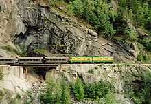
Rail crossings
- This transport-related list is incomplete; you can help by expanding it.
| The green background indicates a crossing that is located at a bridge or a tunnel. |
| The blue background indicates a crossing where passenger rail service is available. |
| The red background indicates a closed railroad crossing. |
| Canada Nearest Community | Canada Rail Company | United States Nearest Community | United States Rail Company | Notes | Structure or Notable Feature | Coordinates |
|---|---|---|---|---|---|---|
| Fraser | WPY | Skagway | WPY | 3 ft (914 mm) narrow gauge route, isolated line not connected to any others in North America. Former northern terminus Whitehorse, now ends at Carcross. | 59°37′27.99″N 135°8′20.58″W / 59.6244417°N 135.1390500°W | |
| White Rock | BNSF | Blaine | BNSF | Used by Amtrak Cascades passenger trains. | 49°0′7.56″N 122°45′27.00″W / 49.0021000°N 122.7575000°W | |
| Huntingdon | CP & SRY | Sumas | BNSF | 49°0′8.64″N 122°16′0.84″W / 49.0024000°N 122.2669000°W | ||
| Grand Forks | KFR | Danville | KFR | Abandoned by the KFR south of the border | 49°0′0.36″N 118°29′33.36″W / 49.0001000°N 118.4926000°W | |
| Billings | KFR | Laurier | KFR | Canada section isolated from Canadian rail network following CP's 1991 abandonment of their Boundary Sub, accessible only through the U.S. | 49°0′0.36″N 118°13′28.56″W / 49.0001000°N 118.2246000°W | |
| Waneta | KFR | Boundary | KFR | Canada section isolated from Canadian rail network following abandonment of Burlington Northern's Nelson Sub in 1989, only accessible through the U.S. | 49°0′2.52″N 117°37′36.84″W / 49.0007000°N 117.6269000°W | |
| Kingsgate | CP | Eastport | UP | 49°0′1.80″N 116°10′55.92″W / 49.0005000°N 116.1822000°W | ||
| Coutts | CP | Sweetgrass | BNSF | 48°59′54.24″N 111°57′32.40″W / 48.9984000°N 111.9590000°W | ||
| North Portal | CP | Portal | CP (SOO) | 48°59′56.04″N 102°32′56.40″W / 48.9989000°N 102.5490000°W | ||
| Northgate | CN | Northgate | BNSF | CN abandoned north of the border in 2001 | 48°59′55.68″N 102°15′51.48″W / 48.9988000°N 102.2643000°W | |
| Gretna | CP | Neche | BNSF | Tracks removed | 49°0′1.80″N 97°33′38.16″W / 49.0005000°N 97.5606000°W | |
| Emerson | CN (west track) / CP (east track) | Noyes | BNSF (west track) / CP (east track) | Since closure of the adjacent road border crossing, this rail crossing has been managed by nearby Emerson (Canada) and Pembina (U.S.) ports. | 49°0′1.44″N 97°12′13.32″W / 49.0004000°N 97.2037000°W | |
| Middlebro (Sprague) | CN | Longworth (Warroad) | CN | The U.S. stretch between Warroad & Baudette connects only through Canada. It was isolated from the U.S. rail network when Minnesota Northern Railroad abandoned the Warroad subdivision in 2009. | 48°59′56.40″N 95°22′32.16″W / 48.9990000°N 95.3756000°W | |
| Rainy River | CN | Baudette | CN | The U.S. stretch between Warroad & Baudette connects only through Canada. | 48°43′10.56″N 94°35′29.04″W / 48.7196000°N 94.5914000°W | |
| Fort Frances | MDW | International Falls | Minnesota, Dakota & Western Railway | Once connecting to CN's nearby mainline, the Fort Frances stretch is now isolated from the Canadian rail network. Trains must cross this bridge to the U.S. to get back into Canada. | Fort Frances – International Falls International Bridge | 48°36′26.69″N 93°24′6.42″W / 48.6074139°N 93.4017833°W |
| Fort Frances | CN | Ranier | CN | Ranier International Rail Bridge | 48°36′53.64″N 93°24′6.42″W / 48.6149000°N 93.4017833°W | |
| Sault Ste. Marie | CN (ACR) | Sault Ste. Marie | CN (WC) | International Rail Bridge | 46°30′30.60″N 84°21′41.76″W / 46.5085000°N 84.3616000°W | |
| Sarnia | CN | Port Huron | CN | Paul M. Tellier Tunnel | 42°57′34.20″N 82°25′21.36″W / 42.9595000°N 82.4226000°W | |
| Windsor | CP | Detroit | CP | Michigan Central Railway Tunnel | 42°19′9.12″N 83°3′30.24″W / 42.3192000°N 83.0584000°W | |
| Fort Erie | CN | Buffalo | CN | International Railway Bridge | 42°55′46.20″N 78°54′28.80″W / 42.9295000°N 78.9080000°W | |
| Niagara Falls | CP | Niagara Falls | CP | Closed to rail traffic in 2000. Presently mothballed. | Michigan Central Railway Bridge | 43°6′30.60″N 79°3′29.52″W / 43.1085000°N 79.0582000°W |
| Niagara Falls | CN | Niagara Falls | CSX | Used by Amtrak/Via Maple Leaf passenger trains. | Whirlpool Rapids Bridge | 43°6′33.27″N 79°3′30.00″W / 43.1092417°N 79.0583333°W |
| Sainte-Agnès-de-Dundee | CSX | Fort Covington | CSX | 44°59′51.36″N 74°29′8.88″W / 44.9976000°N 74.4858000°W | ||
| Elgin | NYC | Trout River | NYC | Abandoned, but ROW intact. | 44°59′31.92″N 74°14′32.28″W / 44.9922000°N 74.2423000°W | |
| Cantic | CP (west track) & CN (east track) | Rouses Point | CP (DH) | Used by Amtrak Adirondack passenger trains, using CN track in Canada. Cantic port of entry next to Lacolle 223. | 45°0′36.72″N 73°22′18.12″W / 45.0102000°N 73.3717000°W | |
| Clarenceville | CN | Alburg Springs | CN | 45°0′45.00″N 73°14′28.32″W / 45.0125000°N 73.2412000°W | ||
| Abercorn | CMQ | Richford | CMQ | U.S. section isolated from the U.S. rail network following 1990 abandonment of Central Vermont Railway's Richford Branch. Trains in the U.S. must pass through Canada. Part of the Farnham-Richford-North Troy line. | 45°0′54.36″N 72°39′49.32″W / 45.0151000°N 72.6637000°W | |
| Glen Sutton | CMQ | East Richford | CMQ | Canadian section has always been isolated from the Canadian rail network. Trains must pass through the U.S. to connect with the rest of Canada. Part of the Farnham-Richford-North Troy line. | 45°0′41.76″N 72°35′9.24″W / 45.0116000°N 72.5859000°W | |
| Highwater | CMQ | North Troy | CMQ | Trains in Canada must pass back through the U.S. from this isolated section. Part of the Farnham-Richford-North Troy line. | 45°0′25.56″N 72°24′43.92″W / 45.0071000°N 72.4122000°W | |
| Lineboro | Quebec Central Railway (QC) | North Derby | Quebec Central Railway (QC) | Tracks were removed in the 1990s. Now Piste cyclable de Stanstead (Canada) and Newport Bikepath (U.S.). Signs urge cyclists not to cross here. | 45°0′20.88″N 72°10′17.40″W / 45.0058000°N 72.1715000°W | |
| Stanhope | SLR | Norton | SLQ | 45°0′38.16″N 71°47′42.36″W / 45.0106000°N 71.7951000°W | ||
| Trudel (Lac-Mégantic) | CMQ | Beattie (Jackman) | CMQ | 45°32′48.12″N 70°41′21.48″W / 45.5467000°N 70.6893000°W | ||
| St. Leonard | MNRY | Van Buren | MNRY | unnamed rail bridge | 47°10′29.64″N 67°56′32.28″W / 47.1749000°N 67.9423000°W | |
| Tinker | CP | Fort Fairfield | CP | Tracks removed | 46°47′36.60″N 67°47′22.56″W / 46.7935000°N 67.7896000°W | |
| Green Road | CAR | Houlton | CAR | abandoned June 1989 | 46°5′42.72″N 67°46′52.32″W / 46.0952000°N 67.7812000°W | |
| St. Croix | NBSR | Vanceboro | EMRY | Only Canada-U.S. border crossing to be attacked by a foreign force. See Vanceboro international bridge bombing. | Saint Croix-Vanceboro Railway Bridge | 45°33′50.40″N 67°25′39.00″W / 45.5640000°N 67.4275000°W |
| Mohannes | NBSR | Woodland | NBSR | The American stretch is isolated from the rest of the U.S. rail network, and trains must cross this bridge to a small portion through Canada to the U.S. at Baring. Part of NBSR’s St. Stephen-Calais-Woodland branch; leased from Woodland Rail. | Sprague Falls Railroad Bridge | 45°10′0.84″N 67°24′15.48″W / 45.1669000°N 67.4043000°W |
| Upper Mills | NBSR | Baring Plantation | NBSR | The Canadian stretch between Mohannes and Upper Mills is isolated from the Canadian rail network, and trains must cross this bridge into the U.S. to connect to the rest of Canada. Sold to Woodland Rail by Pan-Am Railways after a short period out of service. Part of the St. Stephen-Calais-Woodland branch; leased from Woodland Rail. | Baring Railroad Bridge | 45°8′3.84″N 67°24′15.48″W / 45.1344000°N 67.4043000°W |
| St. Stephen (Milltown) | NBSR | Calais | NBSR | The American stretch between Baring and Calais is isolated from the U.S. rail network, and trains in the U.S. must switch direction and cross this bridge into Canada to connect with the rest of the U.S. rail network. The line was disconnected from the U.S. network when Guilford Rail (Pan-Am Railways) abandoned the connecting line to Bangor in 1989; those rails were intact until torn up in the late 2000s. Part of the St. Stephen-Calais-Woodland branch; leased from Woodland Rail on the U.S. side. | Salmon Falls Railroad Bridge | 45°10′29.28″N 67°17′29.40″W / 45.1748000°N 67.2915000°W |
Ferry crossings
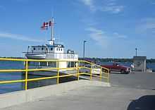
This list is of point-to-point international ferry services, including those for road vehicles, passengers and rail. Other marine ports of entry are not included.
| Canada Ferry Terminal | Waterway | United States Ferry Terminal | Ferry Company | Notes |
|---|---|---|---|---|
| Prince Rupert | Inside Passage / Dixon Entrance | Whittier | CN Aquatrain / Foss Maritime | Rail cars only |
| Prince Rupert | Inside Passage / Dixon Entrance | Ketchikan / Juneau | Alaska Marine Highway | |
| Alaska Marine Highway also operates vehicle ferries between Ketchikan, Alaska and Bellingham, Washington, and Alaska Rail Marine operates train ferries between Whittier, Alaska and Seattle, Washington through the Inside Passage of British Columbia without docking at Canadian ports. | ||||
| Victoria | Strait of Juan de Fuca | Port Angeles | Blackball Transport | Using MV Coho. |
| Victoria | Strait of Juan de Fuca | Seattle | Clipper Navigation | Passengers only |
| Sidney | San Juan Islands | Anacortes | Washington State Ferries | |
| Waterton Park | Waterton Lake | Goat Haunt Ranger Station | Waterton Shoreline Cruise Co. | Scheduled passenger trips originating in Canada from the end of May to mid-September stop at the U.S. station, which is accessed in Glacier National Park only by hiking trails. |
| Sombra | St. Clair River | Marine City | Bluewater Ferry | |
| Walpole Island | St. Clair River | Algonac | Walpole-Algonac Ferry | |
| Windsor | Detroit River | Detroit | Detroit-Windsor Truck Ferry | |
| Pelee | Lake Erie | Sandusky | Ontario Ferries[22] | Seasonal: April to mid-December |
| Wolfe Island | St. Lawrence River | Cape Vincent | Cape Vincent-Wolfe Island Ferry | Seasonal: mid-May to mid-October |
| Deer Island | Head Harbour Passage (Passamaquoddy Bay) | Eastport | Cummings Cove to Eastport Ferry | Seasonal: mid-June to mid-September |
| Yarmouth | Gulf of Maine | Portland | NovaStar Cruises | Seasonal: late-May to mid-October |
Recent and proposed changes
- Canada Border Services Agency implemented changes on April 1, 2011. The result was the closure of Big Beaver, Franklin Center and Jamieson's line. Also, hours were reduced at East Pinnacle, Glen Sutton, Morses Line to 8 am-4 pm.
- On December 21, 2012, US Customs and Border Protection announced the permanent closure of the port of Whitetail, Montana.[23]
- U.S. Customs and Border Protection is proposing the permanent closure of Morses Line, VT.[24] The review process is still ongoing.
- On August 21, 2014, U.S. Customs and Border Protection permanently closed the Jamieson Line Border Crossing.
- The New International Trade Crossing is a proposed new bridge between Windsor, Ontario and Detroit, Michigan aimed at relieving traffic congestion between the two cities.
See also
- Canada–United States border
- American entry into Canada by land
- Border town
- List of Mexico–United States border crossings
References
- ↑ http://www.peacebridge.com/index.php?option=com_content&view=article&id=39
- ↑ http://www.cbsa-asfc.gc.ca/travel-voyage/pptraq-ppvreq-eng.html
- ↑ Saba, Anne, "Point Roberts, WA - Then and Now", US Customs Today, October 1999
- ↑ Ann Briley (April 12, 2011). "Chopaka: The early days". BC Local News. Retrieved 2014-12-30.
- ↑ David G. Jones, "Molson is Becoming Smaller: A Canadian-American Community After the First War", BC Studies, no. 49, Spring 1981, p.54
- ↑ Federal Register 6 FR 705, February 1, 1941
- ↑ Camp, Al, "Border Crossing Diplomacy Opens Way for Canadians", The Omak-Okanogan County Chronicle, June 20, 1990
- ↑ MICHAEL JAMISON of the Missoulian (2002-04-11). "Bust near Glacier nets 120 pounds of pot". Missoulian.com. Retrieved 2011-03-02.
- ↑ 9.0 9.1 Legg, Herbert (1962). Customs services in western Canada, 1867-1925; a History, The Creston Review Ltd., Creston, BC
- ↑ "Obtain information about the Whitetail Port of Entry". Help.cbp.gov. Retrieved 2011-03-02.
- ↑ Northgate, ND. GhostsofNorthDakota.com. Retrieved on 2014-04-12.
- ↑ Maisel, Albert Q. Aliens Are Swarming Over Our Unguarded Northern Border, Look Magazine, New York, November 17, 1953, p. 75.
- ↑ Former Agricultural Inspection Border Station. "193 Meridian Road, Champlain, NY, 12919 - Agricultural Property - Off-Market on". Loopnet.com. Retrieved 2011-03-02.
- ↑ Fried, Joseph P. Gerald Bull, 62, Shot in Belgium; Scientist Who Violated Arms Law New York Times, March 25, 1990
- ↑ O'Neill, Thomas and Yamashita, Michael (Photographer) (1984). Lakes, Peaks and Prairies - Discovering the United States-Canada Border, p. 53. National Geographic Society, ISBN 0-87044-478-6.
- ↑ Bailey, Merton (1982). Border Crossings of Potton Township, p.A5.
- ↑ "Granby Leader-Mail - Google News Archive Search". Google News. Retrieved 2014-06-09.
- ↑ Farfan, Matthew (2009). The Vermont-Quebec Border - Life on the Line, p. 82. Arcadia Publishing
- ↑ "Orange alert on the Pedersen farm". CBC News. April 1, 2003.
- ↑ "Golfers' drive out of bounds, say U.S. officials". CBC News. June 27, 2008.
- ↑ Hon. David Anderson (Minister of National Revenue) as recorded in the House of Commons transcript, 18 April 1994, Ottawa, Canada.
- ↑ "Welcome to the MV Jiimaan". Ontarioferries.com. Retrieved 2011-03-02.
- ↑ "CBP Announces Closure of Port of Whitetail, Montana". www.cbp.gov. January 25, 2013. Retrieved 2013-04-04.
- ↑ "Obtain information about the Morses Line Border Crossing". Help.cbp.gov. Retrieved 2011-03-02.
External links
- Canada Border Services Agency - Highway-Land Border Offices
- U.S. Customs and Border Protection - Locate a Port of Entry
- This transport-related list is incomplete; you can help by expanding it.