Lisle-sur-Tarn
| Lisle-sur-Tarn | ||
|---|---|---|
|
The main square in Lisle-sur-Tarn | ||
| ||
 Lisle-sur-Tarn | ||
|
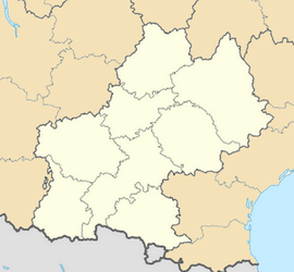
Location within Midi-Pyrénées region  Lisle-sur-Tarn | ||
| Coordinates: 43°51′16″N 1°48′42″E / 43.8544°N 1.8117°ECoordinates: 43°51′16″N 1°48′42″E / 43.8544°N 1.8117°E | ||
| Country | France | |
| Region | Midi-Pyrénées | |
| Department | Tarn | |
| Arrondissement | Albi | |
| Canton | Lisle-sur-Tarn | |
| Intercommunality | Tarn and Dadou | |
| Government | ||
| • Mayor (2008–2014) | Jean Tkaczuk | |
| Area1 | 86.56 km2 (33.42 sq mi) | |
| Population (2006)2 | 4,170 | |
| • Density | 48/km2 (120/sq mi) | |
| INSEE/Postal code | 81145 / 81310 | |
| Elevation |
95–285 m (312–935 ft) (avg. 127 m or 417 ft) | |
|
1 French Land Register data, which excludes lakes, ponds, glaciers > 1 km² (0.386 sq mi or 247 acres) and river estuaries. 2 Population without double counting: residents of multiple communes (e.g., students and military personnel) only counted once. | ||
Lisle-sur-Tarn is a commune in the Tarn department in southern France.
Geography
The city is located halfway between Toulouse and Albi on the A68 motorway, in the Gaillac vineyard, on the banks of the Tarn. Historically speaking, it is also located on one of the ancient Ways of St. James.
History
Created as a bastide by Raymond VII, Count of Toulouse in the 13th century, after the destruction of the castel of Montagut, ordered by the crusaders during the Albigensian Crusade. Thanks to local productions such as pastel and Gaillac wine, the city became an important market with a fluvial port on the Tarn. This rich heritage, in a region that is still producing wine nowadays, plays an important role on the local tourism-oriented economy.
Demography
| Year | 1962 | 1968 | 1975 | 1982 | 1990 | 1999 | 2007 |
|---|---|---|---|---|---|---|---|
| Population | 3308 | 3376 | 3385 | 3413 | 3588 | 3684 | 4171 |
Transport
Notable facts

- the village is made of perpendicular, regularized streets with red-brick half-timbered houses, that draw an ensemble of four districts, each one delimited by a fortified gate.
- the market square is the largest of all the south-western bastides, with about 5,000 m². It has been renovated in 2000.
- the town figures in Tracy Chevalier's first published novel, "The Virgin Blue"
See also
References
| Wikimedia Commons has media related to Lisle-sur-Tarn. |
.svg.png)