Lira Airport
| Lira Airport | |||||||||||
|---|---|---|---|---|---|---|---|---|---|---|---|
| IATA: none – ICAO: HULI | |||||||||||
| Summary | |||||||||||
| Airport type |
Public  Lira | ||||||||||
| Owner | Civil Aviation Authority of Uganda | ||||||||||
| Serves | Lira, Uganda | ||||||||||
| Elevation AMSL | 3,579 ft / 1,091 m | ||||||||||
| Coordinates | 02°14′52″N 32°54′35″E / 2.24778°N 32.90972°ECoordinates: 02°14′52″N 32°54′35″E / 2.24778°N 32.90972°E | ||||||||||
| Runways | |||||||||||
| |||||||||||
Lira Airport (ICAO: HULI) is an airport serving Lira,[1] a town in the Lira District in Uganda. Lira Airport is one of the thirteen upcountry airports that are administered by the Uganda Civil Aviation Authority.[2] It is one of the forty-six (46) airports in the country.[3]
Location
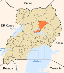
Lira Airport is located in northern Uganda, approximately 250 kilometres (160 mi), by air, north of Entebbe International Airport, the country’s largest civilian and military airport.[4]
The geographic coordinates of this airport are 02°14′52″N 32°54′35″E / 2.24778°N 32.90972°E. Lira Airport is situated at 3,579 feet (1,091 m) above sea level. The airport has a single unpaved runway measuring 846 metres (2,776 ft).
External links
See also
References
- ↑ "Lira, Uganda (ICAO: HULI)". Great Circle Mapper. Retrieved 9 March 2010.
- ↑ "Aerodromes". Civil Aviation Authority of Uganda. Retrieved 9 March 2010.
- ↑ "Uganda". CIA World Factbook.
Airports: 46 (2010)
- ↑ "Distance between Entebbe and Lira with map". Distance Calculator. Globefeed.com. Retrieved 9 March 2010.
249.2 km (approximate travel/road distance 286.6 km to 311.6 km)
| |||||||||||||||||||||||||||||||||
