Lipa, Lukovica
| Lipa | |
|---|---|
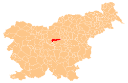
_location_map.svg.png) Lipa Location in Slovenia | |
| Coordinates: 46°11′36.54″N 14°46′4.19″E / 46.1934833°N 14.7678306°ECoordinates: 46°11′36.54″N 14°46′4.19″E / 46.1934833°N 14.7678306°E | |
| Country |
|
| Region | Upper Carniola |
| Municipality | Lukovica |
| Area | |
| • Total | 0.56 km2 (0.22 sq mi) |
| Elevation | 667.7 m (2,190.6 ft) |
| Population (2002) | |
| • Total | 17 |
| [1] | |
Lipa is a small dispersed settlement in the hills north of Krašnja in the Municipality of Lukovica in the eastern part of the Upper Carniola region of Slovenia.[2]