Lillingstone Lovell
| Lillingstone Lovell | |
 Parish church of the Assumption |
|
 Lillingstone Lovell |
|
| Population | 129 [1] |
|---|---|
| OS grid reference | SP7140 |
| Civil parish | Lillingstone Lovell |
| District | Aylesbury Vale |
| Shire county | Buckinghamshire |
| Region | South East |
| Country | England |
| Sovereign state | United Kingdom |
| Post town | Buckingham |
| Postcode district | MK19 |
| Dialling code | 01280 |
| Police | Thames Valley |
| Fire | Buckinghamshire |
| Ambulance | South Central |
| EU Parliament | South East England |
| UK Parliament | Buckingham |
|
|
Coordinates: 52°03′29″N 0°57′40″W / 52.058°N 0.961°W
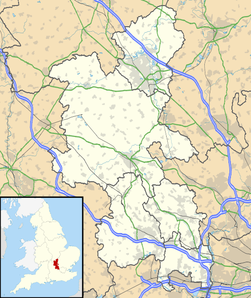
Lillingstone Lovell is a village and civil parish about 4 miles (6.4 km) miles north of Buckingham in Aylesbury Vale the district of Buckinghamshire. The parish adjoins the Northamptonshire boundary and is about 5 miles (8.0 km) south of Towcester in that county. Lillingstone Lovell is about 8 miles (13 km) west of Milton Keynes. The parish adjoins that of Lillingstone Dayrell with Luffield Abbey.
The toponym "Lillingstone" is derived from the Old English for "Lytel's boundary stone",[2] referring to the proximity of both places to the Northamptonshire boundary. At the time of the Domesday Book in 1086 both settlements were recorded jointly as Lillingestan though already at that time there were two manors owned respectively by the Dayrell and Lovell families. During the 13th century Lillingstone Lovell was known as Lillingstone Magna distinguishing it from its neighbour sometimes recorded as Lillingstone Parva. This is believed to refer more to administrative ascendancy rather than territorial size.
The adoption of the "Lovell" name came later probably in reference to the lordship of the manor by the Lovell family line which died out in the early 14th century. Unlike its neighbour, Livingstone Lovell was a detached portion of Oxfordshire under the control of the royal manor of Kirtlington, valued for its woodland and hunting being part of the ancient Whittlewood Forest. It was transferred to Buckinghamshire under the Counties (Detached Parts) Act 1844.[3]
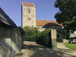
The Church of England parish church of the Assumption of the Blessed Virgin Mary is believed to date from the 13th century but was rebuilt in the 14th century. By the middle part of the 18th century it had fallen into disrepair and was repaired and refurbished around 1777 retaining the original medieval tower.
References
- ↑ "Key Figures for 2011 Census: Key Statistics". Neighbourhood Statistics. Office for National Statistics. Retrieved 3 February 2013.
- ↑ Genuki Project - Lillingstone Dayrell
- ↑ Whittlewood Project University of Leicester
Further reading
- Page, William (ed.) (1927). Victoria County History: A History of the County of Buckingham, Volume 4. pp. 191–197.
- Pevsner, Nikolaus (1973) [1960]. The Buildings of England: Buckinghamshire. Harmondsworth: Penguin Books. pp. 187–188. ISBN 0-14-071019-1.
External links
| Wikimedia Commons has media related to Lillingstone Lovell. |