Libungan, Cotabato
| Libungan | |
|---|---|
| Municipality | |
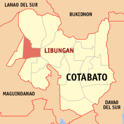 Map of Cotabato with Libungan highlighted | |
.svg.png) Libungan Location within the Philippines | |
| Coordinates: 07°15′N 124°31′E / 7.250°N 124.517°ECoordinates: 07°15′N 124°31′E / 7.250°N 124.517°E | |
| Country | Philippines |
| Region | SOCCSKSARGEN (Region XII) |
| Province | Cotabato |
| Congr. district | 1st District of Cotabato |
| Incorporated | January 27, 1968 |
| Barangays | 20 |
| Government[1] | |
| • Type | Mayor-Council |
| • District Representative | Jesus N. Sacdalan |
| • Mayor | Manuel T. Dela Serna |
| • Vice Mayor | Ronaldo B. Pader |
| Area[2] | |
| • Total | 172.50 km2 (66.60 sq mi) |
| Population (2010)[3] | |
| • Total | 45,295 |
| • Density | 260/km2 (680/sq mi) |
| Time zone | PST (UTC+8) |
| ZIP code | 9411 |
| Dialing code | 64 |
| Language(s) | Cebuano, Hiligaynon, Ilocano, Manobo |
| Income class | 2nd Class[2] |
| Website |
www |
Libungan is a second class municipality in the province of Cotabato, Philippines. According to the 2010 census, it has a population of 45,295 people.[3]
Geography
Libungan is located in the northwestern part of the Province of Cotabato with Libungan River as the main boundary from the Municipalities of Alamada, Banisilan and Carmen.
Barangays
Libungan is politically subdivided into 20 barangays.[2]
- Abaga
- Baguer
- Barongis
- Batiocan
- Cabaruyan
- Cabpangi
- Demapaco
- Grebona
- Gumaga
- Kapayawi
- Kiloyao
- Kitubod
- Malengen
- Montay
- Nica-an
- Palao
- Poblacion
- Sinapangan
- Sinawingan
- Ulamian
Climate
Libungan’s climate is under the 4th type, which is more or less even distribution of rainfall during the year.
History
Libungan in the early times was called by its early settlers in different terms. Originally it was known by its Manobo settlers as “dadas” meaning road down by the river. Generally, Libungan refers to the river of the place. The Manobo’s called it “Limbungan” meaning cheater because during those early times, the river changed its course damaging crops of the farmers in the area. In that way, they were cheated by the river. From then on, it was called Limbungan. “Tubak” is also one of the ancient names of the place, which refers to an “eroding river”. Old accounts also point to a specie of tree that abound in locality according to old Muslim inhabitants.
The main group of immigrants who settled in the place was the Cebuanos from Cebu. They found the place suitable for them because of its terrain. In the early part of 1930’s more immigrants from Luzon and Visayas come to settle here. During the Second World War, Demapaco became the hideouts of the guerrillas while the Libungan River became the battleground. After the liberation in 1945, more settlers came and cleared the forest and fertile lands for cultivation.
In 1955 many of its residents were elected to the Municipal Council of Midsayap. Through their concerted effort, the Municipal Council of Midsayap passed a resolution addressed to the Provincial Government urging the same to cause the passage of an equivalent resolution addressed to the National Government for the creation of the Municipality of Libungan. Luckily, the Municipality of Libungan was eventually established on August 7, 1961. It was created as a regular municipality with 14 barangays pursuant to Executive Order No. 414 dated January 27, 1961. Years later, the number of barangay increased to 32. But in 1969, some of the progressive barangays were merged to become another municipality, the Municipality of Alamada.
The municipality maintained its 19 barangays, part of which are the former barangays of Midsayap, namely Libungan (Poblacion), Barongis, Cabaruyan, Batiocan, Sinawingan, Baguer, Montay and Demapaco. Other barangays that compose the municipality are Abaga, Cabpangi, Grebona, Gumaga, Kapayawi, Kiloyao, Malengen, Sinapangan, Kitubod, Nicaan and Palakat, which later became inactive. Another barangay was created pursuant to Resolution No. 35 dated December 14, 1978; the barangay of Palao and another is Barangay Ulamian thus the number of barangays comprising the municipality became 20.
Libungan started as a 6th class municipality with an initial budget of P29,000.00 and have collected over thirty four thousand (P34,000.00) at the end of the fiscal year. At present it is classified as a 4th class municipality with an average income of 40,224,656.654 on the period from 2002 to 2006.
The first appointed mayor was Mr. Esmeraldo Cedeño (1961-1964). In 1964, the late Pedro Singayao, Sr. a native of Malitubog, an Agriculturist and a product of American Education as pensionado, was elected as mayor (1964-1967). The second mayor elect was the late Pacifico Dela Serna (1967-1971). He was among the early settlers from Cebu. He was succeeded by his wife, Lucila T. Dela Serna.
The socio-economic advancement of this municipality was affected by the destruction of commercial establishment and the local government building, by fire. The former was on January 16, 1979 and the second was on February 17, 1986.
It was barely a week after the destruction of the municipal hall when the historic EDSA revolution which effected the installation of the new government occurred. Reorganization at all levels was effected upon the assumption to duty of the newly installed President, Mrs. Corazon Cojuangco Aquino.
The Municipality was not exempted from the order of reorganizing the local government unit. Hence, then Mayor Lucila T. Dela Serna was replaced by the newly appointed Mayor Atty. Nestor Q. Quintana; a young lawyer- mayor took his turn in steering the development of the municipality. However, Atty. Nestor Q. Quintana was again replaced by Mrs. Leliosa Agravante Villanueva and then later by Mr. Luden A. Laguting as Officer-In-Charge, when Atty. Quintana run for Mayor in the 1988 election.
In 1988, a new elected mayor, Hon. Manuel T. dela Serna, the scion of the former dela Serna Mayors was brought into Office. Unfortunately, Mayor Manuel dela Serna was replaced by his vice-mayor, the young and eloquent Manobo Joel D. Humabad, Sr., during the election of 1992. Mayor Humabad held two terms of office because in the May 1998 election he was in turn defeated by his former vice-mayor, the young and charismatic Hon. Ronaldo B. Pader, MD. Mayor Pader held the leadership mantle for 3 terms of office equivalent to 9 years. In the 2007 election, Hon. Manuel T. Dela Serna who held 3 terms of office as Board Member (1998-2007) was able to capture the Mayorship against 3 opponents. In the just concluded May 2010 automated elections, Mayor Manuel T. Dela Serna got landslide victory against a former municipal councilor.
Demographics
| Population census of Libungan | ||
|---|---|---|
| Year | Pop. | ±% p.a. |
| 1990 | 68,971 | — |
| 1995 | 37,202 | −10.92% |
| 2000 | 40,589 | +1.89% |
| 2007 | 43,923 | +1.09% |
| 2010 | 45,295 | +1.13% |
| Source: National Statistics Office[3] | ||
Economy
The Municipality of Libungan in the first Congressional District of Cotabato is basically an Agricultural area. It has the basic requirements for agro-industries. It has lots of rice/corn mills, Buy/Sell, Agri-supply and Hardware supplies store. In the PALMA Alliance, Libungan has the biggest source of sand and gravel supply owing to the Libungan River bed. Libungan is also the home of the biggest poultry farm in the PALMA Alliance; it has also the Rock crusher and banana chips factory. It also has 2 filling stations, 3 pawnshops and a Rural Bank servicing mobility and financial requirements of local business.
Natural resources
The agricultural land in the municipality is planted with rice, corn and a hundred hectares to the traditional white corn variety. Coconut, mango and banana are also planted in the semi-sloping and upland areas.
Tourist attractions
- Sinapangan Waterfalls located at Barangay Sinapangan, Libungan. A 10-15 meter high falls which is part of the Mt. Akir-akir watershed areas.
- Mt. Akir-Akir located at Sinapangan, Libungan. It has a beautiful panoramic view of the surrounding municipalities of Calma
- Sapang Bato Resort located at Grebona, Libungan. Natural flowing circle shaped pool and has a top view of cascading mountain.
- Eco-Resort Center located at Ulamian, Libungan. A cool place perfect for re;laxing and swimming on its crystal clear water.
Festivals
Kaumahan Festival is a parade and dancing contest featuring local endemic flora and food production paraphernalia. It is conducted during the Catholic Patronal Festival every third Sunday of May.
Samayaan Aroman Manobo Festival, Barongis, Libungan. Practicing Manobo rituals like Kanduli, Pamaya, Bulangan and Ulahingan. It is conducted every 28 December.
References
- ↑ "Official City/Municipal 2013 Election Results". Intramuros, Manila, Philippines: Commission on Elections (COMELEC). 12 May 2014. Retrieved 3 June 2014.
- ↑ 2.0 2.1 2.2 "Province: COTABATO (NORTH COTABATO)". PSGC Interactive. Makati City, Philippines: National Statistical Coordination Board. Retrieved 3 June 2014.
- ↑ 3.0 3.1 3.2 "Total Population by Province, City, Municipality and Barangay: as of May 1, 2010". 2010 Census of Population and Housing. National Statistics Office. Retrieved 3 June 2014.
External links
- http://www.libungan.gov.ph/
- http://www.libungan-cotabatoprov.gov.ph/
- http://www.libungan.com/
- Philippine Standard Geographic Code
 |
Alamada | | ||
| Pigcawayan | |
Carmen | ||
| ||||
| | ||||
| Northern Kabuntalan, Maguindanao | Midsayap | Aleosan |
| ||||||||||||||