Liberty Township, Porter County, Indiana
| Liberty Township | |
|---|---|
| Township | |
 | |
| Coordinates: 41°33′38″N 87°04′33″W / 41.56056°N 87.07583°WCoordinates: 41°33′38″N 87°04′33″W / 41.56056°N 87.07583°W | |
| Country | United States |
| State | Indiana |
| County | Porter |
| Government | |
| • Type | Indiana township |
| Area | |
| • Total | 25.03 sq mi (64.84 km2) |
| • Land | 24.75 sq mi (64.1 km2) |
| • Water | 0.28 sq mi (0.73 km2) |
| Elevation[1] | 650 ft (198 m) |
| Population (2010) | |
| • Total | 9,319 |
| • Density | 376.5/sq mi (145.38/km2) |
| FIPS code | 18-43362[2] |
| GNIS feature ID | 453559 |
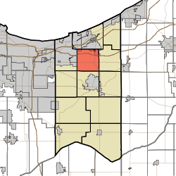
Liberty Township is one of twelve townships in Porter County, Indiana. As of the 2010 census, its population was 9,319.[3]
Cities and towns
The town of Chesterton has grown south from Westchester Township and has incorporated parts of Liberty Township along State Route 49 near the Indiana Toll Road. Otherwise, there are no incorporated communities within the township.[4]
Education
Liberty Township is served by the Duneland School Corporation. The elementary school is Liberty Elementary, which serves grades K-4. Liberty Intermediate School serves grades 5 and 6. Chesterton Middle School serves grades 7 and 8. Its high school is Chesterton High School, located in Chesterton (Westchester Township) to the north which serves grade 9-12.
References
- ↑ "US Board on Geographic Names". United States Geological Survey. 2007-10-25. Retrieved 2008-01-31.
- ↑ "American FactFinder". United States Census Bureau. Retrieved 2008-01-31.
- ↑ "Geographic Identifiers: 2010 Demographic Profile Data (DP-1): Liberty township, Porter County, Indiana". U.S. Census Bureau, American Factfinder. Retrieved March 22, 2013.
- ↑ Porter County, Indiana Sesquicentennial, 150, 1836-1986
External links
| |||||||||||||||||||||||||||||||||