Liberty Township, Montour County, Pennsylvania
| Liberty Township, Mountour County, Pennsylvania | |
|---|---|
| Township | |
|
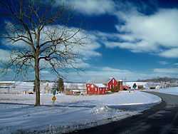
A farm in the township | |
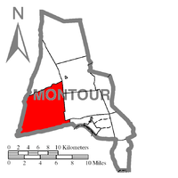 Map of Montour County, Pennsylvania Highlighting Liberty Township | |
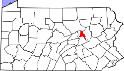 Map of Montour County, Pennsylvania | |
| Country | United States |
| State | Pennsylvania |
| County | Montour |
| Settled | 1771 |
| Incorporated | 1816 |
| Area | |
| • Total | 27.5 sq mi (71.1 km2) |
| Population (2000) | |
| • Total | 1,476 |
| • Density | 53.8/sq mi (20.8/km2) |
Liberty Township is a township in Montour County, Pennsylvania, United States. The population was 1,476 at the 2000 census.
History
The Gottlieb Brown Covered Bridge, Keefer Covered Bridge No. 7, and Mooresburg School are listed on the National Register of Historic Places.[1]
Geography
According to the United States Census Bureau, the township has a total area of 27.5 square miles (71.1 km²), all of it land.
Demographics
As of the census[2] of 2000, there were 1,476 people, 556 households, and 429 families residing in the township. The population density was 53.8 people per square mile (20.8/km²). There were 593 housing units at an average density of 21.6/sq mi (8.3/km²). The racial makeup of the township was 98.98% White, 0.27% African American, 0.14% Native American, 0.27% Asian, 0.14% from other races, and 0.20% from two or more races. Hispanic or Latino of any race were 0.20% of the population.
There were 556 households out of which 34.4% had children under the age of 18 living with them, 68.2% were married couples living together, 6.7% had a female householder with no husband present, and 22.7% were non-families. 18.7% of all households were made up of individuals and 7.9% had someone living alone who was 65 years of age or older. The average household size was 2.65 and the average family size was 3.02.
In the township the population was spread out with 25.0% under the age of 18, 5.6% from 18 to 24, 30.4% from 25 to 44, 27.8% from 45 to 64, and 11.2% who were 65 years of age or older. The median age was 40 years. For every 100 females there were 99.7 males. For every 100 females age 18 and over, there were 95.9 males.
The median income for a household in the township was $43,500, and the median income for a family was $49,250. Males had a median income of $31,711 versus $23,920 for females. The per capita income for the township was $19,986. About 2.1% of families and 3.6% of the population were below the poverty line, including 1.7% of those under age 18 and 4.9% of those age 65 or over.
Notable people
- Alexander Billmeyer, member of the U.S. House of Representatives.
References
- ↑ "National Register Information System". National Register of Historic Places. National Park Service. 2010-07-09.
- ↑ "American FactFinder". United States Census Bureau. Retrieved 2008-01-31.
| |||||||||||||||||||||
Coordinates: 41°01′00″N 76°42′59″W / 41.01667°N 76.71639°W