Libang, Pyuthan
| Libang लिबाङ | |
|---|---|
| Village Development Committee | |
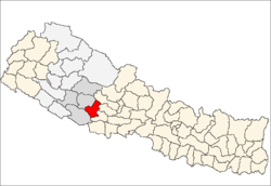
 Libang Location in Nepal | |
| Coordinates: 28°18′N 82°38′E / 28.300°N 82.633°ECoordinates: 28°18′N 82°38′E / 28.300°N 82.633°E | |
| Country |
|
| Region | Mid-Western |
| Zone | Rapti Zone |
| District | Pyuthan District |
| VDC | Libang |
| Population (2001 Census[1]) | |
| • Total | 3,262 |
| 587 households | |
| Time zone | Nepal Time (UTC+5:45) |
Libang is a town and Village Development Committee in Pyuthan, a Middle Hills district of Rapti Zone, western Nepal.
Villages in this VDC
| Ward | Lat. | Lon | Elev. | ||
|---|---|---|---|---|---|
| Bolde | बोल्दे | 28°12'N | 82°59'E | 1,270m | |
| Bukurchaur | बुकुरचौर | 1 | 28°12'N | 82°57'E | 2,010 |
| Dakas | डाकस | 28°12'N | 82°57'E | 1,870 | |
| Daphle | दाफ्ले | 5 | 28°11'N | 82°59'E | 1,330 |
| Dehalna | देहाल्ना | 28°11'N | 82°57'E | 2,055 | |
| Gothantidanda | गोठाँटीडाँडा | 28°13'N | 82°58'E | 2,010 | |
| Kaseri | कसेरी | 28°12'N | 82°59'E | 1,390 | |
| Kopche | कोप्चे | 28°13'N | 82°58'E | 1,618 | |
| Libang | लिबाङ | 5 | 28°12'N | 82°58'E | 1,610 |
| Mahapata | महपाटा | 28°12'N | 82°59'E | 1,415 | |
| Sirwari | सिरवारी | 28°11'N | 82°57'E | 1,690 | |
| Timurchaur | टिमुरचौर | 8 | 28°11'N | 82°58'E | 1,690 |
| Timurchaur Lekh | टिमुरचौर लेख | 28°11'N | 82°57'E | 1,830 |
References
- ↑ "Nepal Census 2001". Nepal's Village Development Committees. Digital Himalaya. Retrieved 21 September 2008.
- ↑ "Index of Geographical Names of Nepal, Volume IV: Mid Western Development Region, List of Settlements, Pyuthan". Government of Nepal, National Geographic Information Infrastructure Program. Retrieved 2011-03-12.