Lhatse County
| Lhatse County Lhazê Zong Lāzī County | |
|---|---|
| County | |
| Lhazê Xiàn | |
| Tibetan transcription(s) | |
| • Tibetan | ལྷ་རྩེ་རྫོང་ |
| • Wylie transliteration | lha rtse rdzong |
| • official transcription (PRC) | Lhazê |
| Chinese transcription(s) | |
| • Simplified | 拉孜县 |
| • Pinyin | Lāzī Xiàn |
|
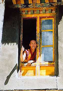
Old Lhatse Monastery | |
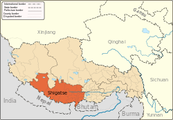
.png) Location of Lhatse County within Tibet | |
 Lhatse County Location in Tibet | |
| Coordinates: 29°11′15″N 88°05′34″E / 29.18750°N 88.09278°E | |
| Country | China |
| Province | Tibet |
| Prefecture-level city | Xigazê |
| Capital | Lhatse |
| Time zone | China Standard (UTC+8) |
Lhatse County is a county of Xigazê in the Tibet Autonomous Region. It was established in 1959, with Lhatse Town as the county seat. In 1968, Quxia Town became the county seat.[1]
Lhatse County, has a population of some 50,000 and is about 200 kilometers from Mount Everest (or Chomolungma). It is among the most impoverished counties in China.[2]
Geography
- Yarlung Zangbo River
Towns and townships
- Lhazê Town (拉孜镇)
- Quxar Town (曲下镇)
- Zhaxizom Township (扎西宗乡)
- Qoima Township (曲玛乡)
- Püncogling Township (彭措林乡)
- Zhaxigang Township (扎西岗乡)
- Liu Township (柳乡)
- Rasa Township (热萨乡)
- Mangpu Township (芒普乡)
- Xiqên Township (锡钦乡)
- Chau Township (查务乡)
- 482 natural villages [1]
Transport
References
- ↑ 1.0 1.1 "Lhatse, Lhatse County – Lhatse Trip". China Travel Blogs – Tour-Beijing.com. 2011-09-01. Retrieved 2013-10-20.
- ↑ "Move to hospital deliveries saves mothers, infants in Tibet." Xinhua Writers Bai Xu and Hu Xing. 25 Feb. 2009
| ||||||||||||||||||||||||||||||
| ||||||||||||||||||||||||||||||||||||||||||||||||||||||||||||||||||||||||||
Coordinates: 29°11′15″N 88°05′34″E / 29.18750°N 88.09278°E