Lewesdon Hill
| Lewesdon Hill | |
|---|---|
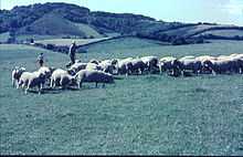
 View of Lewesdon Hill from Pilsdon Pen | |
| Elevation | 279 m (915 ft) |
| Prominence | 185 m (607 ft) |
| Parent peak | Staple Hill |
| Listing | Marilyn, Hardy, County Top |
| Location | |
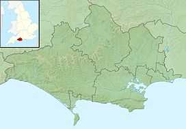 Lewesdon Hill Lewesdon Hill in Dorset | |
| Location | Dorset, England |
| OS grid | ST436013 |
| Coordinates | 50°48′28″N 2°47′59″W / 50.8077°N 2.7996°WCoordinates: 50°48′28″N 2°47′59″W / 50.8077°N 2.7996°W |
| Topo map |
OS Landranger 193 |
Lewesdon Hill is about 4 km west of Beaminster in south west Dorset, England. Like many of the high hills in Dorset, including its neighbour Pilsdon Pen, it is the site of an Iron Age hill fort. The hill is formed from upper greensand which is more resistant to erosion than the surrounding clay.
The hill is the highest point in Dorset, closely followed by Pilsdon Pen (277 m) and Bulbarrow Hill (274 m). To the south of the hill is the Marshwood Vale. It is a National Trust property. There are two main footpaths leading up to the summit, one from the village of Broadwindsor, and one from Coombe Lane (off the B3162 between Broadwindsor and Bridport, just before the "four ash" crossroads). The Coombe Lane footpath leads to the hill via another, smaller hill, Crabb Hill, which is privately owned.