Les Laurentides Regional County Municipality
| Les Laurentides | |
|---|---|
| Regional county municipality | |
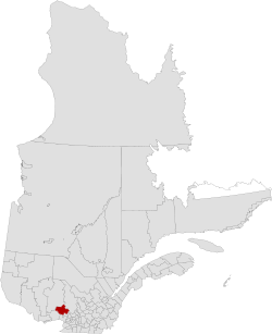 Location in province of Quebec. | |
| Coordinates: 46°07′N 74°36′W / 46.117°N 74.600°WCoordinates: 46°07′N 74°36′W / 46.117°N 74.600°W[1] | |
| Country |
|
| Province |
|
| Region | Laurentides |
| Effective | January 1, 1983 |
| County seat | Saint-Faustin–Lac-Carré |
| Government[2] | |
| • Type | Prefecture |
| • Prefect | Ronald Provost |
| Area[2][3] | |
| • Total | 2,599.70 km2 (1,003.75 sq mi) |
| • Land | 2,478.67 km2 (957.02 sq mi) |
| Population (2011)[3] | |
| • Total | 45,157 |
| • Density | 18.2/km2 (47/sq mi) |
| • Pop 2006-2011 |
|
| • Dwellings | 33,866 |
| Time zone | EST (UTC−5) |
| • Summer (DST) | EDT (UTC−4) |
| Area code(s) | 819 |
| Website |
www |
Les Laurentides (The Laurentians) is a regional county municipality in the Laurentides region of Quebec, Canada. The seat is in Saint-Faustin–Lac-Carré. It is named after the Laurentian Mountains.
The population is 45,157 according to the Canada 2011 Census.[3]
Subdivisions
|
|
|
|
|
Transportation
Access Routes
Highways and numbered routes that run through the municipality, including external routes that start or finish at the county border:[4]
|
|
|
See also
References
External links
 |
Antoine-Labelle RCM | | ||
| Papineau RCM | |
Matawinie RCM | ||
| ||||
| | ||||
| Argenteuil RCM | Les Pays-d'en-Haut RCM |