Ledeča Vas
| Ledeča Vas | |
|---|---|
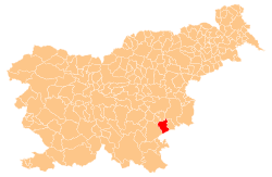
_location_map.svg.png) Ledeča Vas Location in Slovenia | |
| Coordinates: 45°50′38.43″N 15°22′1.36″E / 45.8440083°N 15.3670444°ECoordinates: 45°50′38.43″N 15°22′1.36″E / 45.8440083°N 15.3670444°E | |
| Country |
|
| Traditional region | Lower Carniola |
| Statistical region | Southeast Slovenia |
| Municipality | Šentjernej |
| Area | |
| • Total | 1.09 km2 (0.42 sq mi) |
| Elevation | 171.3 m (562.0 ft) |
| Population (2002) | |
| • Total | 73 |
| [1] | |
Ledeča Vas (Slovene: Ledeča vas, German: Ladendorf[2]) is a village east of Šentjernej, at the foot of the Gorjanci Hills in southeastern Slovenia. The area was traditionally part of Lower Carniola. It is now included in the Southeast Slovenia statistical region.[3]
The local church, built on a slight elevation next to a forest outside the main settlement, is dedicated to Saint Anne and belongs to the Parish of Šentjernej. It was mentioned in written documents dating to 1367, but was extensively rebuilt in the 17th and early 20th centuries.[4]
References
- ↑ Statistical Office of the Republic of Slovenia
- ↑ Leksikon občin kraljestev in dežel zastopanih v državnem zboru, vol. 6: Kranjsko. 1906. Vienna: C. Kr. Dvorna in Državna Tiskarna, p. 72. (Slovene)
- ↑ Šentjernej municipal site
- ↑ Slovenian Ministry of Culture register of national heritage reference number ešd 2438