Ledang District
| Ledang ليدڠ 礼让 | ||
|---|---|---|
| District of Malaysia | ||
| ||
| Country |
| |
| State |
| |
| Seat | Tangkak | |
| Government | ||
| • District officer | n/a | |
| Area | ||
| • Total | 970.24 km2 (374.61 sq mi) | |
| Population (2010) | ||
| • Total | 136,852 | |
| • Density | 140/km2 (370/sq mi) | |

Ledang is a new district in Johor, Malaysia. The district's principal town is Tangkak. The new Ledang district covers Tangkak town, Tanjung Agas, Kesang, Sungai Mati, Serom, Sagil and Bukit Gambir. The district is formerly as the northern part of the Muar district which is separated from the southern part by the Muar River.[1] A ceremony headed by the sultan on 9 June 2008 saw the official proclamation of Ledang becoming Johor's 10th district.[2]
Gunung Ledang National Park
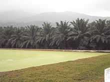
One of the main tourist attractions of Ledang is the Gunung Ledang National Park. The park is situated 170 km from Johor Bahru and has an area of 107 km². The park has two entry points, one in Sagil, Johor and the other in Asahan, Melaka. Gunung Ledang's peak, which is 1276 m above sea level is the highest point in the park and Johor. Gunung Ledang is also the 64th highest mountain in Malaysia and arguably the most climbed mountain in the country. Sagil waterfall, which is also in the park is a famous picnic site. Gunung Ledang is also widely recognised as a friendly training venue for amateur (or beginners) mountain hikers/climbers.
Townships
Townships in Ledang District
See also
- Legend of Gunung Ledang
References
External links
Coordinates: 2°16′17″N 102°32′01″E / 2.27139°N 102.53361°E