Le Versoud
| Le Versoud | |
|---|---|
 | |
 Le Versoud | |
|
Location within Rhône-Alpes region  Le Versoud | |
| Coordinates: 45°13′01″N 5°51′46″E / 45.2169°N 5.8628°ECoordinates: 45°13′01″N 5°51′46″E / 45.2169°N 5.8628°E | |
| Country | France |
| Region | Rhône-Alpes |
| Department | Isère |
| Arrondissement | Grenoble |
| Canton | Domène |
| Intercommunality | Moyen Grésivaudan |
| Government | |
| • Mayor (2014–2020) | Patrick Janolin |
| Area1 | 6 km2 (2 sq mi) |
| Population (2012)2 | 4,637 |
| • Density | 770/km2 (2,000/sq mi) |
| INSEE/Postal code | 38538 / 38420 |
| Elevation |
216–441 m (709–1,447 ft) (avg. 222 m or 728 ft) |
|
1 French Land Register data, which excludes lakes, ponds, glaciers > 1 km² (0.386 sq mi or 247 acres) and river estuaries. 2 Population without double counting: residents of multiple communes (e.g., students and military personnel) only counted once. | |
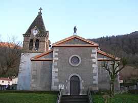
Le Versoud is a commune in the Isère department in the Rhône-Alpes region in southeastern France.
Population
| Historical population | ||
|---|---|---|
| Year | Pop. | ±% |
| 1793 | 603 | — |
| 1806 | 437 | −27.5% |
| 1821 | 481 | +10.1% |
| 1831 | 529 | +10.0% |
| 1841 | 554 | +4.7% |
| 1851 | 543 | −2.0% |
| 1861 | 498 | −8.3% |
| 1872 | 500 | +0.4% |
| 1881 | 410 | −18.0% |
| 1891 | 383 | −6.6% |
| 1901 | 412 | +7.6% |
| 1911 | 513 | +24.5% |
| 1921 | 778 | +51.7% |
| 1931 | 1,238 | +59.1% |
| 1946 | 1,029 | −16.9% |
| 1954 | 1,139 | +10.7% |
| 1962 | 1,445 | +26.9% |
| 1968 | 1,675 | +15.9% |
| 1975 | 1,772 | +5.8% |
| 1982 | 2,217 | +25.1% |
| 1990 | 2,995 | +35.1% |
| 1999 | 3,809 | +27.2% |
| 2006 | 4,309 | +13.1% |
| 2012 | 4,637 | +7.6% |
See also
- Urban unit of Grenoble
- Grenoble - Le Versoud Aerodrome
References
| Wikimedia Commons has media related to Le Versoud. |