Le Grand Champ Bottom
| Le Grand Champ Bottom | |
| Alluvial Floodplain | |
 Le Grand Champ Bottoms | |
| Country | USA |
|---|---|
| State | Missouri |
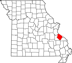
Le Grand Champ is (French for "the big field") is an alluvial floodplain, also called a bottom, extending along the Mississippi River in Ste. Genevieve County, Missouri.
The American Bottom stretches from St. Louis south along the east side of the Mississippi River all the way to the mouth of the Kaskaskia River, just north of Fort Kaskaskia, Illinois. At Morrow Island the American Bottom is broken by the Mississippi River, and on the west side of the Mississippi River the alluvial plain continues as the "Le Grand Champ" or Big Field Bottom, which includes Kaskaskia Island.
Name
Le Grand Champ was so named because it served as the main common agricultural land for Old Ste. Genevieve (Le Vieux Village de Ste. Genevieve). This name was the usual name for the common field of a French village. The field was also known as the "grand carre" or "quarre" to the French. Later, the Americans referred to the field as "The Big Field".[1]
History
Le Grand Champ served as the common field of Ste. Genevieve. It lies south of the community and extends to the River aux Vases in the bottoms along the Mississippi River. The original French name was "Le Grand Champ."
In Colonial French Ste. Genevieve each inhabitant was granted, in addition to his house lot, one or more lots in the common-fields that were set aside for cultivation. These lots were laid out in strips, generally one arpent wide (192 feet, 6 inches) and forty arpent long (roughly a mile), with long narrow plots perpendicular to the Mississippi River, and extended back to the foot of the bluffs. This manner of land distribution was common in medieval Europe, and became the private possession of the individual holder. The common-field was separated from the commons by a fence, which served to keep cattle and livestock from wandering into the fields. Each person owning a strip of land was required to maintain the section of the fence that crossed his land. As late as 1907 the "big field" of Ste. Genevieve was still being cultivated in this manner. The common field is not to be confused with the commons (French: la commune), which was an area set apart and used in common by all inhabitants of the village for the gathering of firewood and the pasturage of livestock.[1] Le Grand Champ not only fed Ste. Genevieve, but also provided a large part of the food for New Orleans, quickly becoming the breadbasket of the Louisiana Territory.[2] A number of crops were cultivated in the field: corn, pumpkins, wheat, oats, barley, flax, cotton, and tobacco. Lacking steel implements, most of the farmers let their crops simply compete with weeds until harvest time.[3] A village of Peorias and Kickapoos lay on Le Grand Champ near old Ste. Genevieve, and their children played with French children.
However, relations with the Osage Indians was not so peaceful. The Osage had no settlement near Ste. Genevieve, but they ranged widely to hunt wild game, as well as to steal livestock from the French. At night the Osage warriors would enter Ste. Genevieve, break into stables, steal livestock and take anything else they found of value. The Periorias and Kickapoos would go on hunts in the fall, spring and summer to supplement their crops, but they had to suspend their hunts for fear of the Osage. The French welcomed Shawnee and Delaware tribes from Ohio to settle south of Le Grand Champ to serve as a buffer against the Osage. However, the Shawnee and Delaware could do little to stop Osage raids. It was said that the Osage did not meet their match until American immigrants arrived, who regarded shooting Indians as being somewhat akin to squirrel hunting.[3][4]
Floods
Flooding has been a constant concern of the residents of Le Grand Champ Bottom ever since settlement began. Under French and Spanish colonial administration, each colonial was required to build and maintain levees on his land. In 1785 a large flood inundated the floodplain, causing the residents to move the town of Ste. Genevieve to a new location that was less susceptible to flooding.[5] In modern times a number of floods have struck the floodplain, particularly in 1943, 1973 and 1993.
Geography
Le Grand Champ lies about three miles south of the present-day site of (New) Ste. Genevieve, in an area of the alluvial floodplain historically known as “Pointe Basse”.[6] In 1811 the bottomland around Le Grand Champ was estimated to be the size of 10,000 acres. However, the size of the cultivated field is estimated to have consisted of roughly three thousand acres of tillable land. To the north of Le Grand Champ lies the American Bottom and to the south lies Bois Brule Bottom.[3]
Communities in the Le Grand Champ Bottoms
- New Bourbon
- Old Ste. Genevieve
Gallery
-

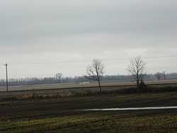
Old Indian Mound
-
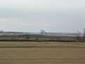
Indian Mound
See also
- Sainte Genevieve County, Missouri
- American Bottom
- Bois Brule Bottom
- Brazeau Bottom
References
- ↑ 1.0 1.1 The State Historical Society of Missouri: Ste. Genevieve County http://shs.umsystem.edu/manuscripts/ramsay/ramsay_sainte_genevieve.html
- ↑ Remnants of French Colonial Architecture in Southeastern Missouri http://www.bonjourparis.com/story/remnants-of-french-colonial-architecture-in-sou/
- ↑ 3.0 3.1 3.2 By Napier Shelton (2005). "Natural Missouri: Working with the Land". ISBN 9780826264718.
- ↑ Louis Houck (1908). "A History of Missouri: From the Earliest Explorations and Settlements Until the Admission of the State Into the Union".
- ↑ Encyclopedia Britannica http://www.britannica.com/EBchecked/topic/518447/Sainte-Genevieve
- ↑ Walter A. Schroeder (2002). "Opening the Ozarks: A Historical Geography of Missouri's Ste. Genevieve District, 1760-1830". ISBN 9780826263063.
| ||||||||||||||||||||||||||||||||
| |||||||||||||||||||||||||||||