Le Glaizil
| Le Glaizil | ||
|---|---|---|
|
Ruins of the Chateau of Lesdiguières | ||
| ||
 Le Glaizil | ||
|
Location within Provence-A.-C.d'A. region 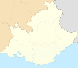 Le Glaizil | ||
| Coordinates: 44°45′16″N 5°59′00″E / 44.7544°N 5.9833°ECoordinates: 44°45′16″N 5°59′00″E / 44.7544°N 5.9833°E | ||
| Country | France | |
| Region | Provence-Alpes-Côte d'Azur | |
| Department | Hautes-Alpes | |
| Arrondissement | Gap | |
| Canton | Saint-Firmin | |
| Intercommunality | Valgaudémar | |
| Government | ||
| • Mayor (2014–2020) | Jean-Pierre Gauthier[1] | |
| Area1 | 21.93 km2 (8.47 sq mi) | |
| Population (2012)2 | 180 | |
| • Density | 8.2/km2 (21/sq mi) | |
| INSEE/Postal code | 05062 / 05800 | |
| Elevation |
774–2,570 m (2,539–8,432 ft) (avg. 862 m or 2,828 ft) | |
|
1 French Land Register data, which excludes lakes, ponds, glaciers > 1 km² (0.386 sq mi or 247 acres) and river estuaries. 2 Population without double counting: residents of multiple communes (e.g., students and military personnel) only counted once. | ||


Le Glaizil is a commune in the Hautes-Alpes department in southeastern France.
Population
| Historical population | ||
|---|---|---|
| Year | Pop. | ±% |
| 1962 | 115 | — |
| 1968 | 155 | +34.8% |
| 1975 | 168 | +8.4% |
| 1982 | 175 | +4.2% |
| 1990 | 169 | −3.4% |
| 1999 | 179 | +5.9% |
| 2008 | 170 | −5.0% |
| 2012 | 180 | +5.9% |
See also
References
- ↑ "List of mayors of the Hautes-Alpes department". Prefecture of Hautes-Alpes (in French). 3 June 2014. Retrieved 20 March 2015.
| Wikimedia Commons has media related to Le Glaizil. |