Le Bouchage, Charente
| Le Bouchage | |
|---|---|
|
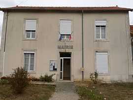
Town hall | |
 Le Bouchage | |
|
Location within Poitou-Charentes region 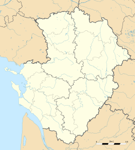 Le Bouchage | |
| Coordinates: 46°02′56″N 0°22′44″E / 46.0489°N 0.3789°ECoordinates: 46°02′56″N 0°22′44″E / 46.0489°N 0.3789°E | |
| Country | France |
| Region | Poitou-Charentes |
| Department | Charente |
| Arrondissement | Confolens |
| Canton | Champagne-Mouton |
| Intercommunality | Confolentais |
| Government | |
| • Mayor (2008–2014) | Jean-Pierre Demon |
| Area1 | 16.43 km2 (6.34 sq mi) |
| Population (2008)2 | 168 |
| • Density | 10/km2 (26/sq mi) |
| INSEE/Postal code | 16054 / 16350 |
| Elevation |
133–193 m (436–633 ft) (avg. 191 m or 627 ft) |
|
1 French Land Register data, which excludes lakes, ponds, glaciers > 1 km² (0.386 sq mi or 247 acres) and river estuaries. 2 Population without double counting: residents of multiple communes (e.g., students and military personnel) only counted once. | |
Le Bouchage is a commune in the Charente department in southwestern France.
Population
| Historical population | ||
|---|---|---|
| Year | Pop. | ±% |
| 1793 | 430 | — |
| 1800 | 512 | +19.1% |
| 1806 | 671 | +31.1% |
| 1821 | 472 | −29.7% |
| 1831 | 428 | −9.3% |
| 1841 | 473 | +10.5% |
| 1846 | 498 | +5.3% |
| 1851 | 521 | +4.6% |
| 1856 | 530 | +1.7% |
| 1861 | 560 | +5.7% |
| 1866 | 586 | +4.6% |
| 1872 | 506 | −13.7% |
| 1876 | 498 | −1.6% |
| 1881 | 497 | −0.2% |
| 1886 | 560 | +12.7% |
| 1891 | 561 | +0.2% |
| 1896 | 514 | −8.4% |
| 1901 | 494 | −3.9% |
| 1906 | 504 | +2.0% |
| 1911 | 475 | −5.8% |
| 1921 | 412 | −13.3% |
| 1926 | 386 | −6.3% |
| 1931 | 403 | +4.4% |
| 1936 | 369 | −8.4% |
| 1946 | 364 | −1.4% |
| 1954 | 346 | −4.9% |
| 1962 | 327 | −5.5% |
| 1968 | 290 | −11.3% |
| 1975 | 246 | −15.2% |
| 1982 | 232 | −5.7% |
| 1990 | 197 | −15.1% |
| 1999 | 190 | −3.6% |
| 2008 | 168 | −11.6% |
See also
References
| Wikimedia Commons has media related to Le Bouchage (Charente). |